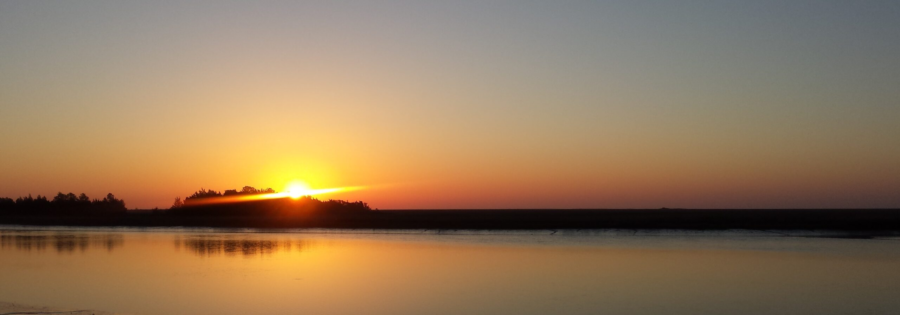
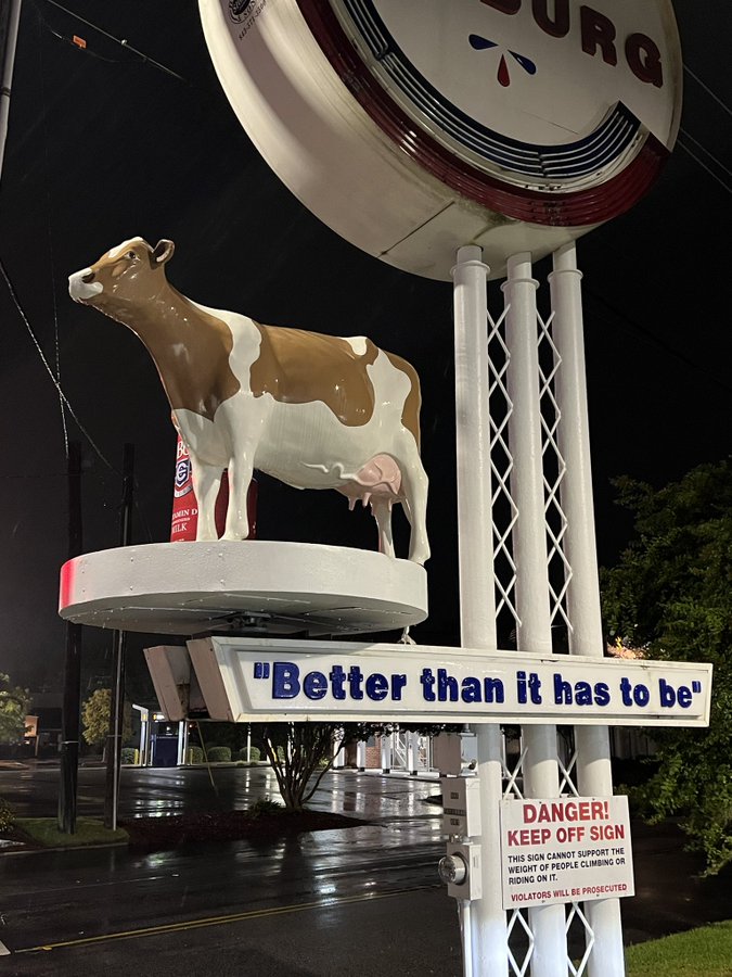
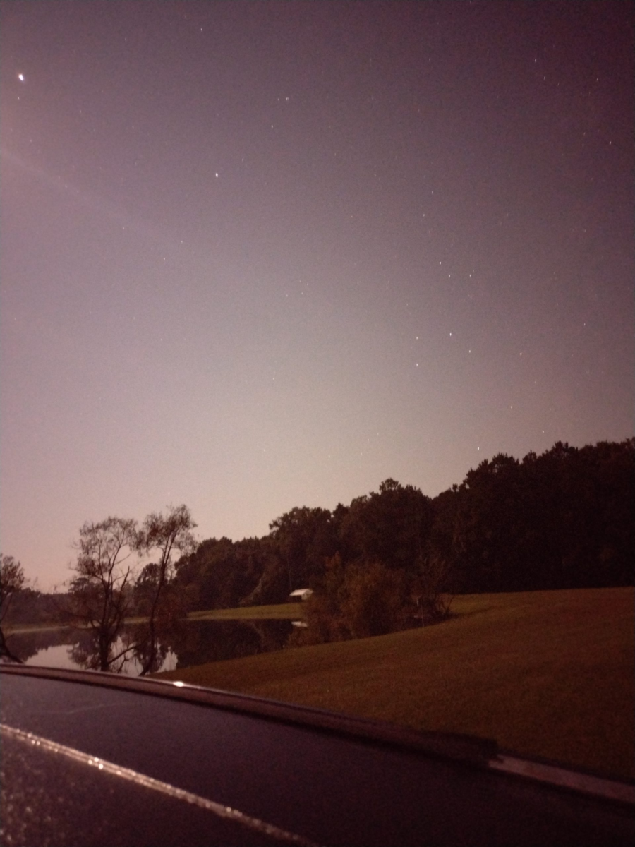
This morning is a calm morning, I guess it’s the truth behind “the calm before the storm.” As I write this Hurricane Idalia has smashed into the Gulf side of Northern Florida and will make her way across the state to the Atlantic side. The current forecast has the storm running just inland today along the coast of Georgia and South Carolina before sliding off into the sea. The schools and many businesses in our area are closed in preparation for the coming storm. We’re expecting winds, rain, and coastal flooding. There are two pieces of good news. First is, according to the internet, Jim Cantore is in Cedar Key Florida, and NOT in South Carolina. The second is the Colberg Cow is still up and in place, at least as of 6 a.m. this morning.
So today with the college closed, it’s a standby day for me, waiting really for the winds which may bring trees or branches down on the farm. Our ground is fairly high so flooding isn’t our big concern this far inland. By this afternoon the hurricane is expected to be a tropical storm again and by later this evening it will be well past us. The downtime is giving me a chance to catch up on some things (like writing).
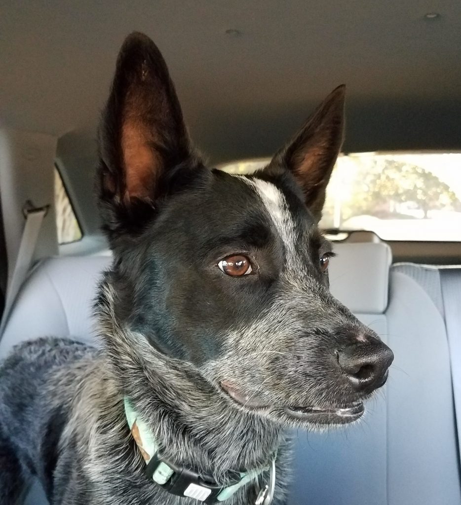
The group I volunteer with just did our annual activity plan and we added several campout events with backpacking. I started updating my blog site with a new page for The Palmetto Trail and in doing so I realized, I have a lot of gaps in my Palmetto Trail journey. And I want to get back on the AT. And the more I think about it the more I just want to get out more. I’ve started planning to grab time as I can to fill in some of the gaps in my Palmetto Trail passages. I’ve hiked passages like the High Hills of Santee a dozen or more times, but I really need to start filling some of the gaps now. I know some will be day trips, and some will be overnighters. My big hurdle really is hiking with one vehicle. Every hike becomes twice as long or I can only go half as far. Maybe I can just go, and keep going? Almost, but not yet. Sigh. Anyway tomorrow after the storm, assuming no major homestead issues, I’m planning to take Radar for the day. I’ve a backpacking trip with some new hikers in January. I need to find a suitable overnight trail campsite around the Swampfox and Awendaw Passages. The rains have come now. The trail is calling and I must go.
The trail is calling
Did you enjoy or find this post useful? Please let me know by leaving a comment below or join me on Instagram or Facebook.
I was able to make an impromptu visit to the park with Radar and stayed with some family for a night. My son and his family are traveling from another park and we are meeting at Devils Fork. The drive up is uneventful and Radar naps most of the way. I stop for gas and a quick snack from the Lakeshop at the junction of SC-11 and the turn-off to Devils Fork. Surprise! Coincidently my son and his family are stopped there as well. I follow their van the remainder of the way into the state park.
Devils Fork Campsite
Our tent site is a gorgeous walk-in tent site about 20 feet from the edge of the lake. We must leave our car in the parking lot and carry everything to the campsite. Our designated camp site is a couple hundred yards in. Most of the walk-in trail is paved but there are some unpaved portions between the trail and tent sights. The pad site is near the waters edge, sheltered a little by trees, yet still with a nice breeze off the lake. Really a gorgeous pick. All of the tent camp sites here are well established pad style tent sites. You must pitch your tent on the site tent pad. Most of the camping tent pads around us are pretty spacious and include a fire ring and lantern stand. With bears are in the area, we were advised to store food overnight in our vehicles at the parking lot.
Devils Fork Lakeshore. My son and his daughter at the waters edge.
This is Radar’s second over-night camping trip (you can catch Radar’s first overnight campout here). He seems concerned and watchful. I think he is still unsure about what the heck is going on. Maybe its the newness of the area, maybe the sounds of the lake, maybe the scent of bears in the wind. This night he sleeps lightly on his bed under my tarp and hammock. It’s around 3 am when Radar alerts to an intruder near our camp. I struggle to get my light and look under the tarp from the my hammock to catch a glimpses of what set him off with some warning barks. Whatever it was has moved moved on leaving us alone the rest of the night. Radar is ever watchful. The next morning is “moist” with light rain as we make breakfast and discuss the days plans. The forecast has a small window of clear weather then rain, rain, and some more rain.
Devils Fork, Radar in camp
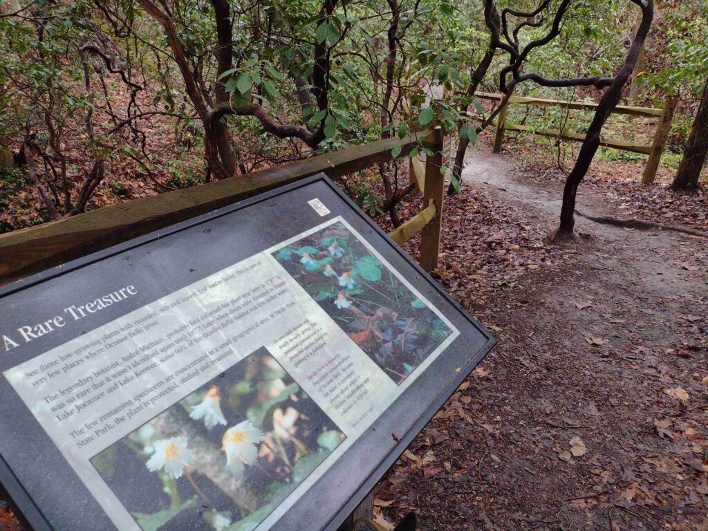
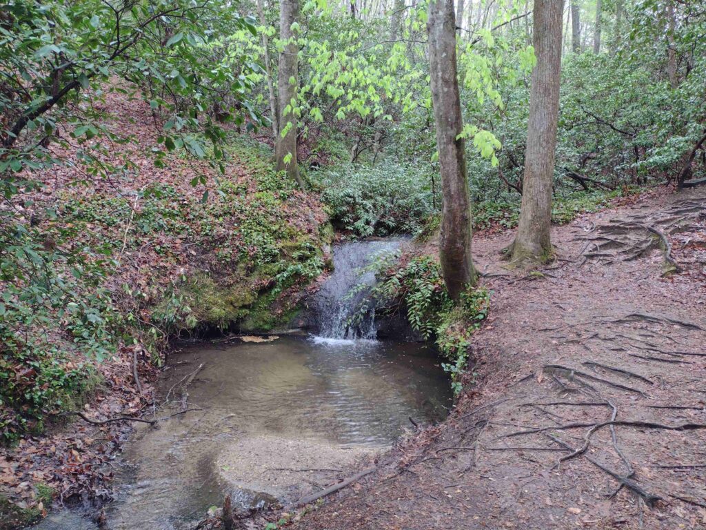
The weather ends up cutting our trip short. But before heading home I took advantage of the break in the rain. I was able to take a quick walk along the park’s nature trail with Radar. We even found some of the rare Oconee Bell plant (See our hike video here, comment below to let me know what you think). Devils Folk has a fairly short 1.5 mile nature trail in the main park. The trailhead is off the large boat ramp parking lot near the visitor center. The Oconee Bell Nature Trail winds through a mostly hard wood forest down around a creek and small pond before returning you to the start. One really nice feature of this trail is the labeling of botanical specimens all along the trail.
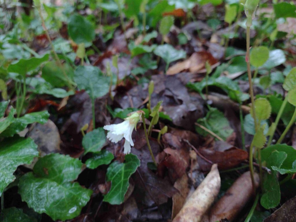
There are dozens of sign posts and story boards along the trail, identifying the various trees and plants along the way. The Friends of Jocassee have a great online trail guide which takes you trough the trail’s plants as you hike. One of the biggest points-of-interest on the trail is the Onconee Bell plant itself. An endangered rare plant, it grows in only a few spots in the state. The weekend we visited the plant happened to be in bloom. A moist area ground cover plant, it was sporting the delicate, white and pink, bell shaped flower.
Devils Fork trail hike, the Oconee Bell flowerDevils Fork Lakeshore
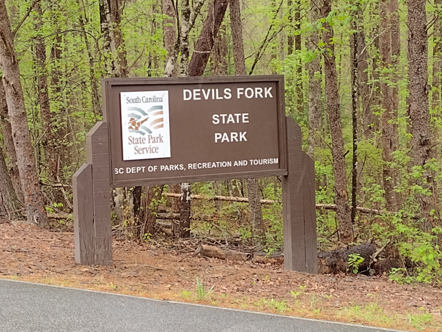
Located in the upstate of South Carolina, on the shores of the 7,565-acre Lake Jocassee, this park offers ready access to the lake, fishing, and camping. You can get a view of Lake Jocassee from the park webcam here. This 644 acre park park is about 10 miles North of Salem, South Carolina in Oconee County or about a 4 hour drive from the Charleston Area. Located in the Northwestern part of the state, Devils Fork State Park is one of South Carolinas newer state parks having been created in 1990. Anchored on the Sothern side of Lake Jocassee, the park has Villas, traditional RV/camping sites, and walk-in tent sites. The park does have some boat-in-only camping sites located on the Northern side of the lake. All sites need to reserved ahead of time.
Favorite Time of year: I will have to go with Spring to catch the Oconee Bell flower in bloom.
Things to Know: The breeze off the lake can be refreshing in the summer. However can bring a good wind chill factor in the winter. Oh and bears.
Pet friendly: Must be leashed at all times, including the forest, okay everywhere outdoors except cabin and lodging areas of the park.
Getting There:Devils Fork State Park is just West of Table Rock State Park off highway 11. Check the State Park directions link. It’s about a 4 hour drive from the Charleston. area.
#
Did you enjoy or find this post useful? Please let me know by leaving a comment below or join me on Instagram or Facebook.
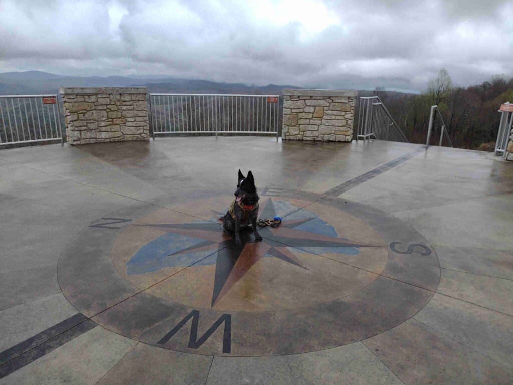
I just “happened” to be in the area and on a whim decided to detour over to Sassafras Mountain and bag this peak. Radar and I are returning from an overnight family camping trip at Devil’s Fork State Park in the North West part of the state. It’s Friday morning and we’re all heading home a day early. Our camping trip was cut a little short due to some rainy weather and the forecast for more of the same.
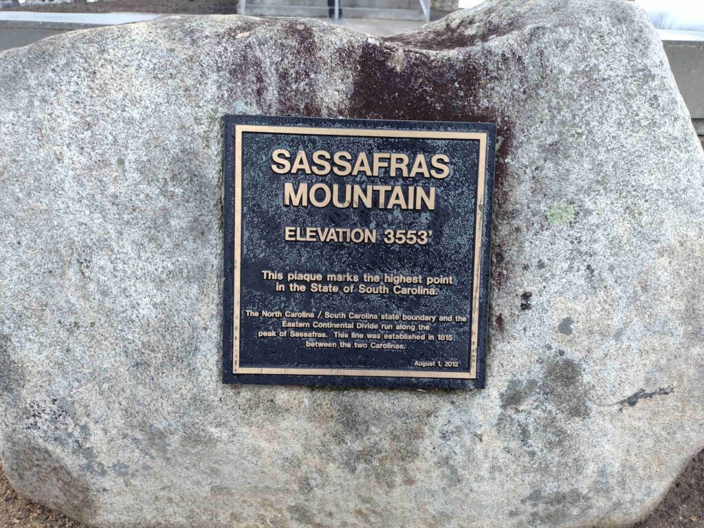
I realized South Carolina’s highest peak, Sassafras Mountain at 3,553 feet, is on the way home. Sort of. I check my map app and it looks like Sassafras Mtn is sort of almost on the way home. I don’t know when I’ll be able to get back up in this area. So a slight detour to the North and we are on our way.
Getting there requires a short drive into North Carolina. It’s strange but you can’t drive to South Carolinas highest peak from South Carolina. You must drive out of the state and into North Carolina in order to get to the peak. Sassafras mounting actually straddles the border of North and South Carolines.
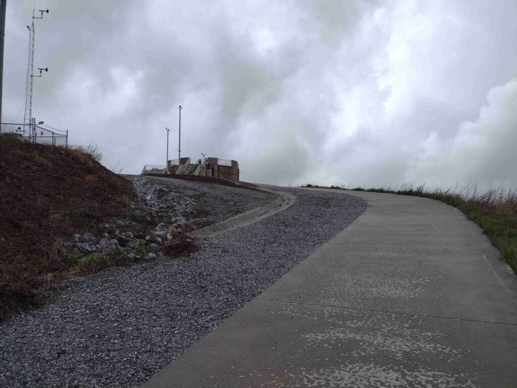
Sassafras Mountain Tower approach
I was here a few years ago (maybe in 2018) when the tower was still under construction. We were dropping some grateful hikers off at their car in the parking lot, It was late a night. I ran up to the peak but could see anything (being nighttime and all). So I’ve always wanted to come back.
Sassafras Mountain Plaque
We’re taking SC highway-11 home anyway so I detoured and take the winding roads to the mountain peak. It’s about 1:40 pm as we get to the Sassafrass Mountain parking lot. The weather has been off and on rain all day but it’s just a short walk up the trail to the observation tower. The rain lets up as we start up the trail. As we get to the top of the tower the sky is overcast but the rain has stopped, at least for now.
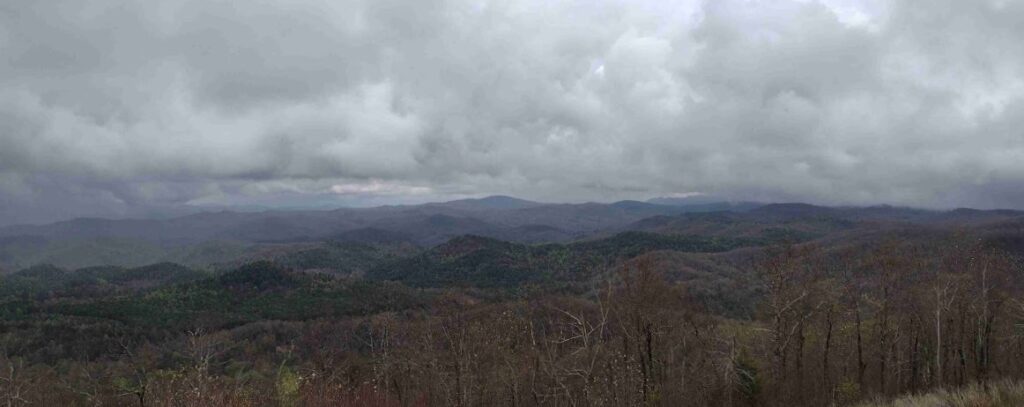
Sassafras Mountain East View
The view is good for the day I think. they say you can see for 50 miles on a good clear day. I imagine the view will be amazing. Maybe on my next visit.
#
Did you enjoy or find this post useful? Please let me know by leaving a comment below or join me on Instagram or Facebook.
A quick aside. It’s Saturday morning. The sun is out. The morning looks bright. Despite the insane pollen, I’ve decided to enjoy this morning. A hot cup of Cafe Mocha, a pancake breakfast, and some quality catch-up time. Later today, I’m planning to make some poles for my scout troop’s dining flys (replacements from our stolen trailer episode) and then take Radar for a long walk.
I’ve done a couple of campouts this year I still need to unpack including an awesome trip in to Florida last month for the Battle of Olustee Reenactment. I’ll try to get out more on those soon. but for now, I’m just going to enjoy the morning.
#
Did you enjoy or find this post useful? Please let me know by leaving a comment below or join me on Instagram or Facebook.
My first efforts to take Radar on a real overnight campout and then hiking went incredibly well. Radar and I have hiked together a fair amount. And we’ve glamped before. But we haven’t actually tent camped and hiked in one outing before. Hopefully this overnight adventure was a test run for more fun outings to come.
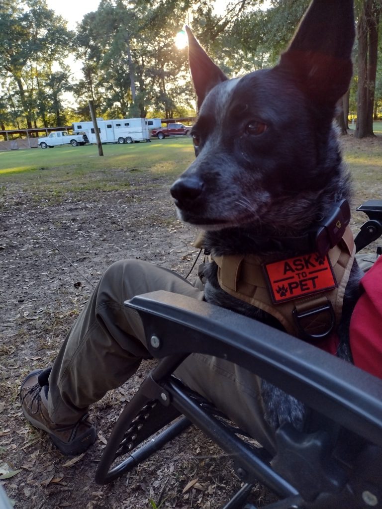
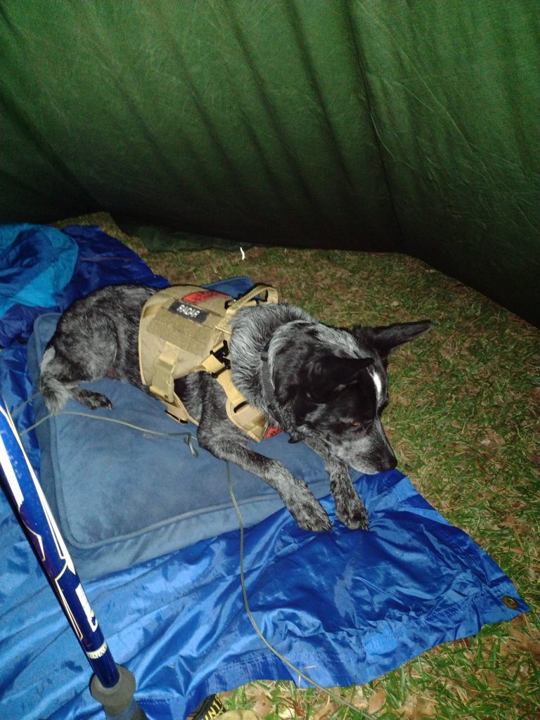
We arrive at Mill Creek county park about 5:30 pm. Mill Creek county park is a popular equine camping staging area located in Sumter County, at the southern end of the High Hills of Santee Passage of the the Palmetto Trail. There are a few horse trailers already set up for camping there. We select and set up our camp site near the trailhead leading north to the High Hills of Santee trail. Radar is nervous. He doesn’t know why we’re here this late in the day. Tent camping is all new to him and he’s not sure what’s happening. I put his vest on him to see if it will help calm him down any. I’m picking tarp camping to start out with him which is a little bit of a challenge in and of itself. I guess I figure we may as well start hard and work toward easy. Park rules say he needs to be on leash in the park, although not all dogs here are. There is at least a pug and another heeler here too. The pug runs up next to my car as I arrived, dragging it’s leash, seemingly convinced it was more important to greet us as new arrivals to camp, regardless of it’s own personal safety and the potential hazards of being crushed by a moving vehicle. Anyway we’ll see how the leash thing goes. I had picked up a 50′ roll of paracord from Lowe’s on the way with the idea I could make a long lead for Radar in camp. I also brought his bedding from home to make him feel a little more at home along with his regular food and water bowls. I have a couple collapsible bowls I usually bring when we go out for hikes but will save them for the trail tomorrow. Right now he’s sitting on my lap in the chair (his choice), watching everyone and everything else around the camp.
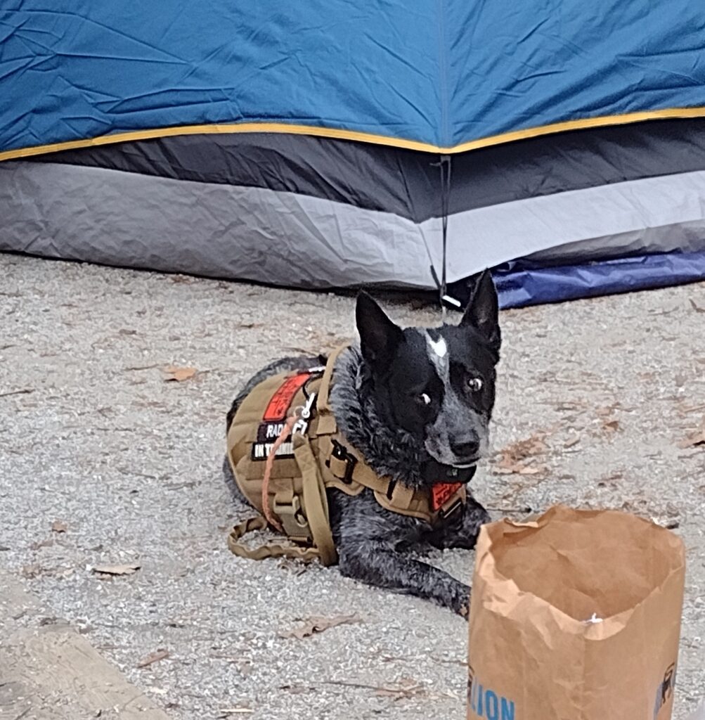
Radar’s not sure
There is a mule in an impromptu electric fence corral next to a couple of horse trailers on the right of us. They have the pug and heeler. Across from us is another pair of horse trailers with a shepherd and lab. Everyone seems to know everyone. They started a camp fire at the pair of trailers across from us and the people from all four trailers are sitting around the fire chatting. The sun is getting ready to set so I’m going to feed Radar and eat now myself.
Radar’s first night tarp camping
Up in the morning. I was awake early but am waiting until the sun starts coming up. It was a little bit cooler than I expected last night with this early morning temperatures at about 45 degrees. Note to future-self: Things to bring on fall campouts, gloves and a warm hat. I am glad I brought my heavier sleeping bag, a 20 degree sleeping bag, which was perfect. Radar did incredibly well for his first night of tarp camping. He only got up a few couple of times in the night, left the tarp, and walked around. I think he was check out noises from the adjacent woods. No barking, just checking. I got up a couple times myself to pee and he followed me close. Because we were under a tarp, I had to keep him on the long lead most of the night but for the last hour or so waiting for sunrise. This last hour we both just lay here waiting for sunrise. The ground is pretty hard and my Z-fold pad isn’t making much of a difference. I’m beginning to think I may need a different pad.
Radar still seems a little nervous this morning so when I got up for a quick walk to the bath house, I took him with me. I wanted to use the larger stall so Radar could come in with me, but someone was already in there so we went back to our campsite. Who get’s up at the crack of dawn to use a bathhouse anyway? When we get back to the camp site, I open up the car to start getting breakfast ready and Radar jumps right in and takes his place on the front seat. I don’t know if he thinks I might leave him or not but he isn’t taking any chances. He comes out of the car for his morning meal while I have a nice trail breakfast of hot oatmeal and a café mocha. It feels good to be in backpacker/hiker mode again. I’m dressed for the trail. It’s been a while (too long) since I’ve been able to get out and do any real hiking.
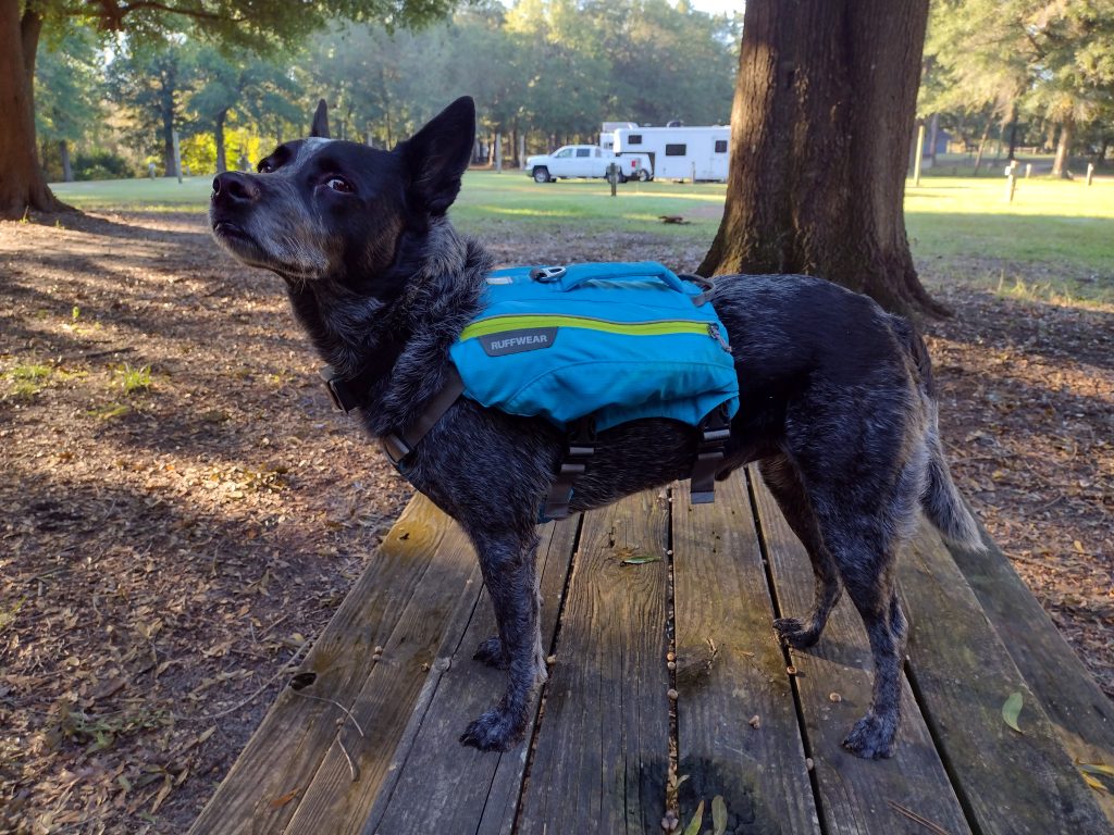
Radar is ready to hike
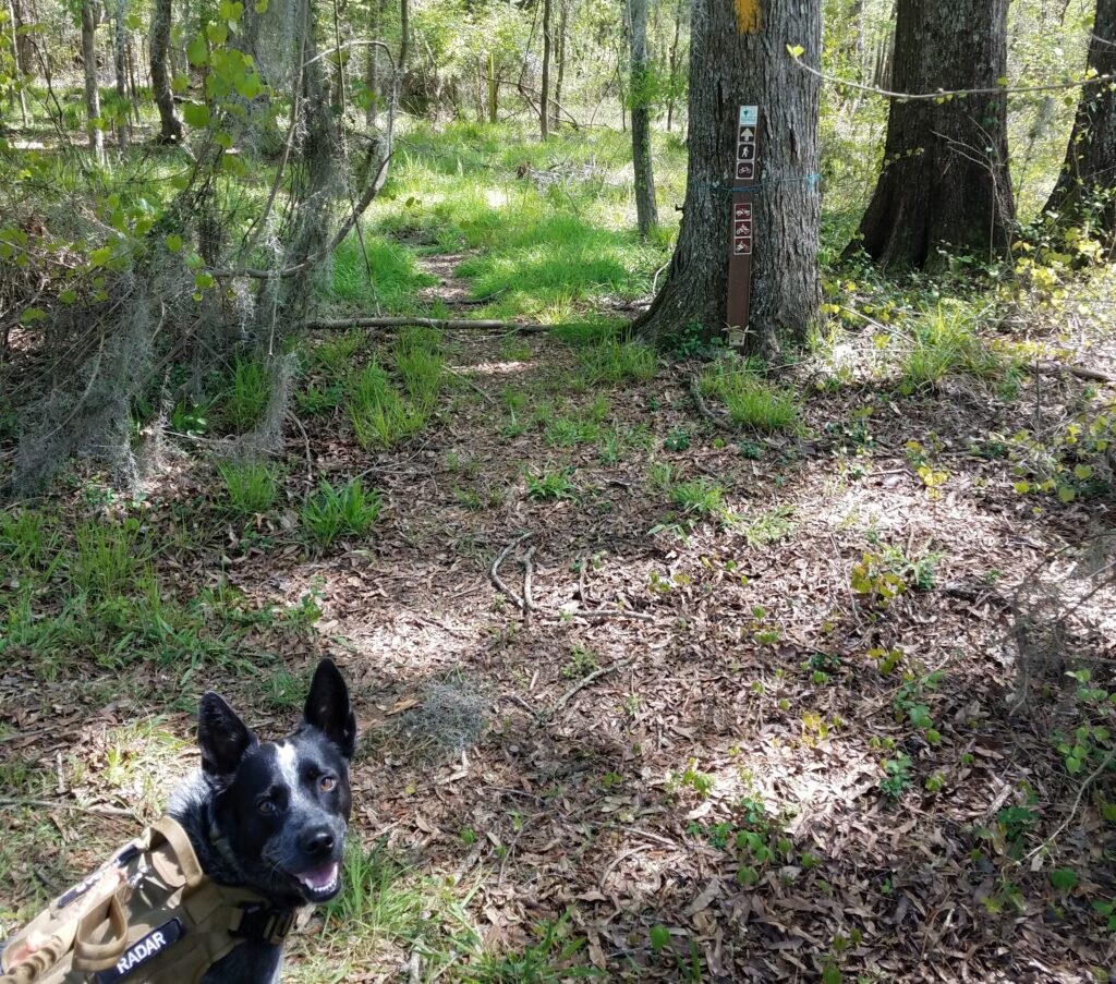
After clean up and repacking my hiking day pack, I put on Radars hiking vest. I want something with a little color on him as we are hiking in the Manchester State Forest, which is public land, during hunting season, and I don’t have any blaze orange with us. I think once Radar realizes we are going hiking he really relaxes a lot. We are on trail, north bound, at 8:50 am. Radar is off leash, much to his hiking joy, once we get out of the park but I do have a leash just incase we meet horses or other hikers. Proper trail etiquette and all. Not everyone seems to like dogs.
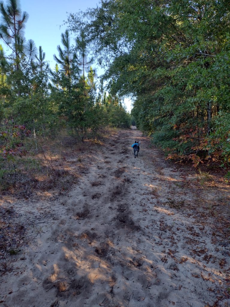
High Hills of Santee Passage heading out
The High Hills of Santee Passage I think I’ve hiked at least a dozen times. It’s a great section to hike and I usually start out new backpackers on this trail. There are a lot of access roads and the trail is well marked most of the time. Since it’s been a while for me, I’m loosely planning to hike maybe 3, 4, or 5 miles out, depending on how I feel and the day goes. Then turning around and hiking back. The trick is leaving enough fuel in the tank for the return trek. I figure if I can start hiking by 9am, we can maybe hike like +-3 hours, we could eat lunch and then hike back. Being on trail by 8:50 is a perfect start.
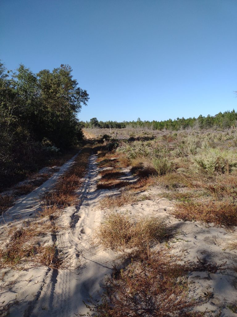
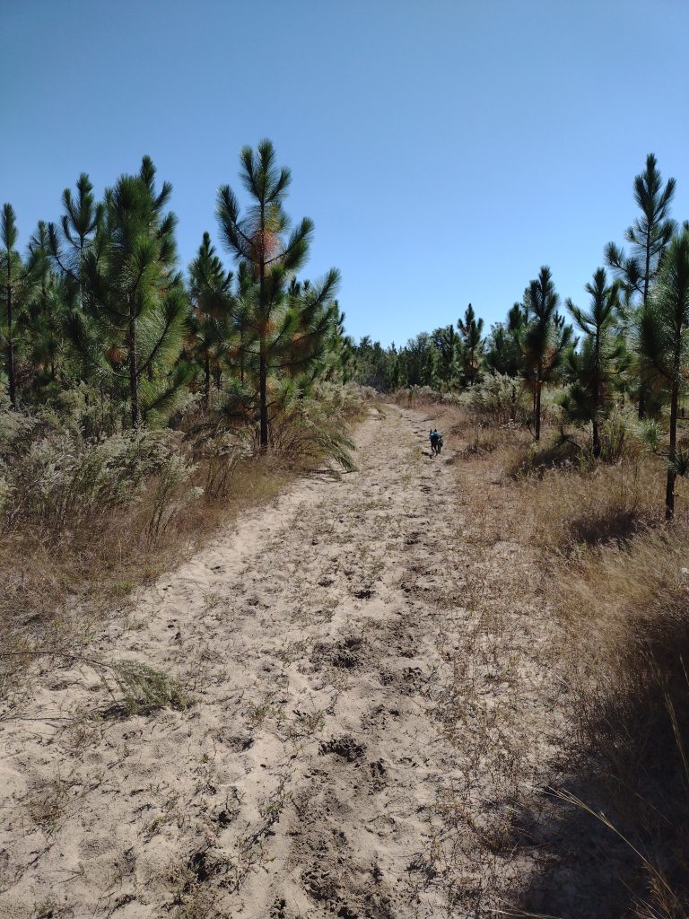
High Hills of Santee Passage sandy trail
The issue with the early section of this trail (besides the quicksand patch) is it’s sandy. Sandy like walking on dry sand at the beach sandy. It really sucks the energy out of you. Starting out in the morning fresh is okay (’cause you’re fresh) but finishing at the end of a hike is tough, it’s like hiking an extra mile or two when you’re tired.
The day goes well, the weather is cool, clear and perfect hiking weather. We hike well and make good time. We covered about five and a half miles and make Christmas Mill Road by about 11:30. As we reach the crossroads, there are a whole group of trucks with hunters coming in and starting to unload. Rather than stop there for lunch, we just start our return leg and hike about an hour more before we stop for a good lunch break.
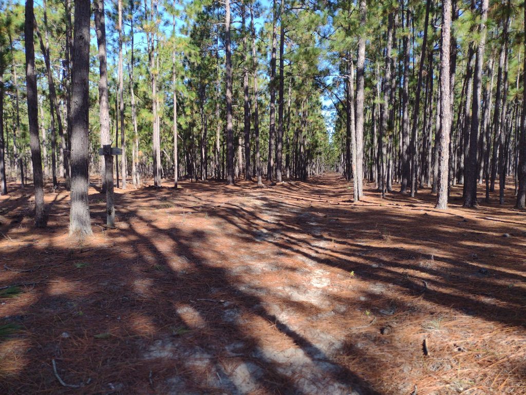
High Hills of Santee Passage young pine forest
Radar seems to understand when I tell him “we’re heading back to camp, back to the car.” His ears are up and he leads the whole way back to camp. He follows the trail flawlessly, even when the trail crosses a road or splits, he picks out the correct path on the other side. As we were hiking out of camp north bound, he would generally stay close to me alternating between ahead, behind, or off trail checking out smells and noises, usually not much more than about 75 feet away. Heading back south bound to camp, he occasionally is going off trail to check a noise or smell, but mostly he is leading with purpose, maintaining about a 50-75 feet lead ahead of me on the trail, stopping ever so often and looking back to make sure I am still with him, stopping in the shade, waiting for me to catch up, and then he starts trotting off down trail again.
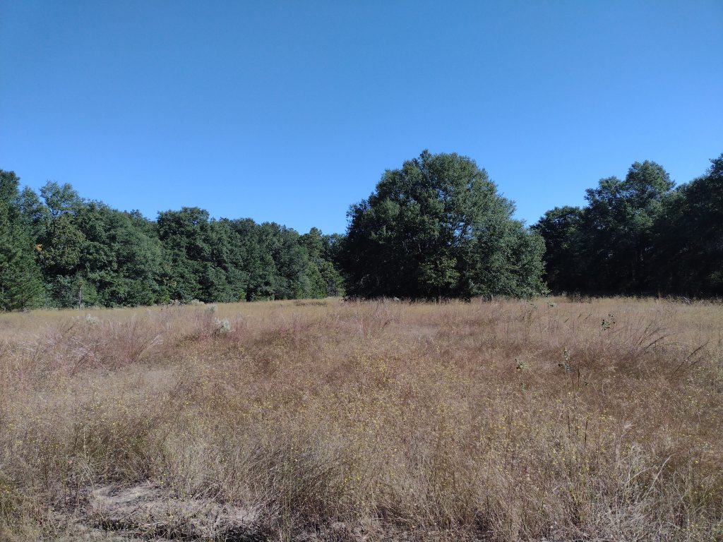
High Hills of Santee Passage pine forestHigh Hills of Santee Passage open field
We stop for lunch around noon. Food and water for both of us. I have a couple collapsible water bowls but it’s hard to judge when hiking and how much water he needs. I make sure he has his fill of water during our lunch stop. The final leg to camp is more sandy and the day is warming up. We’re back on trail by 12:30 heading in to the home stretch now. Nearing the last quarter mile from camp we run into a string of horses with riders, we pull off trail to let them pass, Radar sits and waits. This is a big test because he loves horses. Really, really loves horses. Nipping tails kind of love. He stays, the riders pass intact. We hike on. I’m very happy. We make it back to camp around 2:10 pm. As we enter back in to camp we make for a picnic table in the shade and break out the last of our water. The hike is a win. A great hike and overall a great little campout. Radar crushed the hiking part of the trip and I think he’ll get the hang of this tent camping thing without any issues in the future. Now to figure out the next trip.
#
Did you enjoy or find this post useful? Please let me know by leaving a comment below or join me on Instagram or Facebook.
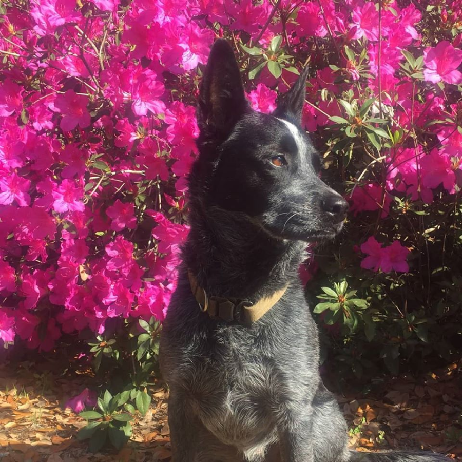
Just a quick aside. It’s been a busy first half of the year and the time has just gone by way too fast. I’m working on a several projects right now, a couple with work and at home. So the year has whizzed by. I’ve also recently had a woman’s group reach out to me, wanting a guided hiking or backpacking trip some time this fall. This sounds like a great opportunity to get out and explore. We’re still way early in planning, I’ve provided a list of possible weekend trips. I’m just waiting to hear back on the kinds of trip they are interested it. This would be a really awesome event if it all comes together. I haven’t had a really good escape to the woods this year yet so I’m looking forward to hiking this fall. I need a trip Radar can come camping with me. My next scheduled outing with my volunteer group will be to Lake Moultrie next month. Small boat sailing is on the agenda and a little lake time in August might just hit the spot.
#
Did you enjoy or find this post useful? Please let me know by leaving a comment below or join me on Instagram or Facebook.
This past weekend I camped with a group of fellow campers on Johns Island. While not summer hot, the weather started out a bit warm.
Fall in South Carolina can still have some pretty warm weather. It can also have some of the best camping weather around. So far this fall the weather has been generally good with the heat of summer is gone, but the evenings still have been hovering between a little too warm and almost cool. Camping weather in the fall is some of the best here because its mostly dry, the bugs are fading, and the evening temperatures are cooler. The days are in the comfortable tee-shirt temperature zone and the nights can dip down in to the sleeping bag snuggling temperatures.
Activities while camping are great don’t get me wrong, but there is something special about camping sleeping. It’s a little complicated to explain, probably because there are so many things which affecting how well someone sleeps outdoors. Partly I think one of the benefits is your body gets to re-tuned and return to natures natural circadian rhythm. For me, one of the big contributors of a good nights sleep is temperature. Too warm and you’re laying in a puddle of sweat, too cold and you’re shivering, either way sleep doesn’t come easily when you are outside of the “great sleeping weather” zone.
When is something broken a good thing? When the heat of the summer breaks for the fall camping weather. There is something special about being a witness to the changing of weather. This past weekend I was able to see and feel this shift, the breaking in to the cooler fall camping weather. It rolled in as a small weather front Saturday afternoon. You could see the clouds moving in, covering the clear blue South Carolina sky. There was a light sprinkling of rain, and then just like that, the cooler weather was here. Sleeping that night, blanketed in a warm sleeping bag, in the shelter of my tent, was great.
#
Did you enjoy or find this post useful? Please let me know by leaving a comment below or join me on Instagram or Facebook.
There isn’t much about August I think I’ll miss. But I’m not sure if fall will be much more fun.
I’ve been busy, and then started working my second job again, teaching (face-to-face) in this fall, which adds to the busy. I’ve been working straight through China virus and am so ready for a break. I have a couple weeks time off coming up, I hope everything goes well.
It’s clear summer is leaving us now the cooler temperatures of fall are starting to drift in. The days are getting shorter. Every morning I notice sunrise is a couple minutes later. With the longer darkness brings thoughts of upcoming holidays and an underlying sadness with them. I’ve heard the fall and winter is problematic for a lot of people. I fear this year maybe worse for some due to the long periods of “self isolation,” quarantine, social distancing, or whatever everyone has been going through.
In other news, it seems the city of Los Angeles has cancelled Halloween this because of the kung flu. The one night of the year people would want to wear a mask and they canceled it? Sigh, the world just doesn’t make much sense anymore.
Skyline of New York City, September 10, 2001.
I saw a post with a skyline picture of NY City from September 10, 2001 which brought back memories. Sadly there is an entire generation now who really have no idea, the trauma people felt on that day, and went through in the following days and weeks after, and still. I think I’ll always remember, that day, where I was. Those thoughts and feelings.
Here’s to tipping one back to the fall, may she woo us with something good and exciting. Stay safe y’all.
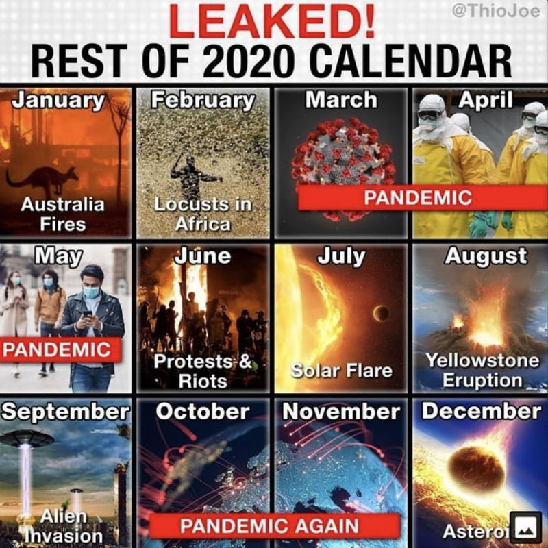
It’s been a bit more of the crazies these last few months, and I can’t wait to see what the next few months have in store for us.
2020 Calendar Coming Events
Most of the country is now slowly reemerging from some level of state imposed, pandemic induced, shutdown and quarantine. I hope your area is recovering well and your family is safe. The global release of a new virus and resulting pandemic was caused either by some conspiracy involving world depopulation with a bio-engineered, lab created, smart bug with no known cure. The other possibly is it was just a bad cup of bat-soup. WHO knows (that’s a punny play by the way, feel free to comment if you get it). Anyway I haven’t had the opportunity to camp, hike, or get lost in the woods since last year. The group I volunteer with had to cancel a long list of events including summer camp and our high adventure back packing trip. Everything was closed, including the wilderness.
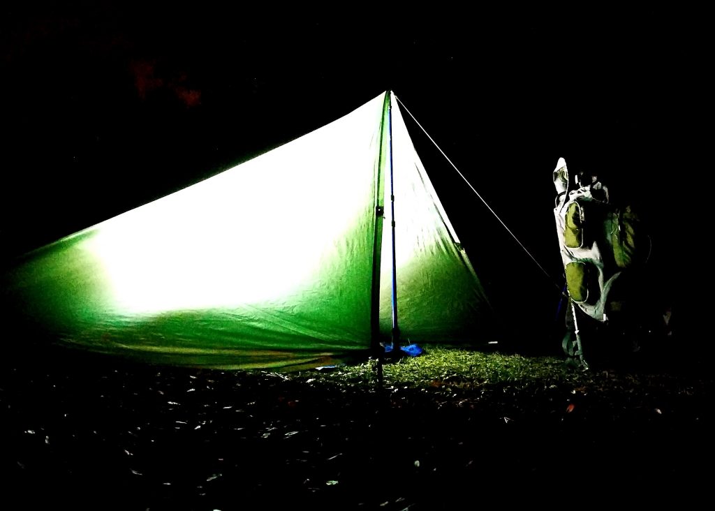
My camp at night
As an “essential worker,” my daily work routine really hadn’t changed much through the whole pandemic. I just see fewer people. Overall, this is probably a good thing. It’s strange times when you can’t get a haircut, yet Walmart, Lowe’s, and Home Depot are packed almost 24/7. One of my favorite things to do in recent years was to sit in a local coffee shop, people coming and going, listening to music, just thinking, maybe write some. Yep well, No Can Do in china virus times. While you can still get a cup of coffee, it’s To-Go only. Sitting is banned. Pretty much I just go to work & go to home. I will tell you, the daily commute to and fro was great for the first month or so. It seems essential workers are also very responsible drivers. You could really tell when the non-essential folks hit the roads again. I was just beginning to think, really soon, things should drift back to normal. But then, Murder Hornets.
Murder Hornets Are Real
Such a creature as the Murder Hornet popped up on the radar for a short period, about early May I think. These hornets are around 2-3 inches long. And can kill people. And wipe out honey bees hives. And they have invaded the Americas and are heading to a field near you. Imagine tripping over a hive of them. Yep that’s the thing of which nightmares are made. For a short while, these horrendous creatures were a real concern. But then, the Purge.
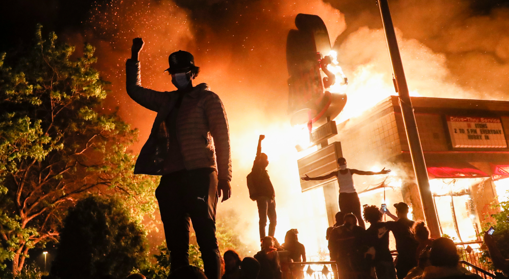
John Minchillo/AP
For those who don’t know, The Purge is a movie where society basically allows crime and mayhem for a one single night and all emergency services are suspended. Admittedly I haven’t seen this movie but then sometimes truth is stranger than fiction. Not to be constrained by a mere single night of mayhem, we’re now about a month into some nightmare real life version of the movie. Either overwhelmed by the volume of chaos, or stifled by governmental leadership, the police aren’t responding to crime in major cities now, which of course limits emergency medical & fire response services. In multiple cities, whole blocks have been vandalized, looted, and burned to the ground by rioters. Dozens murdered. Hundreds injured. And it’s still continuing. I wish it was a movie, because then I could get up and leave. As time grinds on, it seems like people are just getting crazier. And dumber.
I actually find myself getting fatigued from reading or watching the daily news too long now. There are groups of people who literally want nothing more than to watch the world burn. The idiocy sometimes becomes overwhelming, but then I push away, look out a window, go for a walk, and it feels just a little bit better. I am thankful for the people in my life, my family and friends. Being able to gather with family is refreshing and something I miss. Up until recently this social gathering of good people was banned too. June 20, 2020 happens to officially be the first day of Summer, yet the backyard barbecue parties are still restricted or banned in a lot of areas. Beaches in most states have been closed to the general public for months. Only celebrities, heads of state governments, and other special “VIP” get to go beaching or get haircuts. But then mass protesters made it all okay to get together again, but only to riot, not for happy events like birthday parties or friendly gatherings (see what I mean about dumb?). Crazy times. I can’t wait to see what July brings.
Just a quick note as this first day of spring begins to fade. The weather today has been truly spring like, although I’ve been stuck inside working my day job for most of it, I’m looking forward to more of nice weather. The winter has been great but I’m ready to move on. Unfortunately the world is now caught in this whole global China flu Coronavirus pandemic thing and everything around me is closing, or winding down, or being socially isolated, or being washed and disinfected. There is a ton of good info out there on this bug so I’m not going to add to the noise other than to say use some common sense, you don’t need ALL the toilet paper on the shelf, and follow the recommendations of your local health officials. Here in the great state of South Carolina our winter seems to have been pretty mild and the plants are really starting to bud out now with the warmer weather. I’m guessing the Azaleas are probably a week or three from peak bloom, and the Dogwoods are just beginning to flower. I’m so looking forward to getting some trail time this spring, with any luck. We’ll see how the next couple of weeks pan out. Stay safe all.