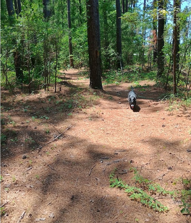
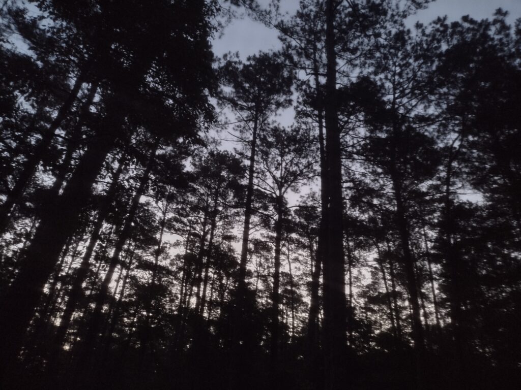
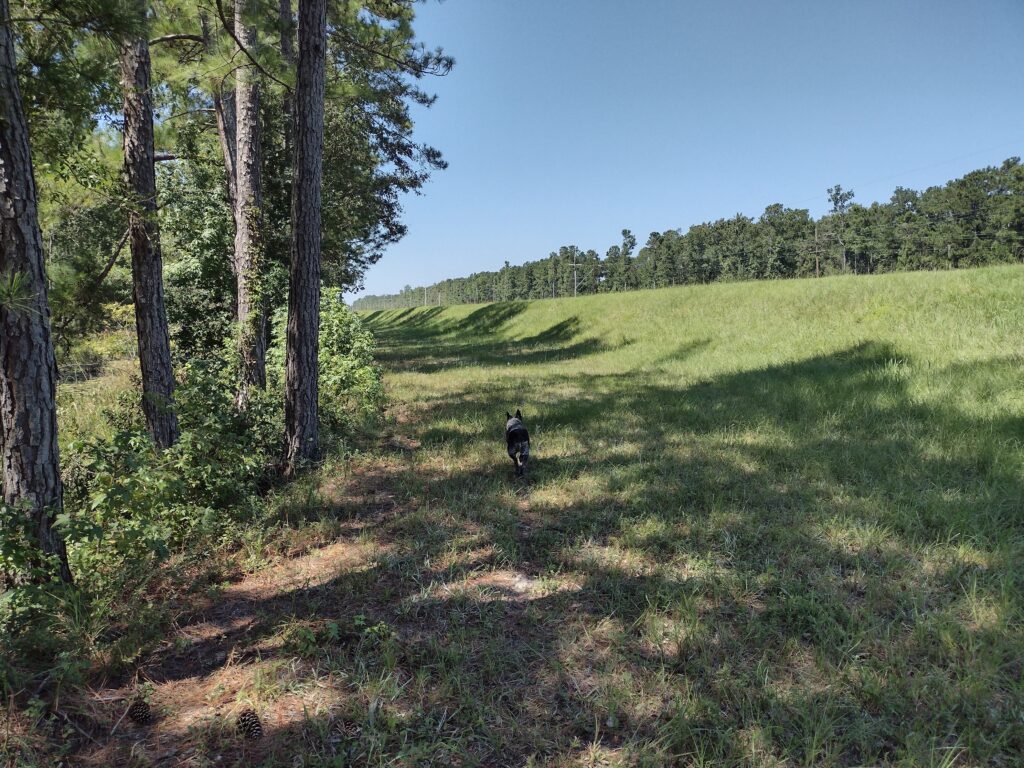
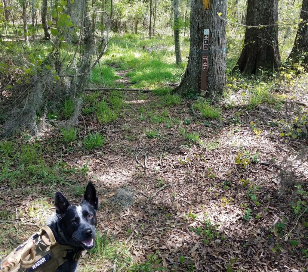
It’s a hot July, and Radar and I are venturing out in search of a new trail.
My volunteer group routinely does a split camping event at Poinsett State Park, where one group with the younger boys goes directly to the state park and sets up a base camp in the primitive group camping area. I take another group of older boys South to Mill Creek County Park and then backpack up through the Manchester State Forest, rejoining the main group at the base camp.
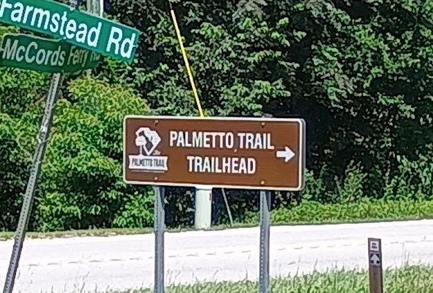
The Palmetto Trail cuts through Poinsett State Park. This really works out great for a weekend backpacking trip. It gives you a great place to end a hike and relax after recovering vehicles. The southern trail is the High Hills of Santee Passage, with the northern trail the Wateree Passage.
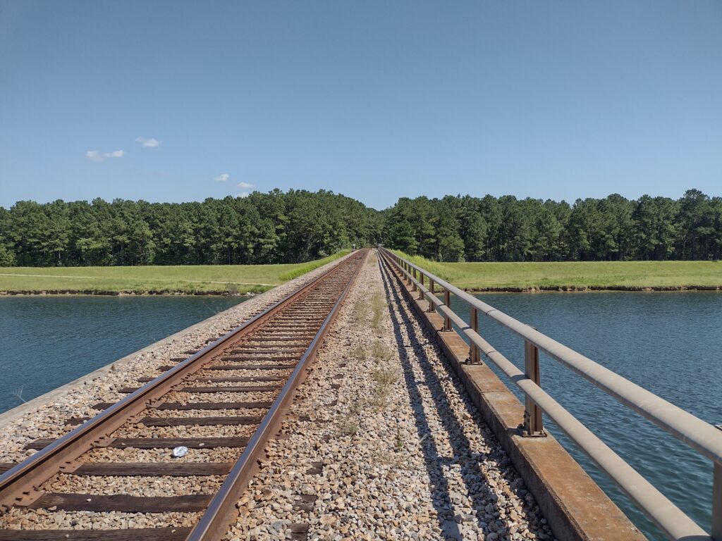
I’ve hiked the High Hills of Santee Passage of the Palmeto trail dozens of times over the years now and want to try a new backpacking trail into Poinsett State Park this coming year. The Wateree Passage looks like an interesting hike. A big chunk of the trail uses an old rail bed with a suspension bridge to cross over the Wateree Swamp to get to the park. Because it will be a group event, I want to research the trail a bit and do some trail scouting.
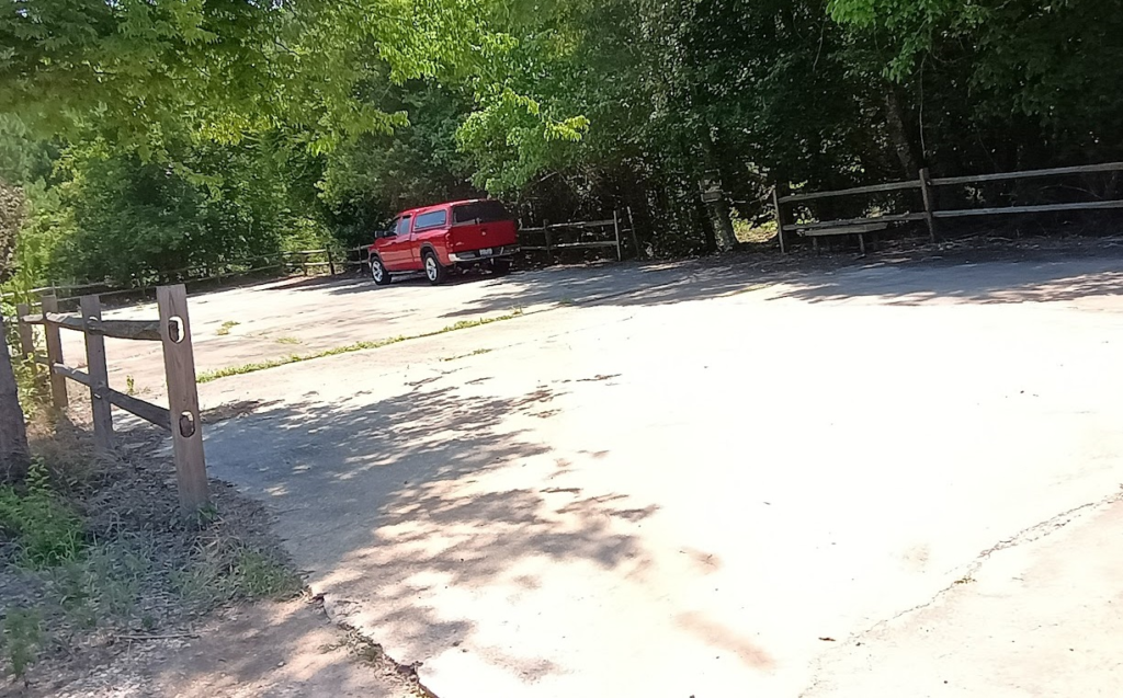
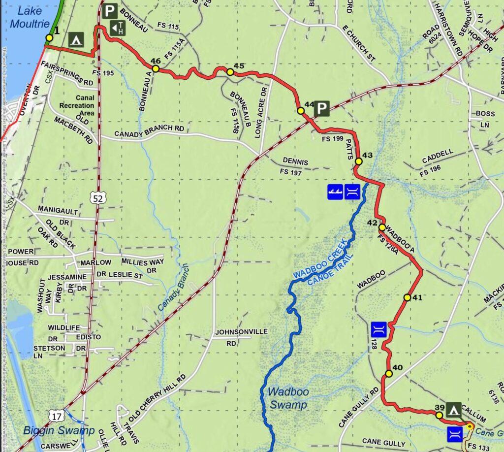
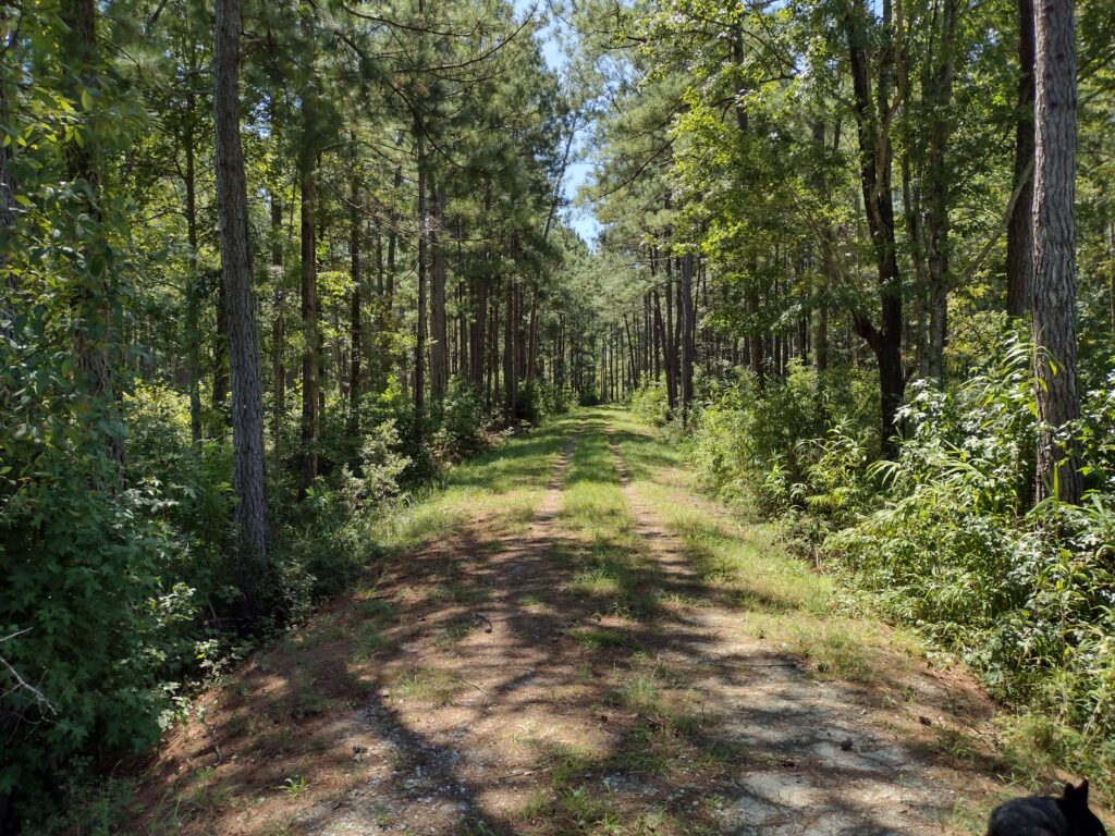
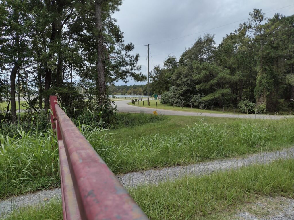
At the northern end of the Wateree Passage, there are two trailheads for this section, one at 11.4 miles and one at 9 miles. While camping is allowed, there are no designated campsites along this passage. There is also no water source indicated until you get to the state park. Normally, with Mill Creek, we camp Friday night at the county park and then hike up Saturday to the state park. So part of what I wanted to see in trail scouting the Wateree Passage is where we could camp Friday night.
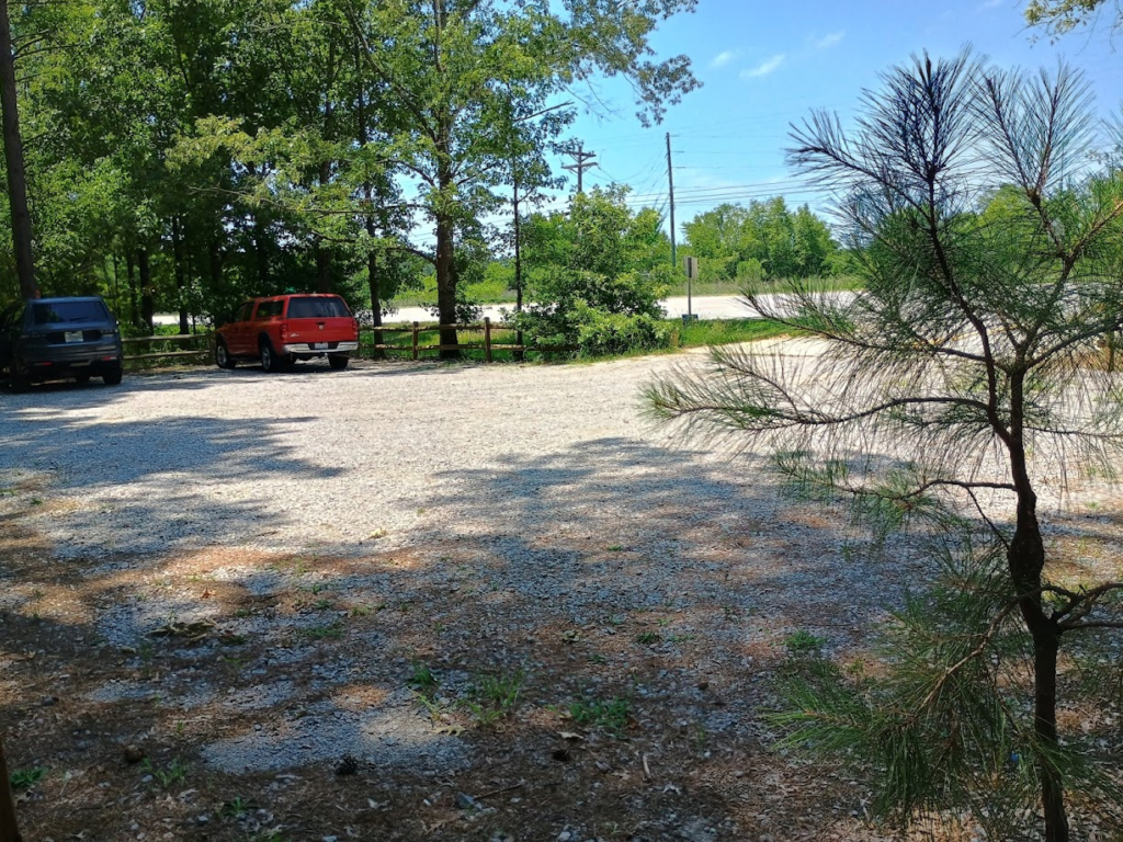
Wateree 11.4 Trailhead Parking
The trailhead at the 11.4-mile mark looks great for parking, not so much for a night of camping. The trail started right off the fenced paved parking lot, after the information kiosk. There are very few places for a group to pitch tents. Radar and I walked down the trail about a mile and didn’t find any real clearing, so we headed down to the trailhead at mile 9.
Wateree 11.4 Mile TrailheadWateree Trail at 11 miles
The fenced gravel parking lot at the mile 9 trailhead was not really any better, but it did include a small picnic table. There was a family from Florida lunching when I arrived. Again, like the 11.4 trailhead, there was an information kiosk, but the trail just continued past with no clearings near this stop.
Wateree 9-mile Trailhead Parking
Just a little further down the road, at around the 8.75-mile point, the trail takes a hard turn to the east to pick up the railroad line and cross the Wateree Swamp.
If we are to camp on the trail Friday night, it’s going to be between the two trailheads somewhere. We’ll also need to bring all the water we’ll need. The other option might be to camp at the state park Friday night, then drive over to a trailhead on Saturday and hike back. The next step will be to get the trip on the calendar with a little bit more planning.
#
This is just a quick aside as the new year begins. As the year starts out, I’m working to detangle some of my work and play. I’m hoping this gives me better trail time this year, with the big adventure in planning being an AT trail trip this summer.
Watch for those tag stickers! As of January 1st, all SC vehicle registration stickers should be white in color. If it’s a green sticker, the tag expired in 2025. If it’s a yellow sticker, the tag expired in 2024. Yes, I have seen a couple of yellow stickers on the road this past week.
A few years ago, I bought a truck and have been tinkering with “truck camping.” I’ve done several weekend camping trips, camping in the truck instead of a tent last year. I want to get in a camping trip with Radar soon, so watch for some upcoming details and insights about how it all works out.
If there is interest in anything specific, please drop me a note in the comments!
It’s refreshing to hike a trail twice and have a completely different experience. Sometimes re-hiking a trail is like a repeat experience, good or bad, it’s just pretty much the same. I’ve hiked a number of trails in my area, including this one, several times. I had been thinking about trying to find an alternative area to hike for this weekend, but this route was the simplest to pull off logistically. This time, the hike felt like a completely new trail.
The weekend weather really paid off for us; forecasted rain never materialized, and the weekend was perfect hiking weather. We camped at the same spot near Cane Gulley Branch Creek. The ground was dry and the overnight was cool, and we woke to a light dew in the morning.
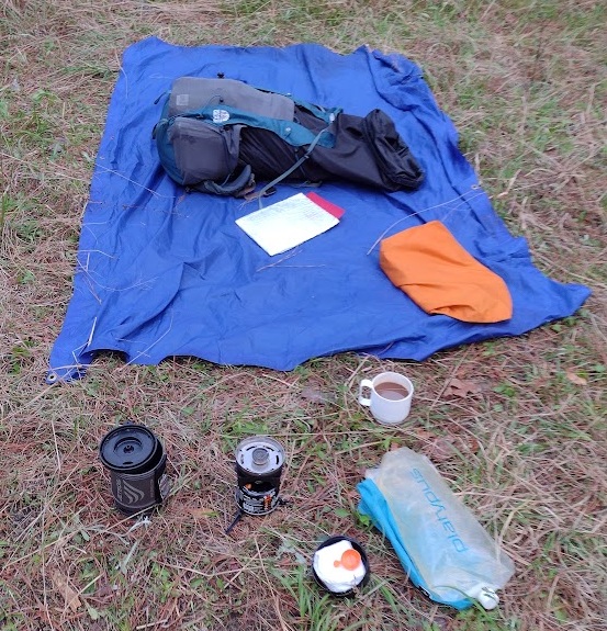
I was up early before the sun and other campers, took care of my morning business, and started breaking down my shelter while making breakfast. Breakfast was my trail, Cafe-Mocha, and instant oatmeal. I let the dew dry a little while I ate before I folded up my tarp.
Breaking down my shelter and making breakfast
Some of our brave hikers had planned a nice hot breakfast of … fried SPAM sandwiches. Unusual, but each their own. I gave up on planning group menus a long time ago.
Fried SPAM Sandwich for Breakfast
Our youth group used to go through the trouble of developing a backpacking trip menu, buying the food, and dividing it among the hikers. It can work sometimes for new hikers as a way to give them ideas. But it’s a lot of work for a couple of people. I shifted to a plan-your-own, buy-your-own menus, and found it’s much simpler for everyone to make their own menu, get their own food, etc. It’s a great learning experience. On one memorable hike, one hiker brought two 1-pound cans of clam chowder soup for dinner. It’s a little over the top, but he hiked it in, ate both cans, and was very happy with his menu. You might say he was as happy as … a clam.
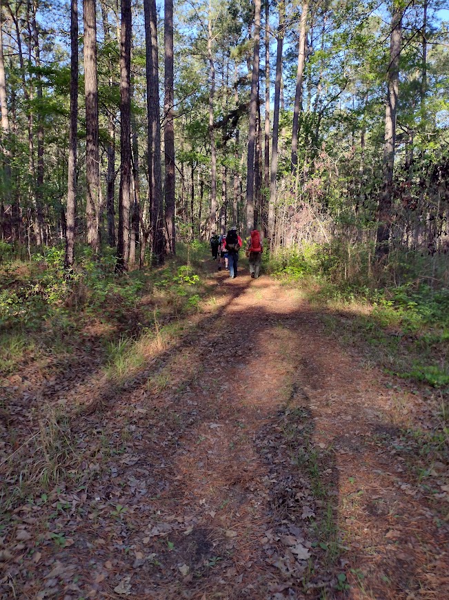
On this trip, we had two new hikers with us, so a quick pack-shakedown was on the agenda once everyone was packed and ready. We talked about equipment and various options for packing and lighter alternative gear in the process. I removed about 15 pounds between the two before we hit the trail. Even with the pack-shakedown and associated coaching, we were on the trail much earlier than I hoped. Our group was on the trail and hiking at 8:15 am.
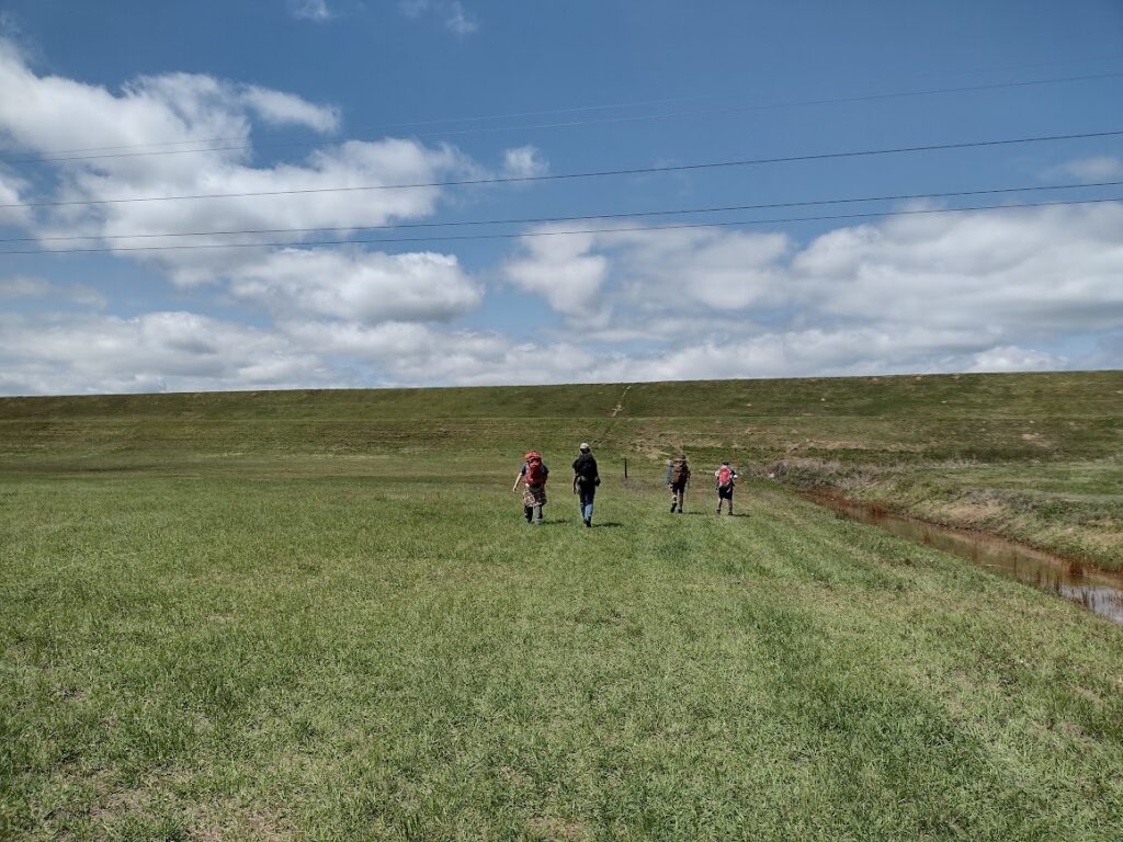
On the Swamp Fox Trail
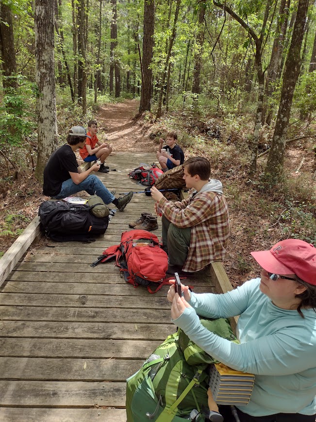
An early start is a great way to start a hike. For me, when hiking, time is miles. Generally, I budget about 2 miles per hour for my hiking time. A late start usually means a late finish. It also means more time hiking during the heat of the day. Even if I hike the same number of hours, I feel better arriving at my destination “early.” We had a strong pace from the start, and it continued for most of the day (Thank you, Kaci!). This gave us more time at lunch to relax and still let us make our base camp in good time.
Lunch on the Trail
The trail was so much drier than last year and a real pleasure. The Swamp Fox Passage weaves its way through over 47 miles of the Francis Marion National Forest from Highway 17 to Lake Moultrie. Depending on the time of year, this trail is often swampy and wet. There are sections of the trail where foot bridges have been installed to help mitigate the wet ground and keep the trail passable. On this trek, the trail was dry, we took our relaxing lunch break on one of these foot bridges.
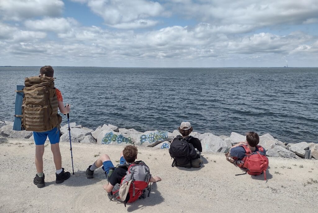
Out of the Woods and on to the DikeA Break on the Dike Before the Home Stretch.Hiking the Dike to Base Camp
Overall, this was a great hike; the trail was dry, we started early, and moved quickly. All the young hikers did a great job. We made our base camp on the shores of Lake Moultrie by 1:40 pm. Once we made our base camp and recovered our vehicles, we were able to sit back and enjoy the rest of the afternoon, relaxing in the shade and cool breeze of Lake Moultrie.
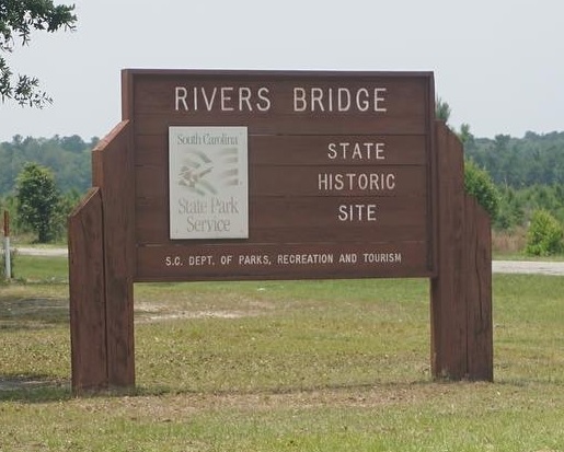
On a recent road trip, I had the opportunity to explore Rivers Bridge State Historic Site. This hidden gem is nestled in the heart of South Carolina near Ehrhardt and is perfect for those looking to enjoy a thoughtful walk through lush forests while uncovering the stories of the past.
Rivers Bridge State Park entrance sign
Rivers Bridge and nearby Broxton Bridge were the sites of a significant Civil War battle in February of 1865. There, Confederate forces attempted to delay Union troops during Sherman’s infamous march to the sea. Today, the park preserves the battlefield and commemorates those who fought here, offering visitors a glimpse into a pivotal moment in American history.
In the coming February, I’ll be attending the Civil War reenactment with a youth group at the Broxton Bridge Plantation. Radar and I stopped here to check the state park as a possible side visit. The state park is just a few miles from the planned reenactment.
Rivers Bridge Confederate Cemetery
We stopped first at the battleground. The Battlefield Trail is supposed to have a short loop trail. It guides visitors to interpretive markers and preserved earthworks. These markers explain the strategies and significance of the battle. At just under a mile, this trail is intended to be accessible for all skill levels. It is a great option for a glimpse of the past. However, at the time of my visit, the battlefield portion of the park was still being cleaned up from the recent hurricane and wasn’t open so we stopped next at the Memorial Grounds.
The Memorial site and casualty exhibit is a solemn reminder of the sacrifices people made in our nation’s history. Here there are four cemeteries including one cemetery which holds the Confederate dead from this battle in 1865. The Memorial site also has a Casualties Exhibit in the old museum. The permanent exhibit in the old relic room at the Memorial Grounds is filled with illustrated interpretive panels to tell about the fate of some of the soldiers and casualties of the Battle of Rivers Bridge.
Rivers Bridge
Favorite Time of year: The Spring should be pleasant. I intend to return in February for the reenactment at Broxton Bridge.
Camping: No camping is available at this park.
Pet friendly: Must be kept under physical restraint or on a leash not longer than six feet.
Getting There: From I-95, take exit 57 at Walterboro onto Hwy 64 W toward Barnwell. Turn onto Hwy 641 toward Allendale and follow the Rivers Bridge State Historic Site directional signs. It’s about a 2-hour drive from the Charleston area.
#
Did you enjoy or find this post useful? Please let me know by leaving a comment below or join me on Instagram or Facebook.
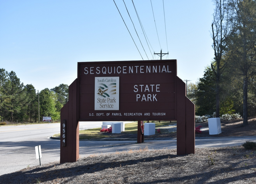
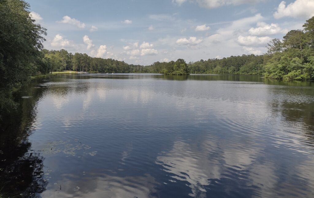
I must come back here. My camping trip to the Sesquicentennial State Park was part of a volunteer group weekend campout. Unfortunately, I didn’t get a chance to explore all this park has to offer. Sesquicentennial State Park is located in the midlands of South Carolina, on the East side of Columbia. This park is an oasis in an urban setting and offers a great retreat from city life back to nature. With over 1,400 acres, this park offers a variety of things to do. Home to a beautiful 30-acre lake, you can fish, kayak, and pedal boat. There are miles of trails for hiking or biking winding through the park’s forests. While I camped the weekend in a Group primitive site, there are both RV and tent sites with essential amenities. Our group planned to use Sesquicentennial State Park on my weekend at this park as a base camp. We planned to drive up Friday evening, visiting the SC State House and the nearby Riverbank Zoo on Saturday, then return home Sunday.
Sesquicentennial State Park Lake
We arrive on Friday night just as rain storms pass through the area. We wait out the rain in our vehicles. It doesn’t take too long before the rain passes and we can get camp set up quickly. The group campsite we are staying in has drained and dried out surprisingly quickly. As we are the only ones using any of the primitive sites this weekend, we have the whole area to ourselves. Most of the younger campers in our group are excited and stay up late talking.
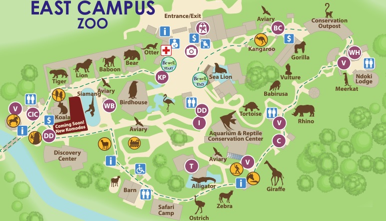
Saturday morning we are up with the sun, getting our breakfast done, and sack lunches made, and on the road for our outings by about 8:30. We arrive a little at the zoo early so we are in line for tickets just before the 9:00 opening. It’s been years since I’ve been to this zoo and it has grown a lot. We spend the morning walking the East Campus which is the zoo or where all the animals and zoo exhibits are. The West Campus is a newer botanical gardens section I haven’t been to before, and it’s not on today’s agenda. I may need to come back for a visit at a later time.
Riverbanks East Zoo Map
We complete our walk about the zoo around noon and break for lunch. The zoo has plenty of opportunities to spend lots of money on food and drink within the park. Packing a lunch is a great way to not spend a bunch of money yet for some of the younger, the elephant ears and dipping dots are too much to resist. Years ago there was a short trail along the banks of the Saluda River and picnic tables where you could lunch along and watch kayakers. All of that is gone with the zoo’s expansion now. We find a shady spot and a few benches outside the front gates to eat our sandwich lunch. We had adjusted our schedule to be in the capital building (air-conditioned) during the afternoon heat. Once everyone finishes lunch we load up and head from the zoo over to the capital.
SC State House
The South Carolina State House building is over a hundred years old and still serves as the capitol seat of our state government. Once we are all inside, we join a tour group in progress. Park Rangers provide guided tours of the State House and provide an insight into the building’s long and impressive history. After our tour, we return to camp to relax and enjoy the afternoon at Sesquicentennial State Park.
Sunrise through the pines, Sesquicentennial State Park
For me, Sesquicentennial State Park was a pleasant surprise. With its forested natural beauty and family-friendly atmosphere, there are plenty of scenic picnic areas for family gatherings and outdoor meals, playgrounds, and even a splash pad. There is something for everyone to enjoy. It’s a great must-visit destination for anyone looking to unwind and connect with nature in the heart of South Carolina. Sunday morning we pack up and head home. I plan on keeping Sesquicentennial State Park on my list of places to return.
Favorite Time of year: I will have to go for the late Spring and early Fall.
Camping: Camping is available at Sesquicentennial State Park (reservations required).
Pet friendly: Must be kept under physical restraint or on a leash not longer than six feet. This park also offers a large dog park but a permit is required.
Getting There:Sesquicentennial State Park is just East of Downtown Columbia, off the I-77 beltway, then Two Notch Road. Check the State Park directions link. It’s about a 2-hour drive from the Charleston area.
The Palmetto Trail, Swamp Fox Passage, Section 3, almost 12 miles.
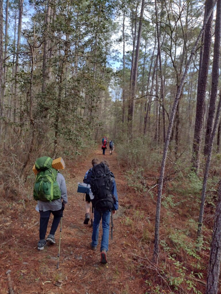
The weather was forecast to be raining most of the weekend, fortunately, the rain backed off some leaving us a great sunny hiking day. This is my volunteer group’s first backpacking trip this year. For some of the hikers, this is their first backpacking trip. I’m pleased with the group’s interest in this trip. It’s nice to get new people into the outdoors camping and backpacking. I think it greatly helps them build self-confidence and a better appreciation of the outdoors.
Our backpacking group this weekend consists of seven new backpackers and another five experienced hikers including myself (4 adults and 8 youth). I had done some trail scouting a month or so earlier, looking for a good drop-in location. Due to recent rain, the whole area was a little soggy, so I picked this section of the Palmetto trail to give us a ten-plus-mile hike to finish at our base camp on the shores of Lake Moultrie. Our drop-in point and campsite for the night is on the North side of the Cane Gully Branch crossing. The designated campsite on the South side of Cane Gully was officially closed and too wet to camp there anyway.
Our Swamp Fox Trail section map
The entire Swamp Fox Passage is just over 47 miles. The Swamp Fox Passage is the longest section of the cross-state Palmetto Trail. Most of the Swamp Fox Passage of the Palmetto trail runs through Francis Marion National Forest and includes the swamps made famous as hideouts of the Revolutionary War hero Francis Marion. The section we are hiking this weekend is the last leg of Section 3 from about mile 38 to the Lake Moultrie dike and then into our base camp at Boy Scout Camp Moultrie.
I selected a site to camp the first night off Callum Road just after the Cane Gully Branch Creek crossing. With the recent rains, this seemed like the best (dryest) option for us. Traveling from Summerville is about an hour’s drive up from Summerville through the Friday evening traffic. We arrive at our campsite just before dark, which is nice. This allows setting up our camp while there is still some daylight. Some of the kids are up late chatting with each other. One group even has fired up a backpacking stove and is making mac & cheese, at 9:00 pm. Just hungry I guess, and they can.
I’m up early-ish, about 6:30 am, just before most. Everyone starts getting up shortly after, and then the routine begins. Breaking down camp, making breakfast, and loading our packs. And not necessarily in that order for everyone. For me, breakfast was hot cafe mocha and oatmeal. For my Trail Cafe Mocha, I use an instant coffee packet mixed with a hot chocolate packet mix and hot water from my Jetboil. My morning oatmeal is a couple of packets from a variety oatmeal box. I mix hot water from my Jetboil in the oatmeal packet to get to the desired consistency and eat it directly from the oatmeal packet. This minimizes waste and cleanup.
Swamp Fox Trail Hike Bridge over Cane Gulley Ceek
We are hiking on the trail by about 9:00 am. I consider this a reasonable time with this size group. But first, we take a short walk back to the bridge over the Cane Gully Creek. This was installed several years ago after one of the hurricanes and was part of the trail reconstruction. We then head northbound towards Lake Moultrie.
Swamp Fox Trail Hike Trail
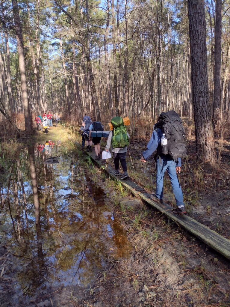
The trail is a bit soggy from the recent rains. But a lot of this trail is soggy all year (hence the part “Swamp” of the name “Swamp Fox”). There are numerous places with elevated walkways to navigate around routinely flooded areas. Hiking along this trail is mostly shaded, the trail is well-defined and maintained, although soggy.
Swamp Fox Trail Hike elevated walks
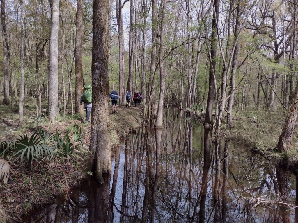
We enter the Wadboo Creek part of the trail about mid-morning. This section of the trail has elevated boardwalks through some of the swamp areas. History says this area is where Francis Marion was headquartered during the Revolutionary War. Later the area became rice fields for area plantations in the 1800’s. The elevated boardwalks take us past the canoe launch point. The launch point is for the Wadboo Creek Canoe Trail and is accessible from Highway 17.
Swamp Fox Trail Hike Wadboo Creek AreaSwamp Fox Trail Hike Wadboo Creek Boardwalk
Once we are past the Wadboo Creek area, we find a shaded spot to break for lunch. We are about 5 miles from our destination now. With our group, you pack what you want for food. I abandoned group menus a long time ago. Today, some folks are doing simple lunches but one is doing a hot lunch involving boiling water to rehydrate their meal. For this trip, I went with a simple canned chicken spread and pita bread. I generally find tortillas pack better than most breads with pita being a close second.
Back to hiking after lunch. Some are getting tired. The day has been warming up and some of the young legs are simply wearing out. We have two more milestones of importance to make and then we are home for the evening. The first is the Trail Head (TH) at the Northern end of the Swampfox Trail, located at mile marker 47. The second is making the dike around Lake Moultrie. The TH has a nice little green grass field around it. I promise a break there to cool off and rest for more than just a few minutes. Years ago, the TH once had a parking lot and outhouse which were nice for hikes. Somewhere in the last ten/fifteen years, the parking area was closed off and abandoned. The TH was moved away from the parking area about a hundred yards.
We finally make the little green field of the TH and rest, share water, snacks, and discuss the remaining distance. Some are very close to their limit and we still have a couple miles to go. It’s important to me to try to provide a positive experience in the outdoors, and encouragement here is important.
The last mile from the TH to the dike is more of a continuation of the walk in the woods we’ve been hiking all day. Generally, the trees shade you but also limit your view to a few hundred feet.
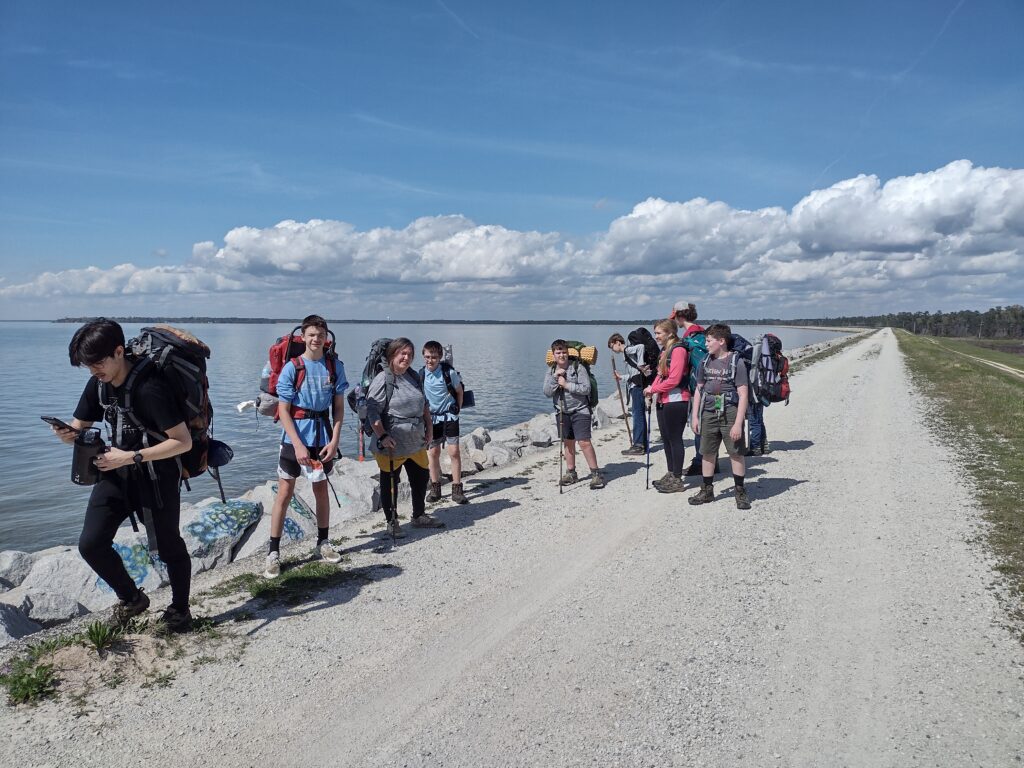
But then we break out of the woods and see the dike ahead. The openness of the view as we break out of the woods and swamp and onto the dike of Lake Moultrie is refreshing.
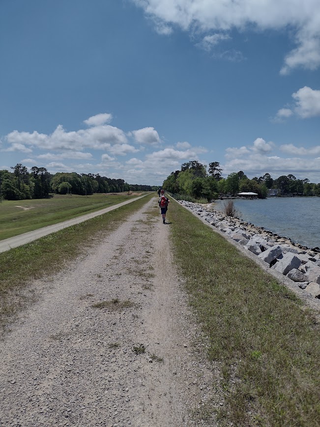
Swamp Fox Trail Hike dike section
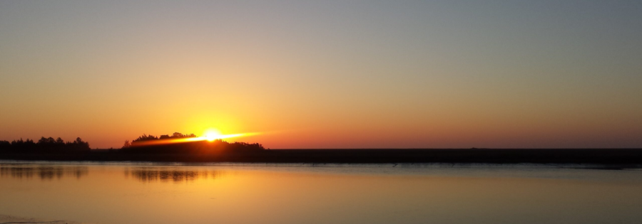
The sky is clear and bright blue. When you climb to the top of the dike you are treated to a beautifully clear view across the lake. However, there are always compromises in life. With the openness of the dike, we’ve now lost the shade of the trees. The mid-afternoon sun bears down on us as we hump the last couple of miles along the open dike to camp. We drop off the dike and into some shade as we hit the lake shore town of Overton and make our final leg into the scout camp on the shores of Lake Moultrie. In camp (4 pm) at last!
We hiked 11.9 miles. A solid day trek and a challenging first hike. I was concerned I had broken some of the new hikers but the best part was learning the new hikers liked this hike and would do another. Here is my Relive video of the Swamp Fox Section 3 hike. If you go, expect wet feet. The trail is soggy. Despite good hiking footwear, I still ended up with several moisture-related blisters on my feet. Towards the end of the hike, I could feel hotspots developing. I should have changed socks at lunch of at the northern trailhead. Sometimes you just want to push that last little bit. Listen to your feet! Dry socks are our friend.
It’s still September in my mind as I finish up part two (go here for part 1) of Hiking the Dike!
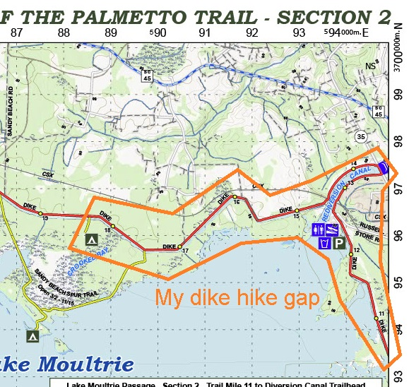
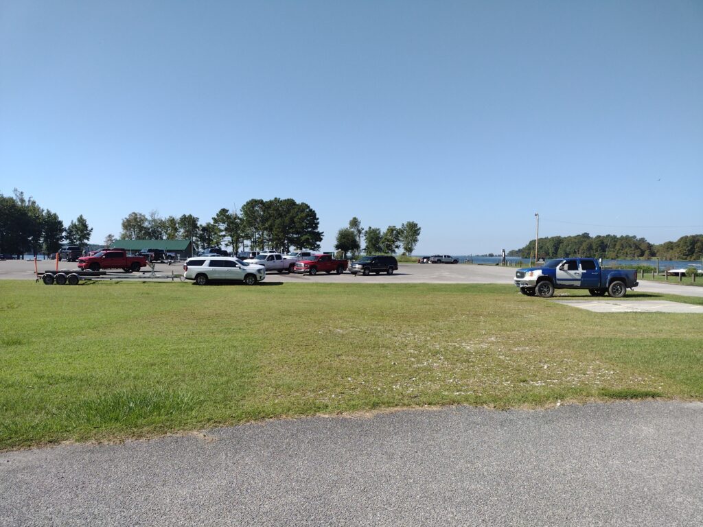
Day 1: (Monday) The drive to the trailhead is just over an hour from the house. Russellville Boat Landing parking lot is about as convenient to the trail as you could ask for. The parking lot is about a hundred feet from the trail and puts me just a couple of miles from the southern end of my gap in the Lake Moultrie Passage of the Palmetto Trail I’m trying to fill in. Unfortunately, it’s just radar and I so this will be an out-and-back hike.
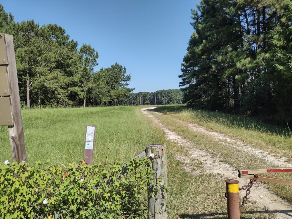
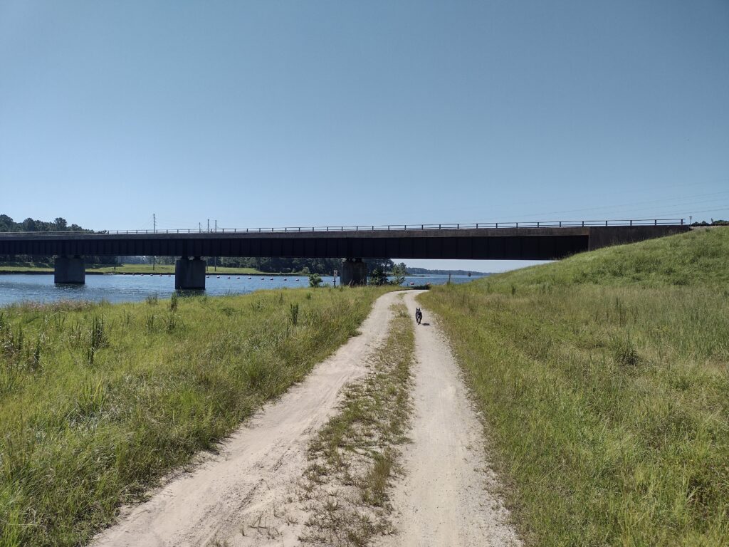
The parking lot is almost full when we arrive so we find a spot out of the way and gear up for our gap-filling hike. From the parking lot to the trail is only about a hundred yards so access to the trail is easy and we make fairly quick time walking along the Rediversion Canal past a rail trestle to State Road 35 which will cross over the canal. With no one around Radar is off-leash now. He’s really good about staying close to me and seems to know how to follow the trail. In this first few miles, we’re walking along the gravel road along the canal. Going past the rail trestle, the trail reaches State Road 35, jumps over the canal using the road bridge, and then the trail drops off on the other side and follows the canal back to the levy and then continues along the levee north and west. These first couple of miles are all in the open and it’s a bright sunny day. It’s pretty warm being September still so we pause for a water break on the north side of the canal under a rail trestle. I am carrying water and lunch for both of us along with a collapsible bowl for Radar.
Heading to the shade under the rail trestle on the west side of the canal.A long trail to go
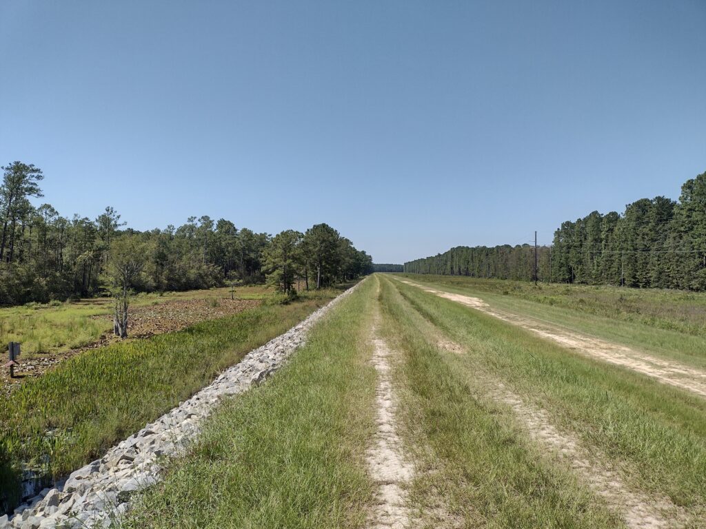
Once we get past the canal we get back on to the dike. The levee is almost all in the sun without shade. Radar is up and down the levee exploring, never more than 50 feet or so from me as we continue hiking. As he gets a little warm he jumps and splashes in the water to cool off on the lakeside of the levee and it looks like he’s having some fun.
A good place to cool off? Radar getting cool
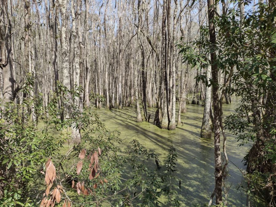
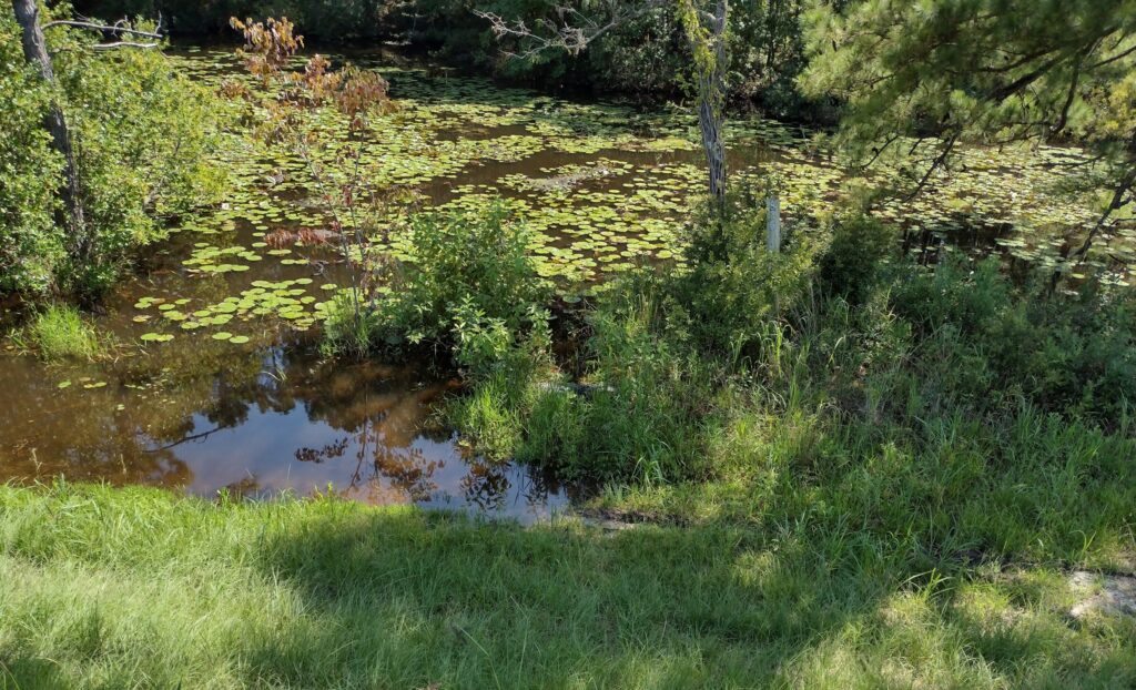
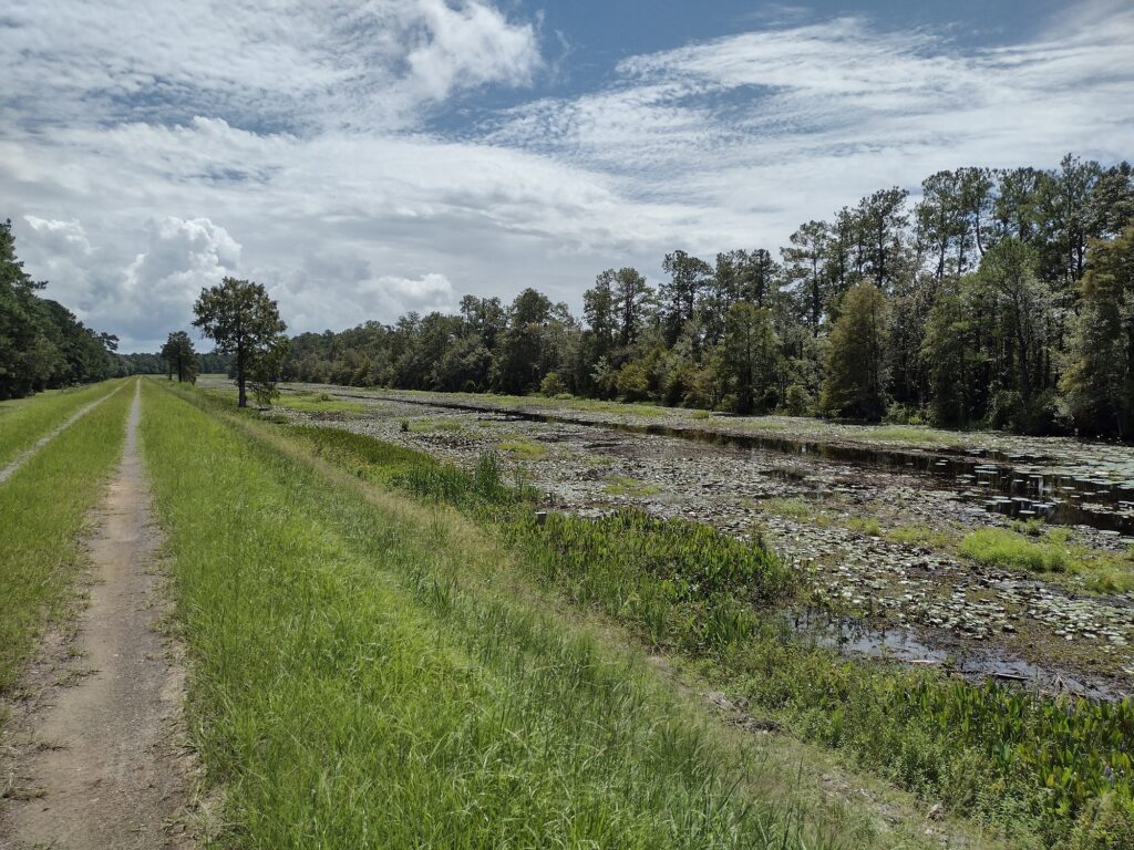
As we continue further on along the levee, I feel like hiking here is a little strange now, maybe surreal. Looking off to the north side of the levee, the area is open, mostly maintained, mowed, traveled, etc., even buildings off in the distance. Looking to south, the lakeside of the levee (you can’t see the lake from this part of the levee), it’s more primordial, almost like stepping back in time. A shallow marsh buffer lays between the levee and woods beyond, with cypress and pine trees, birds chirping, and flowering water lilies. Oh and alligators.
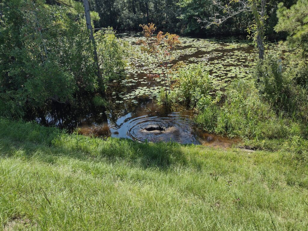
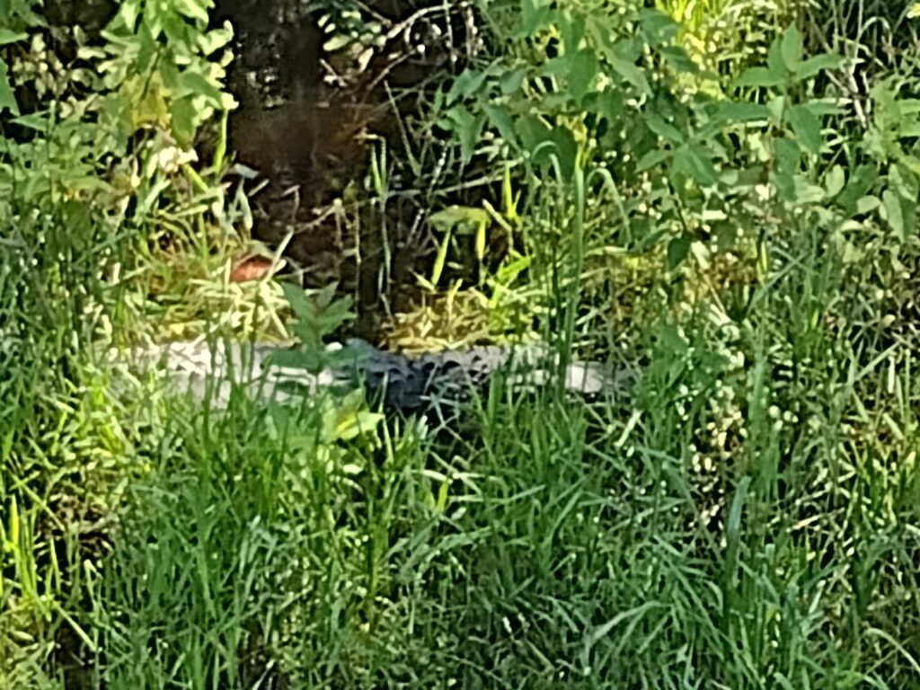
There is an alligator in this swamp.
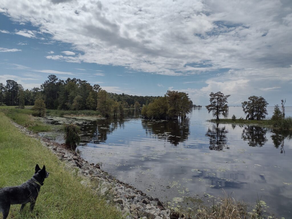
I know there are alligators in SC. I’ve known for a long time there were alligators in South Carolina. I know they are a possibility in the lakes and rivers and I’ve seen smaller ones in Lake Moultrie before. But on this day I wasn’t thinking about them when I started. Because of the heat, Radar would go down to the edge of the water, splash around a little to cool off, and then come bounding up the dike all wet and happy. Radar had just come up from a quick dip in the water as I saw the first alligator.
An Alligator in the swamp.
Seeing him surprised me a bit. He is out in the open, in the middle of the muddy marsh, maybe 50 feet from the levee, just lying in the sun. He was a good 10-12 feet long, his skin oily black, and he lay motionless in the black thick muck of the marsh, ominously waiting patiently for the next prey to wander near. There was no cuteness about him. Swim-calls for Radar are suspended until we get clear of the marshes on the return portion of the hike. Once you see one the rest are pretty easy to spot. They are pretty much everywhere in the swamp now.
Hiking the shade along the dike.
It’s warm but we’re almost to the spur trail leading to the campsite. Reaching the spur trail closes this part of the gap for me. We reach the spur trail and follow it to the campsite. It’s nice to sit for a few minutes and take a break in the shade of the pines for lunch and a drink. The last time I was here was in October of 2003. Our group camped here overnight. It was hot and there were plenty of mosquitos for everyone. It’s better today, still warm but very few bugs today.
Spur trail to the campsite.
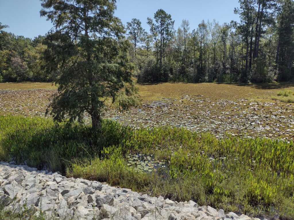
After eating a light lunch we start retracing our path along the trail, heading back to the parking lot. On these solo out-and-back hikes, you usually have to travel twice the distance needed to cover a given piece of trail. So here we go. It’s afternoon to midafternoon on the return leg and it’s hotter. The sun is higher in the clear sky, and there is less shade now along the trail. I’m constantly watching for alligators and Radar is very obediently staying out of the water. We are burning through the last of the water I brought. Radar is panting pretty good, we steal what shade we can. We are nearing the end of the swamp finally and reach a spot where I think Radar can take a much-needed splash to cool off. I haven’t seen any alligators for a little while.
A good place to cool off? Except for the gator in the grass.
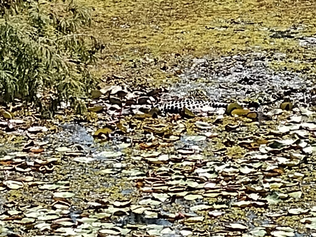
We start down the side of the levee cautiously. Radar is a little ahead of me. And then I see him. Laying in the tall grass is a 6-8 footer, waiting.
Mr. ‘Gator in waiting
I hastily call Radar back and we quickly climb back on top of the levee. It looks like no swim time after all. It turns out this inviting wet spot was also the last spot Radar took a cooling splash on our inbound hike. Now on the hike out, Mr. ‘gator was lying in wait. But somehow Radar understands the danger and returns to the top of the levee with me. After another quarter mile or so we finally are past the swamp and at the banks of the canal. Radar is all in for a cooling dip in the cool waters of the canal.
A shortcut across the canal.
Once we’ve cooled off a bit we decide to cut a mile or two off the return trek by taking the rail trestle over the canal instead of hiking back to State Road 35. When we finally get back to the parking lot, both Radar and I are hot, tired, and out of water. I call it a day and decide to head home. We’ll pick up the last couple of miles another day. Here is my Relive video of the day 1 hike.
Day 2: (Saturday) I’m finishing the last few miles in my Lake Moultrie Passage gap. Driving back to the Russellville Boat Landing parking lot puts me at the beginning of the end of this passage. Again, it’s just radar and I so this will be another out-and-back hike.
Heading out on the trail.
This time it should be just a quick few miles out and back. The trail is again along the top of the level with minimal shade. But today it’s a little cooler, with scattered clouds, and not quite as hot as Day 1.
A view of Lake Moultrie from the levee.
The hiking today is largely uneventful but seems more enjoyable. Maybe the scenery is better? This part of the trail has a much less swampy median and more water from the lake.
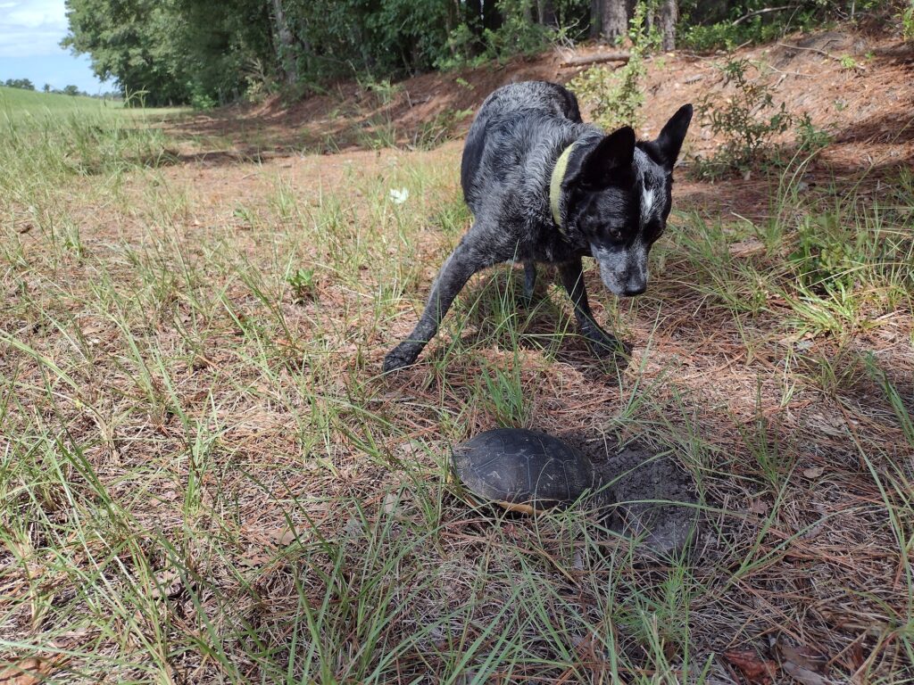
Radar and a turtle.
While I’m sure they are around, we don’t see any alligators today. The only reptile we saw today was a turtle. She looked like she is nesting on the low side of the levee. We make fairly good time along the trail covering almost three miles in just over an hour. Today is an easier hike. There was even a brief sprinkle of rain to help take a little heat off the day.
Reaching our turnaround point completes the entire Lake Moultrie Passage of the Palmetto Trail for me. I have a bunch of marked-up trail maps taped to a wall back at the house, now when I get home, there will be one less. Radar and I simply start heading back the few miles to the parking lot and then on to home. Here is my Relive video of the day 2 hike.
#
Did you enjoy or find this post useful? Please let me know by leaving a comment below or join me on Instagram or Facebook.
As summer is beginning to wane, I felt the urge to get out on the trail again. I also discovered I need to work on filling in some missing gaps in my Palmetto Trail journey. A little bit of the backstory first. I probably started backpacking trails while in Florida and then Texas before moving to South Carolina. Hiking in South Carolina for me started back in the late 1990’s with the Buncombe Trail in the upstate and segments of the Palmetto Trail starting with a large part of the Swamp Fox Passage. Over time it seems I’ve jumped around on the Palmetto Trail a lot. I’ll blame this on the fact the Palmetto Trail is still a work in progress. Early on the Palmetto Trail was more incomplete than complete and today it still remains not fully connected. I did my first portion of the Lake Moultrie Passage back in October 2003 with a small group of new backpackers from our troop. We did most of what is now section 2 then. I had planned a +10 mile, two night weekend backpacking trip for my troop. We started at the Northern end of the section at the Diversion Canal trailhead. This portion of the trail has a short forest section before coming out onto the dike. By the time we got to the trail in the evening, it would be dark, so the first night I plan on just camping a few hundred yards from the trailhead. There is a small flat open grass spot where a group can stealth camp together near the edge of the woods. There was a designated camp on the trail with a well, maybe about a mile in from the trail head but I believe it’s all defunct now and it doesn’t show up on the current map. Once upon a time someone had set water wells along the trail, I think some were artesian wells and some may have been hand pumps. These were a great resource for drinkable water at the time. However, over the years the well heads have been removed and capped off. Probably because they were not “state-approved.” Anyway, the next day we would get up, break camp, and hike to the designated campsite near Sandy Beach. I remember the first time I did this hike it was hot, humid, and the mosquitos were still out. I had started tarp camping back then and instead of any kind of sleeping bag, I had brought a simple bed sheet to sleep under. Even just the sheet was almost too much to sleep with but it helped keep the mosquitoes at bay. It rained the next day and we backtracked to a road access to come off-trail and head home. I’ve since backpacked this same piece a few times with other folks. Later, in September of 2014, I hiked the lower 10-mile portion of section 1 of this passage with a different troop. One of the youth members had planned a 20-mile day hike along the Lake Moultrie dike from the Southern trailhead as an out & back hike. The weather was great. The trail there mostly runs on the flat top of the dike and is easy hiking. One of the interesting parts of the trail is it takes you through the town of Bonneau. However the open exposed nature of the dike with no shade and the hard surface of the dike and paved roads through town can wear you out fast. The out-and-back concept made the return portion a little boring and a bit of a slog to get finished. We were all very happy to finally get back to camp that night.
Recently I was looking over some trail maps highlighting portions of various trails I’ve done and looking at the gaps remaining. While some passages like the High Hills of Santee Passage I’ve hiked completely a dozen times, I had done only parts of other passages. I figured it was about time to get out and close up some of those gaps. So this will be my Lake Moultrie make-up hike to fill in about an 8-mile gap in my Lake Moultrie Passage.
(to be continued …)
Did you enjoy or find this post useful? Please let me know by leaving a comment below or join me on Instagram or Facebook.
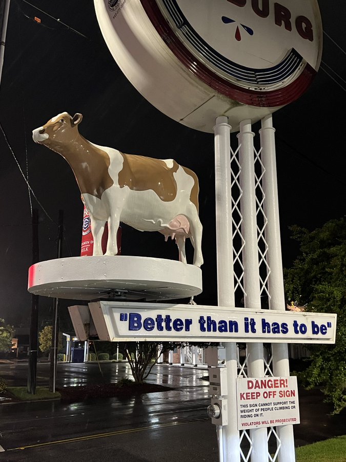
This morning is a calm morning, I guess it’s the truth behind “the calm before the storm.” As I write this Hurricane Idalia has smashed into the Gulf side of Northern Florida and will make her way across the state to the Atlantic side. The current forecast has the storm running just inland today along the coast of Georgia and South Carolina before sliding off into the sea. The schools and many businesses in our area are closed in preparation for the coming storm. We’re expecting winds, rain, and coastal flooding. There are two pieces of good news. First is, according to the internet, Jim Cantore is in Cedar Key Florida, and NOT in South Carolina. The second is the Colberg Cow is still up and in place, at least as of 6 a.m. this morning.
So today with the college closed, it’s a standby day for me, waiting really for the winds which may bring trees or branches down on the farm. Our ground is fairly high so flooding isn’t our big concern this far inland. By this afternoon the hurricane is expected to be a tropical storm again and by later this evening it will be well past us. The downtime is giving me a chance to catch up on some things (like writing).
The group I volunteer with just did our annual activity plan and we added several campout events with backpacking. I started updating my blog site with a new page for The Palmetto Trail and in doing so I realized, I have a lot of gaps in my Palmetto Trail journey. And I want to get back on the AT. And the more I think about it the more I just want to get out more. I’ve started planning to grab time as I can to fill in some of the gaps in my Palmetto Trail passages. I’ve hiked passages like the High Hills of Santee a dozen or more times, but I really need to start filling some of the gaps now. I know some will be day trips, and some will be overnighters. My big hurdle really is hiking with one vehicle. Every hike becomes twice as long or I can only go half as far. Maybe I can just go, and keep going? Almost, but not yet. Sigh. Anyway tomorrow after the storm, assuming no major homestead issues, I’m planning to take Radar for the day. I’ve a backpacking trip with some new hikers in January. I need to find a suitable overnight trail campsite around the Swampfox and Awendaw Passages. The rains have come now. The trail is calling and I must go.
The trail is calling
Did you enjoy or find this post useful? Please let me know by leaving a comment below or join me on Instagram or Facebook.
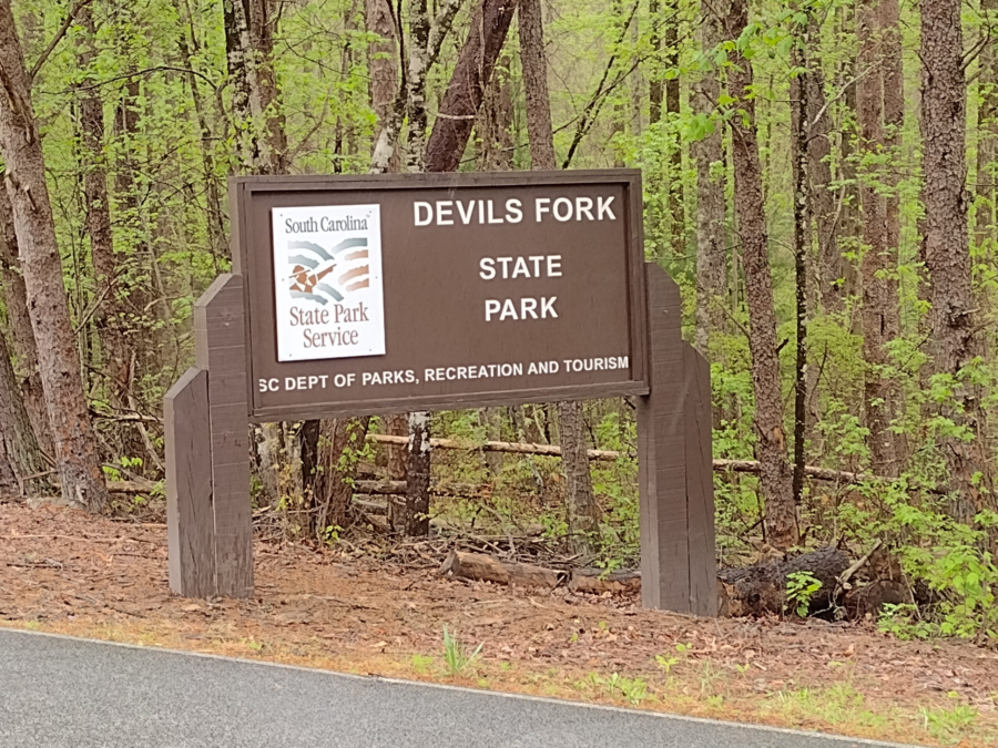
I was able to make an impromptu visit to the park with Radar and stayed with some family for a night. My son and his family are traveling from another park and we are meeting at Devils Fork. The drive up is uneventful and Radar naps most of the way. I stop for gas and a quick snack from the Lakeshop at the junction of SC-11 and the turn-off to Devils Fork. Surprise! Coincidently my son and his family are stopped there as well. I follow their van the remainder of the way into the state park.
Devils Fork Campsite
Our tent site is a gorgeous walk-in tent site about 20 feet from the edge of the lake. We must leave our car in the parking lot and carry everything to the campsite. Our designated camp site is a couple hundred yards in. Most of the walk-in trail is paved but there are some unpaved portions between the trail and tent sights. The pad site is near the waters edge, sheltered a little by trees, yet still with a nice breeze off the lake. Really a gorgeous pick. All of the tent camp sites here are well established pad style tent sites. You must pitch your tent on the site tent pad. Most of the camping tent pads around us are pretty spacious and include a fire ring and lantern stand. With bears are in the area, we were advised to store food overnight in our vehicles at the parking lot.
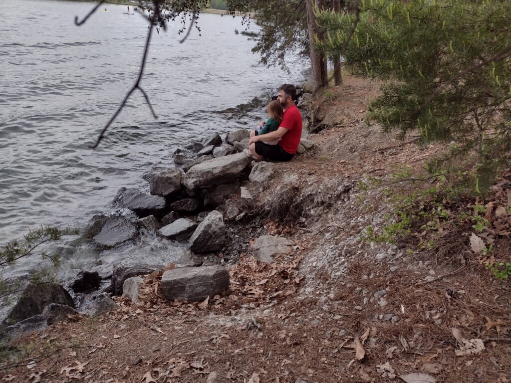
Devils Fork Lakeshore. My son and his daughter at the waters edge.
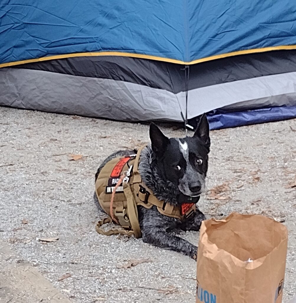
This is Radar’s second over-night camping trip (you can catch Radar’s first overnight campout here). He seems concerned and watchful. I think he is still unsure about what the heck is going on. Maybe its the newness of the area, maybe the sounds of the lake, maybe the scent of bears in the wind. This night he sleeps lightly on his bed under my tarp and hammock. It’s around 3 am when Radar alerts to an intruder near our camp. I struggle to get my light and look under the tarp from the my hammock to catch a glimpses of what set him off with some warning barks. Whatever it was has moved moved on leaving us alone the rest of the night. Radar is ever watchful. The next morning is “moist” with light rain as we make breakfast and discuss the days plans. The forecast has a small window of clear weather then rain, rain, and some more rain.
Devils Fork, Radar in camp
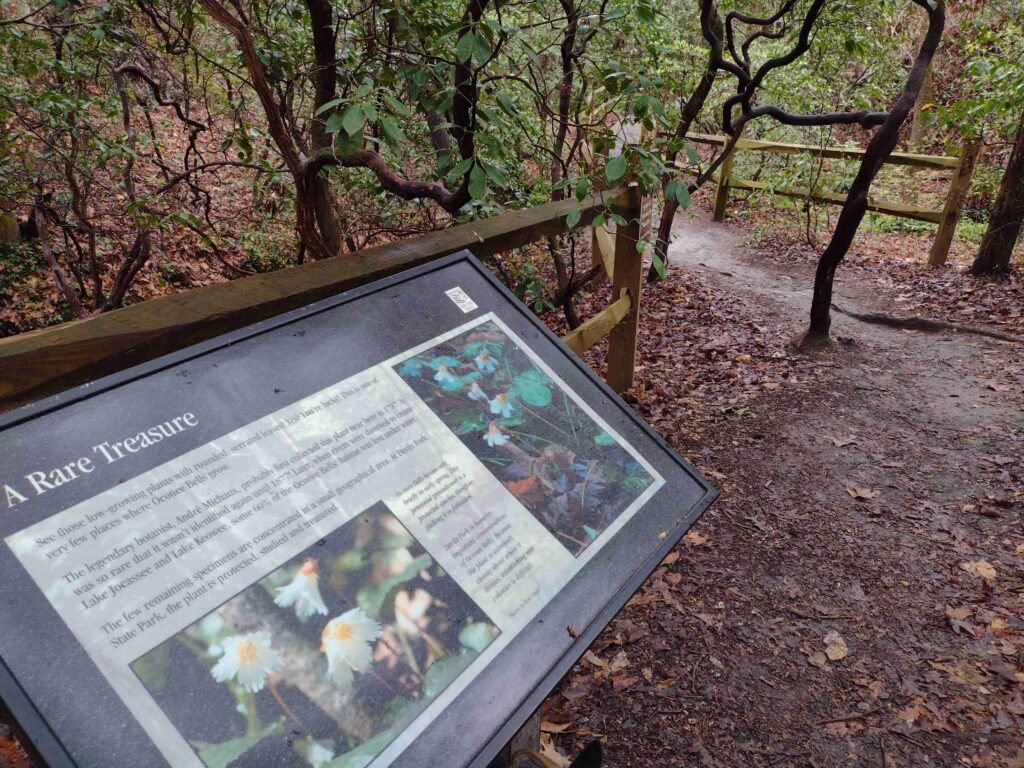
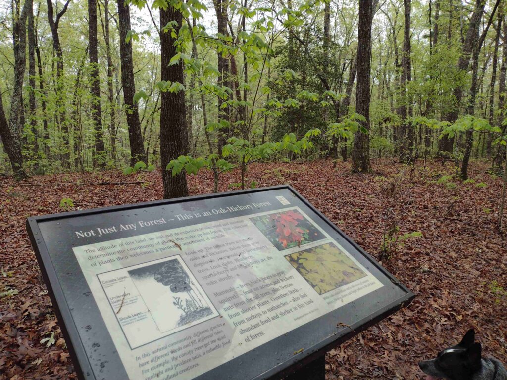
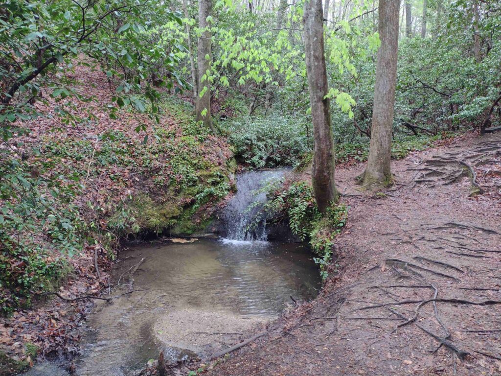
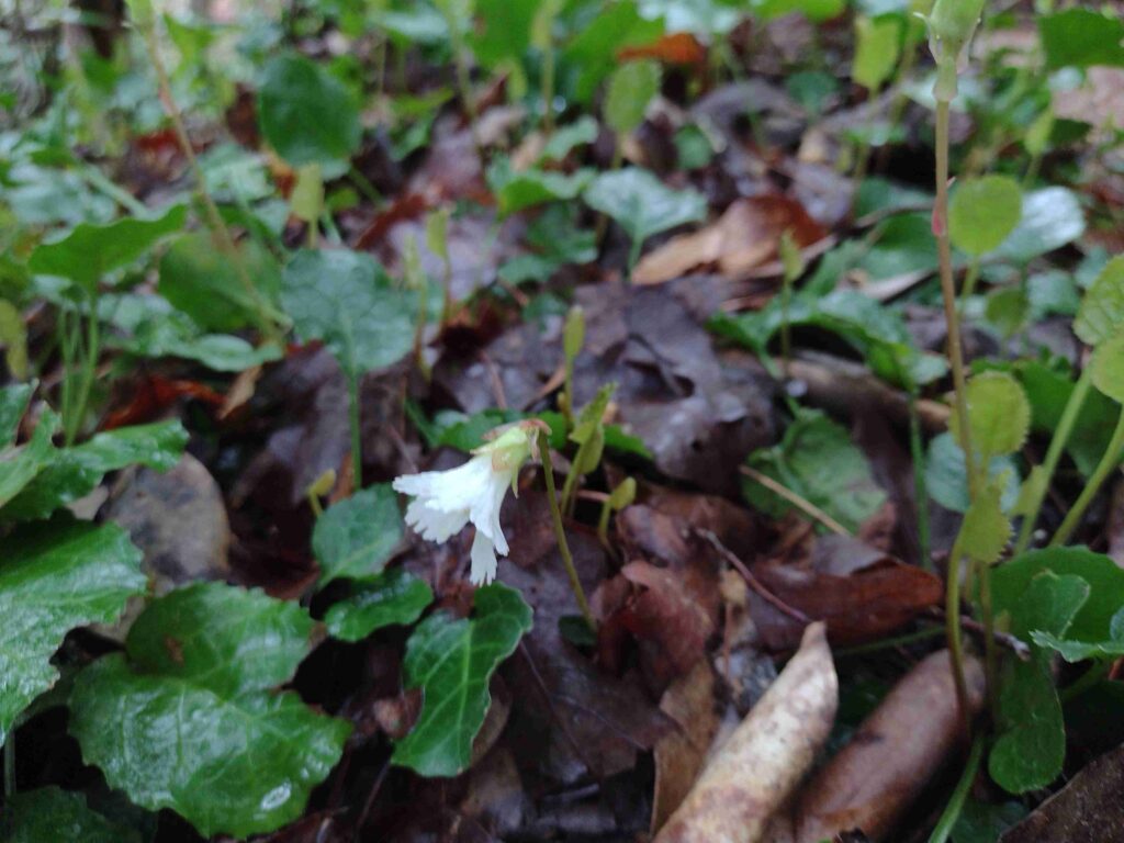
The weather ends up cutting our trip short. But before heading home I took advantage of the break in the rain. I was able to take a quick walk along the park’s nature trail with Radar. We even found some of the rare Oconee Bell plant (See our hike video here, comment below to let me know what you think). Devils Folk has a fairly short 1.5 mile nature trail in the main park. The trailhead is off the large boat ramp parking lot near the visitor center. The Oconee Bell Nature Trail winds through a mostly hard wood forest down around a creek and small pond before returning you to the start. One really nice feature of this trail is the labeling of botanical specimens all along the trail.
There are dozens of sign posts and story boards along the trail, identifying the various trees and plants along the way. The Friends of Jocassee have a great online trail guide which takes you trough the trail’s plants as you hike. One of the biggest points-of-interest on the trail is the Onconee Bell plant itself. An endangered rare plant, it grows in only a few spots in the state. The weekend we visited the plant happened to be in bloom. A moist area ground cover plant, it was sporting the delicate, white and pink, bell shaped flower.
Devils Fork trail hike, the Oconee Bell flowerDevils Fork Lakeshore
Located in the upstate of South Carolina, on the shores of the 7,565-acre Lake Jocassee, this park offers ready access to the lake, fishing, and camping. You can get a view of Lake Jocassee from the park webcam here. This 644 acre park park is about 10 miles North of Salem, South Carolina in Oconee County or about a 4 hour drive from the Charleston Area. Located in the Northwestern part of the state, Devils Fork State Park is one of South Carolinas newer state parks having been created in 1990. Anchored on the Sothern side of Lake Jocassee, the park has Villas, traditional RV/camping sites, and walk-in tent sites. The park does have some boat-in-only camping sites located on the Northern side of the lake. All sites need to reserved ahead of time.
Favorite Time of year: I will have to go with Spring to catch the Oconee Bell flower in bloom.
Things to Know: The breeze off the lake can be refreshing in the summer. However can bring a good wind chill factor in the winter. Oh and bears.
Pet friendly: Must be leashed at all times, including the forest, okay everywhere outdoors except cabin and lodging areas of the park.
Getting There:Devils Fork State Park is just West of Table Rock State Park off highway 11. Check the State Park directions link. It’s about a 4 hour drive from the Charleston. area.
#
Did you enjoy or find this post useful? Please let me know by leaving a comment below or join me on Instagram or Facebook.