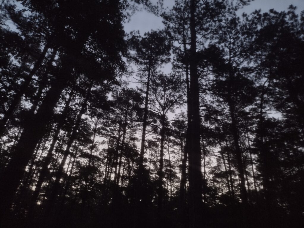
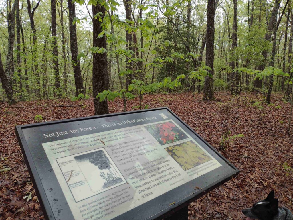
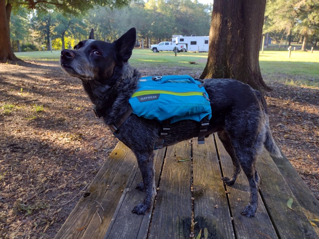
It’s a hot July, and Radar and I are venturing out in search of a new trail.
My volunteer group routinely does a split camping event at Poinsett State Park, where one group with the younger boys goes directly to the state park and sets up a base camp in the primitive group camping area. I take another group of older boys South to Mill Creek County Park and then backpack up through the Manchester State Forest, rejoining the main group at the base camp.
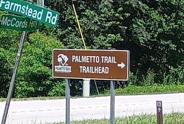
The Palmetto Trail cuts through Poinsett State Park. This really works out great for a weekend backpacking trip. It gives you a great place to end a hike and relax after recovering vehicles. The southern trail is the High Hills of Santee Passage, with the northern trail the Wateree Passage.
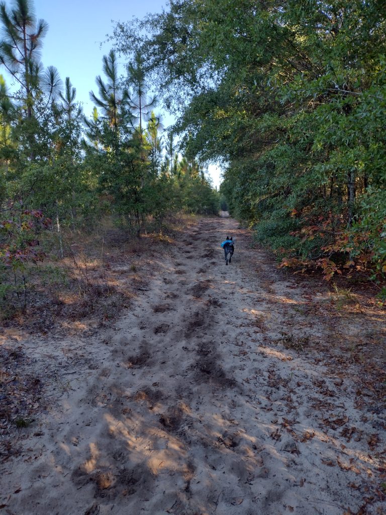
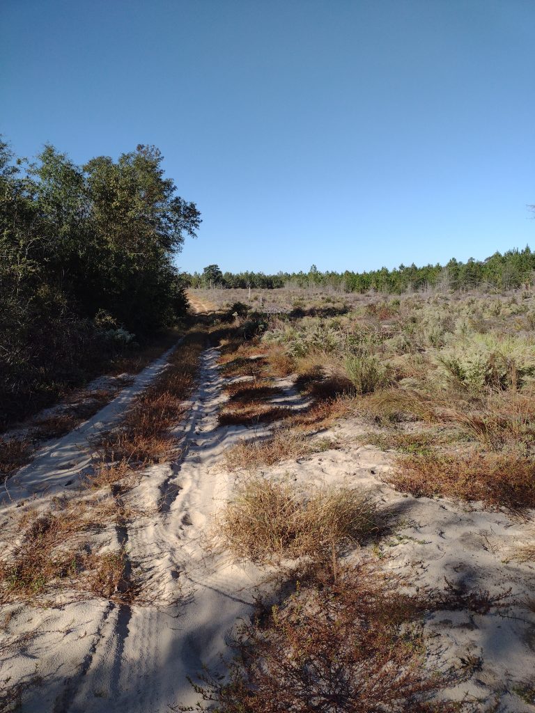
I’ve hiked the High Hills of Santee Passage of the Palmeto trail dozens of times over the years now and want to try a new backpacking trail into Poinsett State Park this coming year. The Wateree Passage looks like an interesting hike. A big chunk of the trail uses an old rail bed with a suspension bridge to cross over the Wateree Swamp to get to the park. Because it will be a group event, I want to research the trail a bit and do some trail scouting.
At the northern end of the Wateree Passage, there are two trailheads for this section, one at 11.4 miles and one at 9 miles. While camping is allowed, there are no designated campsites along this passage. There is also no water source indicated until you get to the state park. Normally, with Mill Creek, we camp Friday night at the county park and then hike up Saturday to the state park. So part of what I wanted to see in trail scouting the Wateree Passage is where we could camp Friday night.
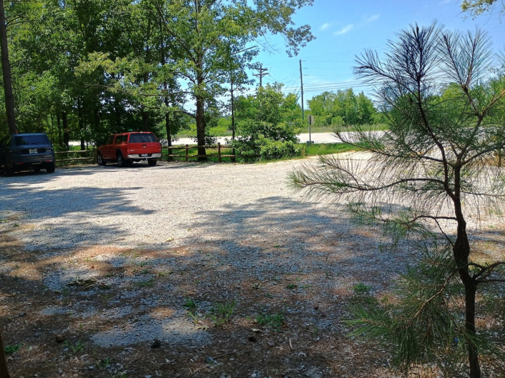
Wateree 11.4 Trailhead Parking
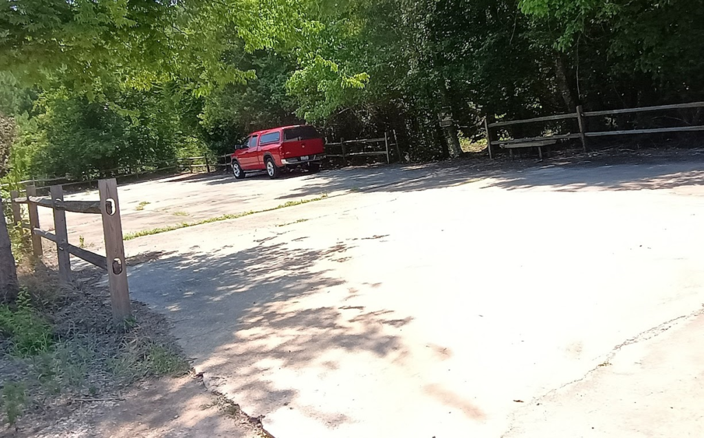
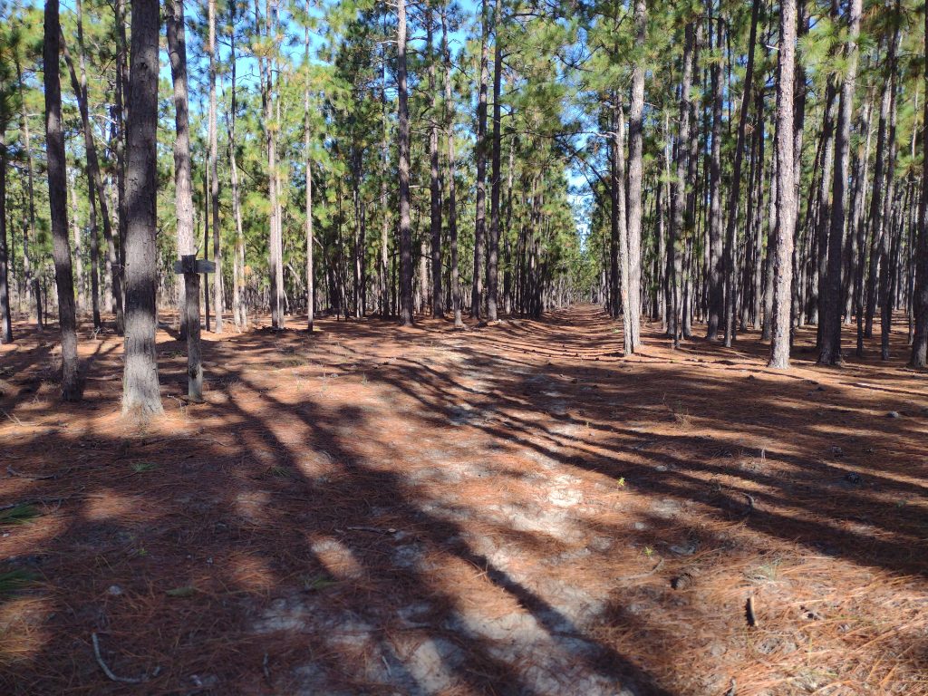
The trailhead at the 11.4-mile mark looks great for parking, not so much for a night of camping. The trail started right off the fenced paved parking lot, after the information kiosk. There are very few places for a group to pitch tents. Radar and I walked down the trail about a mile and didn’t find any real clearing, so we headed down to the trailhead at mile 9.
Wateree 11.4 Mile TrailheadWateree Trail at 11 miles
The fenced gravel parking lot at the mile 9 trailhead was not really any better, but it did include a small picnic table. There was a family from Florida lunching when I arrived. Again, like the 11.4 trailhead, there was an information kiosk, but the trail just continued past with no clearings near this stop.
Wateree 9-mile Trailhead Parking
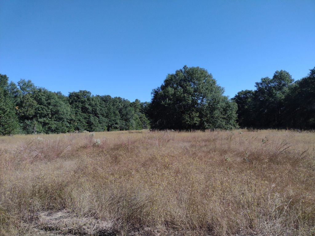
Just a little further down the road, at around the 8.75-mile point, the trail takes a hard turn to the east to pick up the railroad line and cross the Wateree Swamp.
If we are to camp on the trail Friday night, it’s going to be between the two trailheads somewhere. We’ll also need to bring all the water we’ll need. The other option might be to camp at the state park Friday night, then drive over to a trailhead on Saturday and hike back. The next step will be to get the trip on the calendar with a little bit more planning.
There were no April Showers and very few Mar showers too. This has had a significant impact on May flowers. It’s been a dry spring.
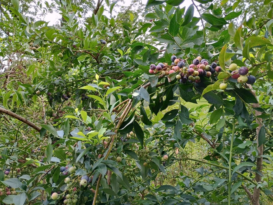
Summer is here (again), and hurricane season is upon us (also again). While the mornings are still cool, summer is definitely upon us. The summer harvest season is rolling in now. The local peach and strawberry farmers are open and in full picking, and our blueberries on the farm are starting to come in now. I think the first hay cutting will be delayed, however, due to the lack of rain.
So far this year I’ve done several weekend camping trips, mostly local; the cool nights of spring are perfect sleeping weather. I’ve been using my truck to camp in recently, and it’s been working well, especially with the cool nighttime weather. As we move into the warm nights of summer, I may need to change it up a little. I’ll post some truck-camping info later and share how I’m currently set up.
I’ve got a group campout coming in late July. It looks like we’re going to Lee State Park for a backpacking-style weekend. It’s been a while since I’ve been to Lee, so I’ll try to get a trail scouting trip in with Radar before the campout. We have some new youth campers in our group, and this may be a good opportunity for them to get out and try some backpack-style camping and hiking without the logistics of being dropped off and picked up at different trailheads—more on that as it develops.
I think that’s all for now; more later.
#
This is just a quick aside as the new year begins. As the year starts out, I’m working to detangle some of my work and play. I’m hoping this gives me better trail time this year, with the big adventure in planning being an AT trail trip this summer.
Watch for those tag stickers! As of January 1st, all SC vehicle registration stickers should be white in color. If it’s a green sticker, the tag expired in 2025. If it’s a yellow sticker, the tag expired in 2024. Yes, I have seen a couple of yellow stickers on the road this past week.
A few years ago, I bought a truck and have been tinkering with “truck camping.” I’ve done several weekend camping trips, camping in the truck instead of a tent last year. I want to get in a camping trip with Radar soon, so watch for some upcoming details and insights about how it all works out.
If there is interest in anything specific, please drop me a note in the comments!
It’s refreshing to hike a trail twice and have a completely different experience. Sometimes re-hiking a trail is like a repeat experience, good or bad, it’s just pretty much the same. I’ve hiked a number of trails in my area, including this one, several times. I had been thinking about trying to find an alternative area to hike for this weekend, but this route was the simplest to pull off logistically. This time, the hike felt like a completely new trail.
The weekend weather really paid off for us; forecasted rain never materialized, and the weekend was perfect hiking weather. We camped at the same spot near Cane Gulley Branch Creek. The ground was dry and the overnight was cool, and we woke to a light dew in the morning.
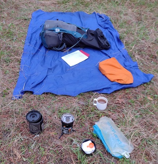
I was up early before the sun and other campers, took care of my morning business, and started breaking down my shelter while making breakfast. Breakfast was my trail, Cafe-Mocha, and instant oatmeal. I let the dew dry a little while I ate before I folded up my tarp.
Breaking down my shelter and making breakfast
Some of our brave hikers had planned a nice hot breakfast of … fried SPAM sandwiches. Unusual, but each their own. I gave up on planning group menus a long time ago.
Fried SPAM Sandwich for Breakfast
Our youth group used to go through the trouble of developing a backpacking trip menu, buying the food, and dividing it among the hikers. It can work sometimes for new hikers as a way to give them ideas. But it’s a lot of work for a couple of people. I shifted to a plan-your-own, buy-your-own menus, and found it’s much simpler for everyone to make their own menu, get their own food, etc. It’s a great learning experience. On one memorable hike, one hiker brought two 1-pound cans of clam chowder soup for dinner. It’s a little over the top, but he hiked it in, ate both cans, and was very happy with his menu. You might say he was as happy as … a clam.
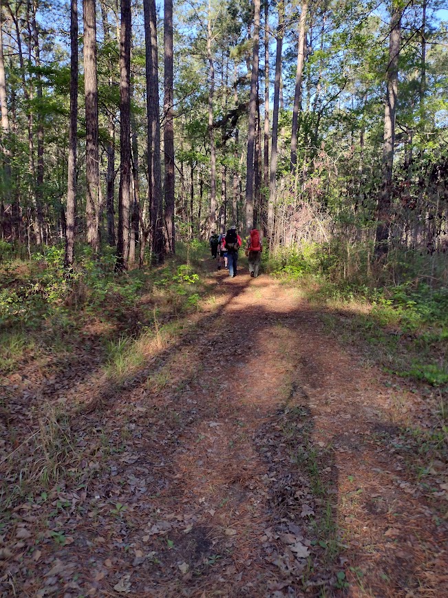
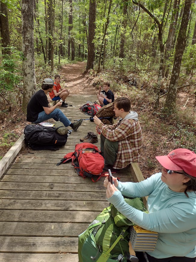
On this trip, we had two new hikers with us, so a quick pack-shakedown was on the agenda once everyone was packed and ready. We talked about equipment and various options for packing and lighter alternative gear in the process. I removed about 15 pounds between the two before we hit the trail. Even with the pack-shakedown and associated coaching, we were on the trail much earlier than I hoped. Our group was on the trail and hiking at 8:15 am.
On the Swamp Fox Trail
An early start is a great way to start a hike. For me, when hiking, time is miles. Generally, I budget about 2 miles per hour for my hiking time. A late start usually means a late finish. It also means more time hiking during the heat of the day. Even if I hike the same number of hours, I feel better arriving at my destination “early.” We had a strong pace from the start, and it continued for most of the day (Thank you, Kaci!). This gave us more time at lunch to relax and still let us make our base camp in good time.
Lunch on the Trail
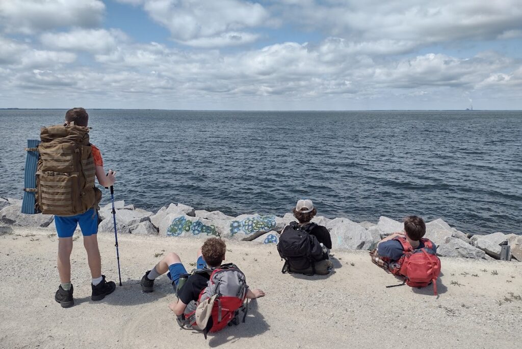
The trail was so much drier than last year and a real pleasure. The Swamp Fox Passage weaves its way through over 47 miles of the Francis Marion National Forest from Highway 17 to Lake Moultrie. Depending on the time of year, this trail is often swampy and wet. There are sections of the trail where foot bridges have been installed to help mitigate the wet ground and keep the trail passable. On this trek, the trail was dry, we took our relaxing lunch break on one of these foot bridges.
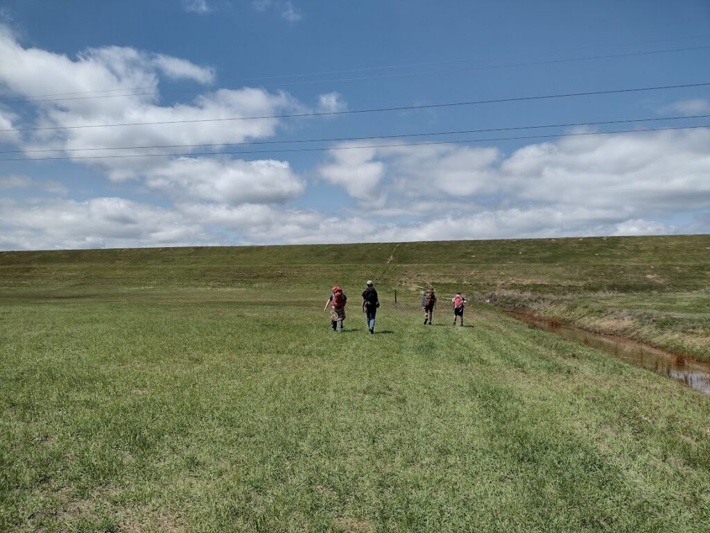
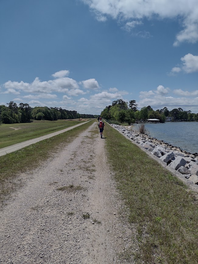
Out of the Woods and on to the DikeA Break on the Dike Before the Home Stretch.Hiking the Dike to Base Camp
Overall, this was a great hike; the trail was dry, we started early, and moved quickly. All the young hikers did a great job. We made our base camp on the shores of Lake Moultrie by 1:40 pm. Once we made our base camp and recovered our vehicles, we were able to sit back and enjoy the rest of the afternoon, relaxing in the shade and cool breeze of Lake Moultrie.
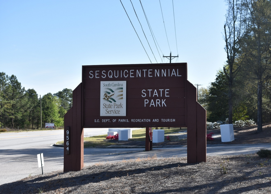
I must come back here. My camping trip to the Sesquicentennial State Park was part of a volunteer group weekend campout. Unfortunately, I didn’t get a chance to explore all this park has to offer. Sesquicentennial State Park is located in the midlands of South Carolina, on the East side of Columbia. This park is an oasis in an urban setting and offers a great retreat from city life back to nature. With over 1,400 acres, this park offers a variety of things to do. Home to a beautiful 30-acre lake, you can fish, kayak, and pedal boat. There are miles of trails for hiking or biking winding through the park’s forests. While I camped the weekend in a Group primitive site, there are both RV and tent sites with essential amenities. Our group planned to use Sesquicentennial State Park on my weekend at this park as a base camp. We planned to drive up Friday evening, visiting the SC State House and the nearby Riverbank Zoo on Saturday, then return home Sunday.
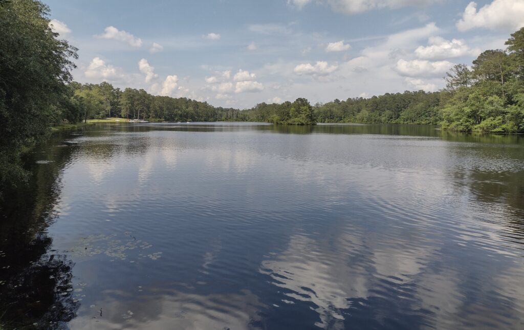
Sesquicentennial State Park Lake
We arrive on Friday night just as rain storms pass through the area. We wait out the rain in our vehicles. It doesn’t take too long before the rain passes and we can get camp set up quickly. The group campsite we are staying in has drained and dried out surprisingly quickly. As we are the only ones using any of the primitive sites this weekend, we have the whole area to ourselves. Most of the younger campers in our group are excited and stay up late talking.
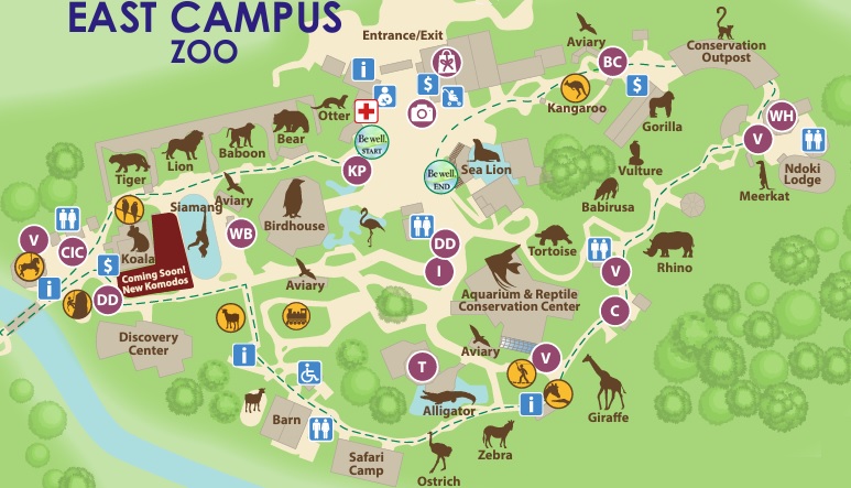
Saturday morning we are up with the sun, getting our breakfast done, and sack lunches made, and on the road for our outings by about 8:30. We arrive a little at the zoo early so we are in line for tickets just before the 9:00 opening. It’s been years since I’ve been to this zoo and it has grown a lot. We spend the morning walking the East Campus which is the zoo or where all the animals and zoo exhibits are. The West Campus is a newer botanical gardens section I haven’t been to before, and it’s not on today’s agenda. I may need to come back for a visit at a later time.
Riverbanks East Zoo Map
We complete our walk about the zoo around noon and break for lunch. The zoo has plenty of opportunities to spend lots of money on food and drink within the park. Packing a lunch is a great way to not spend a bunch of money yet for some of the younger, the elephant ears and dipping dots are too much to resist. Years ago there was a short trail along the banks of the Saluda River and picnic tables where you could lunch along and watch kayakers. All of that is gone with the zoo’s expansion now. We find a shady spot and a few benches outside the front gates to eat our sandwich lunch. We had adjusted our schedule to be in the capital building (air-conditioned) during the afternoon heat. Once everyone finishes lunch we load up and head from the zoo over to the capital.
SC State House
The South Carolina State House building is over a hundred years old and still serves as the capitol seat of our state government. Once we are all inside, we join a tour group in progress. Park Rangers provide guided tours of the State House and provide an insight into the building’s long and impressive history. After our tour, we return to camp to relax and enjoy the afternoon at Sesquicentennial State Park.
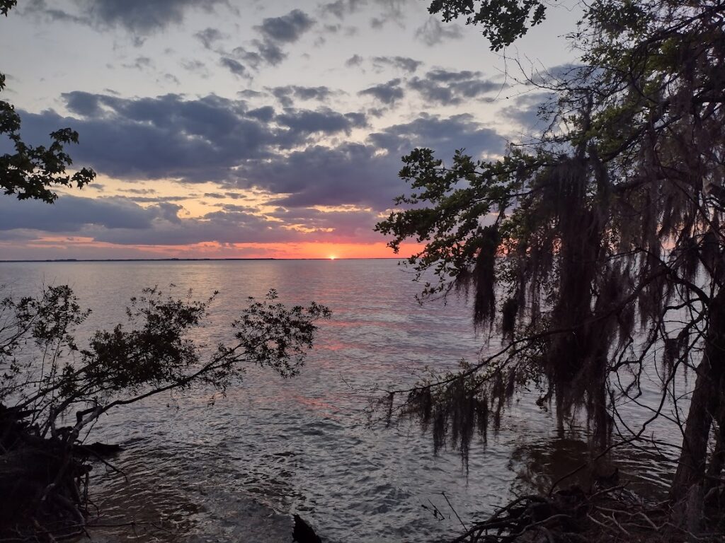
Sunrise through the pines, Sesquicentennial State Park
For me, Sesquicentennial State Park was a pleasant surprise. With its forested natural beauty and family-friendly atmosphere, there are plenty of scenic picnic areas for family gatherings and outdoor meals, playgrounds, and even a splash pad. There is something for everyone to enjoy. It’s a great must-visit destination for anyone looking to unwind and connect with nature in the heart of South Carolina. Sunday morning we pack up and head home. I plan on keeping Sesquicentennial State Park on my list of places to return.
Favorite Time of year: I will have to go for the late Spring and early Fall.
Camping: Camping is available at Sesquicentennial State Park (reservations required).
Pet friendly: Must be kept under physical restraint or on a leash not longer than six feet. This park also offers a large dog park but a permit is required.
Getting There:Sesquicentennial State Park is just East of Downtown Columbia, off the I-77 beltway, then Two Notch Road. Check the State Park directions link. It’s about a 2-hour drive from the Charleston area.
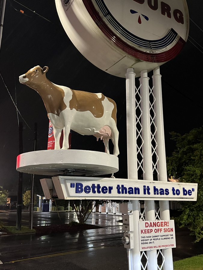
This morning is a calm morning, I guess it’s the truth behind “the calm before the storm.” As I write this Hurricane Idalia has smashed into the Gulf side of Northern Florida and will make her way across the state to the Atlantic side. The current forecast has the storm running just inland today along the coast of Georgia and South Carolina before sliding off into the sea. The schools and many businesses in our area are closed in preparation for the coming storm. We’re expecting winds, rain, and coastal flooding. There are two pieces of good news. First is, according to the internet, Jim Cantore is in Cedar Key Florida, and NOT in South Carolina. The second is the Colberg Cow is still up and in place, at least as of 6 a.m. this morning.
So today with the college closed, it’s a standby day for me, waiting really for the winds which may bring trees or branches down on the farm. Our ground is fairly high so flooding isn’t our big concern this far inland. By this afternoon the hurricane is expected to be a tropical storm again and by later this evening it will be well past us. The downtime is giving me a chance to catch up on some things (like writing).
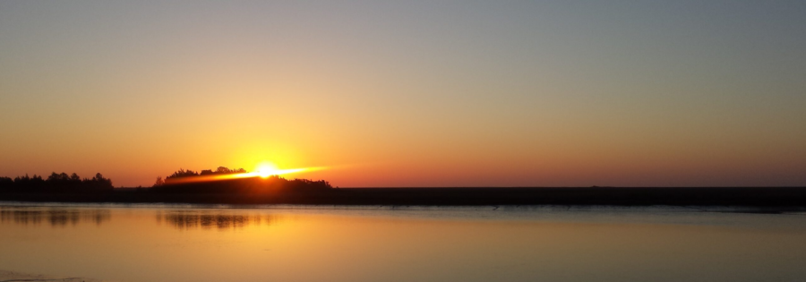
The group I volunteer with just did our annual activity plan and we added several campout events with backpacking. I started updating my blog site with a new page for The Palmetto Trail and in doing so I realized, I have a lot of gaps in my Palmetto Trail journey. And I want to get back on the AT. And the more I think about it the more I just want to get out more. I’ve started planning to grab time as I can to fill in some of the gaps in my Palmetto Trail passages. I’ve hiked passages like the High Hills of Santee a dozen or more times, but I really need to start filling some of the gaps now. I know some will be day trips, and some will be overnighters. My big hurdle really is hiking with one vehicle. Every hike becomes twice as long or I can only go half as far. Maybe I can just go, and keep going? Almost, but not yet. Sigh. Anyway tomorrow after the storm, assuming no major homestead issues, I’m planning to take Radar for the day. I’ve a backpacking trip with some new hikers in January. I need to find a suitable overnight trail campsite around the Swampfox and Awendaw Passages. The rains have come now. The trail is calling and I must go.
The trail is calling
Did you enjoy or find this post useful? Please let me know by leaving a comment below or join me on Instagram or Facebook.
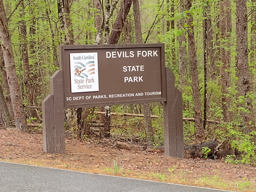
I was able to make an impromptu visit to the park with Radar and stayed with some family for a night. My son and his family are traveling from another park and we are meeting at Devils Fork. The drive up is uneventful and Radar naps most of the way. I stop for gas and a quick snack from the Lakeshop at the junction of SC-11 and the turn-off to Devils Fork. Surprise! Coincidently my son and his family are stopped there as well. I follow their van the remainder of the way into the state park.
Devils Fork Campsite
Our tent site is a gorgeous walk-in tent site about 20 feet from the edge of the lake. We must leave our car in the parking lot and carry everything to the campsite. Our designated camp site is a couple hundred yards in. Most of the walk-in trail is paved but there are some unpaved portions between the trail and tent sights. The pad site is near the waters edge, sheltered a little by trees, yet still with a nice breeze off the lake. Really a gorgeous pick. All of the tent camp sites here are well established pad style tent sites. You must pitch your tent on the site tent pad. Most of the camping tent pads around us are pretty spacious and include a fire ring and lantern stand. With bears are in the area, we were advised to store food overnight in our vehicles at the parking lot.
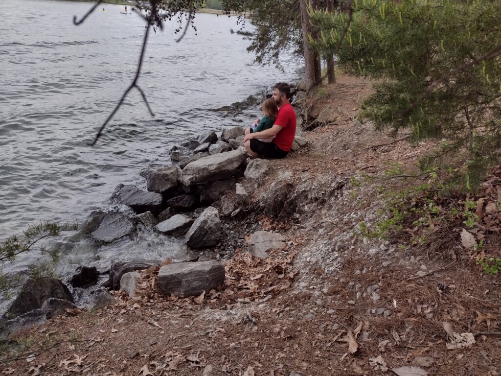
Devils Fork Lakeshore. My son and his daughter at the waters edge.
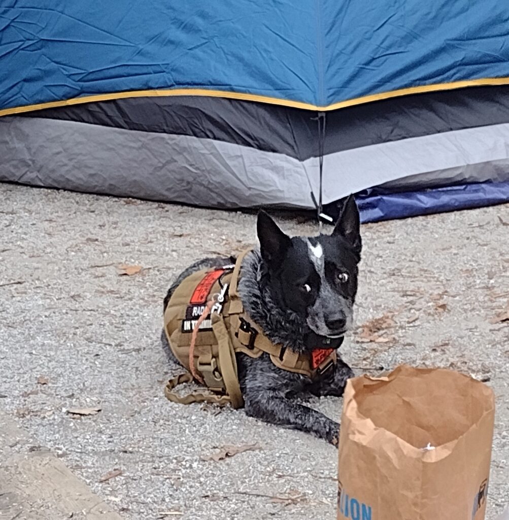
This is Radar’s second over-night camping trip (you can catch Radar’s first overnight campout here). He seems concerned and watchful. I think he is still unsure about what the heck is going on. Maybe its the newness of the area, maybe the sounds of the lake, maybe the scent of bears in the wind. This night he sleeps lightly on his bed under my tarp and hammock. It’s around 3 am when Radar alerts to an intruder near our camp. I struggle to get my light and look under the tarp from the my hammock to catch a glimpses of what set him off with some warning barks. Whatever it was has moved moved on leaving us alone the rest of the night. Radar is ever watchful. The next morning is “moist” with light rain as we make breakfast and discuss the days plans. The forecast has a small window of clear weather then rain, rain, and some more rain.
Devils Fork, Radar in camp
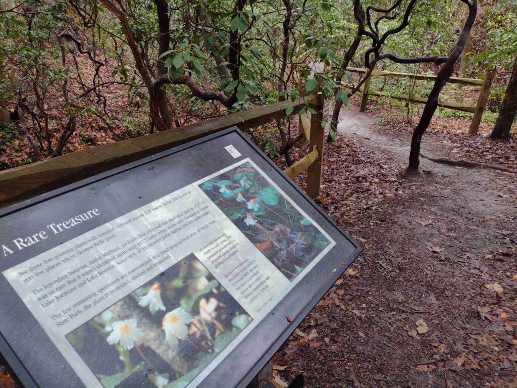
The weather ends up cutting our trip short. But before heading home I took advantage of the break in the rain. I was able to take a quick walk along the park’s nature trail with Radar. We even found some of the rare Oconee Bell plant (See our hike video here, comment below to let me know what you think). Devils Folk has a fairly short 1.5 mile nature trail in the main park. The trailhead is off the large boat ramp parking lot near the visitor center. The Oconee Bell Nature Trail winds through a mostly hard wood forest down around a creek and small pond before returning you to the start. One really nice feature of this trail is the labeling of botanical specimens all along the trail.
There are dozens of sign posts and story boards along the trail, identifying the various trees and plants along the way. The Friends of Jocassee have a great online trail guide which takes you trough the trail’s plants as you hike. One of the biggest points-of-interest on the trail is the Onconee Bell plant itself. An endangered rare plant, it grows in only a few spots in the state. The weekend we visited the plant happened to be in bloom. A moist area ground cover plant, it was sporting the delicate, white and pink, bell shaped flower.
Devils Fork trail hike, the Oconee Bell flowerDevils Fork Lakeshore
Located in the upstate of South Carolina, on the shores of the 7,565-acre Lake Jocassee, this park offers ready access to the lake, fishing, and camping. You can get a view of Lake Jocassee from the park webcam here. This 644 acre park park is about 10 miles North of Salem, South Carolina in Oconee County or about a 4 hour drive from the Charleston Area. Located in the Northwestern part of the state, Devils Fork State Park is one of South Carolinas newer state parks having been created in 1990. Anchored on the Sothern side of Lake Jocassee, the park has Villas, traditional RV/camping sites, and walk-in tent sites. The park does have some boat-in-only camping sites located on the Northern side of the lake. All sites need to reserved ahead of time.
Favorite Time of year: I will have to go with Spring to catch the Oconee Bell flower in bloom.
Things to Know: The breeze off the lake can be refreshing in the summer. However can bring a good wind chill factor in the winter. Oh and bears.
Pet friendly: Must be leashed at all times, including the forest, okay everywhere outdoors except cabin and lodging areas of the park.
Getting There:Devils Fork State Park is just West of Table Rock State Park off highway 11. Check the State Park directions link. It’s about a 4 hour drive from the Charleston. area.
#
Did you enjoy or find this post useful? Please let me know by leaving a comment below or join me on Instagram or Facebook.
You’ve planned a weekend camping and hiking trip with friends. Overall, there is a 12-14 mile hike over two days with at least a gain of 2000 feet in elevation. Your group’s has mixed hiking experience, but you’ve done this trail at least a dozen times over the years. You travel hours to get to the trailhead. The first night’s campsite is a little bit of a tough hike but it’s only four miles in. One of the new hikers starts to struggle on this first leg, however, you make it to the first wilderness camp safely.
Maybe they are just getting used to their pack. Maybe they are just getting used to the strenuousness of the trail. Maybe they will be good to go in the morning after a hot meal and a good night’s sleep. Maybe. What if they are not? The next morning, you are looking at a steep uphill climb to regain the main trail. Now it’s clear one of your hikers just can not go on. For whatever reason, they can’t go any further. Now what?
What is your backup plan if someone falls, or is injured in the middle of your next adventure? What’s the exit plan in the event of an emergency? Is there one? I don’t think most people plan for the exits as they should. After all, who wants to plan for a disaster? We go outdoors for a good time, not to get hurt, end up in the hospital, or worse. It often seems accidents happen in remote locations where it’s hard to get help or get the injured out.
In recent news, a nineteen-year-old experienced hiker died doing a solo hike in a state park when something went completely bad. Another person fell to their death from a popular hiking trail in Zion National Park. Search the internet and you’ll find tons of hiker misadventures. While hiking accidents happen all the time, it’s the worst which makes the news.
I think there is a general misperception where people generally feel safer in state or national parks. Myself included, tend to consider organized parks as safe places with help always nearby. I can just call the rangers and they will come to get me. Right? Most likely, no. The idea “parks are safer” is a dangerous assumption. Most parks have minimal staffing levels at best. Large parks can have very isolated areas which are difficult to get in and out of. Even with popular destinations, help can be hours or days away.
Trip contingency planning simply means planning for problems, understanding what are your exit options, and how to get aid if something goes wrong. Planning for contingency events helps everyone enjoy a safe trip. Add these contingency topics to the planning for your next outing: training (both yours and the group’s), the forecasted weather, the essential items, a trip plan (for use by others), and an emergency plan (for use by you). Let’s take a quick look at these topics.
Training
First-Aid is one type of training I will always highly recommend. You should understand, most first-aid courses assume secondary aid, such as Emergency Medical Services (EMS), is less than 30 minutes away. If you are hiking in a remote section of the backcountry, secondary aid may be hours or days away. Take a simple, basic first-aid and CPR (CardioPulmonary Resuscitation) course to start with. As you find an interest you can take more advanced courses like a Wilderness First-Aid class. The American Red Cross has some good courses. You can even do some of the courses online to get started.
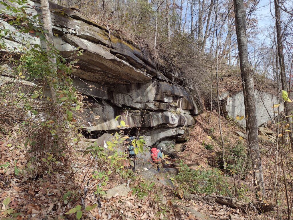
Rock outcrop
Weather
Based on most of the news articles I’ve read, many hikers lost or injured die of exposure to the elements. Regardless if injured or simply lost, they did not have adequate protection from the weather to survive until found. It’s important to both plan for the typical seasonal weather condition and to closely watch the area’s local forecasts for weather changes in the days leading up to the outing. I often find borderline weather conditions can shift significantly in a day or two, sometimes for the good, sometimes for the bad. It’s good to be prepared for the bad.
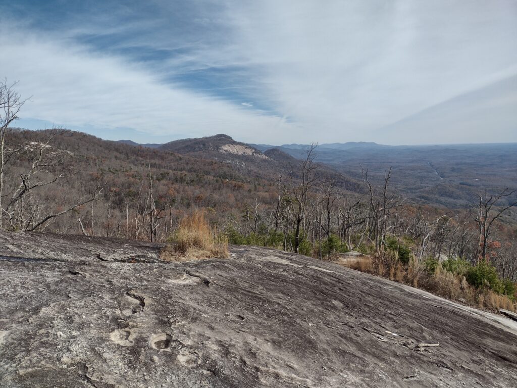
View of Table Rock from Bald
Essential Items
These are the items every hiker should always carry in some form or fashion. These items could include things like matches, compasses, food, water, and even extra clothing. Based on the planned activity, you may need to modify what you carry. Follow my link for a deeper discussion on the essential items.
10 Essential Items
Hiking or Trip Plan
Like a boating float plan, you leave this plan behind with a responsible person in the event the hikers don’t return on time. The information in this plan will aid searchers and rescuers in locating and extracting those in need. A good hiking plan should include the following information:
The name, description, and information about the lead hiker/person in charge.
Any vehicle information, usually left at a trailhead, like the make/model of cars, color, tag numbers, etc.
Equipment the hikers have with them. Do they have first-aid kits, a way to make a fire or signal, cell phone numbers, etc?
Hiking trip details: departure date, return date, destination, proposed route, stops along the way, etc.
Name, and description of hikers in the group. This should include any important medical information.
Emergency Plan
This is the plan the hikers take with them for use in the event of an emergency. Sometimes your emergency plan is just a mental note of the nearest road crossing. But what happens when the one with the “mental notes” gets separated from the group, or is unconscious? This plan should include written emergency contact numbers for logistical support like shuttles or pick-ups at a trail crossing, local rescue phone numbers, the nearest hospitals along the way, and maybe even a route map. Do a short “safety briefing” at the beginning of the outing or the trailhead, just to review the route, and highlight any important safety information with the group.
So be sure to ramp up your next adventure planning with these contingency items. You’ll be better able to turn a possible disaster into a simple change of plans.
***
What does Foxtrot Uniform mean? You may have guessed by now. Let’s just say it’s sort of related to FUBAR and SNAFU. This is when all your planning gets turned upside down and now you have to create a plan “C” on the fly ’cause your plan “B” isn’t going to work out anymore. Remember, in nature, there are no safeties.
#
Did you enjoy or find this post useful? Please let me know by leaving a comment below or join me on Instagram or Facebook.
My first efforts to take Radar on a real overnight campout and then hiking went incredibly well. Radar and I have hiked together a fair amount. And we’ve glamped before. But we haven’t actually tent camped and hiked in one outing before. Hopefully this overnight adventure was a test run for more fun outings to come.
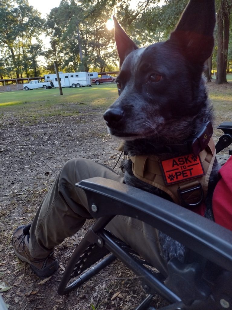
We arrive at Mill Creek county park about 5:30 pm. Mill Creek county park is a popular equine camping staging area located in Sumter County, at the southern end of the High Hills of Santee Passage of the the Palmetto Trail. There are a few horse trailers already set up for camping there. We select and set up our camp site near the trailhead leading north to the High Hills of Santee trail. Radar is nervous. He doesn’t know why we’re here this late in the day. Tent camping is all new to him and he’s not sure what’s happening. I put his vest on him to see if it will help calm him down any. I’m picking tarp camping to start out with him which is a little bit of a challenge in and of itself. I guess I figure we may as well start hard and work toward easy. Park rules say he needs to be on leash in the park, although not all dogs here are. There is at least a pug and another heeler here too. The pug runs up next to my car as I arrived, dragging it’s leash, seemingly convinced it was more important to greet us as new arrivals to camp, regardless of it’s own personal safety and the potential hazards of being crushed by a moving vehicle. Anyway we’ll see how the leash thing goes. I had picked up a 50′ roll of paracord from Lowe’s on the way with the idea I could make a long lead for Radar in camp. I also brought his bedding from home to make him feel a little more at home along with his regular food and water bowls. I have a couple collapsible bowls I usually bring when we go out for hikes but will save them for the trail tomorrow. Right now he’s sitting on my lap in the chair (his choice), watching everyone and everything else around the camp.
Radar’s not sure
There is a mule in an impromptu electric fence corral next to a couple of horse trailers on the right of us. They have the pug and heeler. Across from us is another pair of horse trailers with a shepherd and lab. Everyone seems to know everyone. They started a camp fire at the pair of trailers across from us and the people from all four trailers are sitting around the fire chatting. The sun is getting ready to set so I’m going to feed Radar and eat now myself.
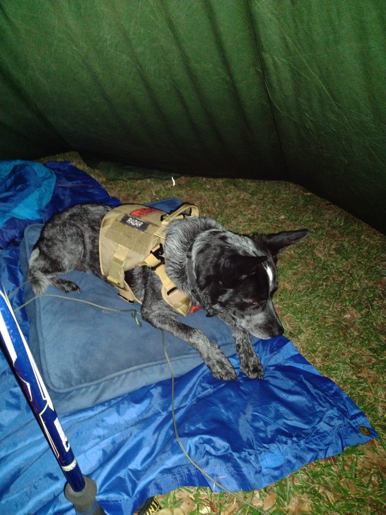
Radar’s first night tarp camping
Up in the morning. I was awake early but am waiting until the sun starts coming up. It was a little bit cooler than I expected last night with this early morning temperatures at about 45 degrees. Note to future-self: Things to bring on fall campouts, gloves and a warm hat. I am glad I brought my heavier sleeping bag, a 20 degree sleeping bag, which was perfect. Radar did incredibly well for his first night of tarp camping. He only got up a few couple of times in the night, left the tarp, and walked around. I think he was check out noises from the adjacent woods. No barking, just checking. I got up a couple times myself to pee and he followed me close. Because we were under a tarp, I had to keep him on the long lead most of the night but for the last hour or so waiting for sunrise. This last hour we both just lay here waiting for sunrise. The ground is pretty hard and my Z-fold pad isn’t making much of a difference. I’m beginning to think I may need a different pad.
Radar still seems a little nervous this morning so when I got up for a quick walk to the bath house, I took him with me. I wanted to use the larger stall so Radar could come in with me, but someone was already in there so we went back to our campsite. Who get’s up at the crack of dawn to use a bathhouse anyway? When we get back to the camp site, I open up the car to start getting breakfast ready and Radar jumps right in and takes his place on the front seat. I don’t know if he thinks I might leave him or not but he isn’t taking any chances. He comes out of the car for his morning meal while I have a nice trail breakfast of hot oatmeal and a café mocha. It feels good to be in backpacker/hiker mode again. I’m dressed for the trail. It’s been a while (too long) since I’ve been able to get out and do any real hiking.
Radar is ready to hike
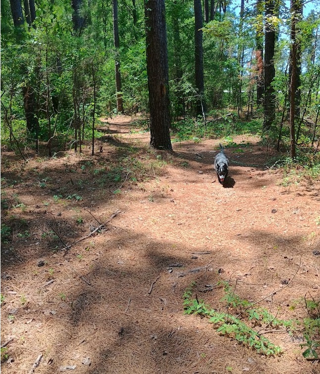
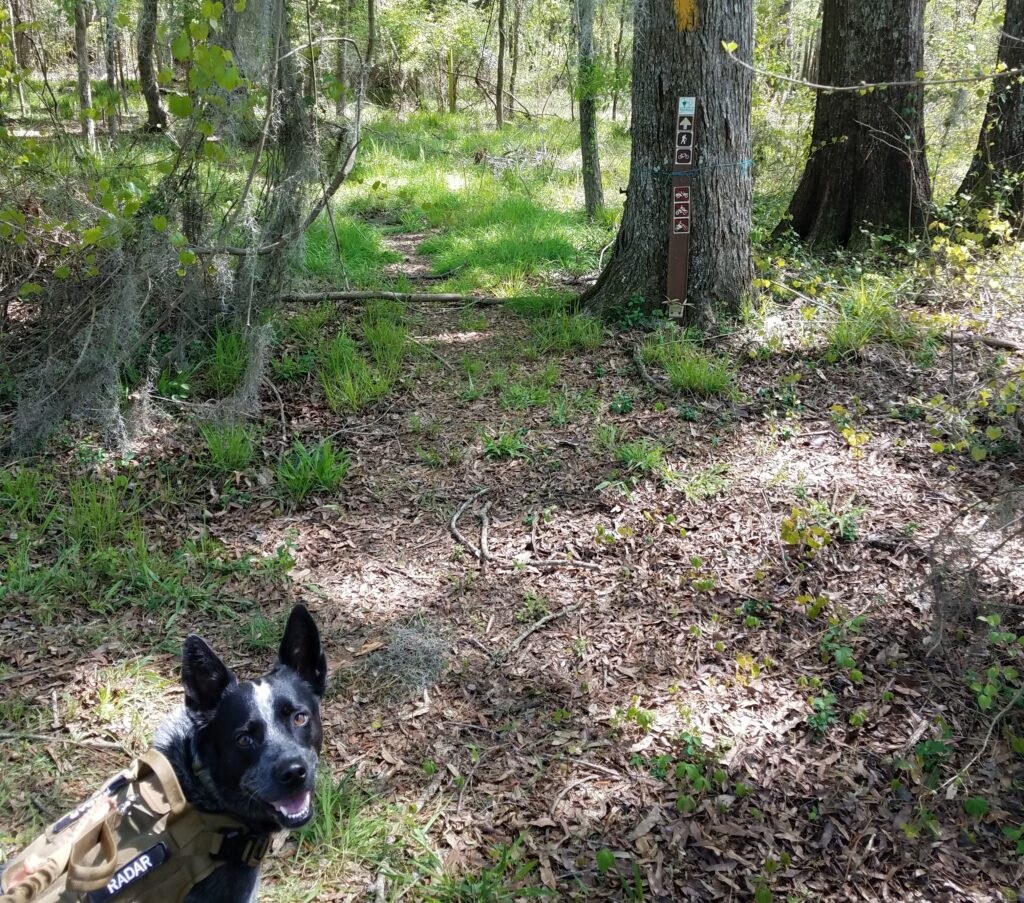
After clean up and repacking my hiking day pack, I put on Radars hiking vest. I want something with a little color on him as we are hiking in the Manchester State Forest, which is public land, during hunting season, and I don’t have any blaze orange with us. I think once Radar realizes we are going hiking he really relaxes a lot. We are on trail, north bound, at 8:50 am. Radar is off leash, much to his hiking joy, once we get out of the park but I do have a leash just incase we meet horses or other hikers. Proper trail etiquette and all. Not everyone seems to like dogs.
High Hills of Santee Passage heading out
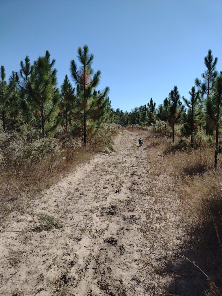
The High Hills of Santee Passage I think I’ve hiked at least a dozen times. It’s a great section to hike and I usually start out new backpackers on this trail. There are a lot of access roads and the trail is well marked most of the time. Since it’s been a while for me, I’m loosely planning to hike maybe 3, 4, or 5 miles out, depending on how I feel and the day goes. Then turning around and hiking back. The trick is leaving enough fuel in the tank for the return trek. I figure if I can start hiking by 9am, we can maybe hike like +-3 hours, we could eat lunch and then hike back. Being on trail by 8:50 is a perfect start.
High Hills of Santee Passage sandy trail
The issue with the early section of this trail (besides the quicksand patch) is it’s sandy. Sandy like walking on dry sand at the beach sandy. It really sucks the energy out of you. Starting out in the morning fresh is okay (’cause you’re fresh) but finishing at the end of a hike is tough, it’s like hiking an extra mile or two when you’re tired.
The day goes well, the weather is cool, clear and perfect hiking weather. We hike well and make good time. We covered about five and a half miles and make Christmas Mill Road by about 11:30. As we reach the crossroads, there are a whole group of trucks with hunters coming in and starting to unload. Rather than stop there for lunch, we just start our return leg and hike about an hour more before we stop for a good lunch break.
High Hills of Santee Passage young pine forest
Radar seems to understand when I tell him “we’re heading back to camp, back to the car.” His ears are up and he leads the whole way back to camp. He follows the trail flawlessly, even when the trail crosses a road or splits, he picks out the correct path on the other side. As we were hiking out of camp north bound, he would generally stay close to me alternating between ahead, behind, or off trail checking out smells and noises, usually not much more than about 75 feet away. Heading back south bound to camp, he occasionally is going off trail to check a noise or smell, but mostly he is leading with purpose, maintaining about a 50-75 feet lead ahead of me on the trail, stopping ever so often and looking back to make sure I am still with him, stopping in the shade, waiting for me to catch up, and then he starts trotting off down trail again.
High Hills of Santee Passage pine forestHigh Hills of Santee Passage open field
We stop for lunch around noon. Food and water for both of us. I have a couple collapsible water bowls but it’s hard to judge when hiking and how much water he needs. I make sure he has his fill of water during our lunch stop. The final leg to camp is more sandy and the day is warming up. We’re back on trail by 12:30 heading in to the home stretch now. Nearing the last quarter mile from camp we run into a string of horses with riders, we pull off trail to let them pass, Radar sits and waits. This is a big test because he loves horses. Really, really loves horses. Nipping tails kind of love. He stays, the riders pass intact. We hike on. I’m very happy. We make it back to camp around 2:10 pm. As we enter back in to camp we make for a picnic table in the shade and break out the last of our water. The hike is a win. A great hike and overall a great little campout. Radar crushed the hiking part of the trip and I think he’ll get the hang of this tent camping thing without any issues in the future. Now to figure out the next trip.
#
Did you enjoy or find this post useful? Please let me know by leaving a comment below or join me on Instagram or Facebook.
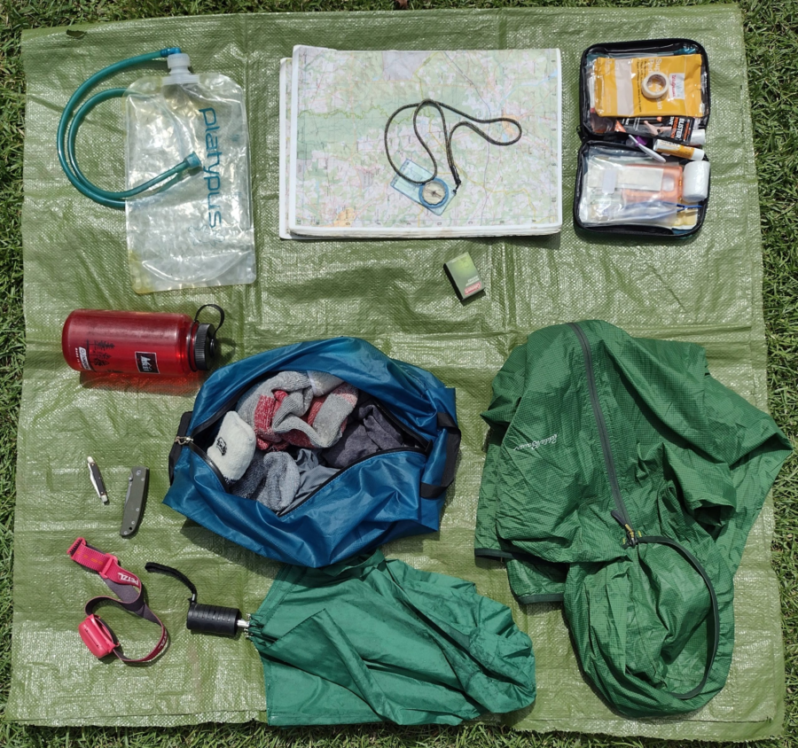
Whether you are heading down the trail for a quick hike or gearing up for a long trek, you don’t want to forget these essential items. You’ll need to start somewhere and this list is a place to start the discussion. There are many versions of these essential things and infinite options for each item. Of course you will want to scale down or up these items based on your specific outing needs. For example, the first-aid kit I take with me on a week long backing trip is vey different from the first-aid kit I take with me for a local day hike. So lets walk through the 10 essential items.
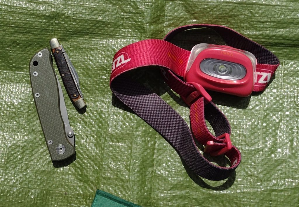
Flash light For me, a simple headlamp works well for almost all situations here. Light weight and easy to pack even for a day hike when you maybe coming in around or after dark. Seldom have I ever needed a handheld style flashlight when hiking. As a trek pole user I prefer the headlamps as it keeps your hands free for other purposes. I would not recommend overly fancy lights or headlamps needing special or button batteries. I’ve seen hikers left in the dark because they couldn’t find replacement batteries in town. Keep it simple, AAA or AA batteries are every where. For short hikes, just make sure you have fresh batteries. For longer treks maybe pack an extra set of batteries.
10 Essential Item Headlamp Knife
Pocket Knife Useful for light cutting and trimming. My primary hiking knife is a small simple folding two blade pocket knife. It’s useful for cutting moleskin, opening meal pouches, chopping beef jerk, even getting out the occasional splinter.
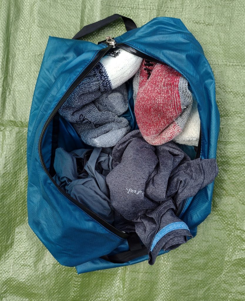
Extra Clothing and Socks
Extra Clothing This can be a simple change of socks, or a change of underwear, or several days of layered clothing. For a local day hike, I might take an extra pair of socks if I thing the trail will be wet. It’s nice to change in to dry socks for the drive home. For backpacking, a hiker travels on their feet so socks are important. For clothing, I usually only pack a change of base layer/underwear, but will always take at least 3 pairs of socks. One pair for today, one pair for tomorrow, and one pair only for sleeping. I try to keep my sleeping socks clean, dry, and reserved only for sleeping. I’ll hike in a pair, then swap them out the next day. My yesterday pair will hang and dry/air on my pack and become my “tomorrow” pair.
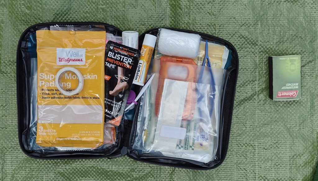
First-aid Kit You can pick up a simple first-aid kit just about any where not much bigger than a deck of cards or even make your own. However you really do need to know how to use what you pack. If you’ve never had any first-aid training, look up an organization like the Red Cross for training in your area, you can even do some of the training on-line. For a day hike a small zip-lock bag with a bit of moleskin and a few bandages is probably enough to get started. For longer hikes I carry a small group kit (I often hike with small groups) containing things like bandages, gauze pads, tape, extra mole skin, antibiotic ointment, ace wrap, KT-tape, some simple over-the-counter meds like aspirin, Tylenol, Ibuprofen, Benadryl, Imodium, small scissors, small tweezers, and the such.
First Aid & Matches
Matches or Fire Starter What’s really needed here is a way to start a fire incase you get lost. This is a survival type situation item here. A butane lighter with some sort of fire starting aid like dry lint or tinder, in a small container works too. My stove has a piezo lighter/igniter, but I also carry a small butane lighter or a small box of water proof matches, just in case the igniter breaks (it has).
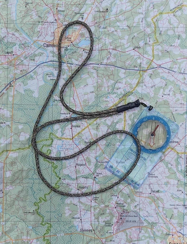
Map and Compass Even when starting out on a well marked trail you need to know where you’re headed and be able to navigate basic directions. I did a day hike from Newfound Gap with my dad a few years ago in the Great Smokie Mountains. We came across a hiker heading our same direction. Long story short, he was lost on a well marked trail and had to backtrack to his start. If you’re using your cell phone or an app as many people (including myself), a compass is a great battery free, water proof, quick and easy to use tool to aid you in finding your way and help keep you from getting lost. This is the compass always take with me backpacking. It’s a older Silva Starter compass I’ve had for years. It’s simple and works well enough to navigate with.
Map & Compass
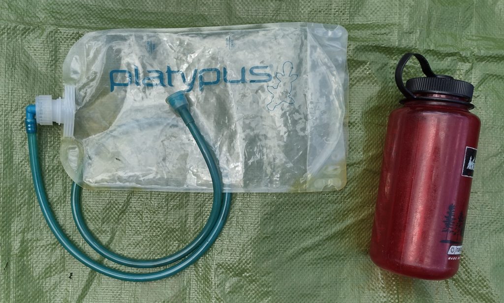
Water Storage For a simple day hike I typically use a standard 1-liter Nalgene style bottle or something of equal capacity. When backpacking, my number 1 recommendation and go-to is the Platypus hydration bottles. I always carry two Platy 2-liter flexible bottles as part of my hydration system. They are very light, tough, fold flat when empty and form to the pack contents. Having two of these bottle gives me flexibility in my water carry based on weather and trail conditions for only ounces. For long treks where potable water may not be available, you also need to consider water treatment options.
Water Storage
Trail Food This is snacks to maintain hiking energy between meals. Any kind of favorite trail mix or granola is a nice treat to nibble on as your walking. This can be a simple homemade trail mix or can also be something like trail snack bars such as Cliff, RxBar, Nature Valley, & PowerBar. These generally pack and keep well. Watch out for some of the snack bars with chocolate drizzle or coatings, when the weather is warm they can be a mess. Pack an extra bar for those “just in case” times.
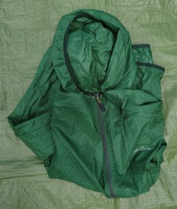
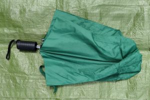
Rain Gear This can be as simple as a disposable poncho or as complicated as a full rain suit. From my experience, if it rains, you will get wet. Regardless of the rain gear. My preferred rain gear is the light wind rain jacket with a hood shown. It breaths well and keeps most of the rain off me. It’s great for short or long hikes, it packs down nicely, and it works well when used as an outer shell over layer or alone as a light rain jacket. An umbrella is also a good option I’ve used on some trails. If I know I’ll be out in a monsoon, I may pack a full rain suit with jacket and pants. A lot of rain can be chilling, carrying away a lot of body heat, and lead to hypothermia.
Rain JacketUmbrella
Sun Protection Here again, an umbrella pulls double duty and works well. Hats, long sleaves shirts, and sunscreen lotions are also great picks. Consider where you will be hiking and the forecasted weather. Look for a small sport stick sunscreen. At just a couple ounces it can help cover the high burn areas like the tops of ears, nose, cheeks, and shoulders without adding lots of weight to your pack.
It’s a good habit to pack some version of these “Ten Essentials” whenever you head out into the backcountry. Even for day hikes, consider carrying with you water, a snack, maybe a pocket knife, and small first-aid kit. You may use only a couple items or even none at all. But when something goes astray, you will appreciate being prepared.
#
Did you enjoy or find this post useful? Please let me know by leaving a comment below or join me on Instagram or Facebook.