It’s still September in my mind as I finish up part two (go here for part 1) of Hiking the Dike!
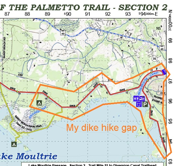
Day 1: (Monday) The drive to the trailhead is just over an hour from the house. Russellville Boat Landing parking lot is about as convenient to the trail as you could ask for. The parking lot is about a hundred feet from the trail and puts me just a couple of miles from the southern end of my gap in the Lake Moultrie Passage of the Palmetto Trail I’m trying to fill in. Unfortunately, it’s just radar and I so this will be an out-and-back hike.
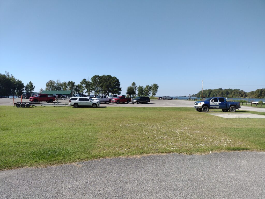
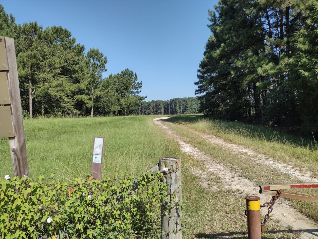
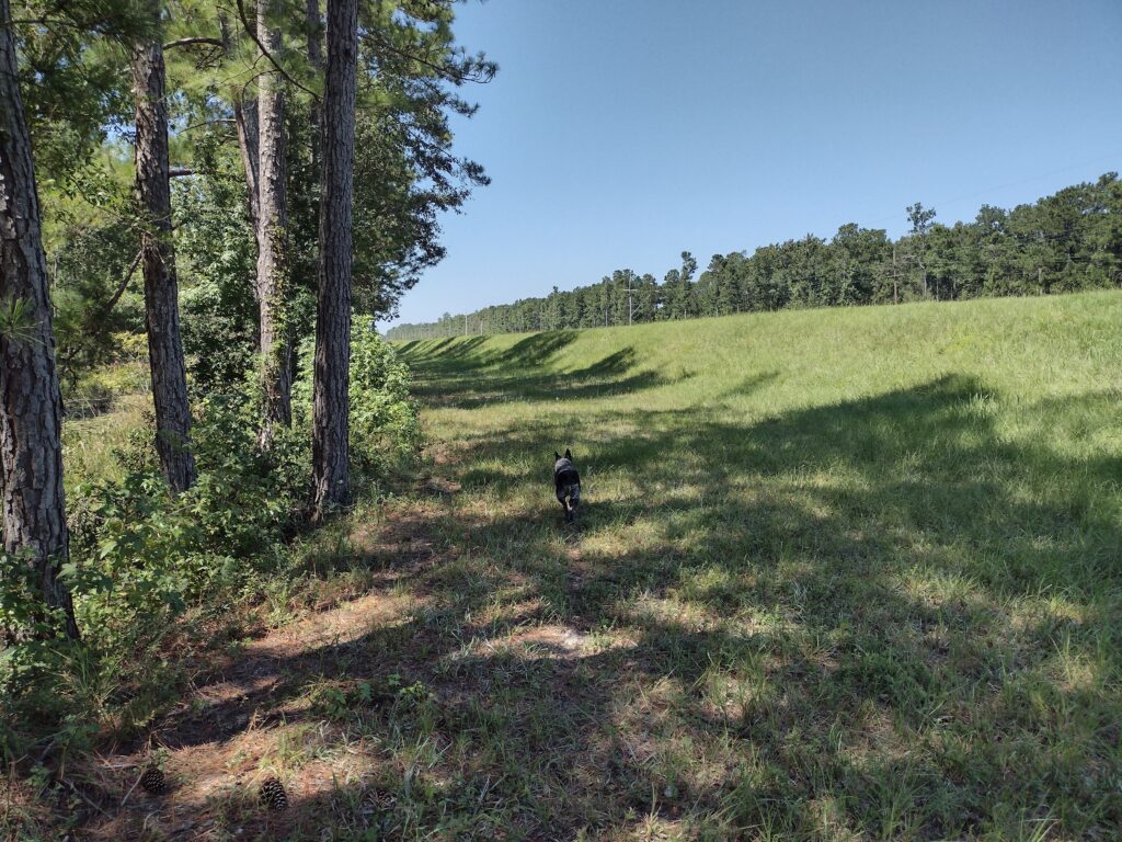
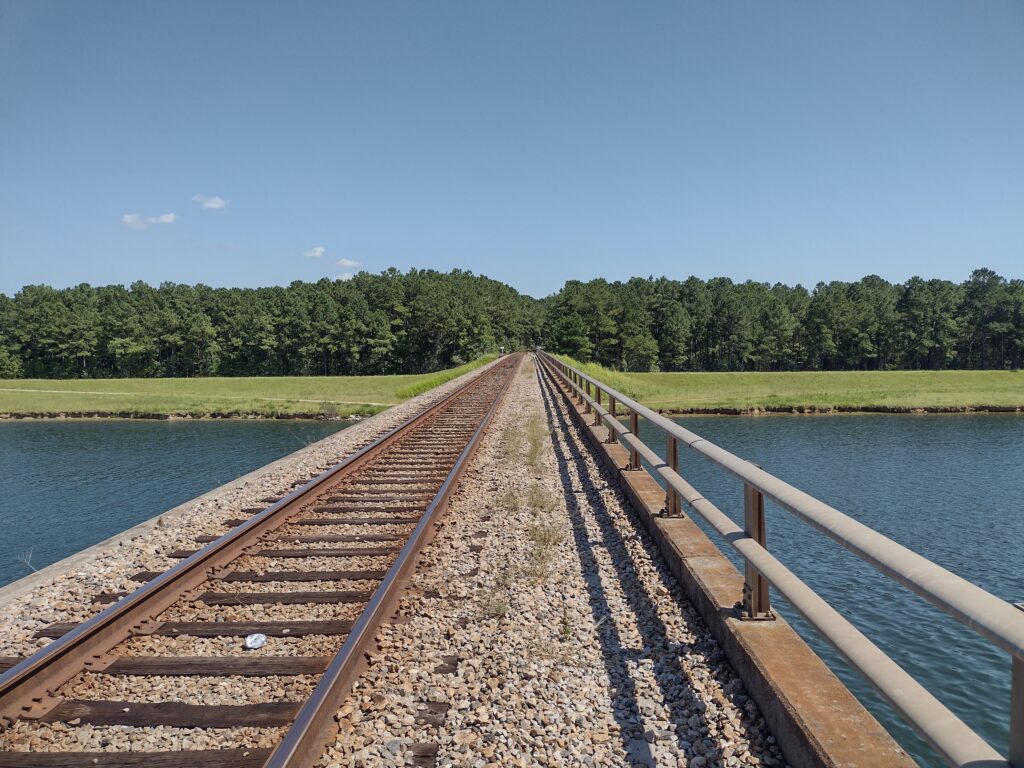
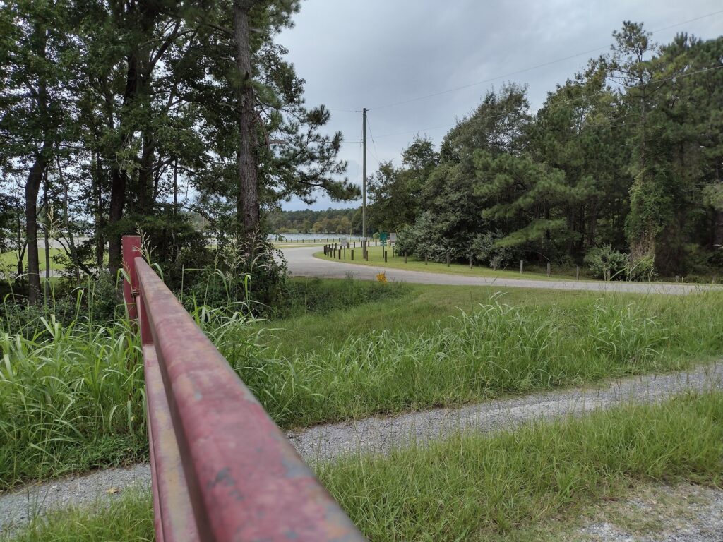
The parking lot is almost full when we arrive so we find a spot out of the way and gear up for our gap-filling hike. From the parking lot to the trail is only about a hundred yards so access to the trail is easy and we make fairly quick time walking along the Rediversion Canal past a rail trestle to State Road 35 which will cross over the canal. With no one around Radar is off-leash now. He’s really good about staying close to me and seems to know how to follow the trail. In this first few miles, we’re walking along the gravel road along the canal. Going past the rail trestle, the trail reaches State Road 35, jumps over the canal using the road bridge, and then the trail drops off on the other side and follows the canal back to the levy and then continues along the levee north and west. These first couple of miles are all in the open and it’s a bright sunny day. It’s pretty warm being September still so we pause for a water break on the north side of the canal under a rail trestle. I am carrying water and lunch for both of us along with a collapsible bowl for Radar.
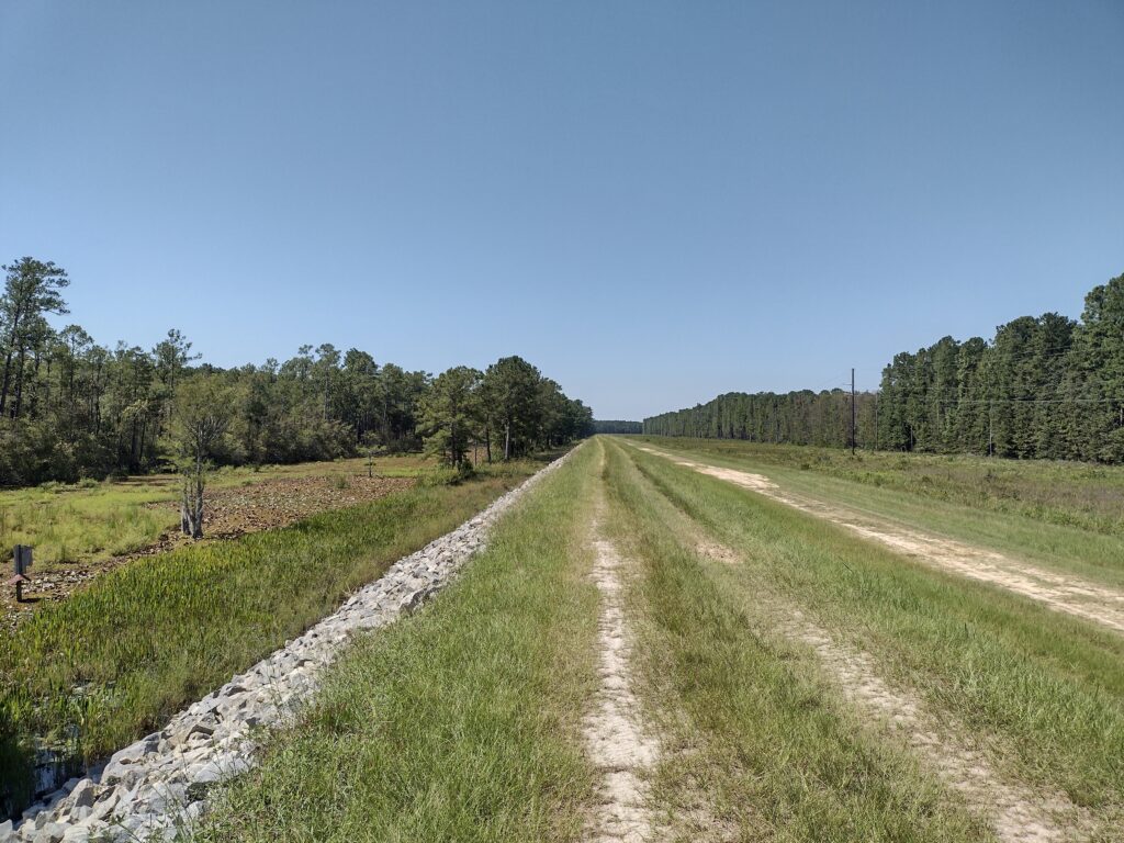
Once we get past the canal we get back on to the dike. The levee is almost all in the sun without shade. Radar is up and down the levee exploring, never more than 50 feet or so from me as we continue hiking. As he gets a little warm he jumps and splashes in the water to cool off on the lakeside of the levee and it looks like he’s having some fun.
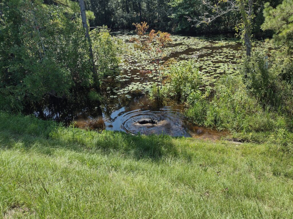
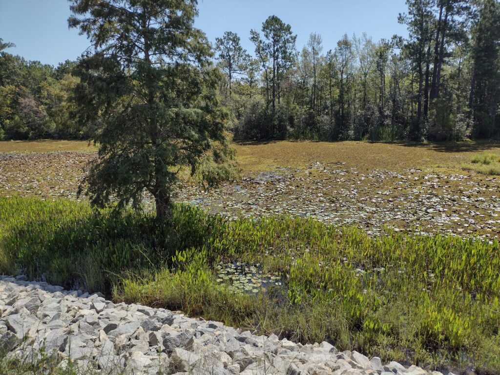
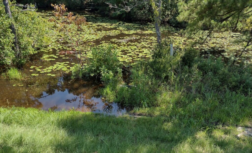
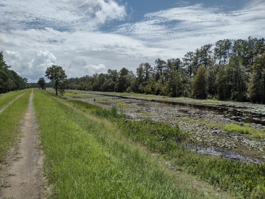
As we continue further on along the levee, I feel like hiking here is a little strange now, maybe surreal. Looking off to the north side of the levee, the area is open, mostly maintained, mowed, traveled, etc., even buildings off in the distance. Looking to south, the lakeside of the levee (you can’t see the lake from this part of the levee), it’s more primordial, almost like stepping back in time. A shallow marsh buffer lays between the levee and woods beyond, with cypress and pine trees, birds chirping, and flowering water lilies. Oh and alligators.
I know there are alligators in SC. I’ve known for a long time there were alligators in South Carolina. I know they are a possibility in the lakes and rivers and I’ve seen smaller ones in Lake Moultrie before. But on this day I wasn’t thinking about them when I started. Because of the heat, Radar would go down to the edge of the water, splash around a little to cool off, and then come bounding up the dike all wet and happy. Radar had just come up from a quick dip in the water as I saw the first alligator.
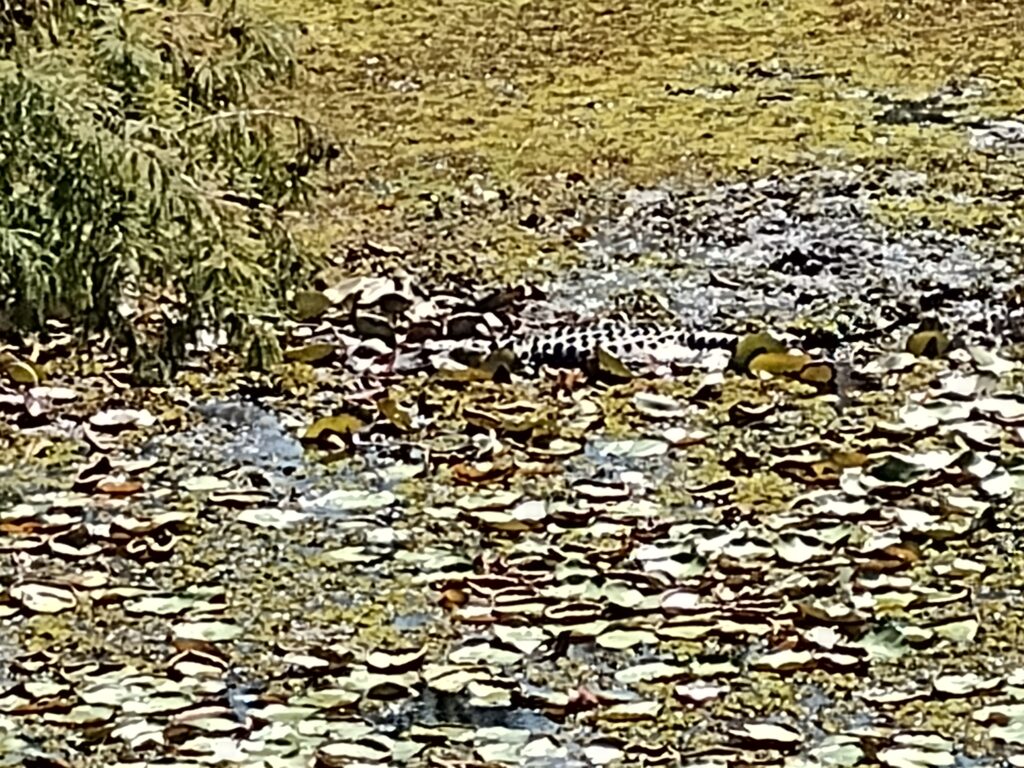
Seeing him surprised me a bit. He is out in the open, in the middle of the muddy marsh, maybe 50 feet from the levee, just lying in the sun. He was a good 10-12 feet long, his skin oily black, and he lay motionless in the black thick muck of the marsh, ominously waiting patiently for the next prey to wander near. There was no cuteness about him. Swim-calls for Radar are suspended until we get clear of the marshes on the return portion of the hike. Once you see one the rest are pretty easy to spot. They are pretty much everywhere in the swamp now.
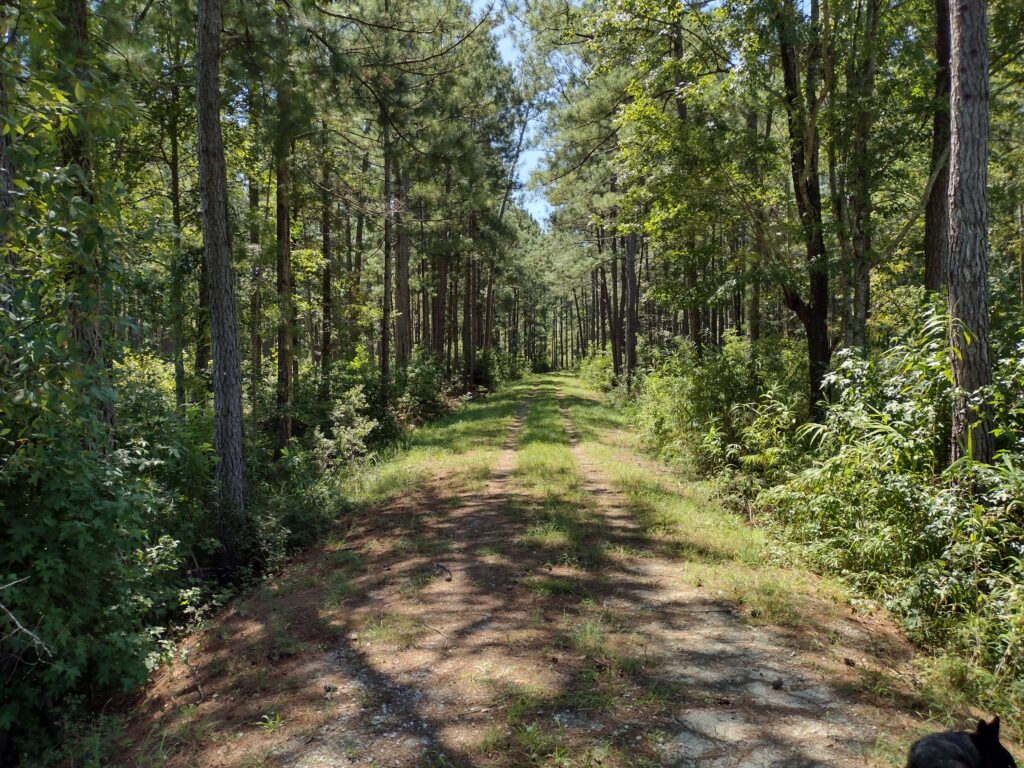
It’s warm but we’re almost to the spur trail leading to the campsite. Reaching the spur trail closes this part of the gap for me. We reach the spur trail and follow it to the campsite. It’s nice to sit for a few minutes and take a break in the shade of the pines for lunch and a drink. The last time I was here was in October of 2003. Our group camped here overnight. It was hot and there were plenty of mosquitos for everyone. It’s better today, still warm but very few bugs today.
After eating a light lunch we start retracing our path along the trail, heading back to the parking lot. On these solo out-and-back hikes, you usually have to travel twice the distance needed to cover a given piece of trail. So here we go. It’s afternoon to midafternoon on the return leg and it’s hotter. The sun is higher in the clear sky, and there is less shade now along the trail. I’m constantly watching for alligators and Radar is very obediently staying out of the water. We are burning through the last of the water I brought. Radar is panting pretty good, we steal what shade we can. We are nearing the end of the swamp finally and reach a spot where I think Radar can take a much-needed splash to cool off. I haven’t seen any alligators for a little while.
We start down the side of the levee cautiously. Radar is a little ahead of me. And then I see him. Laying in the tall grass is a 6-8 footer, waiting.
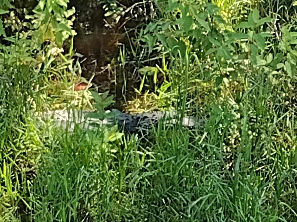
I hastily call Radar back and we quickly climb back on top of the levee. It looks like no swim time after all. It turns out this inviting wet spot was also the last spot Radar took a cooling splash on our inbound hike. Now on the hike out, Mr. ‘gator was lying in wait. But somehow Radar understands the danger and returns to the top of the levee with me. After another quarter mile or so we finally are past the swamp and at the banks of the canal. Radar is all in for a cooling dip in the cool waters of the canal.
Once we’ve cooled off a bit we decide to cut a mile or two off the return trek by taking the rail trestle over the canal instead of hiking back to State Road 35. When we finally get back to the parking lot, both Radar and I are hot, tired, and out of water. I call it a day and decide to head home. We’ll pick up the last couple of miles another day. Here is my Relive video of the day 1 hike.
Day 2: (Saturday) I’m finishing the last few miles in my Lake Moultrie Passage gap. Driving back to the Russellville Boat Landing parking lot puts me at the beginning of the end of this passage. Again, it’s just radar and I so this will be another out-and-back hike.
This time it should be just a quick few miles out and back. The trail is again along the top of the level with minimal shade. But today it’s a little cooler, with scattered clouds, and not quite as hot as Day 1.
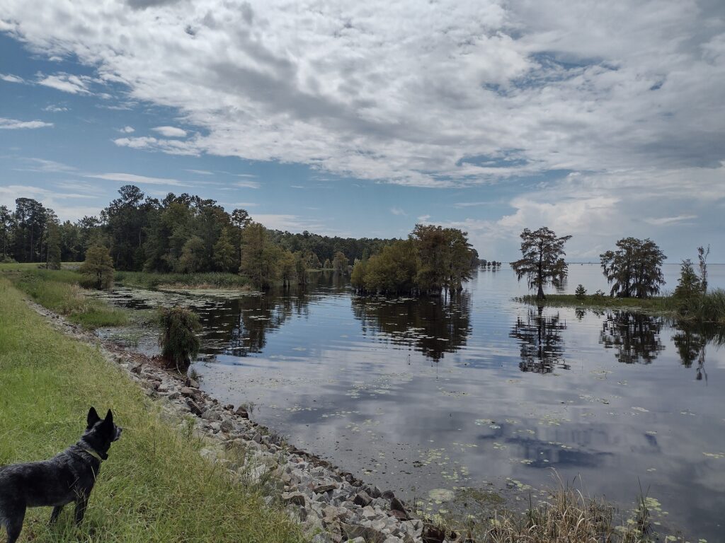
The hiking today is largely uneventful but seems more enjoyable. Maybe the scenery is better? This part of the trail has a much less swampy median and more water from the lake.
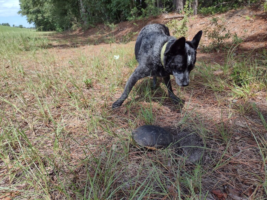
While I’m sure they are around, we don’t see any alligators today. The only reptile we saw today was a turtle. She looked like she is nesting on the low side of the levee. We make fairly good time along the trail covering almost three miles in just over an hour. Today is an easier hike. There was even a brief sprinkle of rain to help take a little heat off the day.
Reaching our turnaround point completes the entire Lake Moultrie Passage of the Palmetto Trail for me. I have a bunch of marked-up trail maps taped to a wall back at the house, now when I get home, there will be one less. Radar and I simply start heading back the few miles to the parking lot and then on to home. Here is my Relive video of the day 2 hike.
#
Did you enjoy or find this post useful? Please let me know by leaving a comment below or join me on Instagram or Facebook.