Two years ago I set a goal for myself to hiking Pike’s Peak. This past week I completed this goal hiking to 14,115 feet, summiting Pike’s Peak, and claiming my first “14er.”
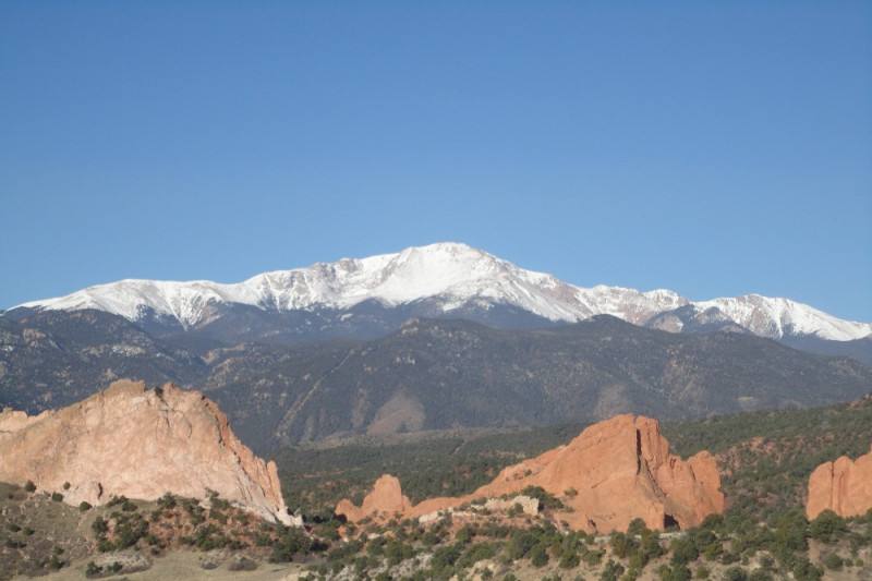
When I first saw Pike’s Peak a couple years ago, I was enchanted by the amazing views of the mountain. Once I learned there were hiking trails to the summit I declared I wanted to hike to the summit. While you can, I didn’t want to simply drive to the peak. What fun is that? For some silly reason I thought hiking to the peak was more in line with the idea of the personal challenge I felt I needed at the time. So from conception, the idea was to hike to the summit. Fortunately for me, my three children (and their dear spouses) were all very supportive and offered to go with me on this adventure as well. Fast forward to August 2nd 2017 and now everything’s a “go.”
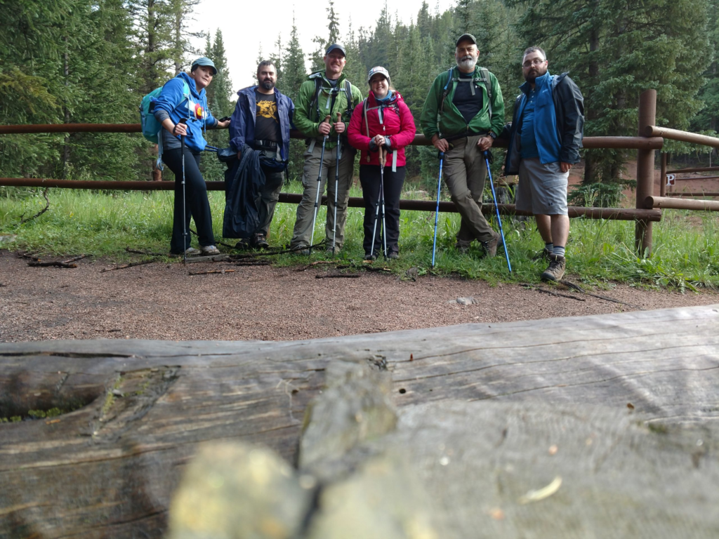
With all of the planning, scheduling, re-scheduling, and logistics of getting six people from two coasts to the same spot at the same time aside, I was very pleased we all arrived at our agreed upon predawn time at the Crags Trail-head on the West side of the mountain. As we all pulled in to the parking lot together, I was so excited and happy my family was hiking with me. I might even have been a little misty-eyed, but it was dark so no one will ever know. The early morning was chilly as we all hugged, chatted, and quickly donned our gear, made our final hiking preparations and last bathroom calls.
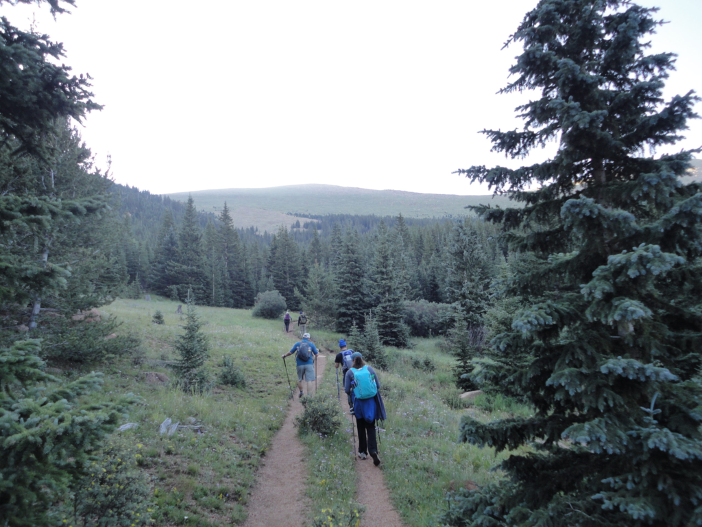
Our objective for the day was to hike up to Pike’s Peak, seven miles away and 4,110 higher than our starting elevation of 10,005 feet, and then hike back down. For gear, everyone had the basically the same or similar elements of their own. Everyone had some sort of day pack ranging from 20 to 40 liter size to carry extra layers of clothing, rain gear, trail snacks, 4 liters of water each, and between us the usually ancillary essential hiking items like flashlights, first-aid kits, maps, compass, etc. We hit the trail together just a few minutes after 6 A.M.
The Crags Trail leaves the parking lot and snakes into the woods for a short distance where the “664A” trail to the Devil’s Playground (and Pike’s Peak) spurs off and heads up through the tall pines and aspen trees. The morning is cool and with the newness of the trail, the hiking is fairly easy through this section. Generally the trail is a mix of straight incline and switchbacks. As we climb, the trees get progressively shorter and shorter as we hiked higher and higher. Watching the tall pines shrinking as we climbed helped mark our progress. The short stubby trees started to give way to grassy meadows. Somewhere around 11,500 and 12,000 feet the trees simply stopped. In this transition area we lost the trail for a moment (I think we zigged when we should have zagged) and dead-ended in an old camp site. After a couple minutes we were able to regain the trail in the grassy meadows above the treeline.
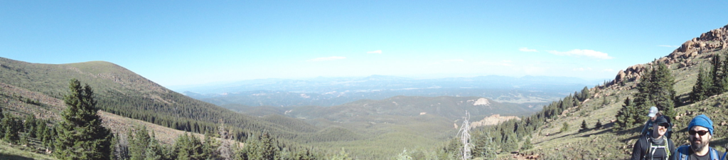
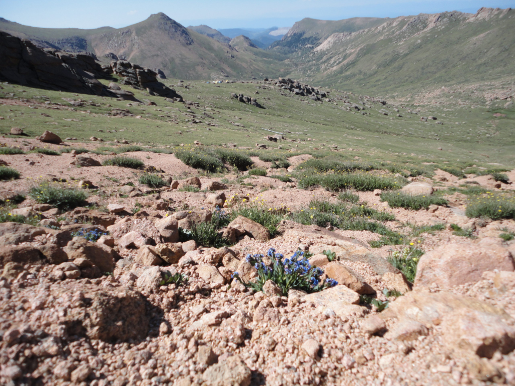
We followed the trail as it continued up through the grass meadows dotted with yellow and blue wildflowers. Once we had cleared the treeline the hiking became noticeable more difficult, the trail a little steeper and the air a little thinner. As the trail finally seemed to level off a little near 12,500 feet, we took our first break and rested a bit. Looking back over from where we had just hiked up were amazing views. The sky was clear and blue, the morning sun shining on the Crags to the North and other rock formations around us to the South. The view of the valley and the countryside to the West below us was breathtaking.
Rejuvenated from our break, we hiked on. The grassy meadows yielding more and more to simply small patches of sparse tundra. Eventually even the tundra simply fades away to just rock. The climb leveling off as we entered into the Devil’s Playground area. Apparently this area is so named due to “the way lightening jumps from rock to rock during a thunderstorm.” Awesome. I did not expect that. I was thinking more along the lines of “oh, rocks. The devil likes rocks.” Not “oh, dancing lighting.” Did I mention we were trying to summit prior to a forecasted rain storm?
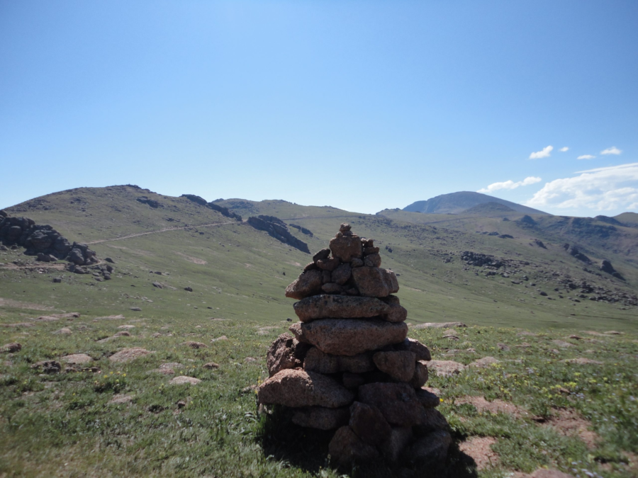
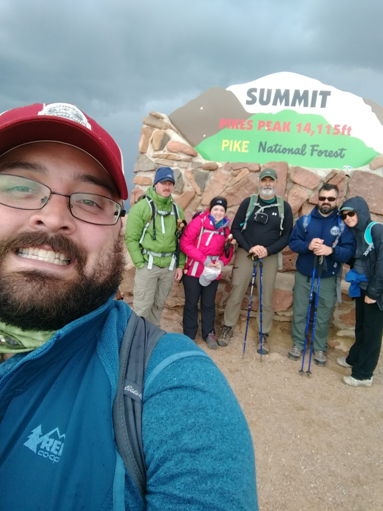
Hiking on we passed through the huge rock formations, now within sight of the peak, I can even make out one of the buildings on top of the mountain. Because of the lack of vegetation now, the trail is hard to follow. Cairns start marking the way. Map check. It’s about 11:30 A.M., we’ve made really good time and are so close now. Literally within a quarter mile of the top. And 800 feet up. 800 feet up this huge rock & boulder incline. This huge rock & boulder incline with no discernible path. That’s not really true. There is a path. And it is marked with cairns. The problem is the stacks of rocks marking the path are made with the same rocks as the rock & boulder incline & mountain are made with, so it’s a little hard to see the path beyond the next cairn. The thin air helps make progress slow. Every step is a climb up the rocks. The exertion requires me to pause every couple of steps to try to pull more air into my lungs. As we are climbing this last painful piece, the sky is building up around us in preparation for the day’s forcasted storm. So there is this extra motivation to get to the peak before the dark clouds around us open up. We slowly pick our way, up through the boulder field, as fast as we can and make summit around 1:30 P.M., just ahead of the weather unloading. Still trying to catch my breath as I hobble over to the visitor center building for shelter, it starts snowing, hailing, and raining, with lightning and thunder beginning as we ducked into the building.
Sitting in the visitor center bathed in the afterglow of success (or maybe it was hypoxia?), was a little surreal. It is storming outside, snow and sleet and rain and lightening and thunder, and I’m panting like a fish out of water after my climb, I’m watch the seeming hundreds of tourist folk who had either drove or rode to the top as they scampered about talking and eating and acting as if everything is normal, like they were thousands of feet lower. I finally get enough air in me to enjoy one of Pike’s Peaks famous donuts and refill my water bladders in preparation for our hike back down once the storm passes.
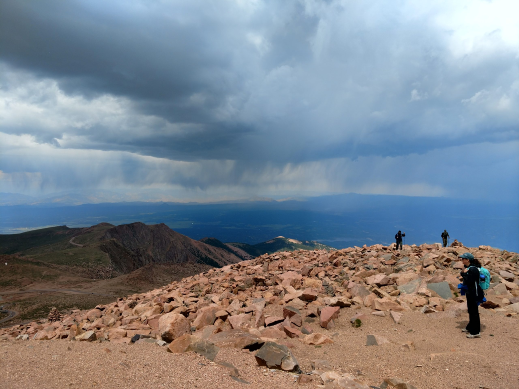
Rested a bit, the main storm has ended and the sun is peeked through the clouds swirling around us. Now to hike back down. Leaving the visitors center, we start retracing our path down the mountain. Getting sprinkled with sporadic rain and sleet, we descended back down through the wet boulder field. We are able to get through this downhill piece pretty quickly, but this was probably the most dangerous section we encountered of the trip. Both my oldest son and I fell in the tricky rocks. My other son opted to hike around the boulder field along the road (he might have been the smarter of the group), but was informed by a ranger doing so was illegal. The rest of the descent went fairly smoothly and quickly. Tired, with sore feet, and with few bumps and bruises, we all came off the trail together just a few minutes after 7 p.m. Absolutely epic awesome and I would do it all again. We completed the round trip in 13 hours total, covering about 14 miles total, all of us earning and claiming our first 14er summit. Standing on top of my first 14er with my family, it was quite the journey.
#