This is just a quick aside as the new year begins. As the year starts out, I’m working to detangle some of my work and play. I’m hoping this gives me better trail time this year, with the big adventure in planning being an AT trail trip this summer.
Watch for those tag stickers! As of January 1st, all SC vehicle registration stickers should be white in color. If it’s a green sticker, the tag expired in 2025. If it’s a yellow sticker, the tag expired in 2024. Yes, I have seen a couple of yellow stickers on the road this past week.
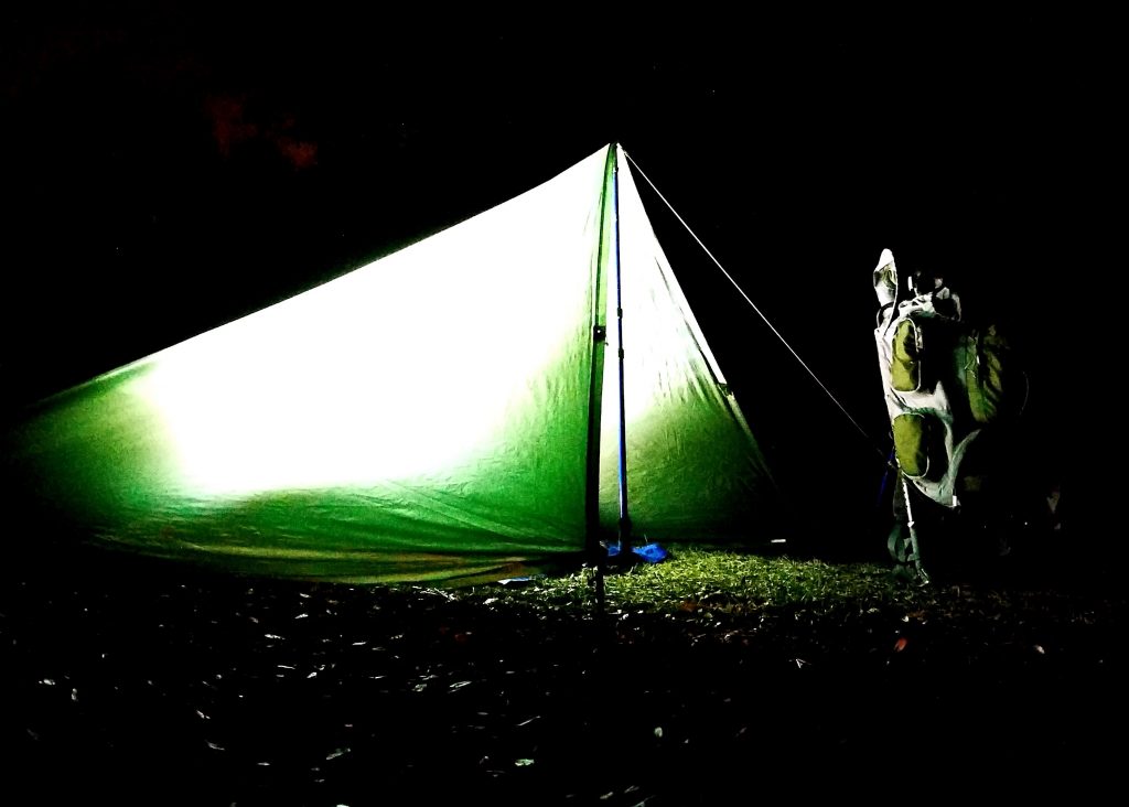
A few years ago, I bought a truck and have been tinkering with “truck camping.” I’ve done several weekend camping trips, camping in the truck instead of a tent last year. I want to get in a camping trip with Radar soon, so watch for some upcoming details and insights about how it all works out.
If there is interest in anything specific, please drop me a note in the comments!
I just “happened” to be in the area and on a whim decided to detour over to Sassafras Mountain and bag this peak. Radar and I are returning from an overnight family camping trip at Devil’s Fork State Park in the North West part of the state. It’s Friday morning and we’re all heading home a day early. Our camping trip was cut a little short due to some rainy weather and the forecast for more of the same.
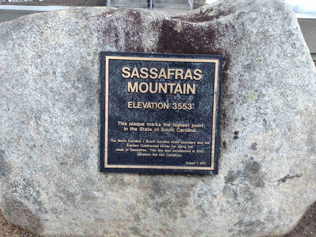
I realized South Carolina’s highest peak, Sassafras Mountain at 3,553 feet, is on the way home. Sort of. I check my map app and it looks like Sassafras Mtn is sort of almost on the way home. I don’t know when I’ll be able to get back up in this area. So a slight detour to the North and we are on our way.
Getting there requires a short drive into North Carolina. It’s strange but you can’t drive to South Carolinas highest peak from South Carolina. You must drive out of the state and into North Carolina in order to get to the peak. Sassafras mounting actually straddles the border of North and South Carolines.
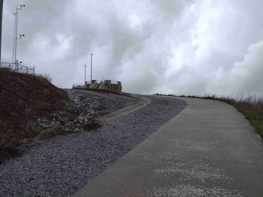
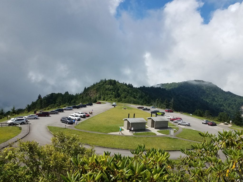
Sassafras Mountain Tower approach
I was here a few years ago (maybe in 2018) when the tower was still under construction. We were dropping some grateful hikers off at their car in the parking lot, It was late a night. I ran up to the peak but could see anything (being nighttime and all). So I’ve always wanted to come back.
Sassafras Mountain Plaque
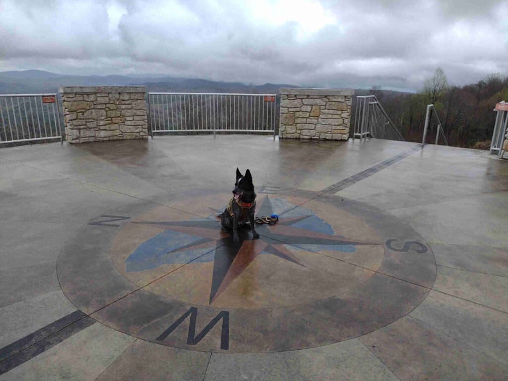
We’re taking SC highway-11 home anyway so I detoured and take the winding roads to the mountain peak. It’s about 1:40 pm as we get to the Sassafrass Mountain parking lot. The weather has been off and on rain all day but it’s just a short walk up the trail to the observation tower. The rain lets up as we start up the trail. As we get to the top of the tower the sky is overcast but the rain has stopped, at least for now.
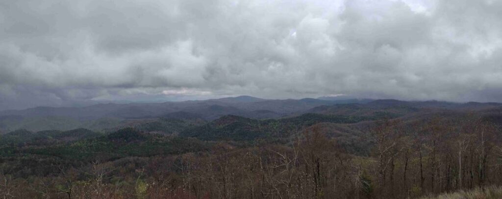
Sassafras Mountain East View
The view is good for the day I think. they say you can see for 50 miles on a good clear day. I imagine the view will be amazing. Maybe on my next visit.
#
Did you enjoy or find this post useful? Please let me know by leaving a comment below or join me on Instagram or Facebook.
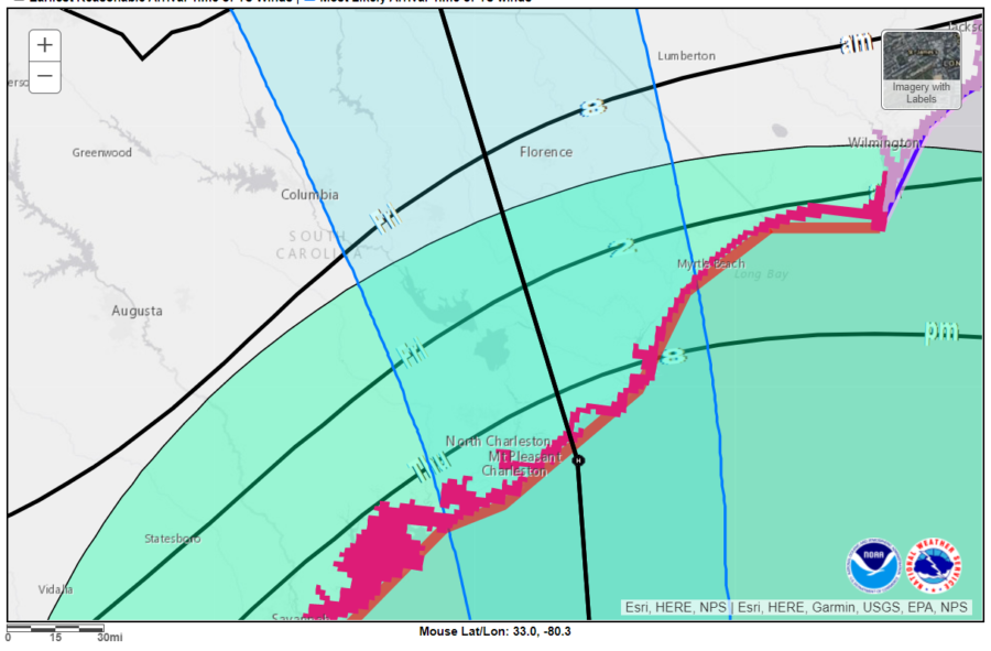
Hurricane Ian is forecast to tear though my neck of the woods in the next 3 to 8 hours (that’s when tropical strength winds are due here). It’s been a bit cool, breezy, and overcast all day. My work is closed the rest of the week so I’m home catching up on some chores like fixing a broken water line and changing a tire on the tedder. But it’s starting to get dark now and the wind is beginning to pick up a little, so I’m in for the evening. My sister and daughter are both in Florida and have been fortunate enough to skirt the worst of the hurricane. Ian’s plowed through south-central Florida doing considerable damage. Ian has jumped over from the Gulf and is back in the warm water of the Atlantic now and has already regained hurricane strength. Ian should start turning towards South Carolina and the rest of my family within the next few hours. Now it’s our turn. I guess we’ll see what day light brings. Be safe out there.
#
Did you enjoy or find this post useful? Please let me know by leaving a comment below or join me on Instagram or Facebook.
This past weekend I camped with a group of fellow campers on Johns Island. While not summer hot, the weather started out a bit warm.
Fall in South Carolina can still have some pretty warm weather. It can also have some of the best camping weather around. So far this fall the weather has been generally good with the heat of summer is gone, but the evenings still have been hovering between a little too warm and almost cool. Camping weather in the fall is some of the best here because its mostly dry, the bugs are fading, and the evening temperatures are cooler. The days are in the comfortable tee-shirt temperature zone and the nights can dip down in to the sleeping bag snuggling temperatures.
Activities while camping are great don’t get me wrong, but there is something special about camping sleeping. It’s a little complicated to explain, probably because there are so many things which affecting how well someone sleeps outdoors. Partly I think one of the benefits is your body gets to re-tuned and return to natures natural circadian rhythm. For me, one of the big contributors of a good nights sleep is temperature. Too warm and you’re laying in a puddle of sweat, too cold and you’re shivering, either way sleep doesn’t come easily when you are outside of the “great sleeping weather” zone.
When is something broken a good thing? When the heat of the summer breaks for the fall camping weather. There is something special about being a witness to the changing of weather. This past weekend I was able to see and feel this shift, the breaking in to the cooler fall camping weather. It rolled in as a small weather front Saturday afternoon. You could see the clouds moving in, covering the clear blue South Carolina sky. There was a light sprinkling of rain, and then just like that, the cooler weather was here. Sleeping that night, blanketed in a warm sleeping bag, in the shelter of my tent, was great.
#
Did you enjoy or find this post useful? Please let me know by leaving a comment below or join me on Instagram or Facebook.
There isn’t much about August I think I’ll miss. But I’m not sure if fall will be much more fun.
I’ve been busy, and then started working my second job again, teaching (face-to-face) in this fall, which adds to the busy. I’ve been working straight through China virus and am so ready for a break. I have a couple weeks time off coming up, I hope everything goes well.
It’s clear summer is leaving us now the cooler temperatures of fall are starting to drift in. The days are getting shorter. Every morning I notice sunrise is a couple minutes later. With the longer darkness brings thoughts of upcoming holidays and an underlying sadness with them. I’ve heard the fall and winter is problematic for a lot of people. I fear this year maybe worse for some due to the long periods of “self isolation,” quarantine, social distancing, or whatever everyone has been going through.
In other news, it seems the city of Los Angeles has cancelled Halloween this because of the kung flu. The one night of the year people would want to wear a mask and they canceled it? Sigh, the world just doesn’t make much sense anymore.
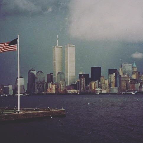
Skyline of New York City, September 10, 2001.
I saw a post with a skyline picture of NY City from September 10, 2001 which brought back memories. Sadly there is an entire generation now who really have no idea, the trauma people felt on that day, and went through in the following days and weeks after, and still. I think I’ll always remember, that day, where I was. Those thoughts and feelings.
Here’s to tipping one back to the fall, may she woo us with something good and exciting. Stay safe y’all.
It’s been a bit more of the crazies these last few months, and I can’t wait to see what the next few months have in store for us.
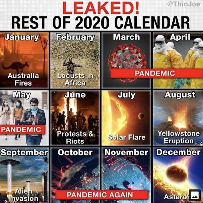
2020 Calendar Coming Events
Most of the country is now slowly reemerging from some level of state imposed, pandemic induced, shutdown and quarantine. I hope your area is recovering well and your family is safe. The global release of a new virus and resulting pandemic was caused either by some conspiracy involving world depopulation with a bio-engineered, lab created, smart bug with no known cure. The other possibly is it was just a bad cup of bat-soup. WHO knows (that’s a punny play by the way, feel free to comment if you get it). Anyway I haven’t had the opportunity to camp, hike, or get lost in the woods since last year. The group I volunteer with had to cancel a long list of events including summer camp and our high adventure back packing trip. Everything was closed, including the wilderness.
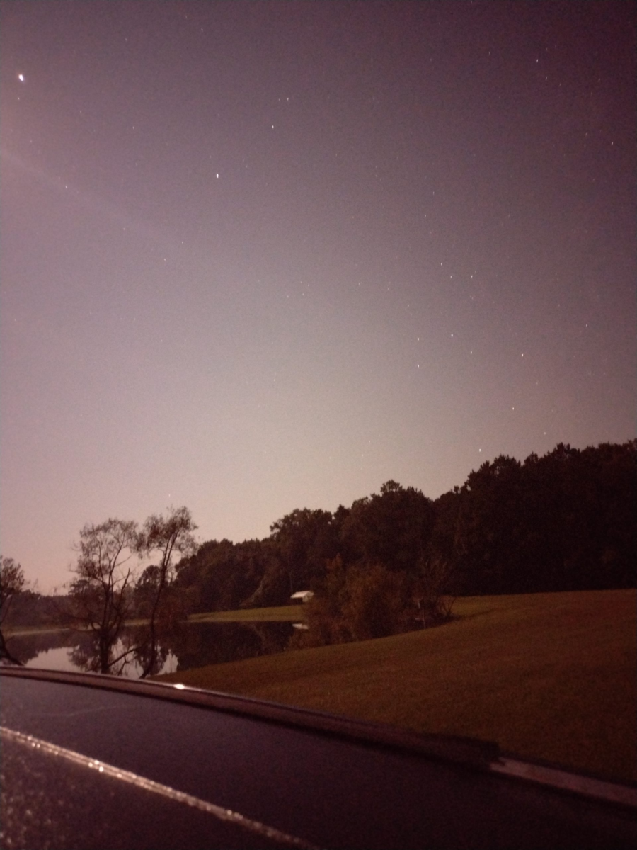
My camp at night
As an “essential worker,” my daily work routine really hadn’t changed much through the whole pandemic. I just see fewer people. Overall, this is probably a good thing. It’s strange times when you can’t get a haircut, yet Walmart, Lowe’s, and Home Depot are packed almost 24/7. One of my favorite things to do in recent years was to sit in a local coffee shop, people coming and going, listening to music, just thinking, maybe write some. Yep well, No Can Do in china virus times. While you can still get a cup of coffee, it’s To-Go only. Sitting is banned. Pretty much I just go to work & go to home. I will tell you, the daily commute to and fro was great for the first month or so. It seems essential workers are also very responsible drivers. You could really tell when the non-essential folks hit the roads again. I was just beginning to think, really soon, things should drift back to normal. But then, Murder Hornets.
Murder Hornets Are Real
Such a creature as the Murder Hornet popped up on the radar for a short period, about early May I think. These hornets are around 2-3 inches long. And can kill people. And wipe out honey bees hives. And they have invaded the Americas and are heading to a field near you. Imagine tripping over a hive of them. Yep that’s the thing of which nightmares are made. For a short while, these horrendous creatures were a real concern. But then, the Purge.
John Minchillo/AP
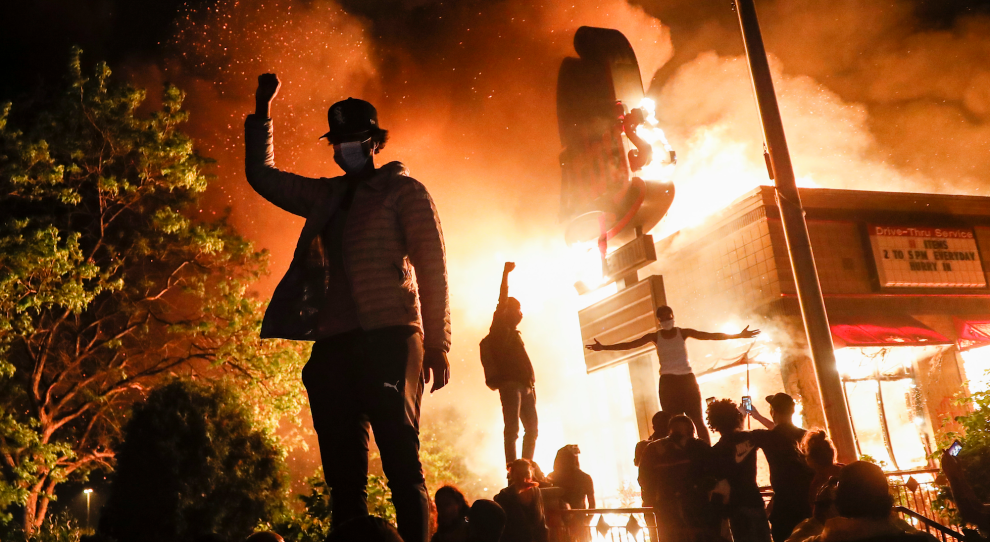
For those who don’t know, The Purge is a movie where society basically allows crime and mayhem for a one single night and all emergency services are suspended. Admittedly I haven’t seen this movie but then sometimes truth is stranger than fiction. Not to be constrained by a mere single night of mayhem, we’re now about a month into some nightmare real life version of the movie. Either overwhelmed by the volume of chaos, or stifled by governmental leadership, the police aren’t responding to crime in major cities now, which of course limits emergency medical & fire response services. In multiple cities, whole blocks have been vandalized, looted, and burned to the ground by rioters. Dozens murdered. Hundreds injured. And it’s still continuing. I wish it was a movie, because then I could get up and leave. As time grinds on, it seems like people are just getting crazier. And dumber.
I actually find myself getting fatigued from reading or watching the daily news too long now. There are groups of people who literally want nothing more than to watch the world burn. The idiocy sometimes becomes overwhelming, but then I push away, look out a window, go for a walk, and it feels just a little bit better. I am thankful for the people in my life, my family and friends. Being able to gather with family is refreshing and something I miss. Up until recently this social gathering of good people was banned too. June 20, 2020 happens to officially be the first day of Summer, yet the backyard barbecue parties are still restricted or banned in a lot of areas. Beaches in most states have been closed to the general public for months. Only celebrities, heads of state governments, and other special “VIP” get to go beaching or get haircuts. But then mass protesters made it all okay to get together again, but only to riot, not for happy events like birthday parties or friendly gatherings (see what I mean about dumb?). Crazy times. I can’t wait to see what July brings.
Mt. Mitchell (6684′) & Waterrock Knob (6292′) are in the bag. This was as much an impromptu therapy couple days as much as anything else. It felt good to get out and go (highly recommended).
I had read about the southern sixer’s and decided to go out and try to bag a couple. Unfortunately, I had some pesky obligations for Monday (work), so I had to box in my plans down to driving up Saturday to North Carolina from Dorchester, South Carolina, hike a couple peaks, and then drive home on Sunday.
Normally I like to do a whole lot more planning when I’m heading in to somewhere new. This time I pretty much just hit the road, I had not really scope out the trails, or much of anything else, so I didn’t know what to expect when I arrived at the trail heads. This worked against me a little where I had wanted maybe a little more trail time and hit another peak or two, but the unknown added to the sense of adventure too. It ended up with me really not too sure where to pick up some of the trails to another nearby peak until it was too late in the day. This was still a really good trip. What I did know is Mt. Mitchell is the highest peak east of the Mississippi, I figured I would go there first.
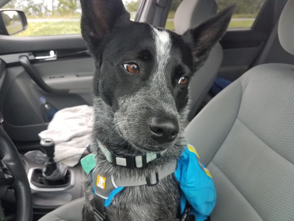
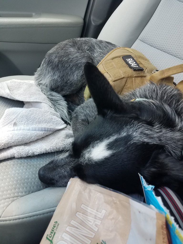
I basically just took my backpack (just in case), a change of clothes, some dog stuff an hit the road with Radar as my co-pilot. It felt like I had loaded more stuff for Radar than me, but I think I’m just a better packer than he is. Radar (with the help of Mr. Garmin) was able to expertly navigate us from the house all the way to the Mt. Mitchell visitor center parking lot without missing a turn.
Radar is concerned about my level of planning
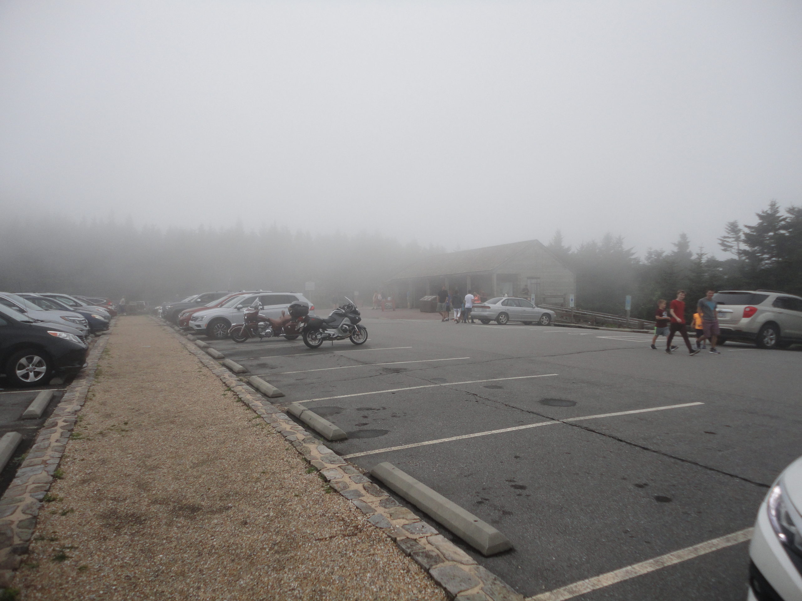
The trip up from south Carolina up to Mt. Mitchell was pretty uneventful, for a 5+ hour drive. Radar and I got to the Mt. Mitchell visitor center parking lot around mid afternoon. The visitor center was amazingly nice with ample parking. We geared up and headed out and up the mountain. Because of my lack of extensive trip planning, I really didn’t have a good idea how far it was to the summit, I found the hike from the visitor center parking lot summit trail head to the summit was incredibly difficult (just kidding, it was surprisingly easy!). The trail to the summit is actually paved and is an easy short walk for most people. The air was cool and a nice refreshing change from the heat in the low-country.
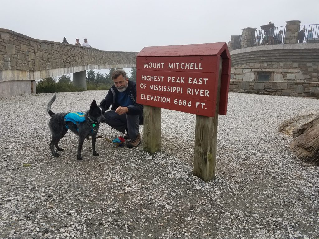
Radar and I submitted Mt. Mitchell about a quarter after 3 in the afternoon, on July 20th. The summit on this day was in the clouds, so visibility was pretty socked in – not really a whole lot to see. But then the view was not the prime reason I had come.
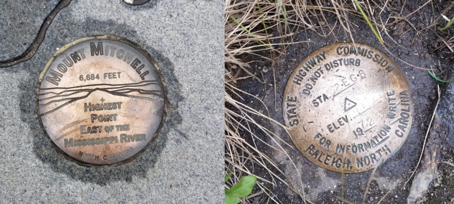
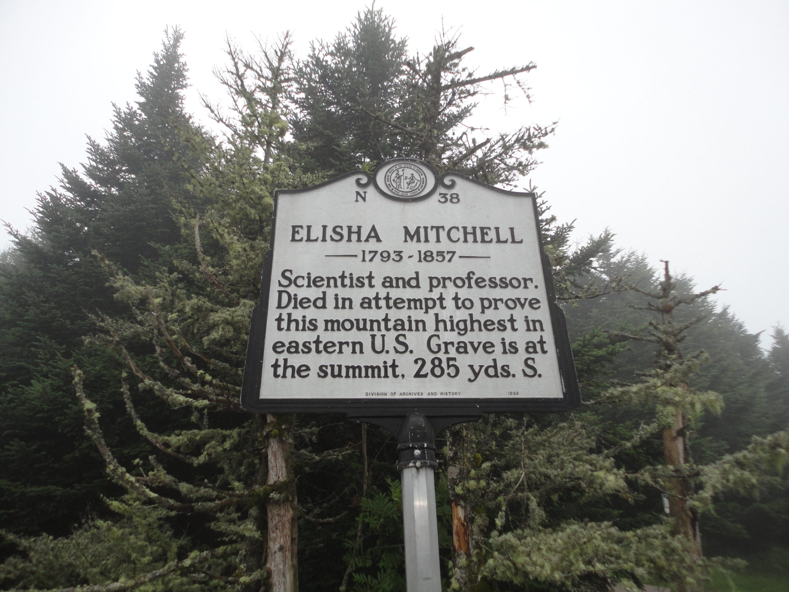
Summit of Mount Mitchell
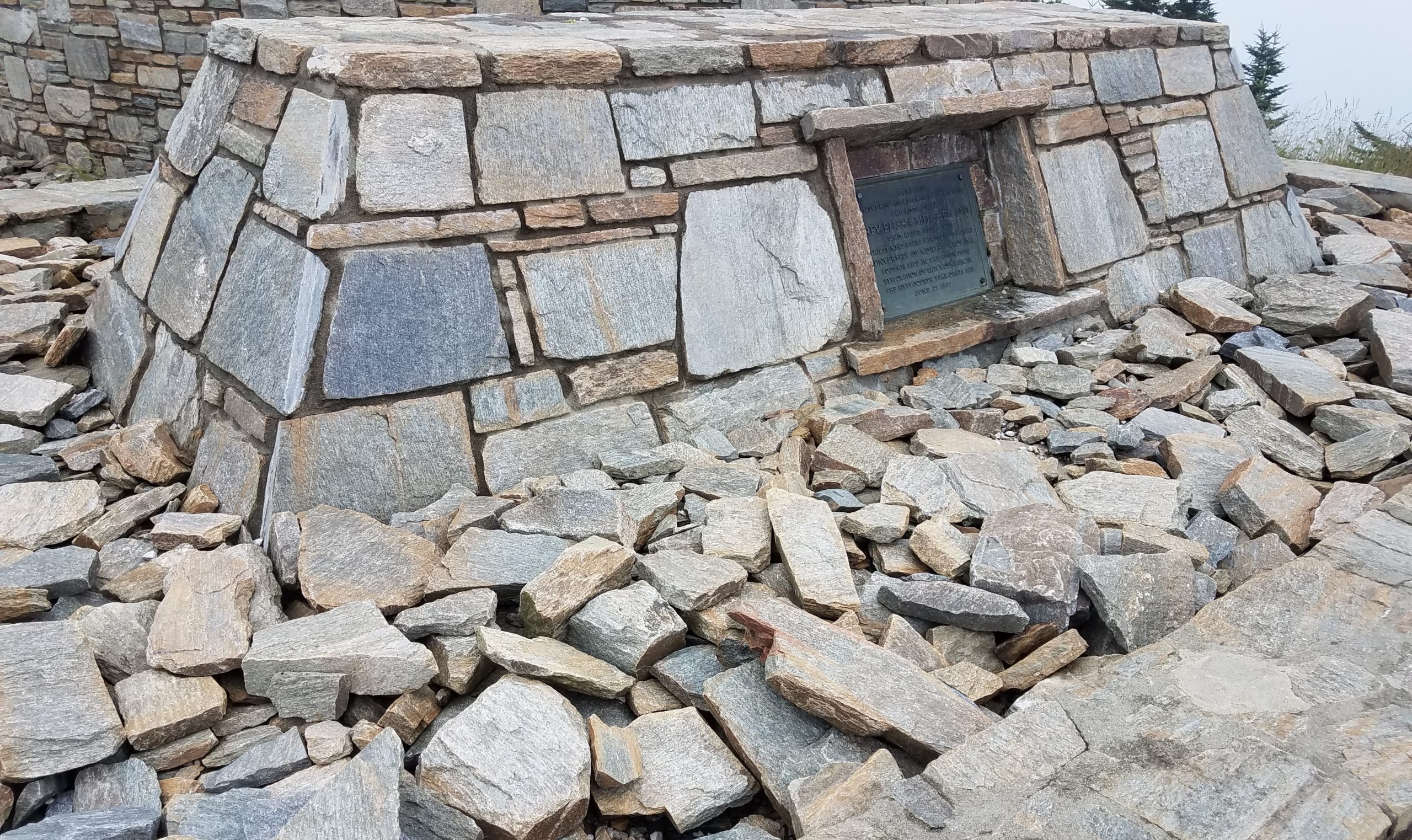
I did not know this until I got to the summit (must remember to planning more), but Mt. Mitchell is named after Elisha Mitchell. He died on the mountain in 1857, trying to prove the elevation of this mountain. His remains are buried on the summit still. Mountain graves and memorials are not uncommon, I’ve seen a number while hiking over the years. I often stop and think about the person behind the plaque. What events in their life brought to where they ended up. I leave a stone to let them know they are not forgotten. I again left a small stone. This time; the name of a cousin of mine was engraved on the stone.
Several years ago I sadly lost a cousin and I had made a small memorial stone for him. In the back of my mind, I wanted to leave it on a tall mountain somewhere. I had brought this stone with me on this trip. It seemed fitting, so I left my stone on this high mountain, 6684 feet above sea level, discreetly near the summit of the highest peak East of the Mississippi River. Radar and I returned to our car and headed down and west along the Blue Ridge Parkway, towards Ashville, for the night.
We stayed in a pet friendly independent motel (which shall remain nameless – unless you ask) on the edge of Ashville. I had selected it on the internet strictly based on price. Radar took one look at the motel room, then me, and pleaded with me not to leave him there alone when I went for dinner. I couldn’t blame him. So we both headed out for some Mexican at restaurant with an outdoor patio. When we returned to the motel we took turns sleeping. I gotta say, they tried, it really wasn’t too bad, and it was an experience, but I likely will not schedule a return there anytime in the near future.
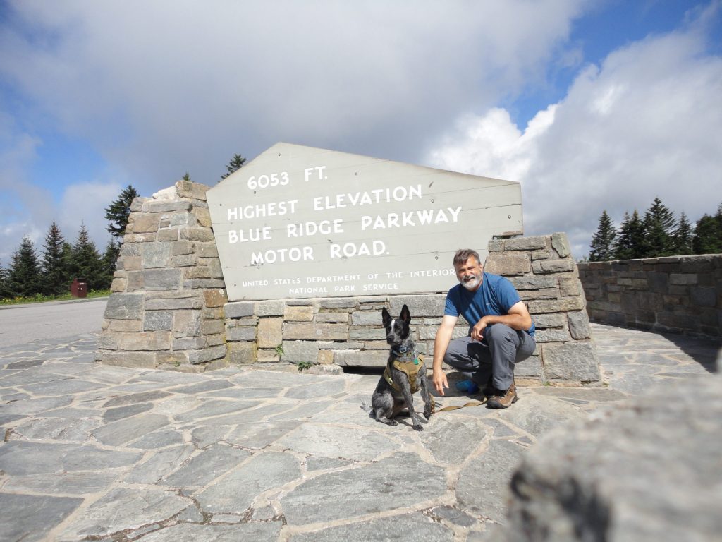
Anyway, Sunday we were up and out early. We had to head home but I wanted to try to bag a couple more peaks, if we could. Back on the Blue Ridge Parkway, we continued heading west from Ashville, towards Waterrock Knob. One of our high points on the way, was being able to claim standing on the highest park of the Blue Ridge Parkway.
The highest road elevation along the Blue Ridge Parkway
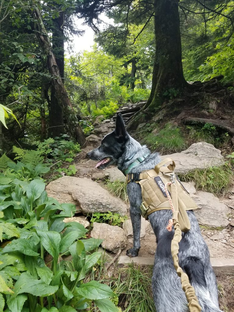
By the time we got to the Waterrock Knob visitor parking area, I knew we would be pressed for adventure time. There was supposed to be a trail at Waterrock Knob which ran across three or four peaks there. Unfortunately again, my (lack of) high level, detailed, planning would catch up with me. This peak also had an amazingly nice visitor center (they even let Radar inside) and nice parking. However, unlike Mt Mitchell, the trail to the summit of Waterrock Knob was not such an easy hike. The trail to the summit, while fairly short, just under a mile, it was a steep up hill climb. It felt good to work a little for the hike up.
Radar leading on the trail to Waterrock Knob
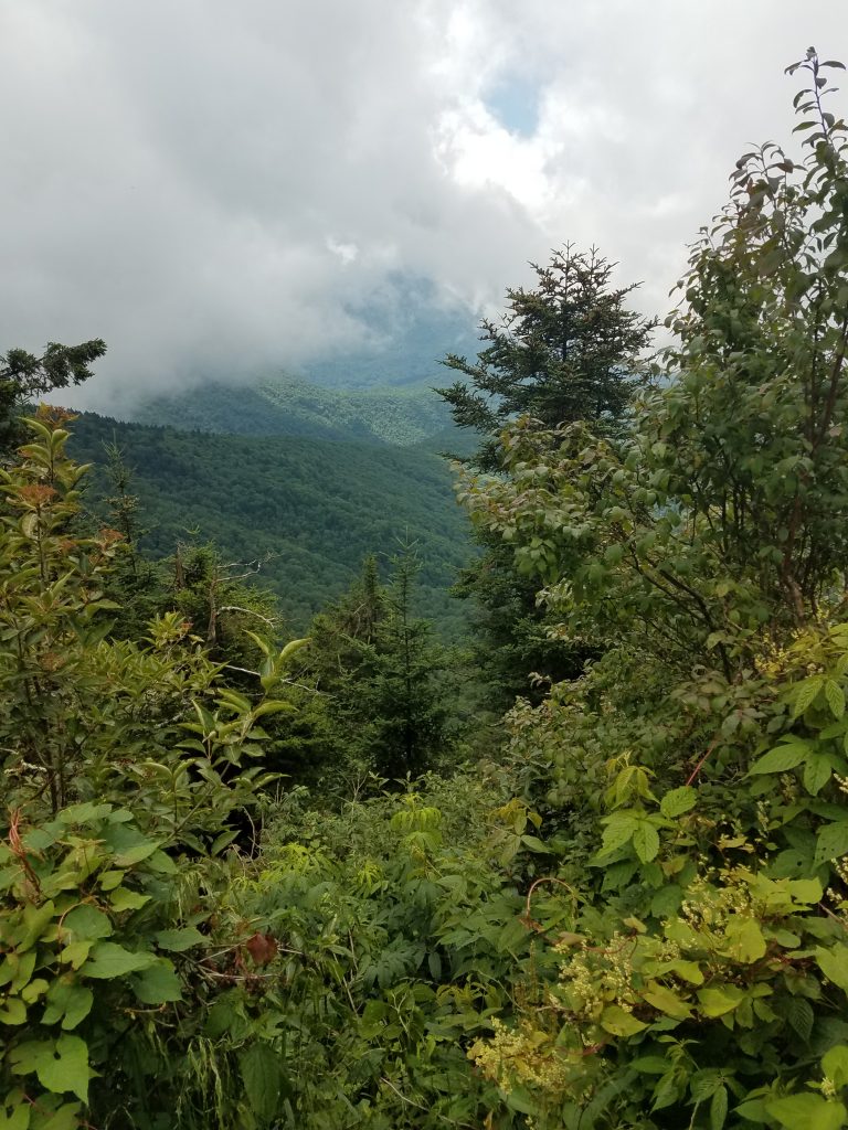
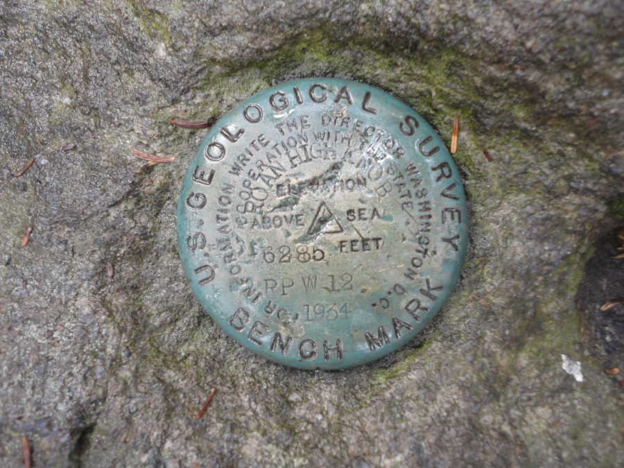
Like Mount Mitchell, the peak was also clouded in so the view was limited to the inside of the clouds. We hung out at the peak a little catching my breath. I tried to pick up the trail to the next peak, but really didn’t know where to go. With a limited time schedule and really not knowing the trails held me back from getting likely hopelessly lost that day. So we just explored the peak a little. Hidden in the grass and almost covered with dirt, we were able to locate the benchmark. With this as the days accomplishment, I felt good about heading back down. I told Radar next time he needs to research this trail stuff a bit more. During our decent we located a couple more trails which were likely candidates for some future hikes, but for now, we were done. It was time to head back home.
View from Waterrock Knob
Waterrock Knob Visitor Parking
Radar after hiking up Waterrock Knob
Radar surprisingly slept almost the entire way back home. It was nice to get out and back up to the mountains. Being on the trail even for just a little while, helps put things back in place. Over all, a very therapeutic and worthwhile trip.
A couple years ago and for a lot of different reasons, I had set and completed the goal of climbing Pikes Peak in Colorado and was able to successfully “bag” my first Fourteener. It was only after I had set my Pikes Peak goal, I learned climbing mountains over 14,000 feet is a thing. Especially in Colorado since they have something like 53 of these beasts. I feel like I would like to try some more of them, maybe, but I would probably need to live in Colorado.
Just this week however, I learned of something called the “Southern Sixers.” These are the tallest mountains in the eastern United States which are all over 6,000 feet. All (besides New Hampshire’s Mount Washington) are in and around the Appalachian mountains of North Carolina and Tennessee. “Wow,” I thought, they sound close to home, maybe I could hike a couple of them. I did a little research, pulled up the list of mountains, and noticed a bunch of very familiar names. Low and behold, it looks like I’ve already hit about a quarter of them!
Now it’s time to start planning to bag the rest of them.
I’m back in my proper time zone now, winding down 2018 with my girlfriend at the farm. Family is home and my daughter wished us a happy new year from the future (she is all the way in tomorrow). The clock is slowly ticking down the remaining hours and minutes of 2018.
Tick.
Tock.
I am looking forward to seeing what the new year brings. I am trying not to pre-build expectations, but as we transition from one year to the next, there is much to be thankful for. The ones we love and care about most are topping my list. 2019 will come no mater what, and like every dawn, new opportunities will present if you watch for them.
Sometimes, when hiking, the trail is so hard, my focus is just on the next step. Then the next step. Then the next step. Until I can catch my breath and start looking about at what is around me. This is when I am in awe of the world, when cresting a ridge, the view relieved, you realize the wonder, presented to you.
I wish everyone a wonderful and glorious new year, may the trail you taking, be amazing.
I’ve been in Okinawa visiting with my daughter and her family for just over a week now. They have been stationed here since the spring. I haven’t seen her or my granddaughter in a while, so a quick visit before Christmas seemed like a good idea. I have seen some pretty “cool” and amazing things. Things like, they have food on conveyor belts, and you just eat as much and whatever you want. You don’t even need talk to a person to order anything. Kind of a point and click situation. That works really well here because they don’t speak English and I don’t speak Japanese (or Okinawan).
Note to self: must work on the language thing next time when time traveling.
Since coming here to Okinawa, I have spent time discovering and learning a little about the island. With my daughter as guide, we visited some historic places, a little bit of traveling back in time if you will. We visited the Urasoe castle ruins at Kakau ridge (Hacksaw ridge) and the Shurijo castle, site of the former Japanese Naval underground HQ. During the second world war, great battles were fought at these sites. Okinawa has a deep history of it’s own right, which unfortunately, has been clouded some with the events of the last world war. It was quite thought provoking, to visit these ancient castle sites and battlefield memorials in a country where they didn’t win. To see how they wrote the history of what happened, humanizes this opponent from long ago. For me I developed a better understanding of the differences between the two cultures of Imperial Japan and Okinawa. It offers a bit of historical insight you can’t find in a book. It’s sad to think of all of the lost lives when the world degrades to total war. Sigh.
We even climbed a mountain, Mt. Katsu Dake. While not the highest point in Okinawa, Mt. Katsu Dake is an honest climb and provides absolutely amazing 360 degree views of the island. I’m told way better viewing than some of the taller peaks (due to the vegetation). Well worth the trip up, but bring plenty of water and solid hiking shoes. The rocks are both treacherously slick and razor sharp, makes for an interesting combination. Ri, my daughters family dog, had worn pup boots which were totally appropriate for the rock climbing over lava rocks.
We did some of the normal tourist things too with shopping and eating. It was fun exploring the shops and trying different foods and tastes. I like food and flavors. The Okinawa people are some of the nicest and most polite people I have ever met and truly a pleasure to interact with. The cars are little here. It’s okay because they just seem to fit. Most of the cars are small compact cars, but they do have the equivalent of some US cars like the Cube and Toyota’s but they all have little tires which make them seem smaller. Oh and they drive on the “wrong” side of the road. As a new passenger, it’s best to not try to pay attention to traffic, let the driver drive, and just enjoy the scenery. Strangely there is no wood (very little) to speak of on the island, so everything is made of cement, even the wood is made of cement here. The “logs” used in the hiking trail and for railings and fences, they are all cement with a faux wood finish. The houses are smaller here. And concrete. almost all buildings are concrete, concrete block, or some combination. A wood frame house is not a thing on this island. There are some small farms. Most seem little more than communal garden plots really, probably local produce. The locals grow small crops and raise a few cows (probably dairy?). I watched a farmer cutting hay. By hand. And then fork into the back of a little truck. The hay field was less than a half acre. I went to a beach with my daughter and granddaughter and watched the sun rise. Sometime around 1992, I touched the eastern side of Pacific Ocean. This week I touched the western side of the Pacific too.
I do like traveling and exploring. Traveling half way around the world however can be a kick in the head, but once you arrive and get settled, the key is to enjoy. I’m actually on the return trip to home now, in a lay-over in Taiwan. I’m waiting for the big time travel hop to New York. I actually take off from here at about 5:30 pm on 12/23 and land in New York 7:15 pm on 12/23 (I know it’s really like a 15 hour flight). Anyway, the best part of this whole far east adventure was really getting to see my daughter and spend a little bit of time with family. I’m heading home now for Christmas with my girlfriend and the some of the rest of my family. I can’t wait until we can all together again in one country. I love you all.