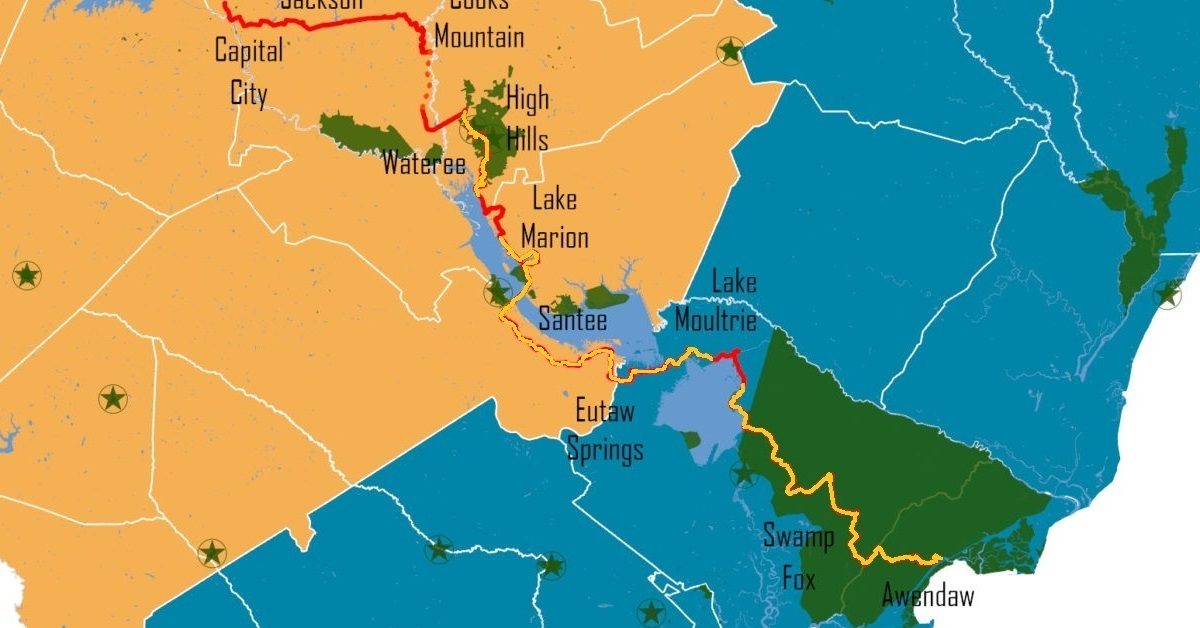
The Palmetto Trail is South Carolina’s “long trail.” Established in 1994, the trail is planned to run about 500 miles from Walhalla in the Blue Ridge Mountains to Awendaw on the coast. Divided into Passages, it’s still a work in progress with several incomplete sections. Currently, there are about 380 miles of completed trails. The red line is the planned trail, and the orange is the sections I’ve completed (some more than once!). More updates to come. Some of the passages I’ve hiked only parts of, as I finish them, I’ll update more
I’ve started tracking my list of completed Palmetto Tail Passages on this page. The bold names are passages I’ve fully completed.
Sections updated: 7/1/2026
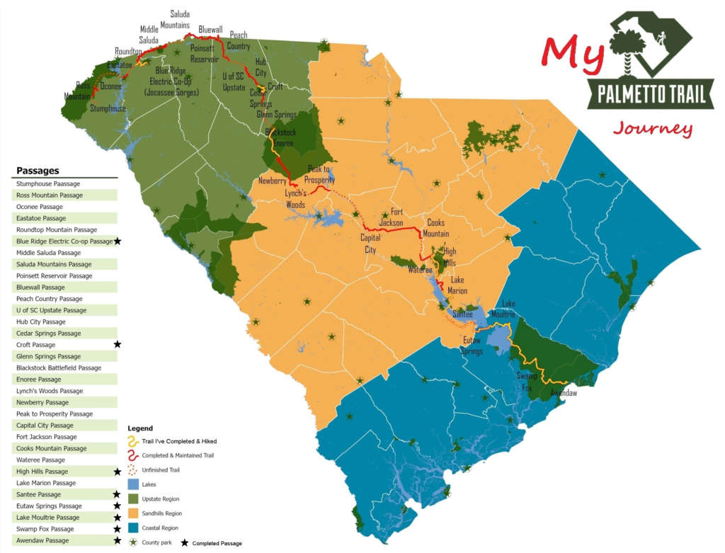
Passages:
Stumphouse (5)
Ross Mountain (1.5)
Oconee (3.73)
Eastatoe (4.6)
Blue Ridge Electic Co-op (12.6)
Roundtop Mountain (5.9)
Middle Saluda (11.1) closed, to be re-routed.
Saluda Mountains (9.1)
Poinsett Reservoir (6.6)
Bluewall (14)
Peach Country (14.1)
U of SC Upstate (2.2)
Hub City Connector (12)
Cedar Springs (2.9)
Croft (12.6)
Glenn Springs (7.3)
Blackstock Battlefield (1.3)
Enoree (36.88) (sections 2 & 3 done)
Lynch’s Woods (4.9)
Newberry (10.7)
Peak to Prosperity (10.7)
Capital City (10.2)
Fort Jackson (16.3)
Cooks Mountain (unfinished trail)
Wateree (11.4)
High Hills (11.4)
Lake Marion (35.9) (sections 1 & 2 done)
Santee (13.9)
Eutaw Springs (21.3)
Lake Moultrie (26.7)
Swamp Fox (47.6)
Awendaw (7.1)
#