I just “happened” to be in the area and on a whim decided to detour over to Sassafras Mountain and bag this peak. Radar and I are returning from an overnight family camping trip at Devil’s Fork State Park in the North West part of the state. It’s Friday morning and we’re all heading home a day early. Our camping trip was cut a little short due to some rainy weather and the forecast for more of the same.
I realized South Carolina’s highest peak, Sassafras Mountain at 3,553 feet, is on the way home. Sort of. I check my map app and it looks like Sassafras Mtn is sort of almost on the way home. I don’t know when I’ll be able to get back up in this area. So a slight detour to the North and we are on our way.
Getting there requires a short drive into North Carolina. It’s strange but you can’t drive to South Carolinas highest peak from South Carolina. You must drive out of the state and into North Carolina in order to get to the peak. Sassafras mounting actually straddles the border of North and South Carolines.
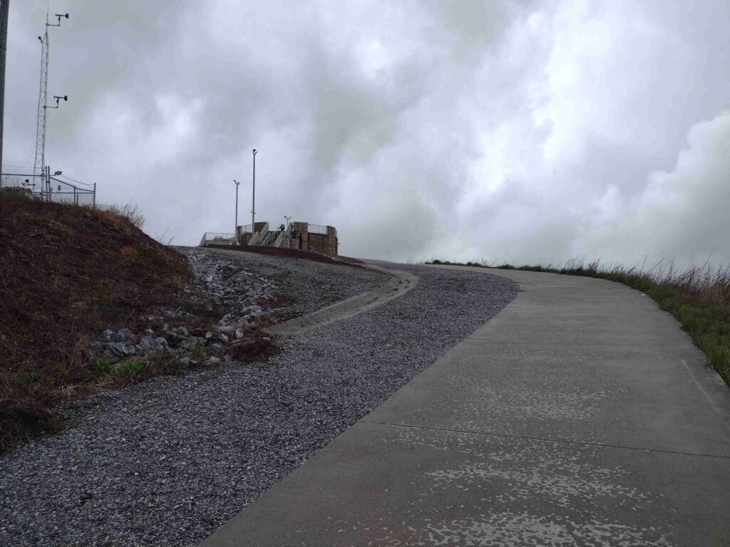
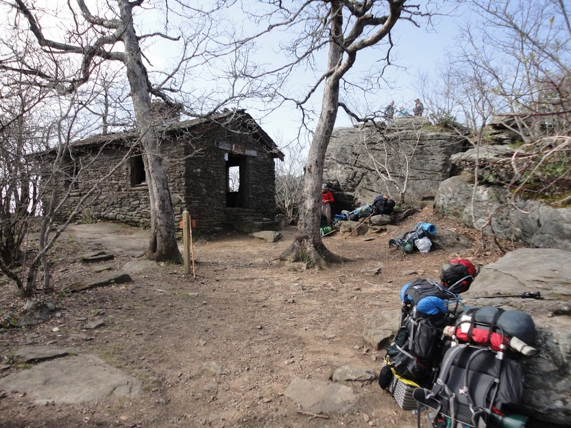
Sassafras Mountain Tower approach
I was here a few years ago (maybe in 2018) when the tower was still under construction. We were dropping some grateful hikers off at their car in the parking lot, It was late a night. I ran up to the peak but could see anything (being nighttime and all). So I’ve always wanted to come back.
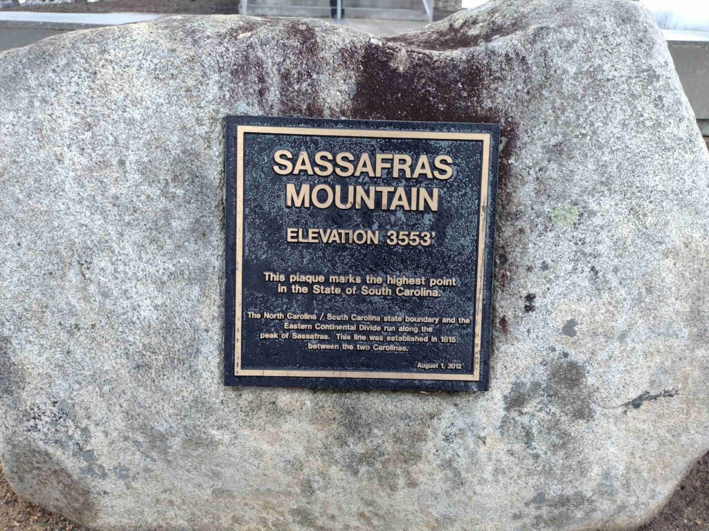
Sassafras Mountain Plaque
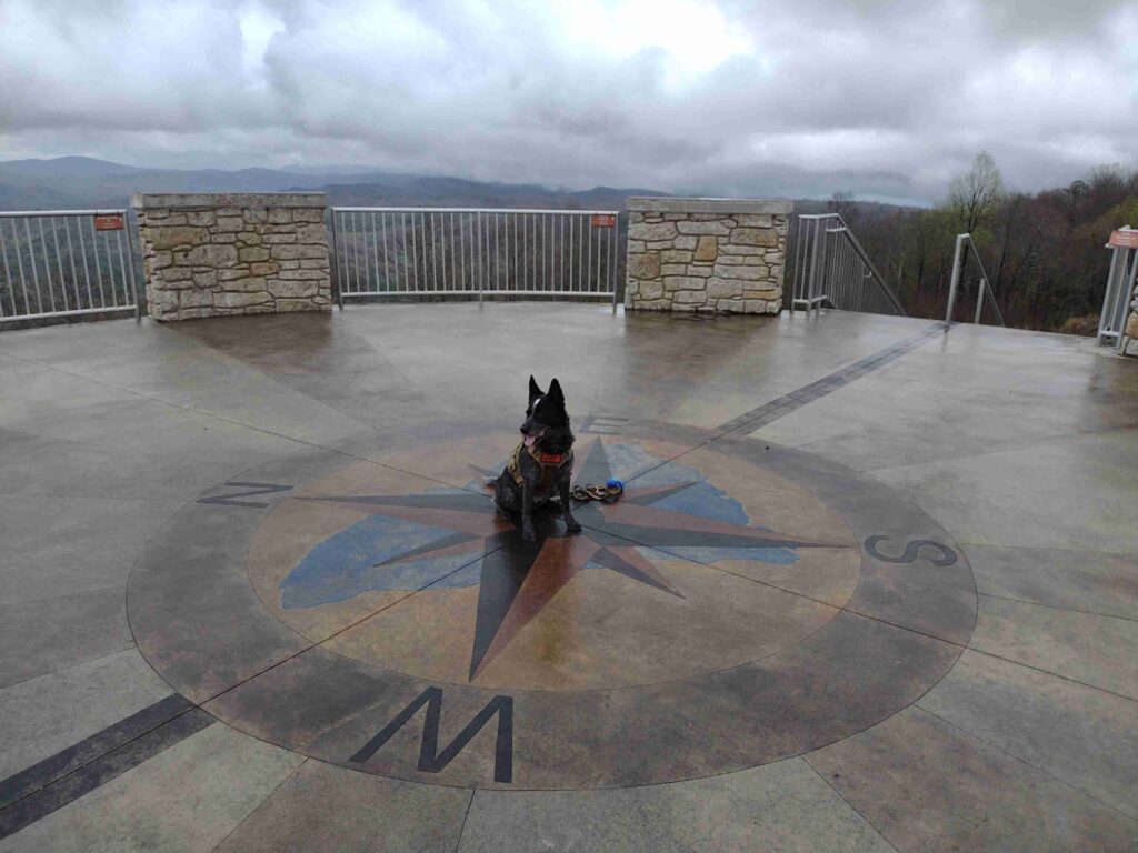
We’re taking SC highway-11 home anyway so I detoured and take the winding roads to the mountain peak. It’s about 1:40 pm as we get to the Sassafrass Mountain parking lot. The weather has been off and on rain all day but it’s just a short walk up the trail to the observation tower. The rain lets up as we start up the trail. As we get to the top of the tower the sky is overcast but the rain has stopped, at least for now.
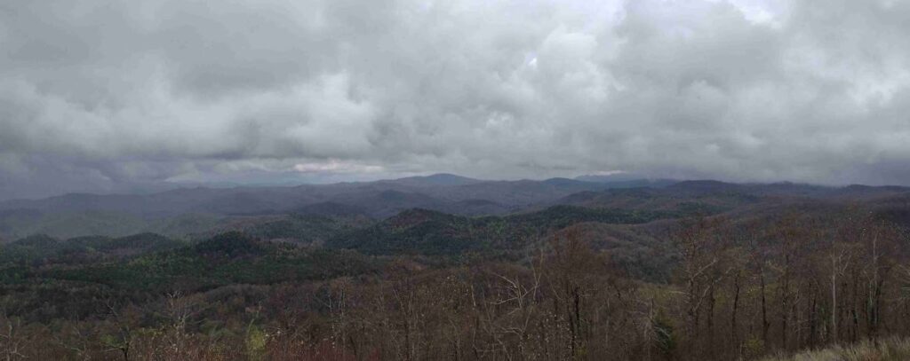
Sassafras Mountain East View
The view is good for the day I think. they say you can see for 50 miles on a good clear day. I imagine the view will be amazing. Maybe on my next visit.
#
Did you enjoy or find this post useful? Please let me know by leaving a comment below or join me on Instagram or Facebook.
You’ve planned a weekend camping and hiking trip with friends. Overall, there is a 12-14 mile hike over two days with at least a gain of 2000 feet in elevation. Your group’s has mixed hiking experience, but you’ve done this trail at least a dozen times over the years. You travel hours to get to the trailhead. The first night’s campsite is a little bit of a tough hike but it’s only four miles in. One of the new hikers starts to struggle on this first leg, however, you make it to the first wilderness camp safely.
Maybe they are just getting used to their pack. Maybe they are just getting used to the strenuousness of the trail. Maybe they will be good to go in the morning after a hot meal and a good night’s sleep. Maybe. What if they are not? The next morning, you are looking at a steep uphill climb to regain the main trail. Now it’s clear one of your hikers just can not go on. For whatever reason, they can’t go any further. Now what?
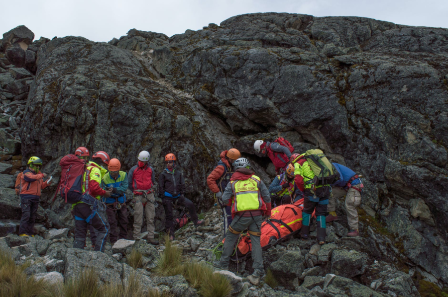
What is your backup plan if someone falls, or is injured in the middle of your next adventure? What’s the exit plan in the event of an emergency? Is there one? I don’t think most people plan for the exits as they should. After all, who wants to plan for a disaster? We go outdoors for a good time, not to get hurt, end up in the hospital, or worse. It often seems accidents happen in remote locations where it’s hard to get help or get the injured out.
In recent news, a nineteen-year-old experienced hiker died doing a solo hike in a state park when something went completely bad. Another person fell to their death from a popular hiking trail in Zion National Park. Search the internet and you’ll find tons of hiker misadventures. While hiking accidents happen all the time, it’s the worst which makes the news.
I think there is a general misperception where people generally feel safer in state or national parks. Myself included, tend to consider organized parks as safe places with help always nearby. I can just call the rangers and they will come to get me. Right? Most likely, no. The idea “parks are safer” is a dangerous assumption. Most parks have minimal staffing levels at best. Large parks can have very isolated areas which are difficult to get in and out of. Even with popular destinations, help can be hours or days away.
Trip contingency planning simply means planning for problems, understanding what are your exit options, and how to get aid if something goes wrong. Planning for contingency events helps everyone enjoy a safe trip. Add these contingency topics to the planning for your next outing: training (both yours and the group’s), the forecasted weather, the essential items, a trip plan (for use by others), and an emergency plan (for use by you). Let’s take a quick look at these topics.
Training
First-Aid is one type of training I will always highly recommend. You should understand, most first-aid courses assume secondary aid, such as Emergency Medical Services (EMS), is less than 30 minutes away. If you are hiking in a remote section of the backcountry, secondary aid may be hours or days away. Take a simple, basic first-aid and CPR (CardioPulmonary Resuscitation) course to start with. As you find an interest you can take more advanced courses like a Wilderness First-Aid class. The American Red Cross has some good courses. You can even do some of the courses online to get started.
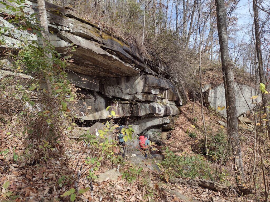
Rock outcrop
Weather
Based on most of the news articles I’ve read, many hikers lost or injured die of exposure to the elements. Regardless if injured or simply lost, they did not have adequate protection from the weather to survive until found. It’s important to both plan for the typical seasonal weather condition and to closely watch the area’s local forecasts for weather changes in the days leading up to the outing. I often find borderline weather conditions can shift significantly in a day or two, sometimes for the good, sometimes for the bad. It’s good to be prepared for the bad.
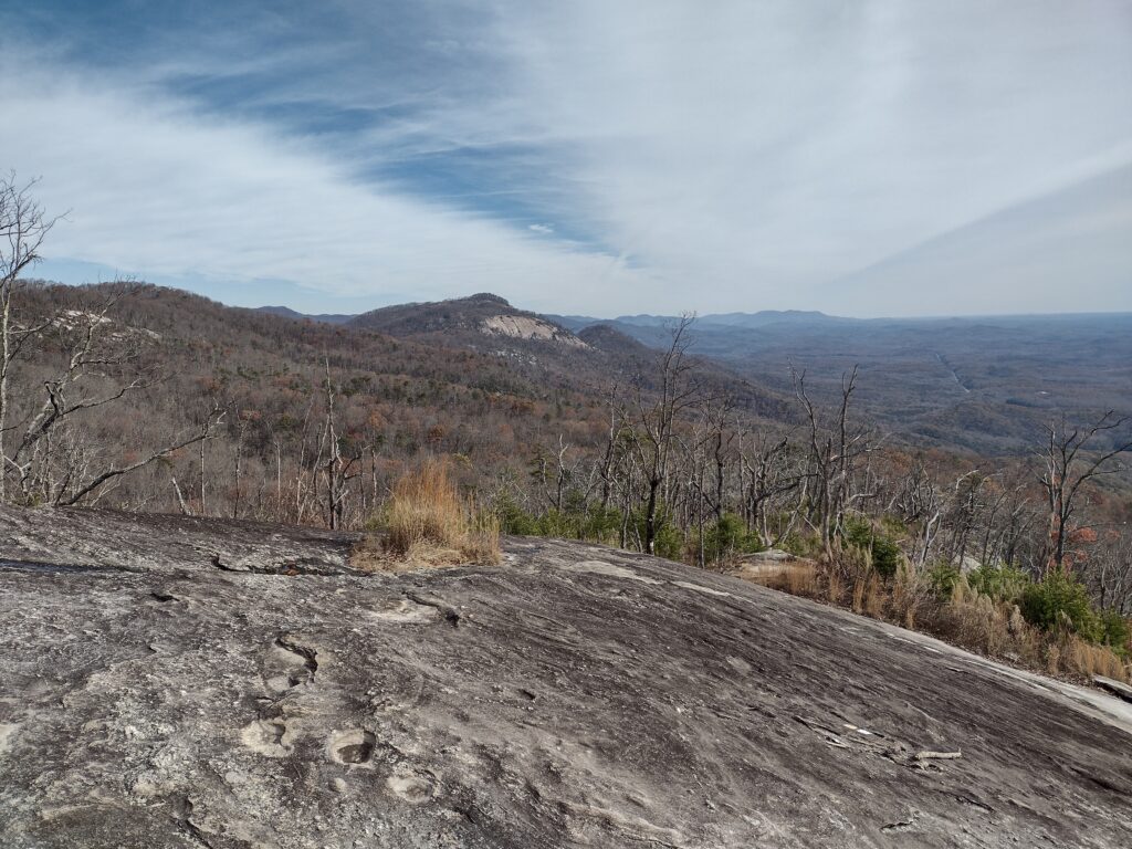
View of Table Rock from Bald
Essential Items
These are the items every hiker should always carry in some form or fashion. These items could include things like matches, compasses, food, water, and even extra clothing. Based on the planned activity, you may need to modify what you carry. Follow my link for a deeper discussion on the essential items.
10 Essential Items
Hiking or Trip Plan
Like a boating float plan, you leave this plan behind with a responsible person in the event the hikers don’t return on time. The information in this plan will aid searchers and rescuers in locating and extracting those in need. A good hiking plan should include the following information:
The name, description, and information about the lead hiker/person in charge.
Any vehicle information, usually left at a trailhead, like the make/model of cars, color, tag numbers, etc.
Equipment the hikers have with them. Do they have first-aid kits, a way to make a fire or signal, cell phone numbers, etc?
Hiking trip details: departure date, return date, destination, proposed route, stops along the way, etc.
Name, and description of hikers in the group. This should include any important medical information.
Emergency Plan
This is the plan the hikers take with them for use in the event of an emergency. Sometimes your emergency plan is just a mental note of the nearest road crossing. But what happens when the one with the “mental notes” gets separated from the group, or is unconscious? This plan should include written emergency contact numbers for logistical support like shuttles or pick-ups at a trail crossing, local rescue phone numbers, the nearest hospitals along the way, and maybe even a route map. Do a short “safety briefing” at the beginning of the outing or the trailhead, just to review the route, and highlight any important safety information with the group.
So be sure to ramp up your next adventure planning with these contingency items. You’ll be better able to turn a possible disaster into a simple change of plans.
***
What does Foxtrot Uniform mean? You may have guessed by now. Let’s just say it’s sort of related to FUBAR and SNAFU. This is when all your planning gets turned upside down and now you have to create a plan “C” on the fly ’cause your plan “B” isn’t going to work out anymore. Remember, in nature, there are no safeties.
#
Did you enjoy or find this post useful? Please let me know by leaving a comment below or join me on Instagram or Facebook.
My first efforts to take Radar on a real overnight campout and then hiking went incredibly well. Radar and I have hiked together a fair amount. And we’ve glamped before. But we haven’t actually tent camped and hiked in one outing before. Hopefully this overnight adventure was a test run for more fun outings to come.
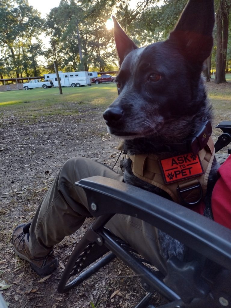
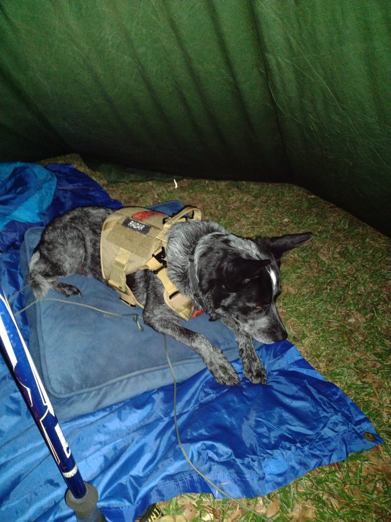
We arrive at Mill Creek county park about 5:30 pm. Mill Creek county park is a popular equine camping staging area located in Sumter County, at the southern end of the High Hills of Santee Passage of the the Palmetto Trail. There are a few horse trailers already set up for camping there. We select and set up our camp site near the trailhead leading north to the High Hills of Santee trail. Radar is nervous. He doesn’t know why we’re here this late in the day. Tent camping is all new to him and he’s not sure what’s happening. I put his vest on him to see if it will help calm him down any. I’m picking tarp camping to start out with him which is a little bit of a challenge in and of itself. I guess I figure we may as well start hard and work toward easy. Park rules say he needs to be on leash in the park, although not all dogs here are. There is at least a pug and another heeler here too. The pug runs up next to my car as I arrived, dragging it’s leash, seemingly convinced it was more important to greet us as new arrivals to camp, regardless of it’s own personal safety and the potential hazards of being crushed by a moving vehicle. Anyway we’ll see how the leash thing goes. I had picked up a 50′ roll of paracord from Lowe’s on the way with the idea I could make a long lead for Radar in camp. I also brought his bedding from home to make him feel a little more at home along with his regular food and water bowls. I have a couple collapsible bowls I usually bring when we go out for hikes but will save them for the trail tomorrow. Right now he’s sitting on my lap in the chair (his choice), watching everyone and everything else around the camp.
Radar’s not sure
There is a mule in an impromptu electric fence corral next to a couple of horse trailers on the right of us. They have the pug and heeler. Across from us is another pair of horse trailers with a shepherd and lab. Everyone seems to know everyone. They started a camp fire at the pair of trailers across from us and the people from all four trailers are sitting around the fire chatting. The sun is getting ready to set so I’m going to feed Radar and eat now myself.
Radar’s first night tarp camping
Up in the morning. I was awake early but am waiting until the sun starts coming up. It was a little bit cooler than I expected last night with this early morning temperatures at about 45 degrees. Note to future-self: Things to bring on fall campouts, gloves and a warm hat. I am glad I brought my heavier sleeping bag, a 20 degree sleeping bag, which was perfect. Radar did incredibly well for his first night of tarp camping. He only got up a few couple of times in the night, left the tarp, and walked around. I think he was check out noises from the adjacent woods. No barking, just checking. I got up a couple times myself to pee and he followed me close. Because we were under a tarp, I had to keep him on the long lead most of the night but for the last hour or so waiting for sunrise. This last hour we both just lay here waiting for sunrise. The ground is pretty hard and my Z-fold pad isn’t making much of a difference. I’m beginning to think I may need a different pad.
Radar still seems a little nervous this morning so when I got up for a quick walk to the bath house, I took him with me. I wanted to use the larger stall so Radar could come in with me, but someone was already in there so we went back to our campsite. Who get’s up at the crack of dawn to use a bathhouse anyway? When we get back to the camp site, I open up the car to start getting breakfast ready and Radar jumps right in and takes his place on the front seat. I don’t know if he thinks I might leave him or not but he isn’t taking any chances. He comes out of the car for his morning meal while I have a nice trail breakfast of hot oatmeal and a café mocha. It feels good to be in backpacker/hiker mode again. I’m dressed for the trail. It’s been a while (too long) since I’ve been able to get out and do any real hiking.
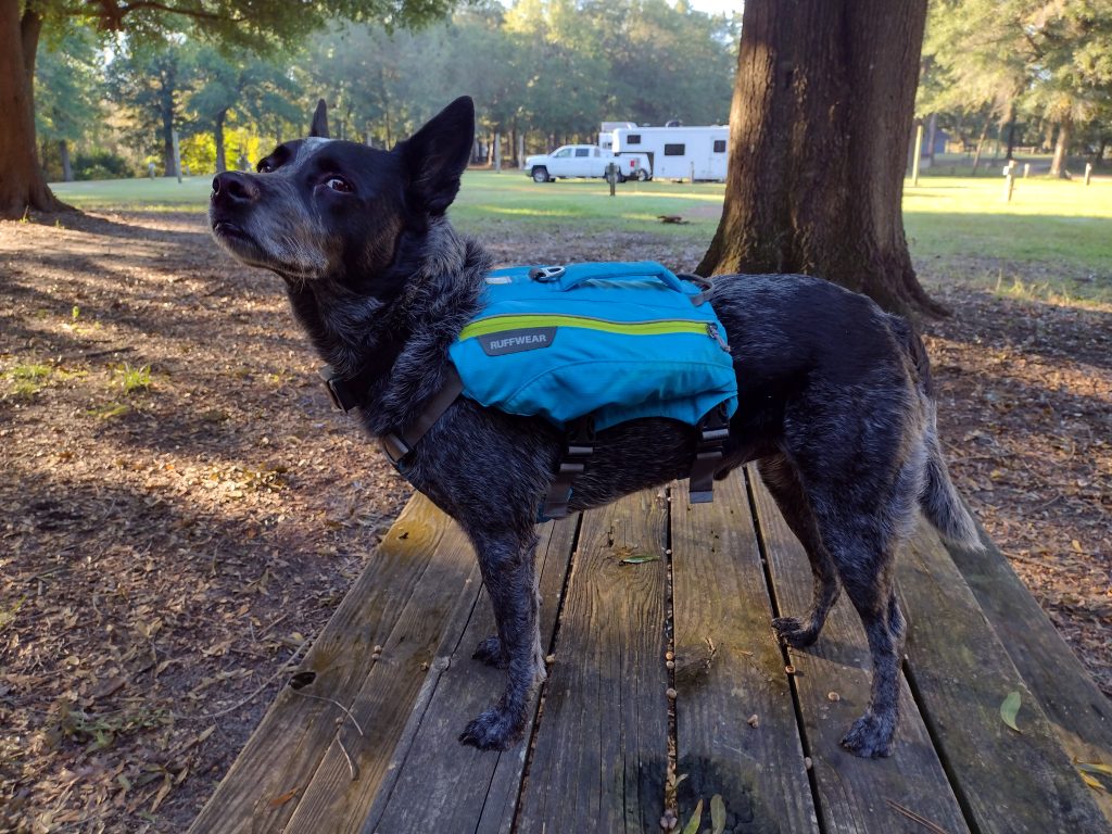
Radar is ready to hike
After clean up and repacking my hiking day pack, I put on Radars hiking vest. I want something with a little color on him as we are hiking in the Manchester State Forest, which is public land, during hunting season, and I don’t have any blaze orange with us. I think once Radar realizes we are going hiking he really relaxes a lot. We are on trail, north bound, at 8:50 am. Radar is off leash, much to his hiking joy, once we get out of the park but I do have a leash just incase we meet horses or other hikers. Proper trail etiquette and all. Not everyone seems to like dogs.
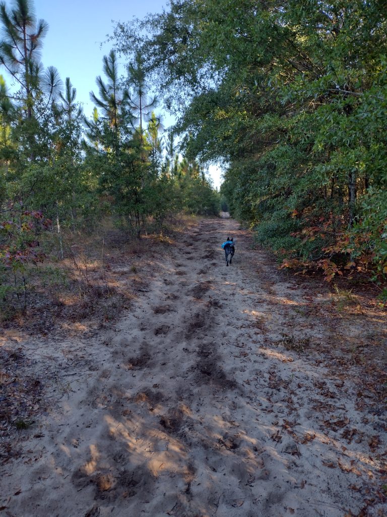
High Hills of Santee Passage heading out
The High Hills of Santee Passage I think I’ve hiked at least a dozen times. It’s a great section to hike and I usually start out new backpackers on this trail. There are a lot of access roads and the trail is well marked most of the time. Since it’s been a while for me, I’m loosely planning to hike maybe 3, 4, or 5 miles out, depending on how I feel and the day goes. Then turning around and hiking back. The trick is leaving enough fuel in the tank for the return trek. I figure if I can start hiking by 9am, we can maybe hike like +-3 hours, we could eat lunch and then hike back. Being on trail by 8:50 is a perfect start.
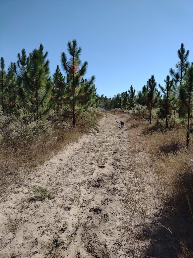
High Hills of Santee Passage sandy trail
The issue with the early section of this trail (besides the quicksand patch) is it’s sandy. Sandy like walking on dry sand at the beach sandy. It really sucks the energy out of you. Starting out in the morning fresh is okay (’cause you’re fresh) but finishing at the end of a hike is tough, it’s like hiking an extra mile or two when you’re tired.
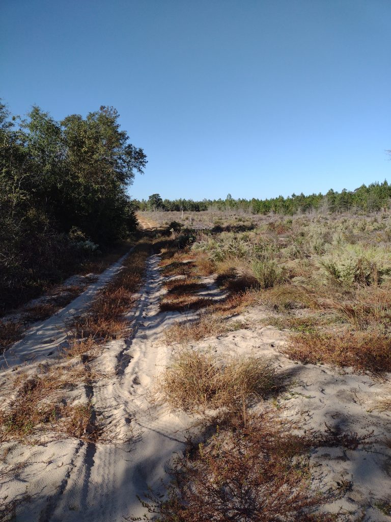
The day goes well, the weather is cool, clear and perfect hiking weather. We hike well and make good time. We covered about five and a half miles and make Christmas Mill Road by about 11:30. As we reach the crossroads, there are a whole group of trucks with hunters coming in and starting to unload. Rather than stop there for lunch, we just start our return leg and hike about an hour more before we stop for a good lunch break.
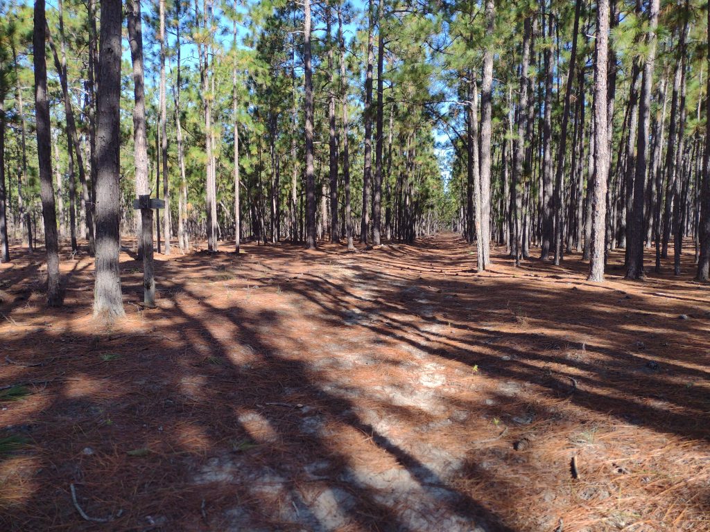
High Hills of Santee Passage young pine forest
Radar seems to understand when I tell him “we’re heading back to camp, back to the car.” His ears are up and he leads the whole way back to camp. He follows the trail flawlessly, even when the trail crosses a road or splits, he picks out the correct path on the other side. As we were hiking out of camp north bound, he would generally stay close to me alternating between ahead, behind, or off trail checking out smells and noises, usually not much more than about 75 feet away. Heading back south bound to camp, he occasionally is going off trail to check a noise or smell, but mostly he is leading with purpose, maintaining about a 50-75 feet lead ahead of me on the trail, stopping ever so often and looking back to make sure I am still with him, stopping in the shade, waiting for me to catch up, and then he starts trotting off down trail again.
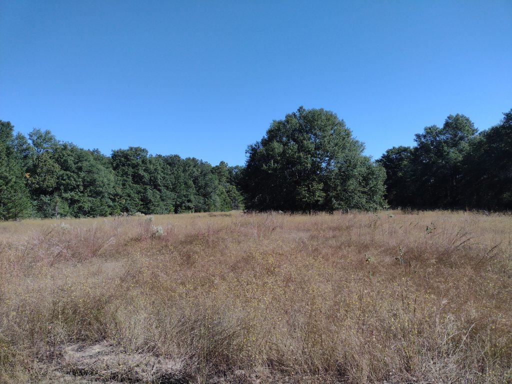
High Hills of Santee Passage pine forestHigh Hills of Santee Passage open field
We stop for lunch around noon. Food and water for both of us. I have a couple collapsible water bowls but it’s hard to judge when hiking and how much water he needs. I make sure he has his fill of water during our lunch stop. The final leg to camp is more sandy and the day is warming up. We’re back on trail by 12:30 heading in to the home stretch now. Nearing the last quarter mile from camp we run into a string of horses with riders, we pull off trail to let them pass, Radar sits and waits. This is a big test because he loves horses. Really, really loves horses. Nipping tails kind of love. He stays, the riders pass intact. We hike on. I’m very happy. We make it back to camp around 2:10 pm. As we enter back in to camp we make for a picnic table in the shade and break out the last of our water. The hike is a win. A great hike and overall a great little campout. Radar crushed the hiking part of the trip and I think he’ll get the hang of this tent camping thing without any issues in the future. Now to figure out the next trip.
#
Did you enjoy or find this post useful? Please let me know by leaving a comment below or join me on Instagram or Facebook.
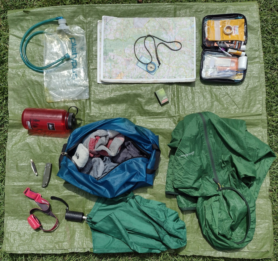
Whether you are heading down the trail for a quick hike or gearing up for a long trek, you don’t want to forget these essential items. You’ll need to start somewhere and this list is a place to start the discussion. There are many versions of these essential things and infinite options for each item. Of course you will want to scale down or up these items based on your specific outing needs. For example, the first-aid kit I take with me on a week long backing trip is vey different from the first-aid kit I take with me for a local day hike. So lets walk through the 10 essential items.
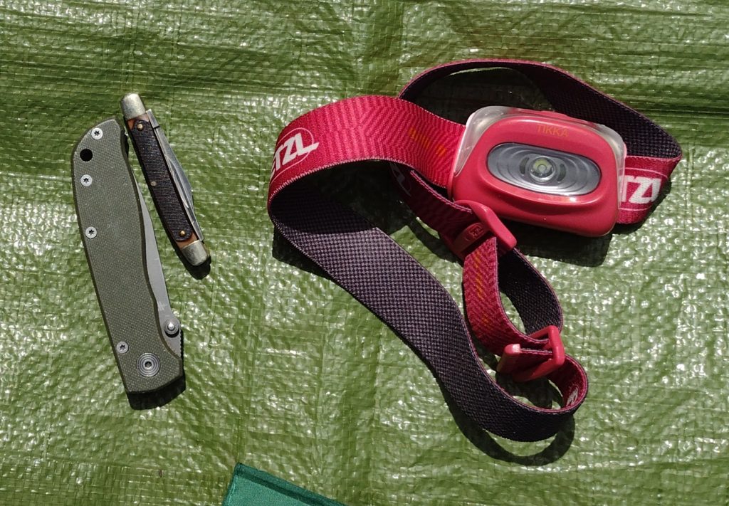
Flash light For me, a simple headlamp works well for almost all situations here. Light weight and easy to pack even for a day hike when you maybe coming in around or after dark. Seldom have I ever needed a handheld style flashlight when hiking. As a trek pole user I prefer the headlamps as it keeps your hands free for other purposes. I would not recommend overly fancy lights or headlamps needing special or button batteries. I’ve seen hikers left in the dark because they couldn’t find replacement batteries in town. Keep it simple, AAA or AA batteries are every where. For short hikes, just make sure you have fresh batteries. For longer treks maybe pack an extra set of batteries.
10 Essential Item Headlamp Knife
Pocket Knife Useful for light cutting and trimming. My primary hiking knife is a small simple folding two blade pocket knife. It’s useful for cutting moleskin, opening meal pouches, chopping beef jerk, even getting out the occasional splinter.
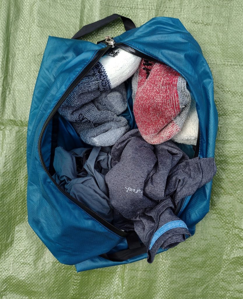
Extra Clothing and Socks
Extra Clothing This can be a simple change of socks, or a change of underwear, or several days of layered clothing. For a local day hike, I might take an extra pair of socks if I thing the trail will be wet. It’s nice to change in to dry socks for the drive home. For backpacking, a hiker travels on their feet so socks are important. For clothing, I usually only pack a change of base layer/underwear, but will always take at least 3 pairs of socks. One pair for today, one pair for tomorrow, and one pair only for sleeping. I try to keep my sleeping socks clean, dry, and reserved only for sleeping. I’ll hike in a pair, then swap them out the next day. My yesterday pair will hang and dry/air on my pack and become my “tomorrow” pair.
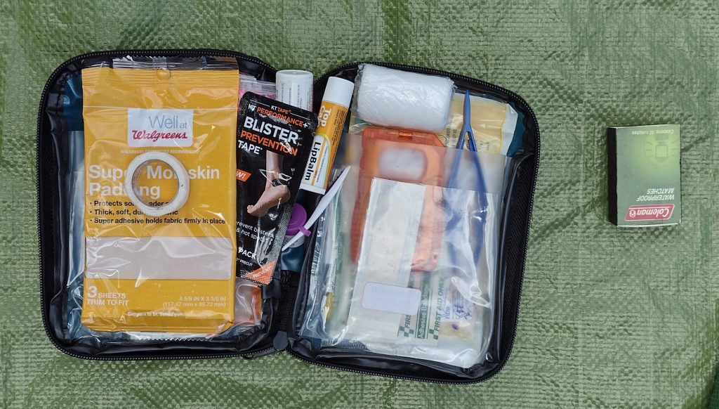
First-aid Kit You can pick up a simple first-aid kit just about any where not much bigger than a deck of cards or even make your own. However you really do need to know how to use what you pack. If you’ve never had any first-aid training, look up an organization like the Red Cross for training in your area, you can even do some of the training on-line. For a day hike a small zip-lock bag with a bit of moleskin and a few bandages is probably enough to get started. For longer hikes I carry a small group kit (I often hike with small groups) containing things like bandages, gauze pads, tape, extra mole skin, antibiotic ointment, ace wrap, KT-tape, some simple over-the-counter meds like aspirin, Tylenol, Ibuprofen, Benadryl, Imodium, small scissors, small tweezers, and the such.
First Aid & Matches
Matches or Fire Starter What’s really needed here is a way to start a fire incase you get lost. This is a survival type situation item here. A butane lighter with some sort of fire starting aid like dry lint or tinder, in a small container works too. My stove has a piezo lighter/igniter, but I also carry a small butane lighter or a small box of water proof matches, just in case the igniter breaks (it has).
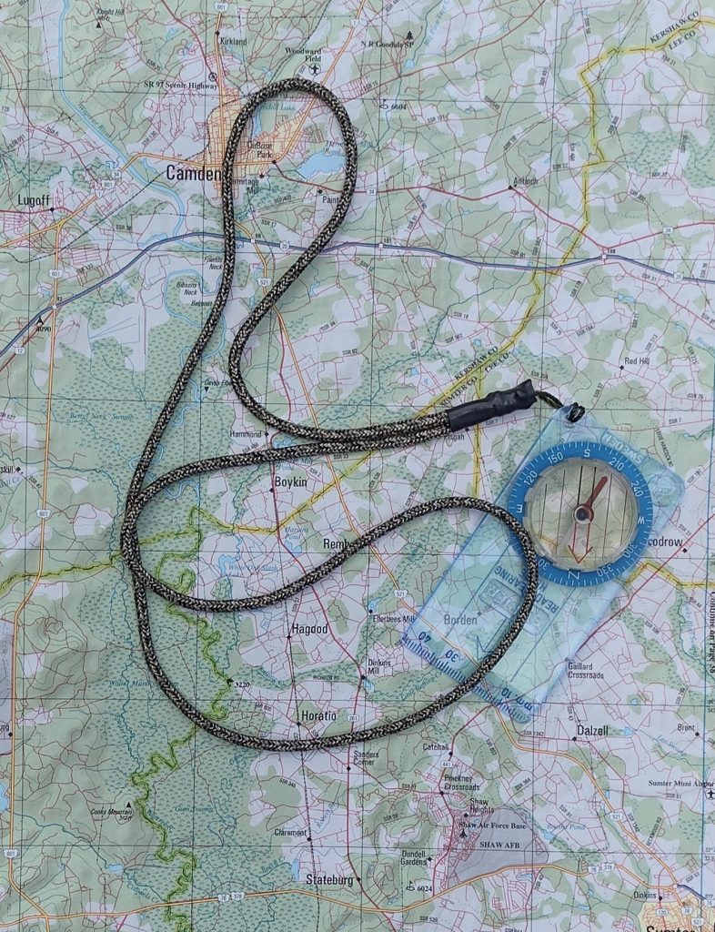
Map and Compass Even when starting out on a well marked trail you need to know where you’re headed and be able to navigate basic directions. I did a day hike from Newfound Gap with my dad a few years ago in the Great Smokie Mountains. We came across a hiker heading our same direction. Long story short, he was lost on a well marked trail and had to backtrack to his start. If you’re using your cell phone or an app as many people (including myself), a compass is a great battery free, water proof, quick and easy to use tool to aid you in finding your way and help keep you from getting lost. This is the compass always take with me backpacking. It’s a older Silva Starter compass I’ve had for years. It’s simple and works well enough to navigate with.
Map & Compass
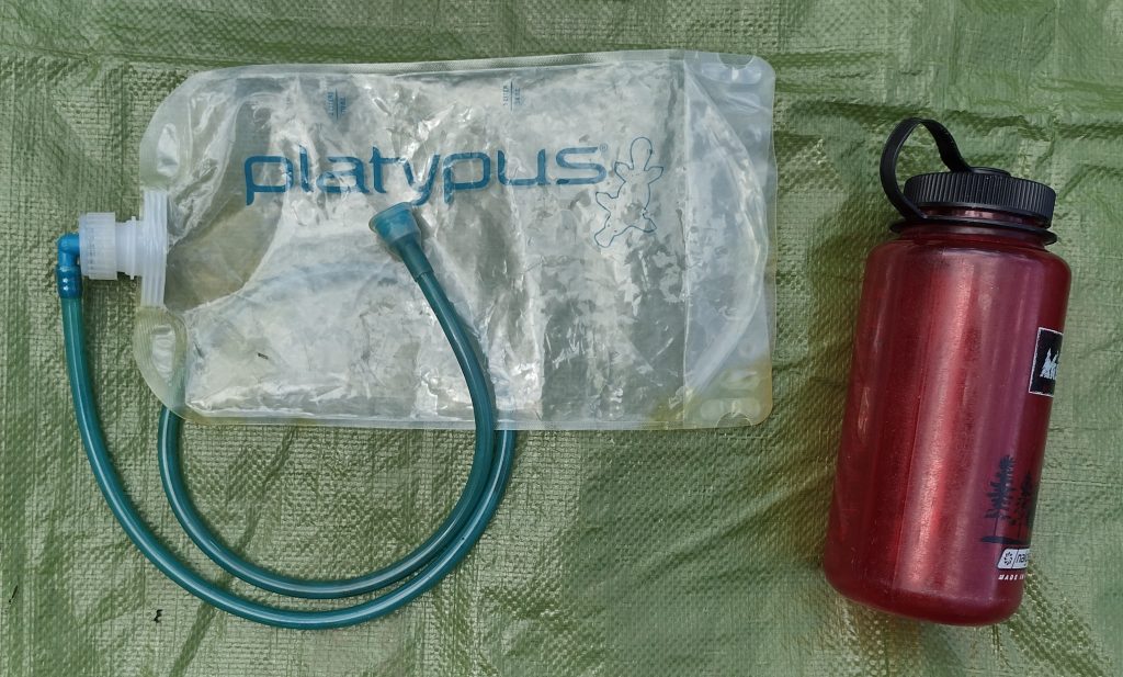
Water Storage For a simple day hike I typically use a standard 1-liter Nalgene style bottle or something of equal capacity. When backpacking, my number 1 recommendation and go-to is the Platypus hydration bottles. I always carry two Platy 2-liter flexible bottles as part of my hydration system. They are very light, tough, fold flat when empty and form to the pack contents. Having two of these bottle gives me flexibility in my water carry based on weather and trail conditions for only ounces. For long treks where potable water may not be available, you also need to consider water treatment options.
Water Storage
Trail Food This is snacks to maintain hiking energy between meals. Any kind of favorite trail mix or granola is a nice treat to nibble on as your walking. This can be a simple homemade trail mix or can also be something like trail snack bars such as Cliff, RxBar, Nature Valley, & PowerBar. These generally pack and keep well. Watch out for some of the snack bars with chocolate drizzle or coatings, when the weather is warm they can be a mess. Pack an extra bar for those “just in case” times.
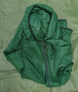
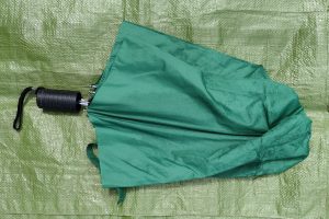
Rain Gear This can be as simple as a disposable poncho or as complicated as a full rain suit. From my experience, if it rains, you will get wet. Regardless of the rain gear. My preferred rain gear is the light wind rain jacket with a hood shown. It breaths well and keeps most of the rain off me. It’s great for short or long hikes, it packs down nicely, and it works well when used as an outer shell over layer or alone as a light rain jacket. An umbrella is also a good option I’ve used on some trails. If I know I’ll be out in a monsoon, I may pack a full rain suit with jacket and pants. A lot of rain can be chilling, carrying away a lot of body heat, and lead to hypothermia.
Rain JacketUmbrella
Sun Protection Here again, an umbrella pulls double duty and works well. Hats, long sleaves shirts, and sunscreen lotions are also great picks. Consider where you will be hiking and the forecasted weather. Look for a small sport stick sunscreen. At just a couple ounces it can help cover the high burn areas like the tops of ears, nose, cheeks, and shoulders without adding lots of weight to your pack.
It’s a good habit to pack some version of these “Ten Essentials” whenever you head out into the backcountry. Even for day hikes, consider carrying with you water, a snack, maybe a pocket knife, and small first-aid kit. You may use only a couple items or even none at all. But when something goes astray, you will appreciate being prepared.
#
Did you enjoy or find this post useful? Please let me know by leaving a comment below or join me on Instagram or Facebook.
Just a quick aside. It’s been a busy first half of the year and the time has just gone by way too fast. I’m working on a several projects right now, a couple with work and at home. So the year has whizzed by. I’ve also recently had a woman’s group reach out to me, wanting a guided hiking or backpacking trip some time this fall. This sounds like a great opportunity to get out and explore. We’re still way early in planning, I’ve provided a list of possible weekend trips. I’m just waiting to hear back on the kinds of trip they are interested it. This would be a really awesome event if it all comes together. I haven’t had a really good escape to the woods this year yet so I’m looking forward to hiking this fall. I need a trip Radar can come camping with me. My next scheduled outing with my volunteer group will be to Lake Moultrie next month. Small boat sailing is on the agenda and a little lake time in August might just hit the spot.
#
Did you enjoy or find this post useful? Please let me know by leaving a comment below or join me on Instagram or Facebook.
I’m heading out this weekend for a backpacking hike in the foothills of upstate South Carolina. I’m leading a small mixed experience group of hikers on this trip. One common question of new hikers is “What do I need to pack?” My answer is usually far from black and white. Specific gear recommendations can be very personal and individualized. I’ve seen people walk in to an outfitter and buy “everything” (from pack to socks everything) new all at once and I’ve seen people stuff what they have in a duffle they and hike the weekend. The bottom line is everyone is a little different and the same gear doesn’t work for everyone. I tell people to look around, shop around, find the things you like and try it out. Hiking or backpacking gear doesn’t need to be the latest top of the line. You need to be comfortable with your gear and it needs to perform for you when you need it to work.
I’ve been working on my gear list for years now. A little here and there. I’ll try something for a while, change it out, try something new. Generally I look for more efficient or lighter as I go. The most recent change up is with my pack. I’ve moved off my external frame to try out an internal frame. The plus of my new pack is it’s half the weight of my old, The con so far is I’ve had to take a whole new approach with organizing my gear in a top loading pack. I’ll probably come back to this later in the year. But for now, this is my basic packing list for 2021. Feel free to take a look and leave a comment.
#
Did you enjoy or find this post useful? Please let me know by leaving a comment below or join me on Instagram or Facebook.
The Lake Marion Passage is a 35.9 section of the Palmetto Trail, South Carolina’s long trail. I’ve hiked a few miles of the lower part of this trail in 2019 (Santee/Hwy 301 to Jacks Creek) before I started working full time again that year. I’ve also backpacked north on the High Hills of Santee Passage dozens of times over the years with my volunteer organizations.
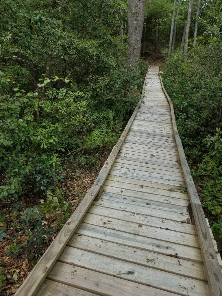
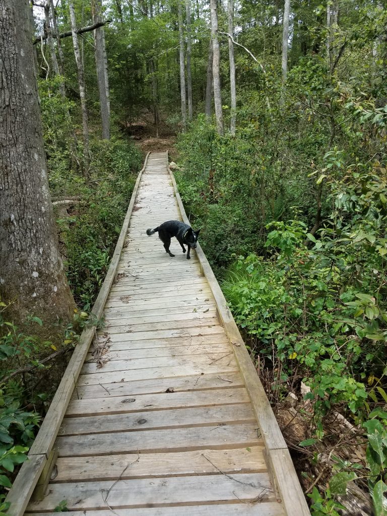
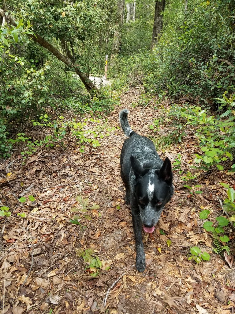
On this day, Radar and I decided to hike the Lake Marion Passage from the Northern end for a few hours. With snacks and water for both of us in my day pack, we headed out South bound from the Mill Creek County Park Trail Head. Our section of trail was in fair to good condition and it was a great hike. It felt good to be out in the woods again. This section doesn’t appear to heavily traveled and we were by ourselves the whole time. The weather was great and cool enough the bugs weren’t an issue. As it’s spring everything was green. After heading out from the trailhead, we hiked in to the woods along the trail a little over a mile before we came across a long boardwalk/foot bridge over the swamp.
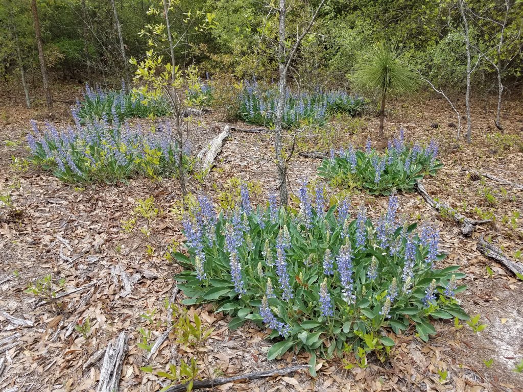
Lake Marion Passage – Foot bridge across the swampLake Marion Passage Wild Flowers
I think Radar picked up the swamp smell before we saw the bridge. He took off, bounding towards the swamp – until he started sinking in the soft mud. realizing the error of his ways, he high-tailed it back to the trail where I was laughing for him. After crossing the swamp via the designated foot bridge, the trail follows the land contour for about a mile, with cut forest on the East side and low ground and swamp canopy on the West. We picked a good turn around point where a dirt access road intersected the trail. Hopefully soon I’ll be back to hike more.
Lake Marion Passage water break
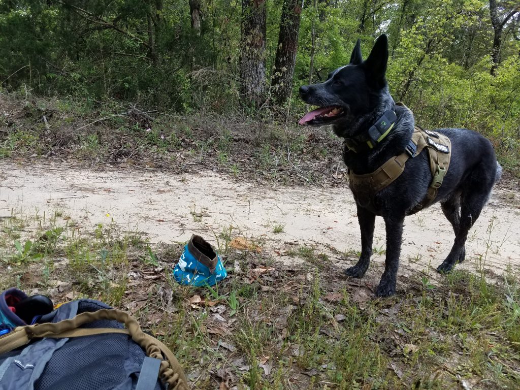
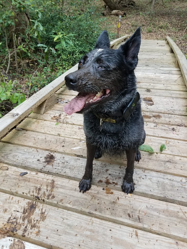
When hiking with a K-9 buddy, it’s important to include a snack and water dish in your day hike gear. I use a small collapsible bowl and carry extra water to share. On this trip I brought a small amount of his regular dog food for a his snack. After a short water and snack break at our turn around spot we headed back the way we had come. This time, Radar took the foot bridge over the swamp. But only about halfway. I guess he figured “Bridges – who needs them when you have the sweet cool savory wetness of the swamp?” and over the side he jumped. Swimming, chest deep, in to the cool mud to the other side of the swamp. Sigh. He couldn’t have been more happier.
Lake Marion Passage – a perfectly good foot bridgeLake Marion Passage – Swamp puppy
We didn’t have any real problems on this portion of the passage. While scenic, the Lake Marion Passage does have some broken sections. Be prepared to work around some issues if you hike the whole passage. Coming out of the town of Santee, there’s a 3 mile section which uses the old 301 bridge. The bridge was closed by SCDOT “indefinitely” in 2017. The only current work around is to catch a ride on I-95 over the lake. Old River Road bridge over the Halfway Swamp has been washed out long enough for the trail to be rerouted along local roads. And depending on the lake levels, some of the trail along the lake shores may be underwater or very soggy.
Hiking Lake Marion Passage trail with Radar
Overall, this was a great in and out 5 miles round trip hike. I’m looking forward to picking up this trail where we left off.
#
Did you enjoy or find this post useful? Please let me know by leaving a comment below or join me on Instagram or Facebook.
Last year, for reasons we’ll not discuss, the Palmetto Trail folks didn’t have an annual hiking challenge. Well this year they are making up for it with a get-21-hike-in-10-months challenge. Oh and the hike need to be on the Palmetto Trail. So I signed up for a fresh hiking start for the new year with the 2021 Palmetto Trail Challenge.
The Palmetto Trail is South Carolina’s long trail. When finished it will run about 500 miles from the mountains to the ocean. Of the currently open sections I’ve completed about a third of the passages so far. Some passages I’ve hiked a dozen times, most only once.
After a year of being trapped inside, I’m looking forward to finding my hiking boots and getting them a bit dirty again. I’ve already completed some sections of Palmetto trail and am hoping to use this challenge to motivation me to stitch in some new sections. But this years tasking will be a bit challenging with my full time job and volunteer schedule. I’ll need a plan to hit those 21 trails in 10 months.
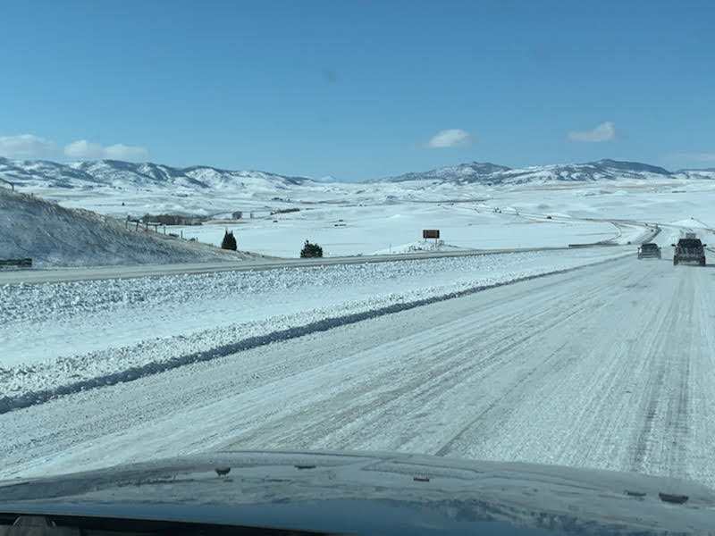
Southeastern Montana is a weird mix of wide open plains, constrained by fences, huge rolling hills, with sparse stands of pines. I am impressed with the scale of the wilderness here. This little corner of Montana feels like it’s a big cattle state. There are fences for cattle everywhere, there are even cattle crossing gates or guards getting on and off the interstate. Even the buffalo are fenced in. The deer and antelope may play but it’s not a free range world anymore. Welcome to Montana.
Landing in the great state of Montana was with a bit of apprehension as the temperatures had dropped and were running below zero our first couple days. Neither of us were ready or prepared for the early morning negative degree temperatures. Who in their right mind would think -7 degrees would be somewhere people would like to live?
Day 1 in Montana – Super Cold!
A little back story is probably due here. My brother is an avid hunter and this year was able to pull a long awaited Elk tag in Montana and had asked me along for the journey. This is actually the third (see An Elk-tastic Adventure) such adventure my brother and I have done. I drove up and met my brother in Virginia where we flew out to Montana. On our first day out in the woods was an every-layer-you-could-wear kind of day. Fortunately, for me at least, the temps over the next week rose to a way more tolerable level with lows running in the low 20’s and 30’s.
Over the course of the next 10 days, our daily routine typical consisted of awake at 5 am, packing gear, making lunches, and get ready for the day, on the road by 6 am. With a quick breakfast sandwich and coffee, we would travel to an area to explore. In the morning, we would hike in (and often up too), hike out, return to vehicle, find an area to explore for the evening, return to home base and repeat.
Mountains of Montana
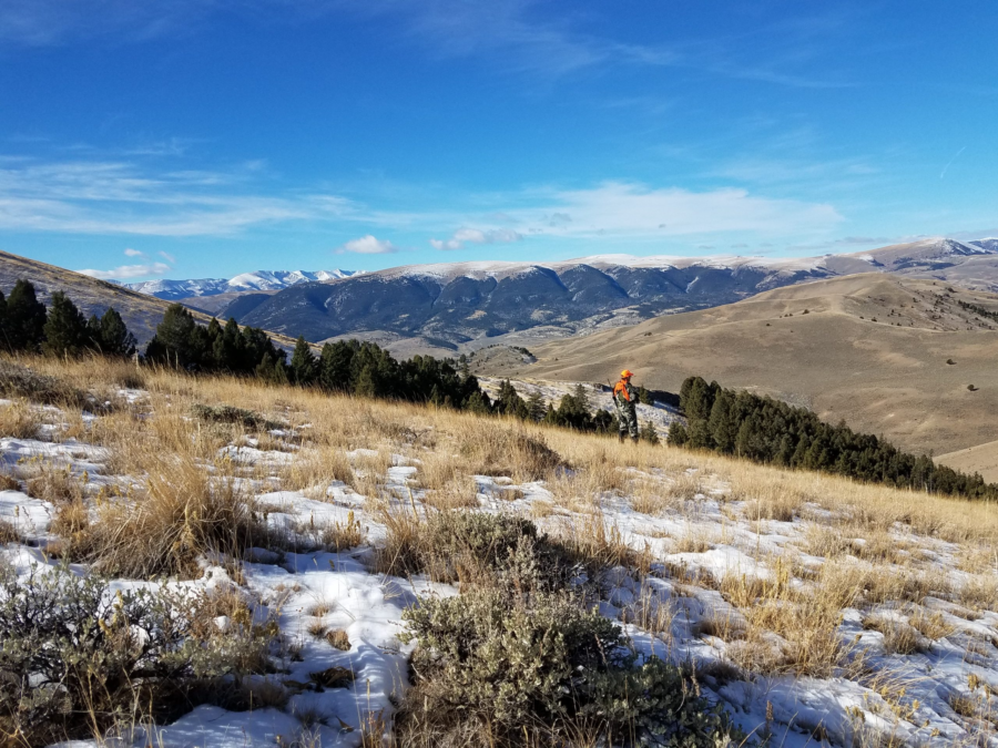
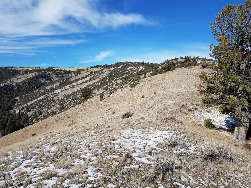
After several days of coming up empty handed, we picked up a “hot tip” from another hunter so we thought we would give it a go. This particular day started as most, with an early morning wake-up, pack up, on the road, and into the woods all in the dark. We’re about halfway through our trip at this point and the hot-tip indicated elk may be hiding in the basin on the other side a tough hike up and over more tough terrain. The route in was described as just over a mile and a half in, but it came with 1500 feet of evaluation gain. Logic indicating if it’s hard to get to, that’s where they elk will be. So off we headed.
The weather was still cold as we hiked partly up an old logging road in to the pine woods. As we slowly made our way up the snow covered trail of the old road, we were even successful in jumping a few deer. This told me we were stealthy enough to get close, we weren’t making too much noise, and if there were deer, maybe there would be elk. We saw lots of track crossing our path, but not much more after the deer. The old logging road passed through the forest to open hillside, the snow and road faded on the high side of the forest, giving way to a game trail at a fence line. We followed the well traveled game trail, continuing up and over another hill as the day warmed. The game trail eventually lead to a rock peak.
We ate a lunch here under the large tree near the ridge.
We had started hiking from around 7100 feet and went up to about 8600 feet. As a short hike goes this sounds easy but it took us a few hours to reach our peak. The peak looked over a basin as promised, with more and more peaks continuing after it. The view in to and across the basin from the peak was awesome, there was just one thing missing. Elk. This particular basin, like the vast majority of the areas we explored in Montana, while promising, was void of game. We sat on the ground under the large pine near the ridge, ate our lunch, and contemplated the ways of nature before we headed back out and down the way we had come.
On one of our treks out to the wilds, we were able to do one of the neatest things, at least from my perspective. We were working an area west of Lima and we were able to hike out far enough to set foot on some hiking trails leading to the Continental Divide Trail (CDT). The CDT is one of Americas long trails running 3100 miles from Mexico to Canada along the Rocky mountains. While I’m still section hiking the Appalachian Trail, being able to step out on to part of the CDT was huge motivation to keep on hiking. It’s one thing to be tromping around in the Montana wilderness, it’s another to walk along a trail you know runs across the country from bottom to top. It’s a little hard to explain the difference here, but just walking along the hiking trail for even a few hundred yards, made the trip worthwhile for me.
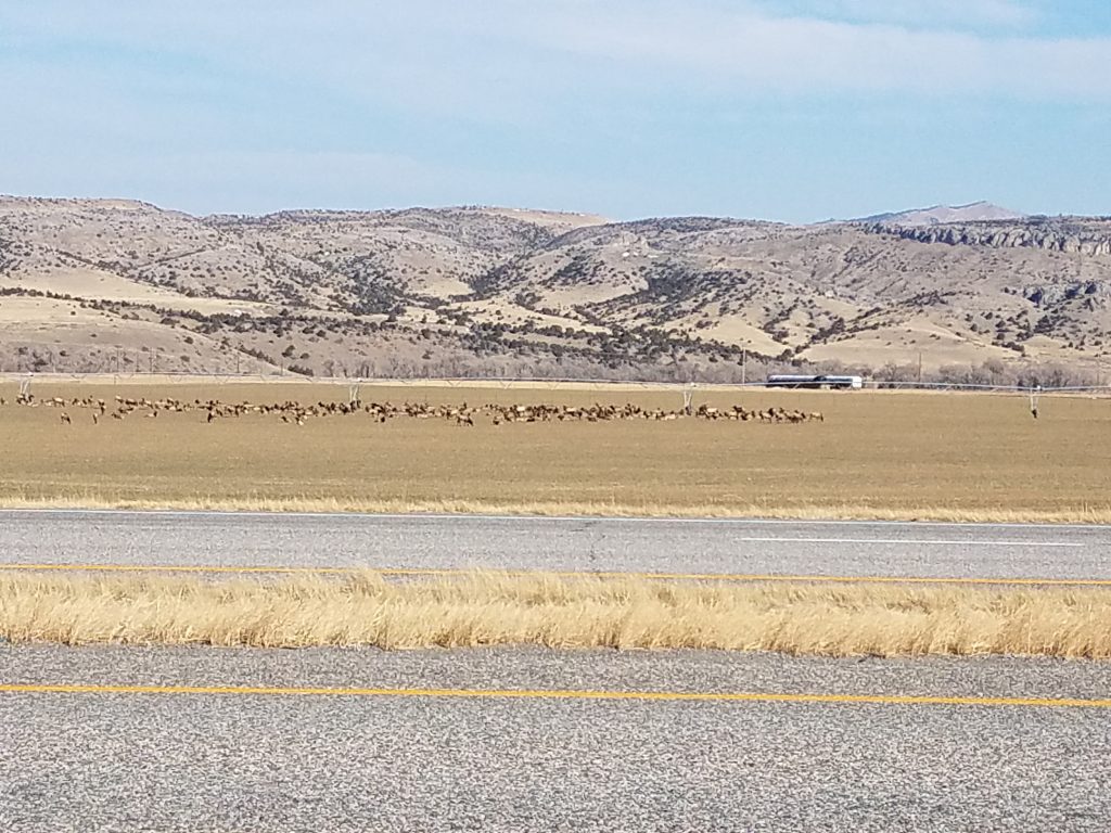
For almost two weeks, we hiked up and down seemingly countless trails, bushwhacking across hill and mountain sides, stalking, standing, siting, waiting, up early, home late, looking very hard for the elusive elk we had traveled so far to tag, all to no avail. For the last hunt day of our trip, we had followed another “hot tip,” (law enforcement had to close one of the interstate roads to allow a heard of elk cross) wo we had been working this valley area. We had selected a promising river basin area we suspected the elk were traveling to and from. Up and in the field early again, we crept our way in, hunkered down and waited. After the sun was up, we stalked around a bit, but to no avail. By lunch we were back at the car and ready to head back to the hotel and pack up for our flight home the next morning.
As fortune would have it, we had just pulled on to the interstate, traveling east, when we spotted the elk. not just one or two elk. not a dozen elk. But a whole herd of elk, maybe herds of elk. Possibly all the elk in Montana (probably not but it looked like it). There were between 200 to 300 elk, sitting safe in the middle of a private field, eating clover, sunning themselves, watching the world go by, not a half mile from the interstate.
All the Elk in one place, in the open.
We pulled off the road and were both laughing. The elk knew what was going on, they knew where it was safe to hangout and enjoy the day, waiting for dark. We watched the hundreds of elk lounging safely in the field for while, then we headed back to the motel to pack for our flight the next day back to Norfolk. With no elk.
Mt. Mitchell (6684′) & Waterrock Knob (6292′) are in the bag. This was as much an impromptu therapy couple days as much as anything else. It felt good to get out and go (highly recommended).
I had read about the southern sixer’s and decided to go out and try to bag a couple. Unfortunately, I had some pesky obligations for Monday (work), so I had to box in my plans down to driving up Saturday to North Carolina from Dorchester, South Carolina, hike a couple peaks, and then drive home on Sunday.
Normally I like to do a whole lot more planning when I’m heading in to somewhere new. This time I pretty much just hit the road, I had not really scope out the trails, or much of anything else, so I didn’t know what to expect when I arrived at the trail heads. This worked against me a little where I had wanted maybe a little more trail time and hit another peak or two, but the unknown added to the sense of adventure too. It ended up with me really not too sure where to pick up some of the trails to another nearby peak until it was too late in the day. This was still a really good trip. What I did know is Mt. Mitchell is the highest peak east of the Mississippi, I figured I would go there first.
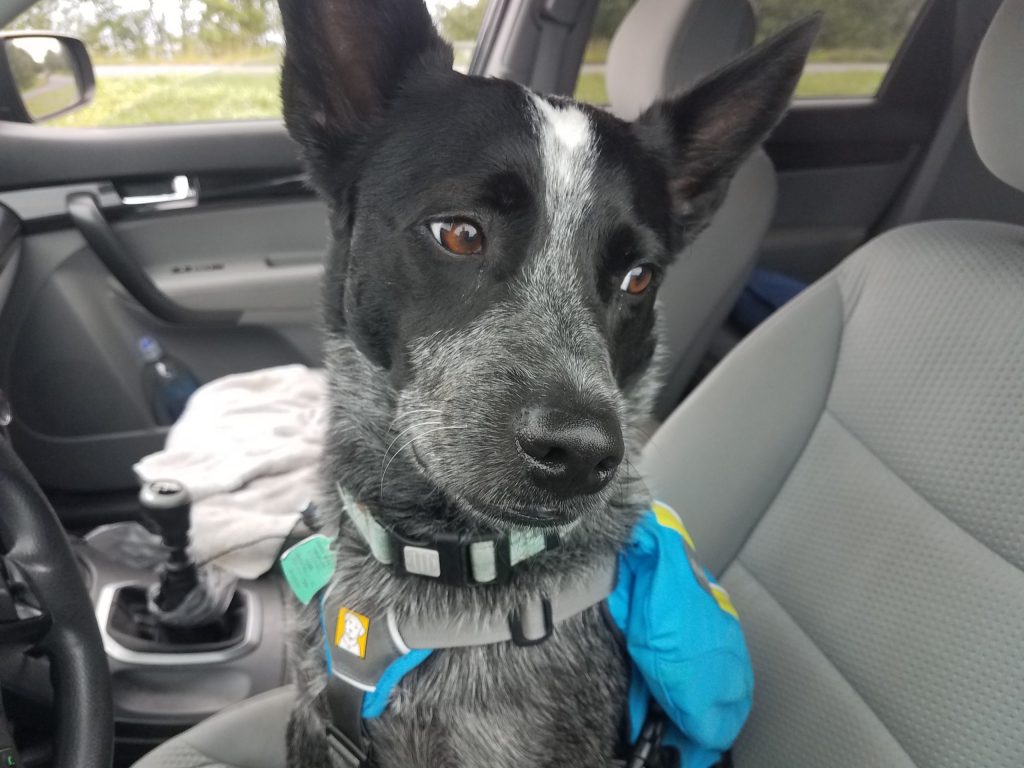
I basically just took my backpack (just in case), a change of clothes, some dog stuff an hit the road with Radar as my co-pilot. It felt like I had loaded more stuff for Radar than me, but I think I’m just a better packer than he is. Radar (with the help of Mr. Garmin) was able to expertly navigate us from the house all the way to the Mt. Mitchell visitor center parking lot without missing a turn.
Radar is concerned about my level of planning
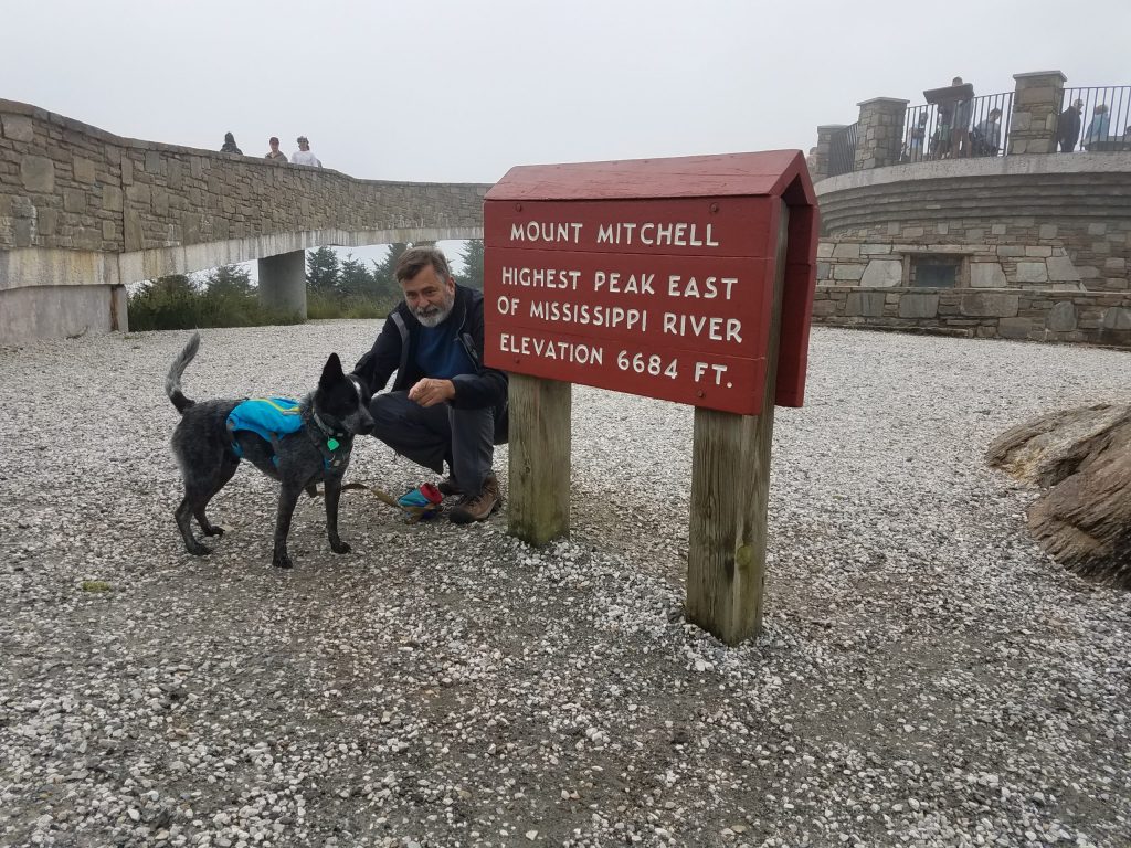
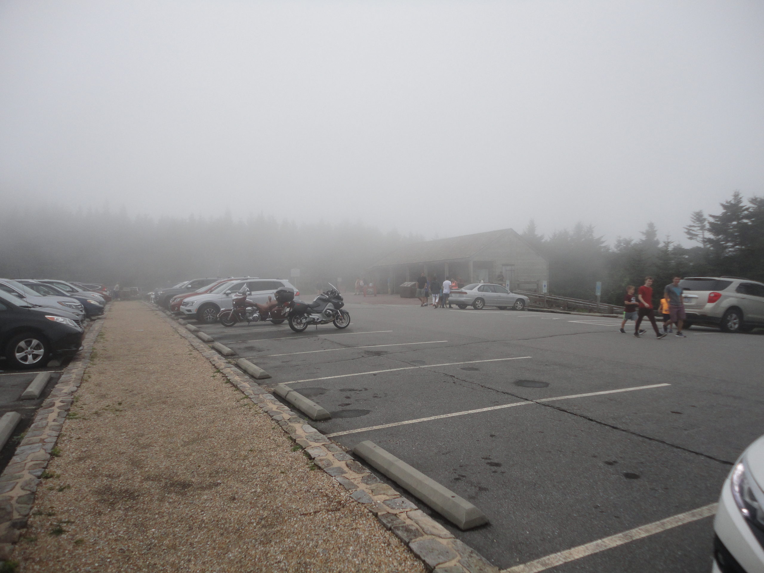
The trip up from south Carolina up to Mt. Mitchell was pretty uneventful, for a 5+ hour drive. Radar and I got to the Mt. Mitchell visitor center parking lot around mid afternoon. The visitor center was amazingly nice with ample parking. We geared up and headed out and up the mountain. Because of my lack of extensive trip planning, I really didn’t have a good idea how far it was to the summit, I found the hike from the visitor center parking lot summit trail head to the summit was incredibly difficult (just kidding, it was surprisingly easy!). The trail to the summit is actually paved and is an easy short walk for most people. The air was cool and a nice refreshing change from the heat in the low-country.
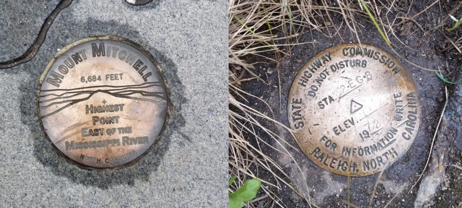
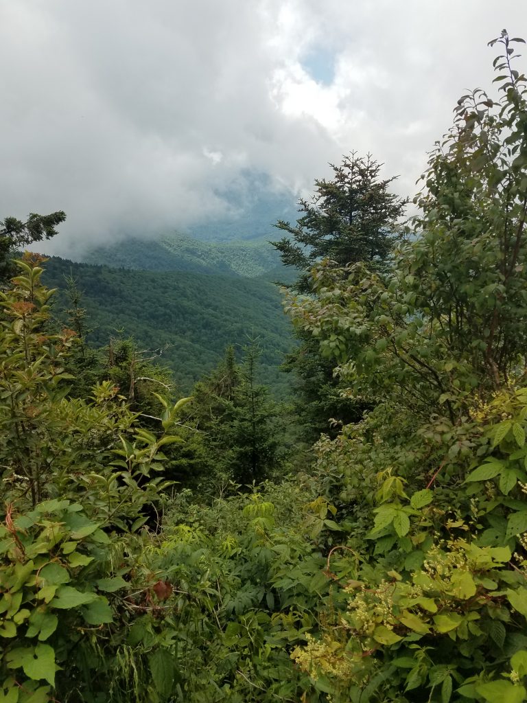
Radar and I submitted Mt. Mitchell about a quarter after 3 in the afternoon, on July 20th. The summit on this day was in the clouds, so visibility was pretty socked in – not really a whole lot to see. But then the view was not the prime reason I had come.
Summit of Mount Mitchell
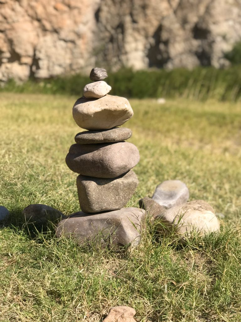
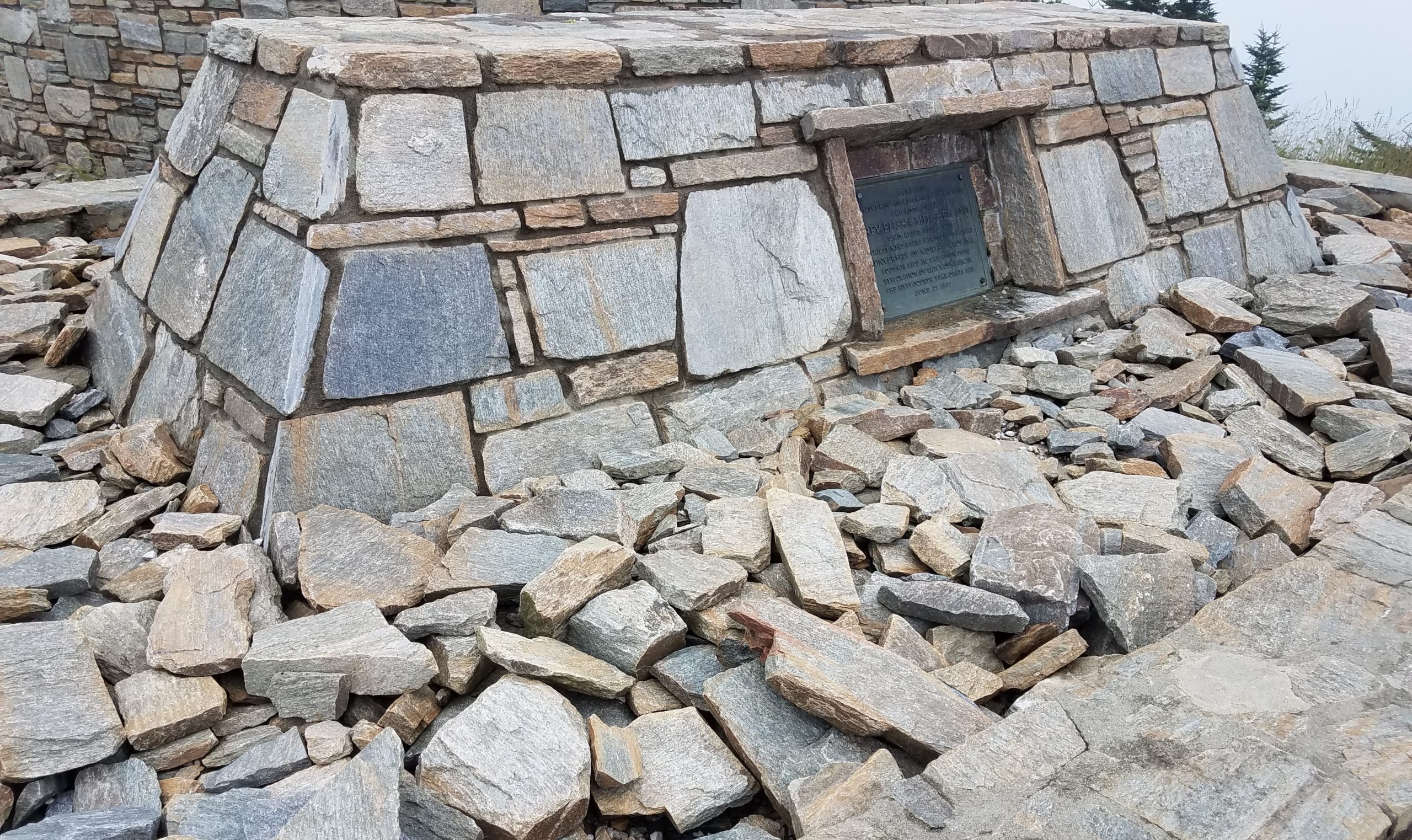
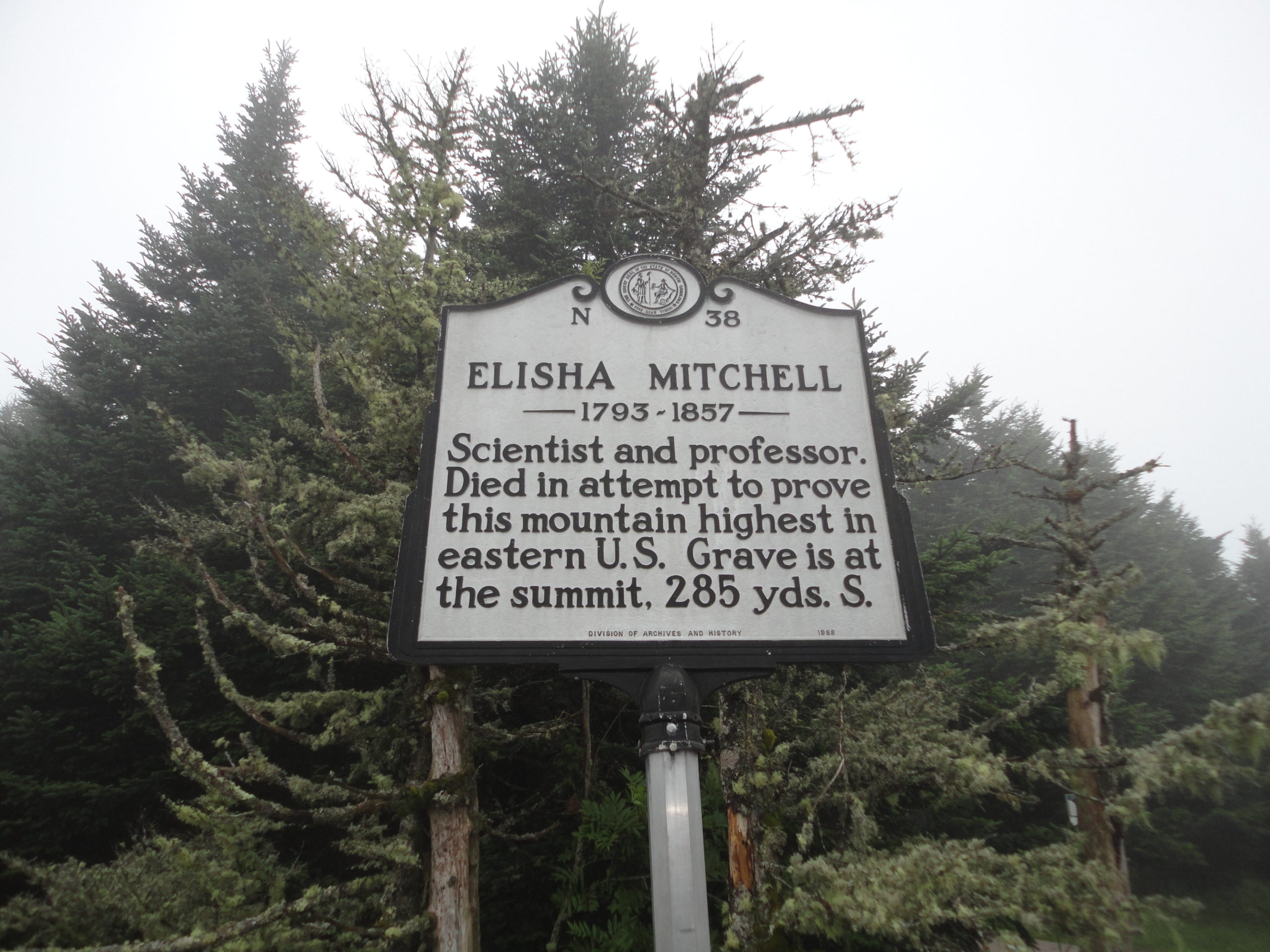
I did not know this until I got to the summit (must remember to planning more), but Mt. Mitchell is named after Elisha Mitchell. He died on the mountain in 1857, trying to prove the elevation of this mountain. His remains are buried on the summit still. Mountain graves and memorials are not uncommon, I’ve seen a number while hiking over the years. I often stop and think about the person behind the plaque. What events in their life brought to where they ended up. I leave a stone to let them know they are not forgotten. I again left a small stone. This time; the name of a cousin of mine was engraved on the stone.
Several years ago I sadly lost a cousin and I had made a small memorial stone for him. In the back of my mind, I wanted to leave it on a tall mountain somewhere. I had brought this stone with me on this trip. It seemed fitting, so I left my stone on this high mountain, 6684 feet above sea level, discreetly near the summit of the highest peak East of the Mississippi River. Radar and I returned to our car and headed down and west along the Blue Ridge Parkway, towards Ashville, for the night.
We stayed in a pet friendly independent motel (which shall remain nameless – unless you ask) on the edge of Ashville. I had selected it on the internet strictly based on price. Radar took one look at the motel room, then me, and pleaded with me not to leave him there alone when I went for dinner. I couldn’t blame him. So we both headed out for some Mexican at restaurant with an outdoor patio. When we returned to the motel we took turns sleeping. I gotta say, they tried, it really wasn’t too bad, and it was an experience, but I likely will not schedule a return there anytime in the near future.
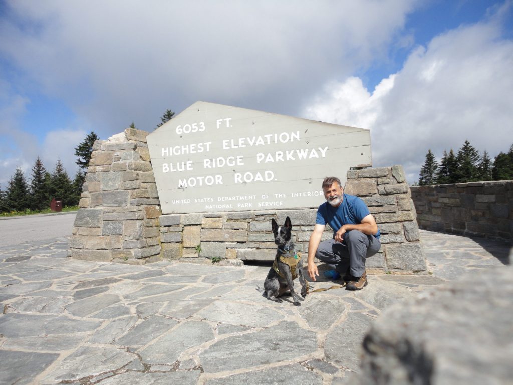
Anyway, Sunday we were up and out early. We had to head home but I wanted to try to bag a couple more peaks, if we could. Back on the Blue Ridge Parkway, we continued heading west from Ashville, towards Waterrock Knob. One of our high points on the way, was being able to claim standing on the highest park of the Blue Ridge Parkway.
The highest road elevation along the Blue Ridge Parkway
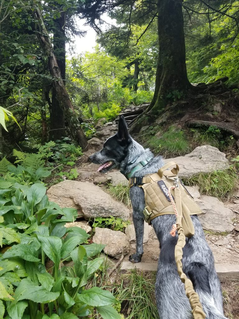
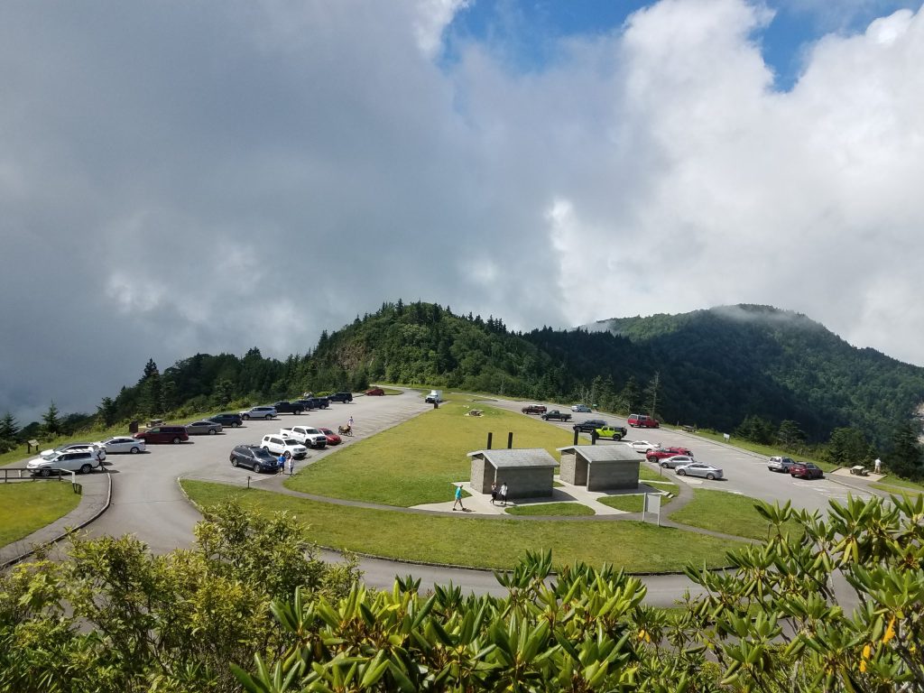
By the time we got to the Waterrock Knob visitor parking area, I knew we would be pressed for adventure time. There was supposed to be a trail at Waterrock Knob which ran across three or four peaks there. Unfortunately again, my (lack of) high level, detailed, planning would catch up with me. This peak also had an amazingly nice visitor center (they even let Radar inside) and nice parking. However, unlike Mt Mitchell, the trail to the summit of Waterrock Knob was not such an easy hike. The trail to the summit, while fairly short, just under a mile, it was a steep up hill climb. It felt good to work a little for the hike up.
Radar leading on the trail to Waterrock Knob
Like Mount Mitchell, the peak was also clouded in so the view was limited to the inside of the clouds. We hung out at the peak a little catching my breath. I tried to pick up the trail to the next peak, but really didn’t know where to go. With a limited time schedule and really not knowing the trails held me back from getting likely hopelessly lost that day. So we just explored the peak a little. Hidden in the grass and almost covered with dirt, we were able to locate the benchmark. With this as the days accomplishment, I felt good about heading back down. I told Radar next time he needs to research this trail stuff a bit more. During our decent we located a couple more trails which were likely candidates for some future hikes, but for now, we were done. It was time to head back home.
View from Waterrock Knob
Waterrock Knob Visitor Parking
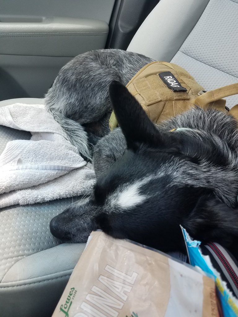
Radar after hiking up Waterrock Knob
Radar surprisingly slept almost the entire way back home. It was nice to get out and back up to the mountains. Being on the trail even for just a little while, helps put things back in place. Over all, a very therapeutic and worthwhile trip.