Just a quick aside. It’s been a busy first half of the year and the time has just gone by way too fast. I’m working on a several projects right now, a couple with work and at home. So the year has whizzed by. I’ve also recently had a woman’s group reach out to me, wanting a guided hiking or backpacking trip some time this fall. This sounds like a great opportunity to get out and explore. We’re still way early in planning, I’ve provided a list of possible weekend trips. I’m just waiting to hear back on the kinds of trip they are interested it. This would be a really awesome event if it all comes together. I haven’t had a really good escape to the woods this year yet so I’m looking forward to hiking this fall. I need a trip Radar can come camping with me. My next scheduled outing with my volunteer group will be to Lake Moultrie next month. Small boat sailing is on the agenda and a little lake time in August might just hit the spot.
#
Did you enjoy or find this post useful? Please let me know by leaving a comment below or join me on Instagram or Facebook.
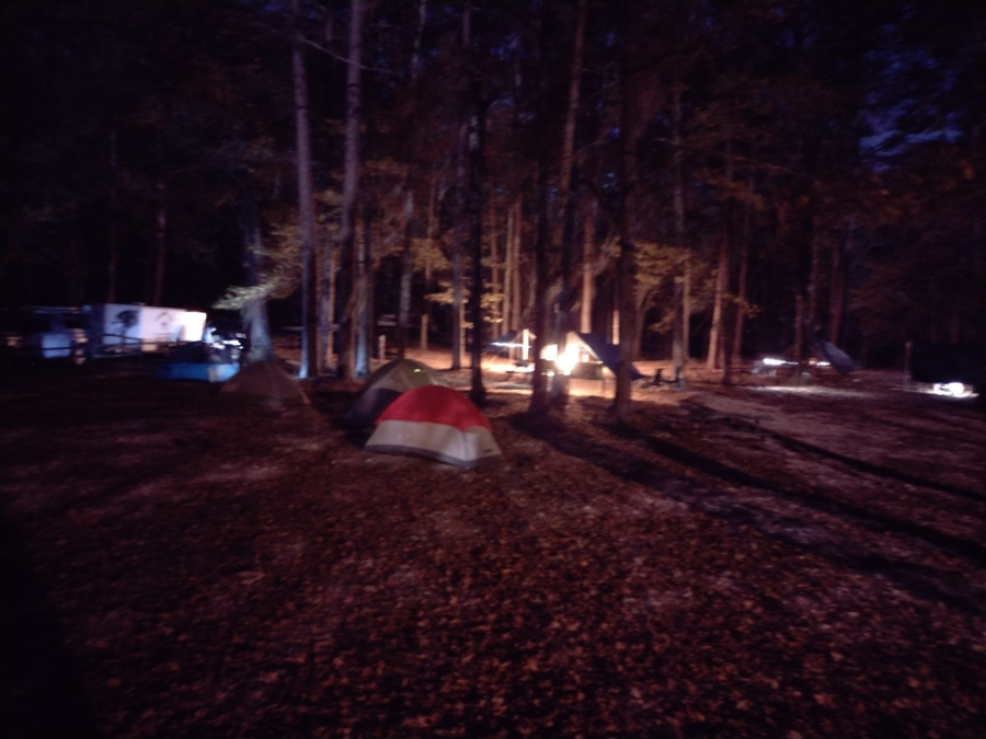
It’s been almost 10 years since I’ve last camped at Santee. It was nice to get back out to this park. Working with a youth group this time, we camped in the primitive “Scout Camping” area at Santee State Park. Santee is yet another State Park gem in the South Carolina State Park system.
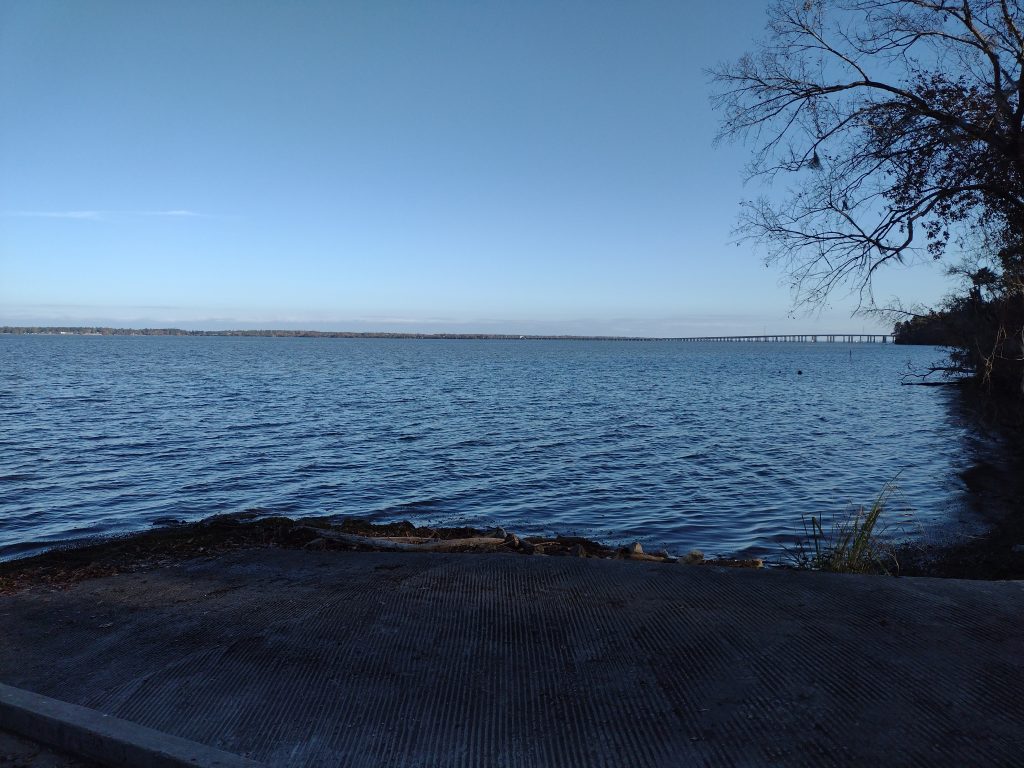
Santee SP boat ramp looking over Lake Marion
Set on the wester bank of Lake Marion, this park offers ready access to the lake, fishing, and camping. This 2500 acre park park in Santee Cooper County is easy to get to. It’s just 3 miles north of I-95 and the town of Santee. It’s a popular camping and recreation site for anyone seeking a break from the daily grind. While I’m usually found in the group or primitive campsite, there are about 158 standard camping sites, including 30 cabins. This park also has about 10 miles of bike/hiking trail. Somehow I’ve overlooked these in the past. I defiantly need to add these to my things-to-explore list for my next trip.
I’ve been to this camp dozens of times over the years. After a long hiatus, it was interesting to find virtually nothing had changed, at least at the primitive site. While functional, the primitive area old cold water bathrooms seemed exactly the same, down to the same peeling paint. Again functional, but unchanged in over a decade. I was able to get out of camp for a short walk. See a video of the hike here and let me know what you think.
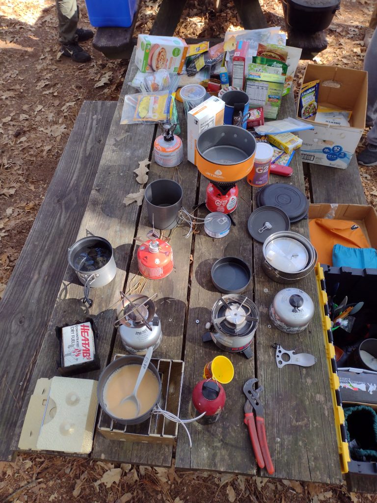
Cooking class
Our main purpose for this trip was to teach and model different cooking techniques for new campers. We included base camp and backpack style recipes, foods and food preparation, and cooking methods.
Free Recipe
Here is one simple quick backpacker recipe which everyone seemed to enjoy.
Chicken & Stuffing
Ingredients:
1 Package of Chicken/Turkey Flavored Seasoned Stuffing Mix
1 or 2 Foil Pouches of cooked chicken.
1/2 to 1 Cup of water

In a group size pot (+- 1 liter), boil the cup of water and remove from heat. Add the cooked chicken, stir. Add the stuffing mix, stir well. Serve.

A 12-once package of stuffing mix can feed about two hikers. Adding a couple 2 or 3-ounce packs of chicken will boost up the protein. You can fancy the meal up with a few cranberry raisins and chopped nuts stirred in from your trail mix too.
Favorite Time of year: Anytime for camping.
Things to Know: The breeze off the lake can be refreshing in the summer. However can lower the chill factor in the winter.
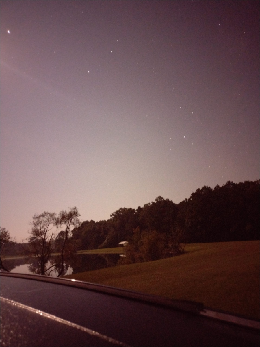
This past weekend I camped with a group of fellow campers on Johns Island. While not summer hot, the weather started out a bit warm.
Fall in South Carolina can still have some pretty warm weather. It can also have some of the best camping weather around. So far this fall the weather has been generally good with the heat of summer is gone, but the evenings still have been hovering between a little too warm and almost cool. Camping weather in the fall is some of the best here because its mostly dry, the bugs are fading, and the evening temperatures are cooler. The days are in the comfortable tee-shirt temperature zone and the nights can dip down in to the sleeping bag snuggling temperatures.
Activities while camping are great don’t get me wrong, but there is something special about camping sleeping. It’s a little complicated to explain, probably because there are so many things which affecting how well someone sleeps outdoors. Partly I think one of the benefits is your body gets to re-tuned and return to natures natural circadian rhythm. For me, one of the big contributors of a good nights sleep is temperature. Too warm and you’re laying in a puddle of sweat, too cold and you’re shivering, either way sleep doesn’t come easily when you are outside of the “great sleeping weather” zone.
When is something broken a good thing? When the heat of the summer breaks for the fall camping weather. There is something special about being a witness to the changing of weather. This past weekend I was able to see and feel this shift, the breaking in to the cooler fall camping weather. It rolled in as a small weather front Saturday afternoon. You could see the clouds moving in, covering the clear blue South Carolina sky. There was a light sprinkling of rain, and then just like that, the cooler weather was here. Sleeping that night, blanketed in a warm sleeping bag, in the shelter of my tent, was great.
#
Did you enjoy or find this post useful? Please let me know by leaving a comment below or join me on Instagram or Facebook.
Out for my first campout in at least six months, and the first two things which popped in to mind were my crocks and hot sauce, I forgot them. Surprisingly, I’m not overly disappointed.
A good pair of light camp shoes are a huge comfort item when out camping. After a day of walking around in shoes & socks, it’s a joy to slip in to some light and cool footwear. Especially when camping in coastal Carolina. Crocks reall fit the bill. Light & easy to carry, great for those 3 AM trips to the latrine. And I left mine at the house.
And my small bottle of hot sauce. I’ve got a 50/50 track record on bringing or leaving the sauce. I think it’s a habanero based sauce one of my sons gave me a while back. It has a nice heat and with just a drop or two, it lasts a long time. And it’s safe in my fridge, at the house.
I really should make a list of things I forgot, but I also just realized, I left my trail journal at home too. Sigh.
As we’re now in to full blown summer, remember to stay hydrated!
If you don’t get enough water, your body simply can’t perform as well and you could end up with heat related illness such as heat stress or heat stroke. Using a hydration bladder is way better than just bottled water. When people relying on just bottled water, they tend to wait until they are thirsty to get their water out and drink, then they gulp water. If you feel thirsty, your body is already becoming dehydrated. When using a hydration bladder you can sip continuously, greatly leveling out your water in-take and making staying hydrated easier. If you are sweating while hiking or working in the summer heat, remember you are dumping electrolytes too. You need to replenish them. Munching on salty snack as you hike helps keep both your energy levels up and replaces electrolytes you may be sweating out.
Carry plenty of water and a few snacks. Remember your pack will get lighter as the day wears on.
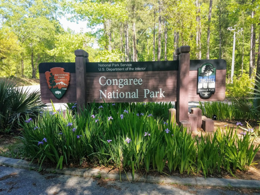
Radar and I hit the boardwalks of the Congaree National Park as part of our Palmetto Challenge and we were not disappointed. The last time I had visited the Congaree swamp area, it was the Congaree Swamp National Monument. There was just a basic visitor center, a few hundred feet of boardwalk, and an open field designated for camping. Congress did a great thing in 2003 when they re-designated the monument as the Congaree National Park.
Many improvements have been made as a result of the national park (NP) designation. The campsites have been upgraded to actual real designated camp sites with central latrines. There is paved parking and a new, much larger, visitor center which explains the history and importance of the entire Congaree basin. It’s here you can also pick up the map and narrative for the Self-guided Boardwalk Tour, which Radar and I did at the start of our walk. The best part of the the park improvements are expansion of the boardwalks and trails. There are almost two and a half miles of boardwalks with dozens of miles of foot trails winding deep through the rich swamp.
On the day of our visit, the weather was perfect. The trees were in their spring green and their high 130 foot canopy providing wonderful shade and a cool breeze. The river water however was elevated at just over 8 feet, and as part of the natural flood cycle, almost all of the low trails were underwater including a portion of the low boardwalk. We walked the low boardwalk out about a half mile to where the flooding waters took over. We stood at the waters edge and watched the water slowly making it’s way through the trees around us. It was kind of magical to be able to stand in the middle of a flooded, flowing swamp. We backtracked and followed the elevated boardwalk out to Weston Lake and then a little past where one of the trails intersected the boardwalk. The floodwaters prevented us from looping any of the trails this day, but we had a great time exploring anyway.
This park offers some great opportunities to explore a rare old growth forest, either afoot or afloat. You can hike deep in to the park on the River & Kingsnake trails. if you like paddling, you can take some amazing float trips through the swamp via canoe or kayak on Cedar Creeks and along the Congaree River itself. My first couple canoe trips in South Carolina were centered around the Congaree River and Swamp. My family and I canoed a very memorable 48 miles of the Congaree River, camping in the wilderness on the banks of the Congaree Park (National Monument at the time). The following month, I led a weekend canoe trek with my scout troop starting on Cedar Creek in the swamp and making our way out on to the Congaree River, again camping in the wilderness. Both trips were adventures in exploration of a wilderness not likely to be found anywhere else.
Conagree NP Weston Lake
As the largest remaining tract of old-growth bottom-land hardwood forest in North America, the Congaree National Park is a must-visit if you ever find yourself in the area.
Congaree National Park (120′) | SC 48 (Bluff Road) | Richland Co. | Hopkins, SC | 16 April 2019 | 6 miles | 106′ gain | Easy
Favorite Time of year: Spring and fall for camping.
Things to Know: Check the water levels prior to going, you can call or check the river gauges here. Please speak to a park ranger before setting a geocache.
Camping: You need a prepaid reservation for front-country campgrounds, you can make reservations through Recreation.gov or by calling 1-877-444-6777. Back-country camping is allowed please the the Camping page of the NP site for details.
Pet friendly: Pets allowed in most outdoor areas but must be physical restraint or on a leash not longer than six feet. Be respectful of others on the boardwalks.
Getting There: Congaree NP is in the midlands of South Carolina, just South of Columbia about 30 miles, East of I-26 and South of I-77, just off Old Bluff Road. It’s about an hours drive from the Charleston area.
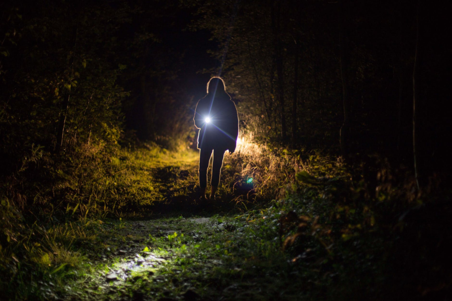
Are you looking for a new or replacement headlamp but not sure what to get? Between styles, cost, weight, lumens, batteries, different settings etc. It can get really confusing. Check out this headlamp guide from REI, it’s a great resource to help sift through some of the jargon. Whatever you settle on, consider a headlamp which uses common (AA or AAA) batteries. My headlamp uses AAA’s and I can a long time between needing to re-battery. A few years ago, while section hiking a part of the Appalachian Trail, I met a fellow hiker in the Nantahala Outdoor Center gear store. He was very frustrated, his “fancy” headlamp used special button batteries and of course the batteries had died several days prior. He had dropped off trail a couple times trying to find new button batteries with No-Joy, he couldn’t find replacement batteries anywhere and finally ended up just buying a new headlamp. Increasing your gear reliability and supportability will help save yourself some miles of future frustrations.
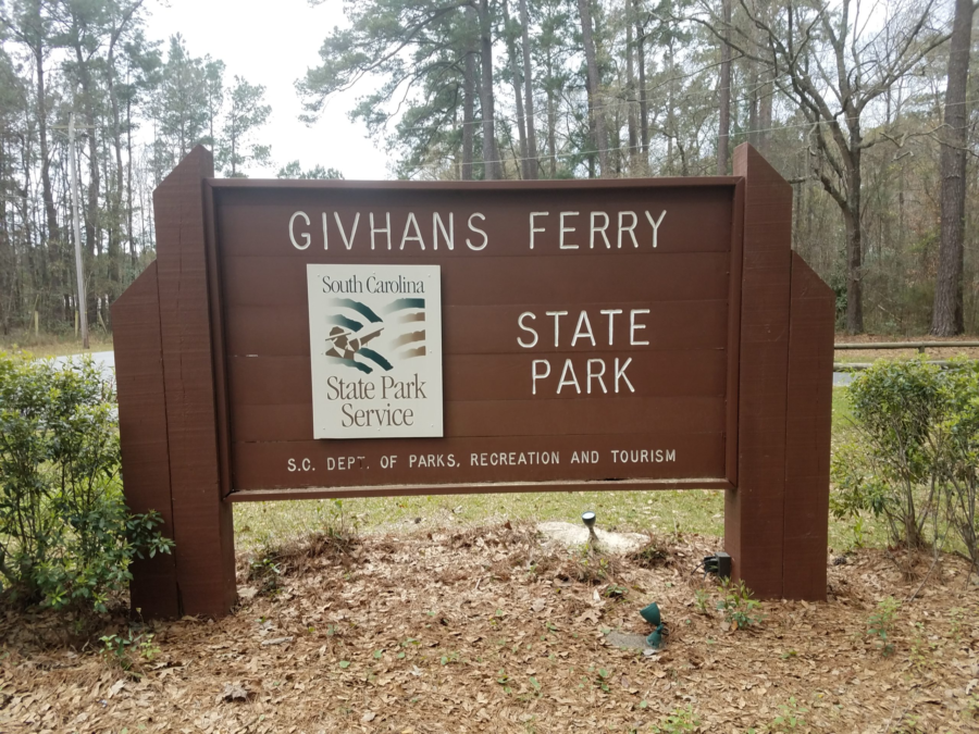
Located on the high limestone bluff on a gentle bend in the Edisto River, Givhans Ferry State Park offers a relaxing place to sit and watch the river flow by.
Relax on the porch of the Riverfront Hall a popular spot for family gatherings (from the SCSP web site).
Just 35 miles from downtown Charleston, Givhans Ferry has cabins, RV, and standard tent sites, as well as a primitive camping area. This park has the unique distinction of being located at the end of the 23-mile Edisto River kayak and canoe trail which begins upriver at Colleton State Park. The Edisto River is the longest free-flowing, blackwater river in North America. There is a really nice sand beach for wading and swimming along with a new integrated ramp for launching and recovery of canoes and kayaks making this a must do for paddle craft sports.
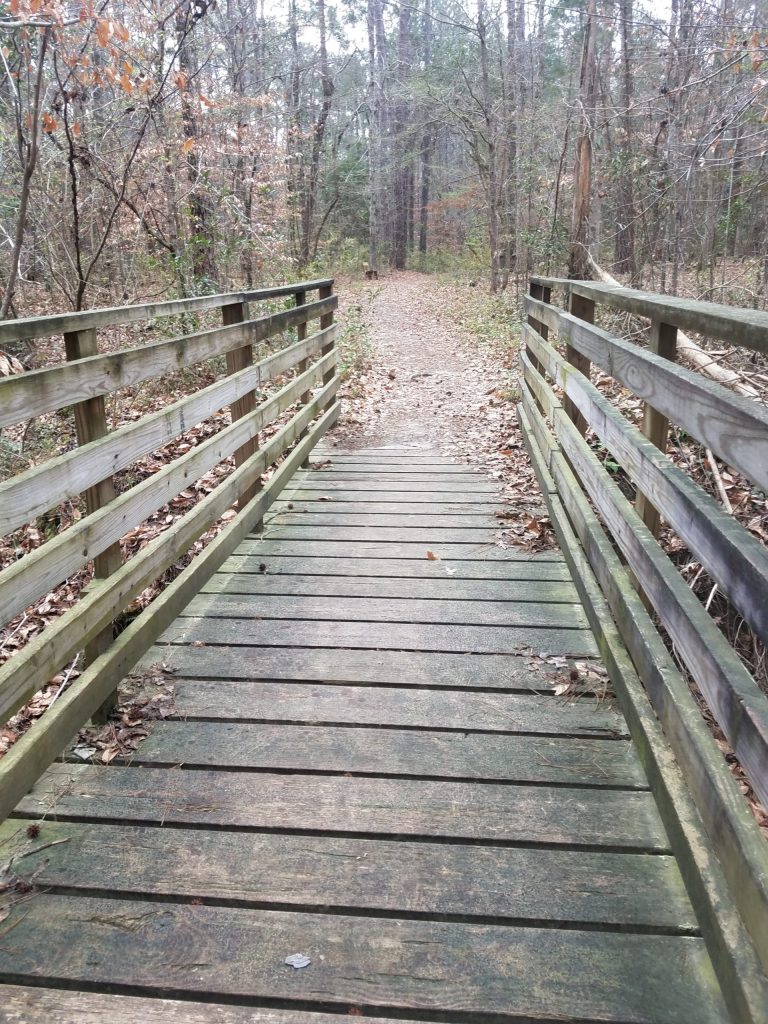
The bridge in Givhans Ferry State Park on the River Bluff Trail
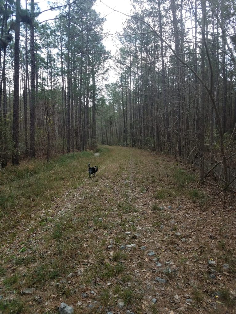
For hiking, Givhans has a fairly short 1.5 mile River Bluff trail in the main park, however if you cross the road at the park entrance you can pick up the 4.7 mile Old Loop Trail which winds around the perimeter of the largely undeveloped park boundary with woods on both sides. Radar and I took a day and hiked both the River bluff trail and then the Old Loop trail as one big loop, for just over 7.4 miles returning to where we started.
Hiking the Old Loop Trail with Radar
The park is located where there was a ferry crossing the river dating way back to the 1700’s. In the 1930’s, this was one of the original 16 South Carolina state parks built with the help of the Civilian Conservation Corps. The park consists of about 988 acres and offers swimming, fishing, boating, and bird watching. There are also picnic shelters, a playground, and several geocaches are located on the park.
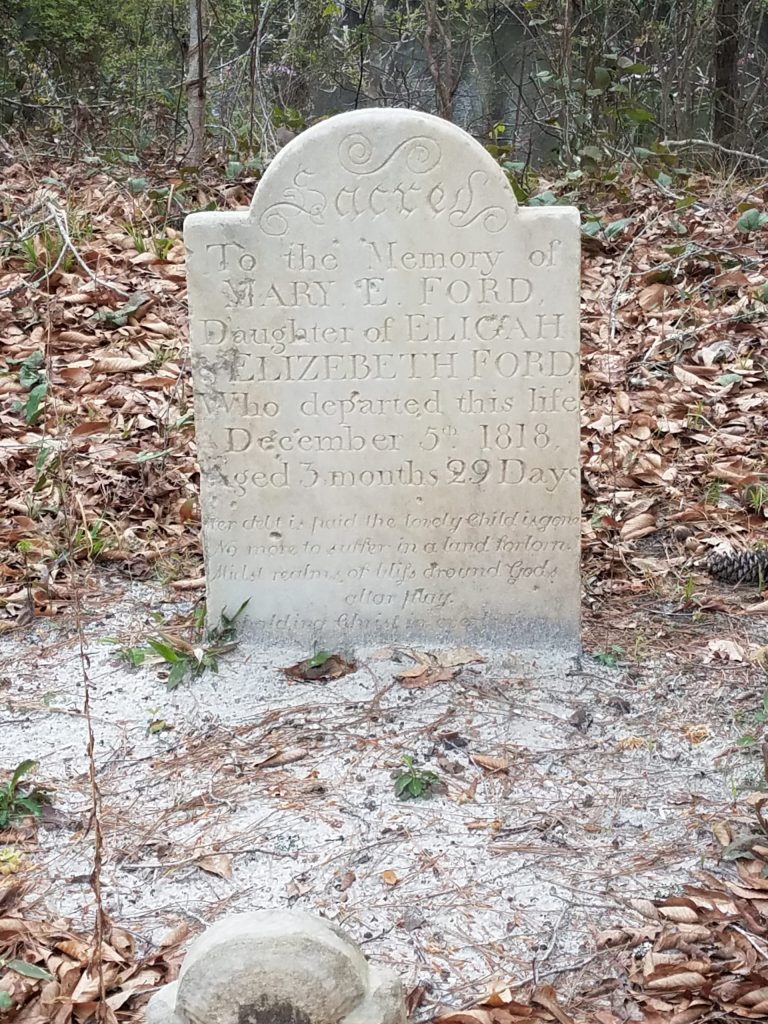
On the bluff is a small grave for Mary E. Ford
Givhans Ferry State Park (123′) | County Rd S-18-30 |Ridgeville | Dorchester, SC | 11 March 2019 | 7.4 miles | 163′ gain | Moderate
Favorite Time of year: Spring and fall for camping.
Things to Know: Please speak to a park ranger before setting a geocache. Swimming is permitted in the Edisto River, but with no life guard, at your own risk of course.
Camping: Camping from RV to primitive is available at Givhans. go here for reservations or call (843) 873-0692.
Pet friendly: Pets allowed in most outdoor areas but must be physical restraint or on a leash not longer than six feet.
Getting There: Givhans is in the lowcountry of South Carolina, just East of Summerville, between I-95 and I-26, just off SC-61N. It’s about an hours drive from the Charleston area.
Looking to upgrade or replace gear? Watch for sales.
I know, I know. This sounds like “duh, no kidding.” It’s tempting, but new camping – hiking – backpacking gear can be crazy expensive. If you want to sale a little money, be patient and spend some time figuring out what you’re really looking for in a particular item. There’s so much information available now you can compare features and pricing easily. Considering last years model may save you considerably on “new” gear. Expect to pay full retail price on the new gear when it first comes out. When the “latest and greatest” new gear does come out however, stores will often discount the old or last years model to move it to make room for the new. I had been thinking about a new backpack for some time but the packs I had been considering were several hundred dollars and I just couldn’t make the plunge. And as luck would have it, one day there was an ad, I did some quick research, and was able to pick up a name brand backpack for half price because it was last years model. The best part is it’s also half the weight of my old pack!
There is little worse than being warmly huddled in a tent at 2 AM as the heavy rain starts, and there is a drip on your forehead. Except maybe waking up cold and wet to a flooded tent. Depending on how often you camp or use your gear, applying a fresh coat of waterproofing at the beginning of the season helps keep you happy when it rains.
The obvious item to hit is the tent rain fly, but also consider a healthy application of water proofing on other exposed tent fabric, backpacks, shoes, and even your rain gear. After several years of wear and tear and cleaning and washing, some of the original waterproofing may need a boost. Another useful tool in the weather proofing toolbox is seam sealer. Check the stitched seams for your rain fly’s and exposed tent seams for old or no sealer. It’s a huge help in stopping leaks where stitching pokes holes in the fabric. Apply as needed and of course follow the manufacture application instructions.
Checking your gear and applying fresh waterproofing and seam sealer (as needed) at the beginning of the camping season goes a long way toward extending the life of your tent and other gear, not to mention keeping have a dry place to go when the rains come.