The journey of a thousand miles begins with the first step, and this is mine.

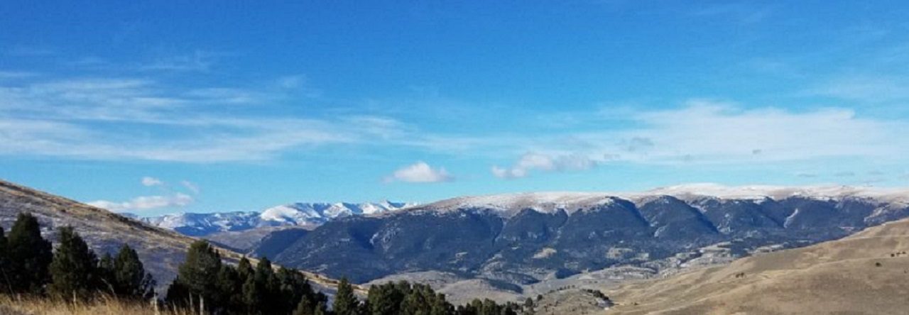
Montana Mountains

Tag: backpacking Page 2 of 5

Outdoor Tips – Stay Hydrated

As we’re now in to full blown summer, remember to stay hydrated!

If you don’t get enough water, your body simply can’t perform as well and you could end up with heat related illness such as heat stress or heat stroke. Using a hydration bladder is way better than just bottled water. When people relying on just bottled water, they tend to wait until they are thirsty to get their water out and drink, then they gulp water. If you feel thirsty, your body is already becoming dehydrated. When using a hydration bladder you can sip continuously, greatly leveling out your water in-take and making staying hydrated easier. If you are sweating while hiking or working in the summer heat, remember you are dumping electrolytes too. You need to replenish them. Munching on salty snack as you hike helps keep both your energy levels up and replaces electrolytes you may be sweating out.

Carry plenty of water and a few snacks. Remember your pack will get lighter as the day wears on.

#

Roan High Knob Survey Marker

A new adventure in the Southern Sixers

A couple years ago and for a lot of different reasons, I had set and completed the goal of climbing Pikes Peak in Colorado and was able to successfully “bag” my first Fourteener. It was only after I had set my Pikes Peak goal, I learned climbing mountains over 14,000 feet is a thing. Especially in Colorado since they have something like 53 of these beasts. I feel like I would like to try some more of them, maybe, but I would probably need to live in Colorado.

Just this week however, I learned of something called the “Southern Sixers.” These are the tallest mountains in the eastern United States which are all over 6,000 feet. All (besides New Hampshire’s Mount Washington) are in and around the Appalachian mountains of North Carolina and Tennessee. “Wow,” I thought, they sound close to home, maybe I could hike a couple of them. I did a little research, pulled up the list of mountains, and noticed a bunch of very familiar names. Low and behold, it looks like I’ve already hit about a quarter of them!

Now it’s time to start planning to bag the rest of them.

#

Outdoor Tips – Headlamps

Are you looking for a new or replacement headlamp but not sure what to get? Between styles, cost, weight, lumens, batteries, different settings etc. It can get really confusing. Check out this headlamp guide from REI, it’s a great resource to help sift through some of the jargon. Whatever you settle on, consider a headlamp which uses common (AA or AAA) batteries. My headlamp uses AAA’s and I can a long time between needing to re-battery. A few years ago, while section hiking a part of the Appalachian Trail, I met a fellow hiker in the Nantahala Outdoor Center gear store. He was very frustrated, his “fancy” headlamp used special button batteries and of course the batteries had died several days prior. He had dropped off trail a couple times trying to find new button batteries with No-Joy, he couldn’t find replacement batteries anywhere and finally ended up just buying a new headlamp. Increasing your gear reliability and supportability will help save yourself some miles of future frustrations.

#

Eutaw Springs Passage of the Palmetto Trail

South Carolina – Eutaw Springs & Santee Passages

Are you looking for a nice +20 or 30 mile section of trail to take you through shaded woods and rolling meadows to see nature while you hike or backpack? Possibly a secluded camp overnight? Then these two sections of the Palmetto Trail are not for you.

The Eutaw Springs Passage is a 21.3 mile section and the Santee Passage is a 12.7 mile section of the Palmetto Trail bridging the end of the Lake Moultrie Passage to the south and the Lake Marion Passage to the north. I selected both of these sections to explore and hike with Radar as part of our Palmetto Challenge mileage. Boy was I surprised.

Often when trails overlap roads out of necessity, the trails will run parallel with roads. Sometime the trails will be just off the road in the woods, occasionally using a short section of asphalt as a bridge or to link the actual hiking trail. So when I looked at the maps for these areas, I didn’t think anything of the route following along the roads. However, in this case the roads are the trail. Make no mistake here, there is no hiking “trail.” You will be walking along the roadway. For miles. There are short sections of wooded hiking trails used to link the miles of roads these routes claims to be. Out of the 34 miles these two sections make up, there is only like about 5 miles of what most people would call actual hiking trails. There is a statement included on the back of the Eutaw Springs map which states:

“Much of this trail uses rural highways and dirt roads. You should prepare for possibility of unleashed dogs and wear bright clothing (and reflectors) to warn drivers. The spur trail is occasionally wet and muddy”

I can honestly say, it’s an understated but accurate statement. I drove from the start of the Eutaw Springs Passage to mile 7 before I could find where any of the “trail” left the road for a walk in the woods. The trail section from mile 7 to 9 is a wooded trail. Radar and I hiked this in and back, enjoying a light trail side lunch. At mile 9 the wooded trail yields again to more paved road. Once we got back to the car, we drove most of the remaining route trying to identify any remaining wooded trails. Absolutely much of the roadway travels through rural neighborhoods and communities on the southwest side of Lake Marion. To call some of the houses, trailers, and buildings along this section of trail “rustic” might be a bit too generous. It looks like from mile 10.5 to 12.2 is another wooded trail section joining roads. Fedcon Road (miles 12.5 to 17) is a deceiving dirt road which was impassable somewhere around mile 15 due to really heavy deep mud ruts. There was a pick-up truck with an older guy and his hound dog, traveling ahead of us, which ended high-centered and stuck. I tried to help push him out but we ended up turning around in my car and taking him and his pup back to his home so he could get a wrecker to extract his truck from the mud.

I would not recommend hiking any of this section in the summer as you will be out on the open road and under the sun 90% of the time. And I wouldn’t hike if it’s rained recently. While most of the roads will be fine, any actual hiking trail will likely be wet and or muddy. The Rocks Pond camp ground (about a mile down campground road from mile 13) is mostly RV sites but likely has some tent sites as well. The other camp site on the trail (about mile 18.5) we didn’t make due to helping out the stuck truck, but looks like it’s on the only other section of wooded trail. We explored the Santee Passage section and it’s virtually all roadway with no designated camping.

The one really cool place to visit is in Eutaw Springs. Located just past a turn in the trail/road is the American Revolutionary War era Eutaw Springs Battlefield. This was one of the last major engagement of the war in the Carolina’s, both sides claimed victory. We forget sometimes, how old our country is and the sacrifices our forefathers made to create a new nation. Definitely worth stopping, walking, and reading the self guided interpretive signs around the battleground.

Favorite Time of year: Maybe the Spring and fall (low bug time) for camping when its cool and dry.

Things to Know: You will be traveling on public roads most of these two trail sections. Pick a day with good cloud cover and use a good sunscreen.

Camping: RV and tent camping is available at Rocks Pond Campground, trail side primitive camping around mile 18.5 on the Eutaw Springs Section. There is no designated camping in the Santee Passage Section.

Pet friendly: There are no known restrictions on the trail but I would keep on leash while on the roadways. Watch for unleashed local dogs.

Getting There: The Eutaw Springs Section starts at the Diversion Canal, about an hours drive from the Charleston area. Good luck.

#

Outdoor Tips – New Gear

Looking to upgrade or replace gear? Watch for sales.

I know, I know. This sounds like “duh, no kidding.” It’s tempting, but new camping – hiking – backpacking gear can be crazy expensive. If you want to sale a little money, be patient and spend some time figuring out what you’re really looking for in a particular item. There’s so much information available now you can compare features and pricing easily. Considering last years model may save you considerably on “new” gear. Expect to pay full retail price on the new gear when it first comes out. When the “latest and greatest” new gear does come out however, stores will often discount the old or last years model to move it to make room for the new. I had been thinking about a new backpack for some time but the packs I had been considering were several hundred dollars and I just couldn’t make the plunge. And as luck would have it, one day there was an ad, I did some quick research, and was able to pick up a name brand backpack for half price because it was last years model. The best part is it’s also half the weight of my old pack!

Outdoor Tips – Seal It

There is little worse than being warmly huddled in a tent at 2 AM as the heavy rain starts, and there is a drip on your forehead. Except maybe waking up cold and wet to a flooded tent. Depending on how often you camp or use your gear, applying a fresh coat of waterproofing at the beginning of the season helps keep you happy when it rains.

The obvious item to hit is the tent rain fly, but also consider a healthy application of water proofing on other exposed tent fabric, backpacks, shoes, and even your rain gear. After several years of wear and tear and cleaning and washing, some of the original waterproofing may need a boost. Another useful tool in the weather proofing toolbox is seam sealer. Check the stitched seams for your rain fly’s and exposed tent seams for old or no sealer. It’s a huge help in stopping leaks where stitching pokes holes in the fabric. Apply as needed and of course follow the manufacture application instructions.

Checking your gear and applying fresh waterproofing and seam sealer (as needed) at the beginning of the camping season goes a long way toward extending the life of your tent and other gear, not to mention keeping have a dry place to go when the rains come.

#

2019 Palmetto Challenge

He doesn’t know yet …

I signed us up for the 2019 Palmetto Trail Challenge and Radar is going to be my plus one. He just doesn’t know it yet.

This 48 day event is hosted by the Palmetto Conservation Foundation (PCF) and is intended to inspire teams to hike or bike as many miles as possible between March 11 and April 28 “on the state’s trails, greenways, sidewalks, and hallways” (yes, they said hallways).

This is great motivation to get out and hike more. I needed some trail time to help me prepare for this summer’s Appalachian Trail section hike with our volunteer group this summer. I’ve been doing fair amount of daily walking (along with other fitness stuff) around the neighborhood, but I want to get out more and see some of the local trails too. The challenge sounds kind of open ended if it includes “hallways” but I intend to use the challenge to close some of the trail section gaps I have in the Palmetto Trail, as well as hit the local trails around me. For Radar, he loves taking walks and hikes with me. He regularly walks with me in the neighborhood and we have done a couple day hikes in state parks like Lee and Croft, he has been a really great trail partner. With this challenge I hope to include at least one overnighter with him. I fully expect to work him (and me) up to both our longer hikes and our first over night camping experience. This should be a great learning experience for both of us. I’m excited for him. He just doesn’t know it yet but he’ll be excited too.

Radar sporting his Ruffwear day pack
Radar Radar sporting his Ruffwear day pack

So, whats a challenge without a goal? I’m going to put 200 miles on the table as our goal. We’ll see. I thing it’s obtainable with enough stretch to be motivating. But I’m not including any hallways.

Each week the teams send in their prior week total mileage, it gets recorded and displayed on the PCF website to help motivate the other teams. It seems last years participants hiked 8,000 mikes. If you are interested in taking up the challenge, then March 4th (noon) is the last day to register!

#

Good News for South Carolina State Parks!

But why isn’t this it’s own news story?

In today’s local paper, it was reported state tourism is at record levels “marking six years of consecutive record-breaking growth for the state’s visitor industry” according to the Post and Courier. Buried about half way through the article was a couple paragraphs indicating the state park system has “become almost entirely self-sufficient.”

Traveling across the country, I’ve often camped at parks. They are a welcome change from the commercial overcrowded main-stream lodging options. I love state and federal parks, there is so much hidden beauty and history in them. When I first moved to South Carolina over twenty years ago, it was readily apparent the states parks were under funded and under maintained. Kind of like a well worn deck of playing cards, a bit worn around the edges. Heck, some were out right in horrible shape. Colleton State Park was little more than a gate with a dirt road to the river front. Today it’s a little gem in the South Carolina crown of park jewels. This rise from the dust didn’t happen overnight and improvements across the state seem to be ongoing. A lot of hard work by dedicated park rangers have elevated each park from dependency to independence.

Having a park system which is paying their own way is a huge plus-up for the state. With over $30 million in park revenue last year they are just about paying their own way now and still improving. The powers that be are to be commended for the long hard trail to self-sufficiency they have been hiking. Support your local parks system, Come Out & Play!

#

It’s a WIN!

The headlines of the Chicago Tribune read “Senate backs biggest conservation bill in a decade, protecting millions of acres of land and adding four national monuments”. This is great news not just for the outdoors folks but really for all Americans and here is why.

This is one of the biggest outdoor conservation bills in a long time and it looks like it’s been done right. While the bill still needs to make it through the House and then be signed by the President, this bill has an impact in just about every state of the nation and when signed, will have a positive and lasting impact for a long time to come.

The Senate, working together, in a seemingly and sometimes rare bipartisan manner, passed S.47 – Natural Resources Act. The bill is to protect millions of acres of land, hundreds of miles of wild rivers, and establishing four new national monuments. Legally, by congress coming together to pass federal legislation. This is hugely important to the outdoor community and should be as important to everyone. The outdoor community at first was celebratory with former President Obama’s executive orders declaring new areas as protected lands, then anguishing as current President Trump looked at undoing some of these “protected” areas. Many may have felt rightly upset, as if the outdoor conservation rug had been pulled out from under them.

This bill makes a giant step forward in cementing the protection of what Americans love about our lands. From wilderness area, to historical areas, to outdoor sports and activities we enjoy, this bill has something for just about any one who steps outside of their house. This new legislation is a huge win for everyone really. If you read the Tribune’s article, you get an idea of the magnitude of this piece of legislation. And unlike executive orders, bills like this will have the proper funding to go with it for park and program maintenance.

The value of this bill really struck home with me as I was reading over the introduction in Section 1 of the bill. One of the very first things I read was about the Crags Land Exchange to enhance the Pike’s National Forest and provide permanent trail easement. This is the side of Pikes Peak I climbed with my family. For me anyway, this is an amazing section of trail and land. The experience was something I will hold dear to me. If any of the rest of the areas or items in the bill are worth even a fraction of the Crags portion and my experience hiking there, then this bill is priceless in providing current and future generations with the best outdoor experience possible.

#

Outdoor Tips – Land Navigation

Staying found is both a skill and an art. Having solid map and compass skills are invaluable when exploring the outdoors, even if you are using modern digital navigation tools. Traditional map and compass know-how will make you a better navigator and help you stay found. 

The first thing you need is a good basic compass. Here I lean toward simpler is better. I have an old starter compass I always carry with me backpacking as my go to compass. It’s fairly small, light and easy to use. Something simple like the Silva starter compass is inexpensive, works really well, and is small enough fit comfortably in a pocket or leave in a pack so you will be more likely to have it with you.  The main features your compass really need are a rotating degree ring or bezel with clean easy to read graduations, an index line, and clear base plate with a direction of travel arrow. These features make it easier to read a map with the compass and plan a course. At least initially, I would stay away from folding or lensatic compasses, small button or pendant compasses, compasses with bells, whistles, mirrors, and hard to read dials. There are lots of great internet learning resources and videos such as REI’s How to use a Compass video, Backpacker’s and WikiHow’s How to Use a Compass instructions. If you buy new compass it likely will come with instructions as well, read them and practice a little.

Being able to using a map and compass together allows you match the physical terrain of where you with your location on the map and plot a course when you need to go or where have come from.  Any map is better than no map. Even a simple hand sketch of a map is better than no map. If you can, use a map with good detail for the area you’ll be navigating. Unlike with the compass, the more detail in the map the better. I can navigate a whole lot better with a simple compass and detailed map, than I can with a complicated compass and simple map.  And use the map for planning so you can better picture and orientate the map to you location. Look for a maps compass rose or symbol. Most of the time the top of the map will be North, unless there is a compass symbol. Once you can figure out the map north then look for some sort of scale. Now you can measure direction and distance. You’re ready to navigate now. 

A few tips: When selecting a compass, try reading the dial in a dark room or area of the store, when you really need a compass it’s often in poor lighting. Some markings and graduations are difficult to read in low light. Keep the compass away from metal objects when using it. Things like belt buckles, watches, necklaces may affect the magnetic needle of the compass. Also be sure to hold the compass base plate flat and level so the compass needle can float and move freely. 

Knowing how and being able to use a map and compass together will help ensure you stay found and when other things go wrong, these skills will help you find your way.

#

Page 2 of 5

Powered by WordPress & Theme by Anders Norén