The journey of a thousand miles begins with the first step, and this is mine.

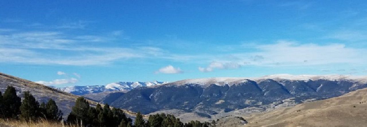
Montana Mountains

Category: Uncategorized

Expired SC Tag

Be aware. Watch out for these people and give them a wide berth.

I think I noticed this because it’s January and a new year. Every state has different rules but in South Carolina, the vehicle tag registration decals are a different color each year. For 2024 vehicle registration decals were yellow and the 2025 decals are green. So, I’m thinking as I’m driving January should be the only month where all the cars, excluding the tags being renewed this January, all SC vehicle tags should be green. Yet while traveling around town, I noticed a surprising number of yellow registration tags still out there.

Have you ever noticed something when you focus on one thing, you start seeing it everywhere? At first I thought well maybe this one vehicle tag ahead of me is just a January 2024 registration yet to be updated by the end of the month. In about 15 minutes of driving, I noticed no less than a dozen expired tags. As I looked closer, surprisingly, yes there was a January 2024 sticker or two, but most of these yellow stickers were months old. A couple were from December but many were older, from October, September, and August, at least one as old as June. What the heck?

I started thinking about what this means. Besides the “oops I forgot to put the sticker on my plate” excuse, it may mean the taxes weren’t paid. It’s a sign registration is likely expired. And then it hit me. They may not be insured. In South Carolina vehicles are required to be insured if they are registered and operated on public roads and having an expired vehicle registration sticker is a “primary offense.” This means it’s all law enforcement needs to see to initiate a traffic stop.

When I worked in federal law enforcement, I would always profile a vessel with an observable violation. If I could see a broken law from a distance, it never failed, the boat always had multiple violations of the law once you boarded and inspected the boat and crew. That vehicle driving around on expired tags probably has lapsed or no insurance at a minimum. They very likely have other illegal things going on, and are a menace to those around them.

In the last five years, I’ve known dozens of people hit (sometimes hit-and-run) by people driving with no insurance. Most of the this the other driver has had no insurance and often has been either DUI or “undocumented” or both. It’s never been fun for the victims and sometimes it’s been life-changing.

#
Hiking South Carolina – Croft State Park

If you like the outdoors, then Croft State Park has something for you. From horses to bikes to hiking to boating to shooting sports, this park offers a heavy helping of fun for everyone and is another outstanding South Carolina destination to explore.

Located in the rolling, wooded terrain of the upstate, Croft has an amazing amount of trails within the park to explore. All the 50 miles of trails at Croft are open to hikers and include the 12.6 mile Croft Passage of the Palmetto Trail, almost 17 miles of trails for Mountain Bikes, and another 17 miles of horse trails. While my girlfriend rode the horse trails with her friends, Radar and I took a day and hiked just about 13 miles of various trails including 8.5 of the Palmetto Trail section. We barely scratched where we could go.

This park opened in 1949 and with 7054 acres, is the third largest in the South Carolina State Park system. Besides the hiking, biking, and horseback riding, this park is packed with other things to do too. There are about 190 acres between the two lakes which support fishing, boating, and bird watching. There are picnic shelters, a playground, and several geocaches are located on the park. This is also one of the few South Carolina Sate Parks with a shooting range (contact the park for more information).

Favorite Time of year: Anytime for camping.

Things to Know: Please speak to a park ranger before setting a geocache. Swimming is not permitted in the lake, but you may wade in the Fairforest Creek at your own risk of course.

Camping: Camping from RV to primitive is available at Croft. Call 1-866-345-PARK (or go here for reservations).

Pet friendly: Pets allowed in most outdoor areas but must be physical restraint or on a leash not longer than six feet.

Getting There: Croft is in the upstate of South Carolina, just 5 minutes South and East of Spartanburg, between I-26 and US-176. It’s about a 4 hour drive from the Charleston area.

#

International time traveler and other recent discoveries (part 2)

I’ve been in Okinawa visiting with my daughter and her family for just over a week now. They have been stationed here since the spring. I haven’t seen her or my granddaughter in a while, so a quick visit before Christmas seemed like a good idea. I have seen some pretty “cool” and amazing things. Things like, they have food on conveyor belts, and you just eat as much and whatever you want. You don’t even need talk to a person to order anything. Kind of a point and click situation. That works really well here because they don’t speak English and I don’t speak Japanese (or Okinawan).

Note to self: must work on the language thing next time when time traveling.

Since coming here to Okinawa, I have spent time discovering and learning a little about the island. With my daughter as guide, we visited some historic places, a little bit of traveling back in time if you will. We visited the Urasoe castle ruins at Kakau ridge (Hacksaw ridge) and the Shurijo castle, site of the former Japanese Naval underground HQ. During the second world war, great battles were fought at these sites. Okinawa has a deep history of it’s own right, which unfortunately, has been clouded some with the events of the last world war. It was quite thought provoking, to visit these ancient castle sites and battlefield memorials in a country where they didn’t win. To see how they wrote the history of what happened, humanizes this opponent from long ago. For me I developed a better understanding of the differences between the two cultures of Imperial Japan and Okinawa. It offers a bit of historical insight you can’t find in a book. It’s sad to think of all of the lost lives when the world degrades to total war. Sigh.

We even climbed a mountain, Mt. Katsu Dake. While not the highest point in Okinawa, Mt. Katsu Dake is an honest climb and provides absolutely amazing 360 degree views of the island. I’m told way better viewing than some of the taller peaks (due to the vegetation). Well worth the trip up, but bring plenty of water and solid hiking shoes. The rocks are both treacherously slick and razor sharp, makes for an interesting combination. Ri, my daughters family dog, had worn pup boots which were totally appropriate for the rock climbing over lava rocks.

We did some of the normal tourist things too with shopping and eating. It was fun exploring the shops and trying different foods and tastes. I like food and flavors. The Okinawa people are some of the nicest and most polite people I have ever met and truly a pleasure to interact with. The cars are little here. It’s okay because they just seem to fit. Most of the cars are small compact cars, but they do have the equivalent of some US cars like the Cube and Toyota’s but they all have little tires which make them seem smaller. Oh and they drive on the “wrong” side of the road. As a new passenger, it’s best to not try to pay attention to traffic, let the driver drive, and just enjoy the scenery. Strangely there is no wood (very little) to speak of on the island, so everything is made of cement, even the wood is made of cement here. The “logs” used in the hiking trail and for railings and fences, they are all cement with a faux wood finish. The houses are smaller here. And concrete. almost all buildings are concrete, concrete block, or some combination. A wood frame house is not a thing on this island. There are some small farms. Most seem little more than communal garden plots really, probably local produce. The locals grow small crops and raise a few cows (probably dairy?). I watched a farmer cutting hay. By hand. And then fork into the back of a little truck. The hay field was less than a half acre. I went to a beach with my daughter and granddaughter and watched the sun rise. Sometime around 1992, I touched the eastern side of Pacific Ocean. This week I touched the western side of the Pacific too.

I do like traveling and exploring. Traveling half way around the world however can be a kick in the head, but once you arrive and get settled, the key is to enjoy. I’m actually on the return trip to home now, in a lay-over in Taiwan. I’m waiting for the big time travel hop to New York. I actually take off from here at about 5:30 pm on 12/23 and land in New York 7:15 pm on 12/23 (I know it’s really like a 15 hour flight). Anyway, the best part of this whole far east adventure was really getting to see my daughter and spend a little bit of time with family. I’m heading home now for Christmas with my girlfriend and the some of the rest of my family. I can’t wait until we can all together again in one country. I love you all.

Outdoor Tips – Land Navigation

Staying found is both a skill and an art. Having solid map and compass skills are invaluable when exploring the outdoors, even if you are using modern digital navigation tools. Traditional map and compass know-how will make you a better navigator and help you stay found. 

The first thing you need is a good basic compass. Here I lean toward simpler is better. I have an old starter compass I always carry with me backpacking as my go to compass. It’s fairly small, light and easy to use. Something simple like the Silva starter compass is inexpensive, works really well, and is small enough fit comfortably in a pocket or leave in a pack so you will be more likely to have it with you.  The main features your compass really need are a rotating degree ring or bezel with clean easy to read graduations, an index line, and clear base plate with a direction of travel arrow. These features make it easier to read a map with the compass and plan a course. At least initially, I would stay away from folding or lensatic compasses, small button or pendant compasses, compasses with bells, whistles, mirrors, and hard to read dials. There are lots of great internet learning resources and videos such as REI’s How to use a Compass video, Backpacker’s and WikiHow’s How to Use a Compass instructions. If you buy new compass it likely will come with instructions as well, read them and practice a little.

Being able to using a map and compass together allows you match the physical terrain of where you with your location on the map and plot a course when you need to go or where have come from.  Any map is better than no map. Even a simple hand sketch of a map is better than no map. If you can, use a map with good detail for the area you’ll be navigating. Unlike with the compass, the more detail in the map the better. I can navigate a whole lot better with a simple compass and detailed map, than I can with a complicated compass and simple map.  And use the map for planning so you can better picture and orientate the map to you location. Look for a maps compass rose or symbol. Most of the time the top of the map will be North, unless there is a compass symbol. Once you can figure out the map north then look for some sort of scale. Now you can measure direction and distance. You’re ready to navigate now. 

A few tips: When selecting a compass, try reading the dial in a dark room or area of the store, when you really need a compass it’s often in poor lighting. Some markings and graduations are difficult to read in low light. Keep the compass away from metal objects when using it. Things like belt buckles, watches, necklaces may affect the magnetic needle of the compass. Also be sure to hold the compass base plate flat and level so the compass needle can float and move freely. 

Knowing how and being able to use a map and compass together will help ensure you stay found and when other things go wrong, these skills will help you find your way.

#

Pikes peak through The Garden of the Gods

There is snow on Pike’s Peak

According to the Denver Post, Pikes Peak picked up some snow this weekend and commented as a fitting indication of the start of the changing seasons.

Last year I hiked to the peak of this amazing mountain with my family and absolutely loved it (now I’ve been able to catch my breath – at the time I think I probably just liked it). I loved hiking this mountain and would hike it again and again if I could.

The new piece from the Denver Post was one of those blips which shows up in your news feed. It reminded me how thank full I was then and am now. So many thing can change in a persons life over a year, I think it’s important to recognize the good things which happen and the good people which happen to you.

#

Outdoor Tips – Sleeping Warm

Avoid hypothermia – Never sleep in wet clothes, I tried this once, horrible idea. You should change out of your day activity clothes and into night or sleep clothes. You perspire during the day, and even with layers of clothes it will be likely the inner layers are damp although you may not realize it at the time until it’s too late. The dampness will cause you to chill at night. Leave your day clothes out to dry or air out overnight. Absolutely change your socks to a dry pair for sleeping.

#

Powered by WordPress & Theme by Anders Norén