The journey of a thousand miles begins with the first step, and this is mine.

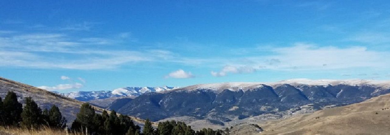
Montana Mountains

Tag: hiking Page 6 of 7

Hiking South Carolina – Colleton State Park

This one is a little different. With “just” a .3 mile interpretive trail, hiking is not really the main draw, but yet Colleton State Park is a hidden little gem in the South Carolina State Park system.

Nestled on the banks of the amazing Edisto River, this 34 acre park serves as the headquarters of the Edisto River Canoe and Kayak Trail. The Edisto River is the longest free-flowing black-water river in North America and offers some 63 miles of incredible canoeing & kayaking. Having a watercraft is not a requisite for visiting this park. While this park is the smallest in the SC park system, located in Colleton County, just off I-95, this 34 acre park is a popular dropping in point for paddlers, fishermen, and anyone seeking a break from the hustle and bustle of life.

I have camped at Colleton State Park dozens of times over the years (with and without a canoe) and am impressed with the parks steady improvements. Every year there seems to be more and more done to improve the park and services offered. While I’m usually found in the group or primitive campsite, there are about 25 standard camping sites, including a cabin overlooking the Edisto River. The short Cypress Swamp interpretive trail runs from the park entrance down through to the river side Canoe Dock.

Favorite Time of year: Summer for paddling, Anytime for camping.

Distance: About .3 miles.

Things to Know: This is an Easy hike.

Camping: Camping is available at Colleton State Park (reservations required).

Pet friendly: Must be leashed at all times, including the forest, okay everywhere outdoors except cabin and lodging areas of the park.

Getting There: Colleton State Park is just East of I-95, between Walterboro and St. George, right off highway 15. It’s about less than 1 hour drive from the Charleston. .area.

#

Outdoor Tips – Layering

Layer your clothes. Rather than a single heavy layer use multiple thin layers. Layering helps build insulation you can add or remove from to maintain a dry comfort level.

Use a wicking base layer; it will help draw moisture away from the skin helping to keep you dry. Remember at least three layers, a wicking base, insulating middle, and outer shell layer.

#

Outdoor Tips – Mittens

In frigid temperatures, mittens are warmer than gloves. But also bring a pair of lightweight gloves or glove liners for ease in handling camp chores like tent-pitching and cooking.

Forgot the mittens? Hands still cold? Try using a pair of wool socks either as a mitten substitute or as a mitten liner to add layers under a mitten. Another reason to carry an extra pair of clean wool socks.

#

Outdoor Tips – Keep Dry

On a blustery, cold, or wet day, change into dry warm clothes as soon as you get to camp. Otherwise, sweat which has been collecting all day in your hiking clothes will soon cool and you’ll start to feel chilled.

Keep your outer layer shell handy, when you stop hiking for put it on the help keep you from getting chilled. Take it off before you start hiking to keep from overheating and sweating.

Hiking South Carolina – High Hills of Santee

Looking for a great one day hike? Then this may be the answer. This passage of South Carolina’s Palmetto Trail snakes through the Manchester State Forest, linking Mill Creek County Park with Poinsett State Park. The High Hills of Santee Passage trail gets its name from the high, rolling sandy dunes, which are part of the regional geology. These rolling hills are the ancient ocean shoreline found in the state’s midland area. This is one of my favorite hikes when introducing new hikers to the trail.

Located in Sumter County, near the Northern side of Santee Lake, this 10 mile trail winds through the forest from Sumter County’s Mill Creek Park (+-195’), North up to Poinsett State Park. As the Manchester forest is state managed, you will pass through a couple areas which have been logged in the past and are now in various stages of regrowth. The term forest however is a little misleading.  With fairly diverse terrain, including rolling sand ridges, mixed pines and hardwood forest, creeks, and even a patch of quicksand, there is plenty to keep the hike interesting every step of the way.

Of course you can hike in either direction, I prefer starting at Mill Creek Country Park and Hiking toward Poinsett State Park. The southern end of the trail is a bit more sandy and easier to travel through while you’re fresh. Towards the northern end of the trail you enter more rolling hills and wooded sections. As you come up from Shanks Creek crossing, there is a parking lot area before the trail crosses Poinsett Park Road. You are within the last few miles before entering the state park. With a latrine here, this is a great spot to take a short break before the last leg of this hike. Crossing over the road you pick up the trail again. You will step into another completely different type of wooded area as you enter a forest of scrub oaks draped with Spanish moss. This is one of my favorite sections of this hike. As the trail enters the park, it crosses and drops off to the left of the park road and winds down around the creek as you head toward and around the Old Levi Mill Pond. You will comes out of the woods and cross the earthen dam holding back Old Levi Mill Pond. While you are there, take a few minutes and explore the Singleton Grist Mill ruins and old grinding wheel. You end your hike at the park visitors center (+-100’) trail head at the parking lot.

Favorite Time of year: Fall through Spring

Distance: About 10 miles

Things to Know: This is a Moderately Easy hike.

Camping: Camping is available at both Mill Creek County Park and Poinsett State Park (reservations required). Both parks have restrooms, bathhouses, and parking. For all permit and reservation information at Mill Creek county park, call Steve at (803) 436-2248.

Pet friendly: Must be leashed at all times, including the forest, okay everywhere outdoors except cabin and lodging areas of the park.

Getting There: Poinsett State Park and Mill Creek Park are both located near on the Northern side of Santee Lake, and West of the town of Sumter, in Sumter County, South Carolina. It’s about a 1 hour drive from the Charleston area.

Outdoor Tips – Fire

To make a waterproof emergency fire starter, roll 20 narrow strips of newspaper together and secure with twine or a rubber band. Soak the roll in melted paraffin, then let drain and harden. Make up a supply of these fire starters to have ready for future camping trips.

Outdoor Tips – Tents

Looking for a new tent? Consider borrowing or renting one and take it out for a test-run. See what you like and dislike. Consider one with a rain fly which almost completely covers the tent. Often people are disappointed in their tents simply because the rain fly is too small to properly work.

Skills – Socks, a Basic but Critical Item

Hikers and backpacker use their feet as a primary mode of travel. Despite all physical conditioning and preparation, unhappy feet will fail you and can make a great trip into a torturous experience. My son and I were invited as “seasoned hikers” to backpack with a Florida youth group one year. The group was new and had set a goal of hiking 50 miles in the Ocala National Forest their first year. While my son and I may have had slightly more experienced at the time, this was our first real long distance trek. The group had been planning and conditioning the boys for months, menus were planned, and then we were off! Well, despite the best laid plans, we encountered many issues from giant squirrels tearing into backpacks to get at food, and hiking through clear cut portions of forest under the heat of Florida’s summer sun, to starting at the wrong trail head. It’s the little things which make a trip memorable.

What had been planned as an adventurous week long trip ground into a miserable hike as we were just trying to get to the next water stop. To make a long sad story short, many of us ended up with larger than quarter size blisters on our feet. At the time I attributed the blisters to poor shoes and poor conditioning on my part. However with hundreds of trail miles now under me since, I can confidently tell you the problem was cotton socks (who wears wool socks in Florida!?). I remember at the end of each day my feet were wet from sweat. The cotton socks simply did not move the moisture away from my feet and the result was some pretty impressive blisters.

Your feet can sweat 1-2 pints a day, imagine pouring a 20 ounce bottle of water into each boot and then going for a long walk. If you can’t get the moisture away from and out of your boot, your feet will likely blister. It’s pretty much that simple. Cotton does wick moisture, however it does not release it well. Cotton clothing and socks will hold wetness against the skin. Wet skin under pressure will shear or tear and blister. Wet feet will also tend to get colder quicker and in cooler weather, hasten hypothermia..

Today’s wool, synthetics, and wool blended synthetics are amazing in their ability to keep your feet dry and happy. Some people will spend a lot of time looking for a great boot or shoe, but then short change themselves with cheap socks. When shopping for hiking socks, take a close look at what they are made from. Socks with any cotton – pass them up. Move on to the next ones. You should look for either 100% wool, a wool blended with some kind of synthetics or 100% synthetics. If you don’t like the typical itchiness feel of wool, try Merino wool. It’s a finer grade of wool and is less scratchy. Synthetics such as nylon and polyester, or made with CoolMax, Olefin, or Hollofil help disperse blister-causing perspiration and keep your feet drier and cooler. Consider socks that are padded in high impact areas, like the heel and toe, especially if you have a heavy foot strike or are prone to blisters in these areas. Pick out socks that have a tighter weave in the middle of the foot. This provides support and helps prevent slippage. Make sure you buy the correct size. This prevents bunching and slipping and the resulting blisters.

A great pair of hiking socks will wick away sweat, cushion impact, and protect against shearing forces especially at the heel, ball of the foot, and toes. Proper hiking socks are extremely important to your overall comfort and trip satisfaction. Leave the cotton for home wear or sock puppets. Take care of your feet like you depend on them to make it home, because you do.

Hiking South Carolina – Awendaw Passage

Need a quick getaway? Then hike this out and back. Just a short hop from Charleston, this trail winds down along the Intracoastal Waterway to the southern terminus of the Palmetto Trail and the Buck Hall Recreation Area.

This trail has a lot of hiking flexibility. If you are hiking solo or with only one vehicle or want to simply do the extra mileage, you can hike this trail out & back in a day, enjoying your trail lunch at the Buck Hall Recreation Area. With a couple vehicles, you can do a quick one way hike in either direction. I prefer hiking to the recreation area as there are picnic tables, bathrooms, and waterfront scenery which are nice amenities while you enjoy a lunch break.

For an out and back day hike, park at the Palmetto Trail Swamp Fox trail head on the west side of Hwy 17. Heading north on Hwy-17, you will go past the trailhead before you get to a turn-around on the divided highway. This trailhead is a little hard to pick out but it is just after Steed Creek and before Murell roads (you went too far if you get to the St. James AME Church). Once you get parked and geared up, the trail heads north out of the parking lot for about a half mile where it connects to the Swamp Fox portion of the Palmetto Trail. You’ll head East to branch off towards Awendaw. Heading to the West, the main trail will continue as the Swamp Fox portion of the Palmetto Trail. The Awendaw portion of the trail will loop back easterly along an old railway bed then following a dirt road, will head southerly crossing Hwy-17 (use caution) and continue to the canoe launch ramp on Awendaw Creek. This is a nice place for a short break. You can sit, enjoy a snack, and watch the water flow by. You’re about halfway to the recreation area here. From the canoe ramp, the trail will generally following the creek winding along the salt marsh and through the coastal palmettos, scrub oaks, and pines. You will cross over several foot bridges until the creek enters the Intracoastal Waterway. The trail loops back to the North just a short stretch and then turn southerly as it enters and ends at the Buck Hall Recreation Area boardwalk. The recreation area has a number of shaded picnic area where you can sit and enjoy lunch and views of the intracoastal waterfront.

Favorite Time of year: Fall through Spring.

Distance: 7.1 miles (one way)

Things to Know: This is an easy hike. If day hiking and leaving a vehicle at the Buck Hall Recreation Area there is small a day use/parking fee. Remember, this is the Lowcountry of South Carolina, so be prepared for a few wet parts along the trail, especially after a good rain. During the warmer months, the South Carolina mosquitoes can be a bit … ferocious.

Camping: Waterfront camping and restrooms are available at Buck Hall Recreation park (reservations required).

Pet friendly: Must be leashed at all times.

Getting There: Located along US-17 just a short distance from downtown, it’s about a 40 minute drive from the Charleston area.

Hiking South Carolina – Kings Mountain

This is a great hike any time but more so during reenactment weekends. The national park hosts several living history events with period encampments and demonstrations throughout the year. I  normally have done this hike over the Memorial Day weekend inconjunction with the park’s “Military Through the Ages” event. The historic significance of the battle ground really is driven home as you near the end of the hike. You get a real sense of what life and travel was like 200 years ago.

This 16 mile trail loops through both Kings Mountain State Park and Kings Mountain National Military Park. You can pick up the trail from one of the organized group primitive camping sites (+-800′) or from the state park camp ground, the trail loop conveniently passed both. Water and latrines are available in both areas. You will start out heading South and wind towards the South-west as the trail takes you over some rolling hills. The trail passes several wilderness designated camp sites and streams along the way. Near the state park’s southern boundary, the trail will make a fairly sharp turn to the North and rising up and away from the water. Just before this direction shift happens, the stream flattens out a little with some low banks. This is a good place to top off your water. The Garner Creek Campsite (+-700′) on the national park side is on high ground and dry. There is another stream past the Garner Creek Campsite but it’s about a quarter mile after the campsite. Once the trail shifts to the North, it rises out of the cooler valleys, becomes a little dryer and warmer. You know you are getting close to the camp site when you cross a dirt road. The Garner Creek Campsite is clearly marked and the only designated wildernes campsite of the national par side.

Up and on the trail the next morning this section goes pretty quickly with a run up bowns’s mountain and exploring the battle ground visitors center. about a mile after you leave Garner Creek, you will come to a spur trail for Browns Mountain (1045′). Summiting this peak is a short run up to the top of Brown’s Mountain and back down. The visitors center is only a couple short miles from here. The trail loop passes to the North of the battle ground and visitor center. Hike the spur trail on in for a stop at the national park visitor center.

This is a must do if you have not been here before. First of all, the visitor center has bathrooms and water. The area near the bathrooms is shaded and a great place to eat lunch. Second, but probably most importantly, the visitor center and 1.5 mile self-guiding walking trail around the battle field (+-1020′) is the heart of the park and key to understanding the history of the site. One of the cool things about Kings Mountain is the connection to the Appalachian Trail in the Roan Mountain area. In the late September-early October of 1780 (the rebel Americans were knee deep in a not-going-so-well break-away revolt against the British empire), hundreds of men crossed what is today the Appalachian Trail near the Over Mountain Shelter in Tennessee and hiked 80 miles in to history at the Battle of Kings Mountain, changing the tide of the Revolutionary war. Hiking these areas really adds a depth and an order of magnitude to history you just can’t get from a text book.

After touring all of the sights at the national park visitor center, simply retrace your way back to the loop trail and continue the remaining few miles to your starting point.

Favorite Time of year: Memorial Day Weekend, but check the park schedule for reenactments events.

Distance: 16 miles (the 1.5 mile battle field trail is a bonus)

Things to Know: This is a moderate hike. The actual battle ground is in the national park with regular park camping on the state park side. The 16 mile trail loops through both.

Camping: Primitive on the trail. Primitive, tent site, and cabins designated within the park (reservations required). There are several primitive trail camp sites on trail in the state park, however on the national park side camping is only allowed at Garner Creek Campsite.

Pet friendly: Mostly pet friendly, must be leashed at all times, okay everywhere outdoors except cabin and lodging areas of the park.

Getting There: Located near the Northern border of the state, Kings Mountain State Park is in Cherokee and York Counties, South Carolina, just to the West of Charlotte North Carolina. It’s about a 4 hour drive from the Charleston area.

#

Page 6 of 7

Powered by WordPress & Theme by Anders Norén