Out for my first campout in at least six months, and the first two things which popped in to mind were my crocks and hot sauce, I forgot them. Surprisingly, I’m not overly disappointed.
A good pair of light camp shoes are a huge comfort item when out camping. After a day of walking around in shoes & socks, it’s a joy to slip in to some light and cool footwear. Especially when camping in coastal Carolina. Crocks reall fit the bill. Light & easy to carry, great for those 3 AM trips to the latrine. And I left mine at the house.
And my small bottle of hot sauce. I’ve got a 50/50 track record on bringing or leaving the sauce. I think it’s a habanero based sauce one of my sons gave me a while back. It has a nice heat and with just a drop or two, it lasts a long time. And it’s safe in my fridge, at the house.
I really should make a list of things I forgot, but I also just realized, I left my trail journal at home too. Sigh.
It’s been a bit more of the crazies these last few months, and I can’t wait to see what the next few months have in store for us.
2020 Calendar Coming Events
Most of the country is now slowly reemerging from some level of state imposed, pandemic induced, shutdown and quarantine. I hope your area is recovering well and your family is safe. The global release of a new virus and resulting pandemic was caused either by some conspiracy involving world depopulation with a bio-engineered, lab created, smart bug with no known cure. The other possibly is it was just a bad cup of bat-soup. WHO knows (that’s a punny play by the way, feel free to comment if you get it). Anyway I haven’t had the opportunity to camp, hike, or get lost in the woods since last year. The group I volunteer with had to cancel a long list of events including summer camp and our high adventure back packing trip. Everything was closed, including the wilderness.
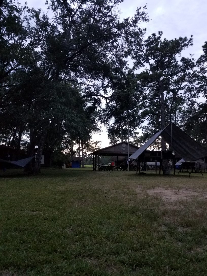
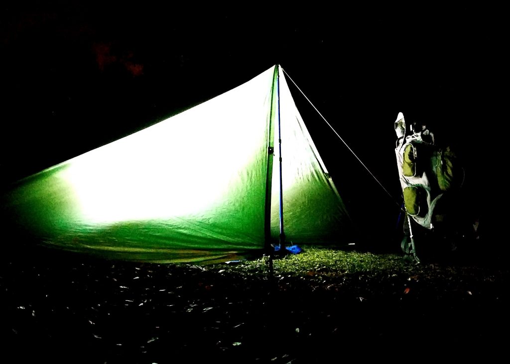
My camp at night
As an “essential worker,” my daily work routine really hadn’t changed much through the whole pandemic. I just see fewer people. Overall, this is probably a good thing. It’s strange times when you can’t get a haircut, yet Walmart, Lowe’s, and Home Depot are packed almost 24/7. One of my favorite things to do in recent years was to sit in a local coffee shop, people coming and going, listening to music, just thinking, maybe write some. Yep well, No Can Do in china virus times. While you can still get a cup of coffee, it’s To-Go only. Sitting is banned. Pretty much I just go to work & go to home. I will tell you, the daily commute to and fro was great for the first month or so. It seems essential workers are also very responsible drivers. You could really tell when the non-essential folks hit the roads again. I was just beginning to think, really soon, things should drift back to normal. But then, Murder Hornets.
Murder Hornets Are Real
Such a creature as the Murder Hornet popped up on the radar for a short period, about early May I think. These hornets are around 2-3 inches long. And can kill people. And wipe out honey bees hives. And they have invaded the Americas and are heading to a field near you. Imagine tripping over a hive of them. Yep that’s the thing of which nightmares are made. For a short while, these horrendous creatures were a real concern. But then, the Purge.
John Minchillo/AP
For those who don’t know, The Purge is a movie where society basically allows crime and mayhem for a one single night and all emergency services are suspended. Admittedly I haven’t seen this movie but then sometimes truth is stranger than fiction. Not to be constrained by a mere single night of mayhem, we’re now about a month into some nightmare real life version of the movie. Either overwhelmed by the volume of chaos, or stifled by governmental leadership, the police aren’t responding to crime in major cities now, which of course limits emergency medical & fire response services. In multiple cities, whole blocks have been vandalized, looted, and burned to the ground by rioters. Dozens murdered. Hundreds injured. And it’s still continuing. I wish it was a movie, because then I could get up and leave. As time grinds on, it seems like people are just getting crazier. And dumber.
I actually find myself getting fatigued from reading or watching the daily news too long now. There are groups of people who literally want nothing more than to watch the world burn. The idiocy sometimes becomes overwhelming, but then I push away, look out a window, go for a walk, and it feels just a little bit better. I am thankful for the people in my life, my family and friends. Being able to gather with family is refreshing and something I miss. Up until recently this social gathering of good people was banned too. June 20, 2020 happens to officially be the first day of Summer, yet the backyard barbecue parties are still restricted or banned in a lot of areas. Beaches in most states have been closed to the general public for months. Only celebrities, heads of state governments, and other special “VIP” get to go beaching or get haircuts. But then mass protesters made it all okay to get together again, but only to riot, not for happy events like birthday parties or friendly gatherings (see what I mean about dumb?). Crazy times. I can’t wait to see what July brings.
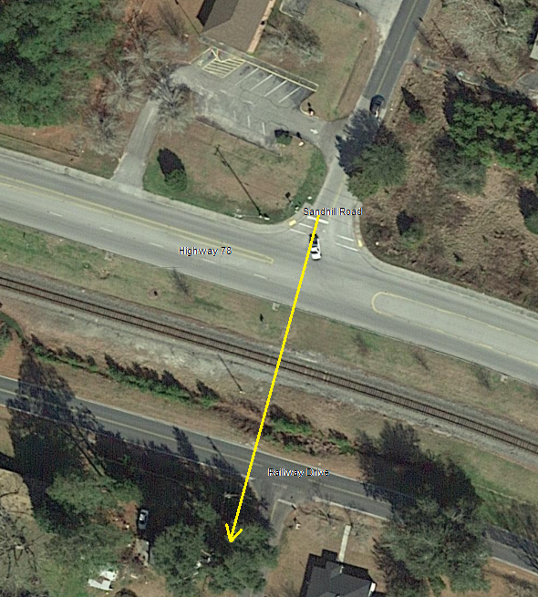
This would have been a like a real life Dukes of Hazzard moment, sort of.
On a recent Friday night, some Bo & Luke wannabe, with nothing better to do at 2 in the morning, fired up his Toyota 4-Runner, and proceeded to wreck a neighbors house. ‘Seems he got a running start up on Sandhill Road somewhere. Sandhill Road is a small neighborhood side street which T’s on to highway 78, but it doesn’t cross 78. I’m not sure how far back up Sandhill he started, but he had to have been running close to 100 miles an hour to make the jump. And how he missed hitting anyone as he rocketed across highway 78 is a miracle.
Now the story starts getting interesting. After he crossed 78, he hit the curb but kept on going. He left a nice set of tire tracks in the grass until he plowed in to the railroad track embankment. He must have been going “faster than a cheetah on cocaine.” When he hit the steel train rail, he was traveling so fast and hard, he left the imprint of his tire treads in the steel rail. He actually displaced the rail from the wooden ties and a rail crew had to come out and nail back down the steel rail. Trains were doing a slow craw through this section for almost a week after. When he hit the rail, it caught his truck skid plate, folded it half, and ripped it off the truck. But the train tracks didn’t stop him. With the truck speed and slope of the embankment, he was actually able launched his truck up in to the air (this is the Dukes of Hazzard moment). Based on the snapped-off trees he blew through before he touched back down, he was flying at least 4 feet off the ground, and from where he hit the rail to where he landed in the middle of Railway drive, he flew a good 75 feet, narrowly missing a power pole on the way.
But wait, there’s more. His travels didn’t stop there. He still had lots of forward “go” to get rid of. After slamming down on Railway Dive, he plowing through the neighbors hedgerow, barely missing their camper parked in the front yard. Ol’ Bo there (you can’t see him, but he’s the one in the upside down truck the fire men are trying to extract), crashed right in to the neighbors house and big picture window, smashing in the front wall, hitting both the house foundation and roof with his truck. From where he hit the curb after crossing 78, to the point he landed upside down in the neighbors house was about 175 feet. Almost half the distance was via Toyota-Air. Fortunately, no one was injured in the house and reportedly the driver made it out of the truck alive and was transported to the hospital.
Just a quick note as this first day of spring begins to fade. The weather today has been truly spring like, although I’ve been stuck inside working my day job for most of it, I’m looking forward to more of nice weather. The winter has been great but I’m ready to move on. Unfortunately the world is now caught in this whole global China flu Coronavirus pandemic thing and everything around me is closing, or winding down, or being socially isolated, or being washed and disinfected. There is a ton of good info out there on this bug so I’m not going to add to the noise other than to say use some common sense, you don’t need ALL the toilet paper on the shelf, and follow the recommendations of your local health officials. Here in the great state of South Carolina our winter seems to have been pretty mild and the plants are really starting to bud out now with the warmer weather. I’m guessing the Azaleas are probably a week or three from peak bloom, and the Dogwoods are just beginning to flower. I’m so looking forward to getting some trail time this spring, with any luck. We’ll see how the next couple of weeks pan out. Stay safe all.
Now what? It’s over, the gathering of family, or at least those available, a table spread with dozens of dishes, full bellies, the warmth of the heater on the drive home. Now what?
With Thanksgiving now behind us, this years Christmas is looming closer than the years before, I heard on the radio today, it’s like three weeks away (25 days if I did the math right, but who’s counting?). I feel like this year’s holiday season is especially disjointed for me. Family is spread out, travel agendas don’t match well, everything feels a bit piecemeal. Sigh. On top of all my mixed seasonal holiday feelings is the rising tide of gift-giving hopelessness. In all openness, I struggle with the holidays in general now. In another life time far far away, we would all sit at the thanksgiving table before we ate and have to say something for which we were thankful. I think this tradition has now slipped away with this year. It’s all good I guess. One of many. Sometimes these things just happen, people get older, everyone moves on. But if Thanksgiving is like a city bus, Christmas is a freight train. It’s coming and there is nothing anyone could really do to stop it. I know the reason for the season and all the good stuff it’s supposed to be, but it doesn’t really help. At least not yet. It’s just something I guess I need to get used to, kind of like the new normal. It is what it is. There is still time to get in to the spirit. Right?
Right! Because who wants to read a depressing post like this when everywhere you look are jingle bells, candy canes, Hanukkah bushes, and artificial snow in the window corners. If you find yourself feeling like a fleck circling the drain, you need to reset your thoughts a bit. You may need to dig deep, but find even just one thing, the one thing which worked well for you today. Maybe a person who makes you happy, anything really, to build on. Once you find one happy thought, embrace it. Build on it. You can borrow a could of mine if you need to. Example one – your dog wasn’t the one who had such an anxiety attack last night, he ate through the cat door to try to get in to the house (yeah, really happened). Example two – the six inch water main which burst at work today, completely shutting the building down, was fixable in just two hours (including the hour round trip to get the parts). Example three – well, you get the idea, I’ll let you think of something now. Just pick one thing which worked out, anything, and say it to yourself. It can be as simple as having electricity and a computer just to read posts like this. Lots of people struggle this time of year. You can help them by reaching out. Doing something nice for someone is like doing something nice for yourself. Build on that and it’s a step in the right direction.
Despite a mild case of the holiday blues (I think maybe I’ve been indoors too much lately), there is much I’m truly thankful for. I just need to listen, and take the next step.
#
Did you enjoy or find this post useful? Please let me know by leaving a comment below or join me on Instagram or Facebook.
I like the title, it sounds more dramatic and mysterious than the situation really is, so we’re rolling with it.
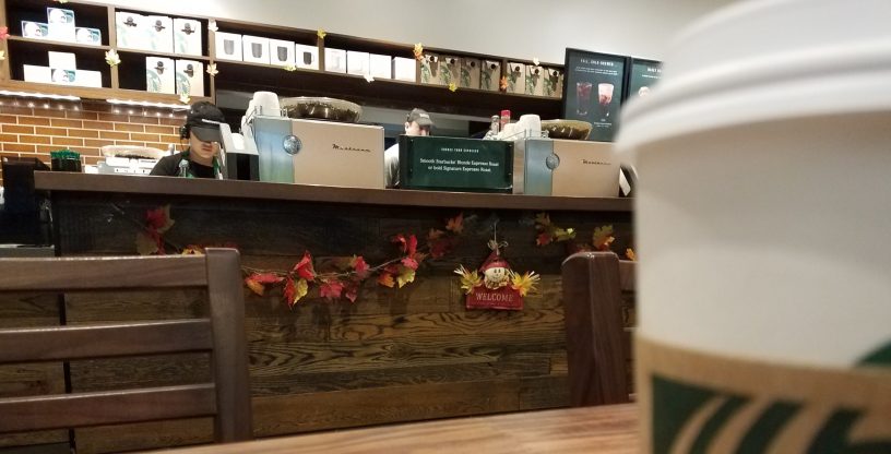
I’m sitting in a coffee shop right now, waiting for a business appointment later this evening. I’m doing something I really don’t feel like I’ve had a chance to do in a while, killing time. It’s kind of nice to sit back, listen to some music, and just unwind the mainspring of my mind a little. So, this may ramble a bit.
The funny thing about these coffee shops, each one seems to have a bit of their own personality to them. This one is in North Charleston, near a local college. It’s busy, a lot of the people are doing the same thing (studying for their next class), some are solo, some are in small groups, text books & laptops open as they scribble notes. A few people meeting before or after work. But my sense is no one really knows anyone. I’ve been here before, usually my self before a class. It’s kind on impersonal I guess. Almost like feeling alone in a crowd. There is a coffee shop in Summerville called Coastal Coffee Roasters, closer to home which has a more interesting personality. People know each other, say hi & bye. It’s close to their home, its a common meeting place, nice to relax in. I’ve met the owner, toured the area where they roast their own beans, I know his daughter was attempting a through-hike of the AT this year, not sure if she completed it, I’ll need to stop back by there and check. It’s a much homier hangout. I don’t get by there as much as I did earlier this year (pesky work thing going on and all).
The last few month have been busy for me, or at least they feel like I’ve been busy. Partly because the commute back and forth is mostly an hour each way to anywhere. Right now it serve the purpose, so I put up with it. Fortunately, there are weekends. But even they seem to fly by now. I kind of miss the days when I could walk up the street and “hang out” at another then my neighborhood coffee shop. At one point it was almost like stepping into the bar on “Cheers.” You know, it was the kind of place where everyone knows your name. Sadly these kinds of experiences are fleeting. Staff changes, customers change, and poof it’s gone. Unfortunately there isn’t a hang-out like this in the quaint little town of Dorchester where I live now with Brenda, Radar, and a small herd of assorted others.
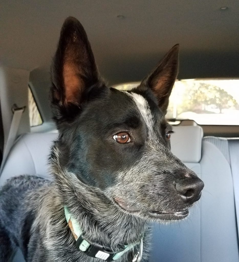
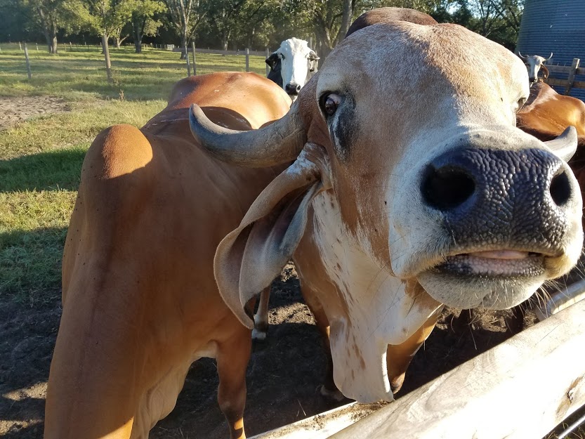
Part of the herd of others
Our little town just isn’t quite big enough for such things as a coffee shop yet, but I suspect it may soon work it’s way there some day. I do think I like our town. We don’t have any stop lights (I hate stop lights and my kids will attest to my feelings of a government conspiracy related to them), we do have a Post Office (our own little federal building), a gas station-convenience store, and a cute new little farmers market called Ray-O-Sunshine. A family operation which should do well, they keep adding items and are growing smartly. We’ll see how things go. I can see the town incorporating some day soon, if we don’t we’ll be pushed under by the development heading our way. South Carolina continues to grow, and when you run out of “city” you dig up the country to make more city. Who knows, maybe I can run for mayor, the commute will be shorter.
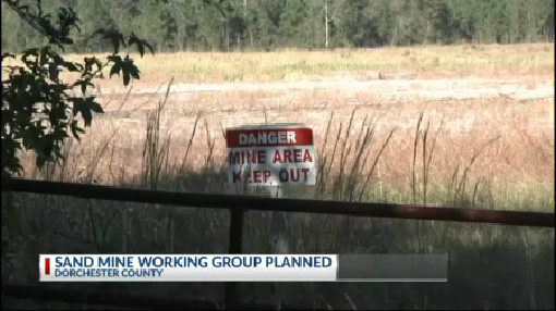
So I live up in the town of Dorchester and we saw there were some road signs in our neighborhood advising of a special exemption zoning hearing last night. So being the interested civic minded citizens we are, my GF and I made a special date to attend.
It turns out someone wanted to open another sand mine (where they mine out the sand from the ground) in our area. We have a couple small mines already down the road from us, they are a pain. The trucks start early and run late and they pump silty water in to the wetlands. They have “rules” but there is no monitoring and no enforcement.
I wan’t really sure what to expect (my first zoning board meeting and all), but it was interestingly well attended by fellow neighbors. When the board got to the sand mine on the agenda, the rep for the mine got up an made his pitch. Much to my surprise this is planned to be a +300 acre mine, literally across the street from where I live. It’s not everyday a small community like Dorchester gets a +300 acre sand mine dropped right in the middle of their lap.
During the “Public Comment” portion of the meeting, folks raised concern after concern after concern about the mines impact to the small community. How the trucks, noise, dust, and broken promises will ruin their homes. I watched the board members as citizens spoke, most were sporting their best stone-face “I just need to sit here a little longer” stare. The arguments against were compelling and virtually unanimous.
And then they closed the public comments (well almost – they failed to acknowledge yet another concerned resident/citizen. But she had no issues explaining their error and express her concerns), and then just like that, the Dorchester County Board of Zoning Appeals board voted “Yes” to approved the Special Exception for a private sand mine in the Town of Dorchester.
Despite all of the concerns and citizens appeal, most of the board voted “yes” to the raping of the land and local community. One of the board members did explain they were almost “required to vote to approve” regardless of the community concerns. All the little the boxes had been checked, and all the concerns of the community really didn’t matter. The public comment “show” was really just a formality it seems.
The town doesn’t benefit from this mine. None at all. But what they do get is +300 acres of quiet rural farm land stripped of its topsoil so the sand can be dug out, trucked away, and sold. They get a commercial mining office in the middle of their neighborhood. They get grossly increased truck traffic & (more) torn up roads. Yep, hundreds of additional dump trucks are now going to grind up and down the narrow country roads. As it is now with the small mines, the trucks start early and run all day long, either with road crushing loads or they’re racing back for another load. Now the new mine wants to bring in hundreds of more additional trucks each day as this new mega mine opens. They also get Silica air pollution from the large scale mining operations, contaminated ground water and pollution from the wastewater pumping (can’t dig out the sand if it’s covered with water – did I mention everyone in Dorchester is on well water?).
The people who live here do not want this mine. But it’s okay, all the boxes have been checked. For the next ten years, the mine will get to dig and chew and grind up the earth to make someone richer. And then at the end, we who live here, will have what?
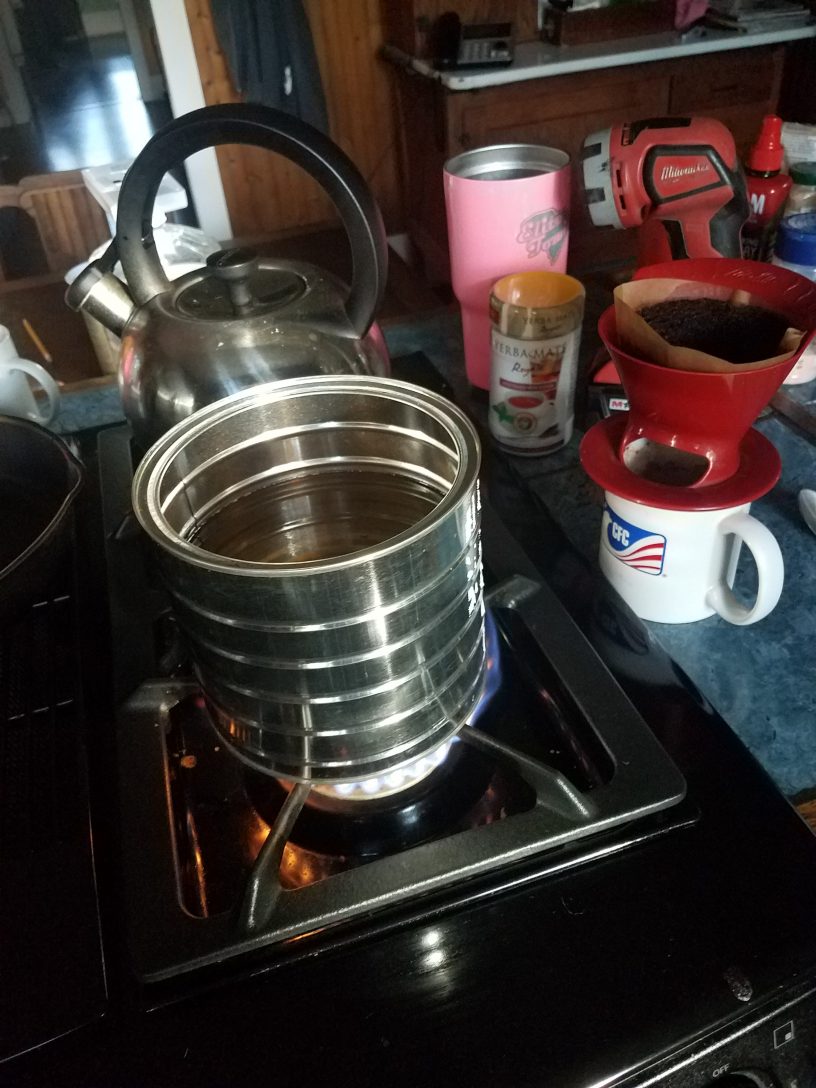
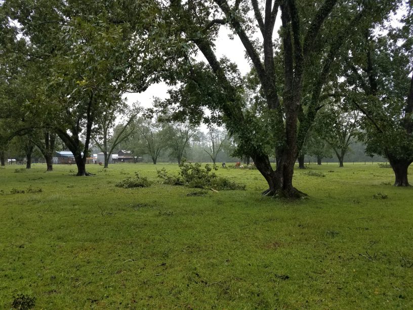
Oh happy happy joy joy, the pleasures of primal life. And so starts day two of no power. We lost power yesterday at about 7 am. My GF is waiting for an email from the power company advisiting us of when the power is restored. Seriously. And with no power of course comes no well water. Fortunately I put out buckets yesterday to capture rain water for such basic non-drinking needs like washing and toilet flushing so we can save the bottled water for drinking. When the drinking water is gone I may have to shift to rum. Fortunately there is propane and coffee. Add a little swiss miss for a home made cafe mocha and the morning is mostly tolerable. Sigh. Well there is work to do today. Yesterday we cut up most of the downed limbs so GF can haul them off to the burn pile in the back field, bless her, there is a fair amountof hauling to do. All this means there is much carbon to release soon. I need to head in to the hospital to see what’s needed to reopen it. My normal commute is almost a hour. Yesterday 90% of the roads between here and there were closed at one point due to either downed trees or flooding. Okay, I’m being chased out the kitchen, I have chores to do, and then I must head out to the yard, with my warm beverage and a coffee can of hot water, for a little camp bath before I head off to work (day job work). Be safe.
Officially, we’re on the back side of hurricane Dorian as she continues to churn slowly towards the North Carolina coast and the outer banks. Most of our area has been without power for a while now. My town of Dorchester is about 30-ish miles from the coast and we’ve been without power since about 7am. I honestly don’t expect power back until tomorrow maybe. The only connection with the outside world is old school radio and cellphone. It’s kind a weird because people from the company I work for are based on the west coast. They have been calling for reports, which I can’t give them because my work computer is at the hospital, and it’s been shut down since Monday (a holiday), my staff and I are all home in a hurricane stand-by state, waiting for the all-clear (which may come tomorrow). So when they call I have to explain “um, well, there’s like this hurricane thing going on, work is closed, the roads are closed, and it’s literally raining and blowing like … a hurricane … here.” It’s all good. The response every time has been something like “oh yeah! that’s right.” Anyway, we’ve been fortunate here for the most part besides the lack of power, it’s mostly been a windy rain event. The biggest problem on the farm has been downed branches. These are not your normal “city” branches either. Bonafide farm branches here, 6″ or greater. Otherwise all is good, GF, dogs, horses, cats, cows, chickens and chicken egg eating snake are all weathering this well. Maybe when the rain’t let’s up some I go looking for the ego stealing snake. Be safe.
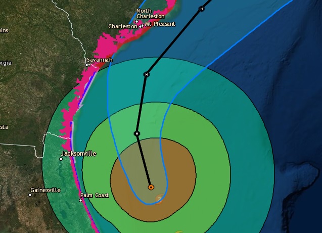
It’s been a few days now since the Governor of South Carolina declared a state of emergency and started the wheels rolling to get people off the South Carolina coast. Hurricane Dorian hadn’t even hit the Bahamas yet. The ripple effect is we have been in a state of waiting now for half a week now. The long holiday weekend has made everything a little surreal, a three day weekend slowly drifting longer and longer. I can’t leave as I’m in a recall status, so it’s a waiting game now. Schools are closed as shelters are open, our major interstate highway, I-26, been under lane reversals for the last two days, so travel is by back roads. Hurricane warning & watches are running up the coast from South Florida to Virginia like a racing stripe. And yet Dorian still churns off North Florida, slowly making it’s way up the coast. Make no mistake, Dorian has proven to be a deadly storm. It’s death toll is in the single digits today but sadly, I fully expect it to tragically rise as the Bahamas start their recovery. Locally, we should see the worst of Dorian tomorrow as she slowly grinds past us. Most of our hurricane prep’s are done. Fortunately for us, it looks like we’ll suffer not much more than a glancing blow as she makes her way in to the Atlantic over the next few more days. But for now, we just wait.