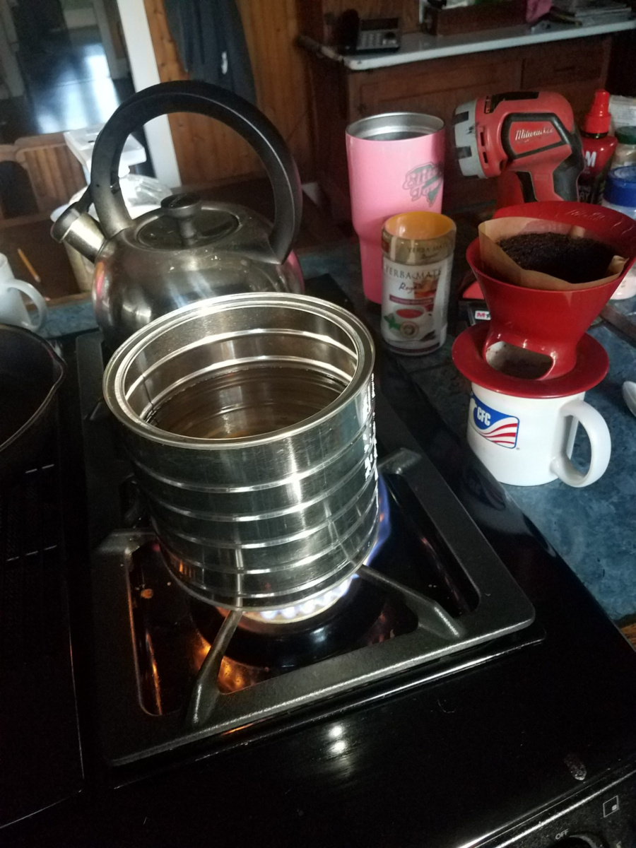
Oh happy happy joy joy, the pleasures of primal life. And so starts day two of no power. We lost power yesterday at about 7 am. My GF is waiting for an email from the power company advisiting us of when the power is restored. Seriously. And with no power of course comes no well water. Fortunately I put out buckets yesterday to capture rain water for such basic non-drinking needs like washing and toilet flushing so we can save the bottled water for drinking. When the drinking water is gone I may have to shift to rum. Fortunately there is propane and coffee. Add a little swiss miss for a home made cafe mocha and the morning is mostly tolerable. Sigh. Well there is work to do today. Yesterday we cut up most of the downed limbs so GF can haul them off to the burn pile in the back field, bless her, there is a fair amountof hauling to do. All this means there is much carbon to release soon. I need to head in to the hospital to see what’s needed to reopen it. My normal commute is almost a hour. Yesterday 90% of the roads between here and there were closed at one point due to either downed trees or flooding. Okay, I’m being chased out the kitchen, I have chores to do, and then I must head out to the yard, with my warm beverage and a coffee can of hot water, for a little camp bath before I head off to work (day job work). Be safe.
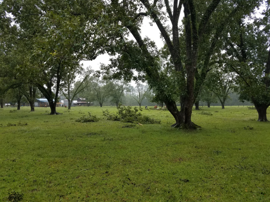
Officially, we’re on the back side of hurricane Dorian as she continues to churn slowly towards the North Carolina coast and the outer banks. Most of our area has been without power for a while now. My town of Dorchester is about 30-ish miles from the coast and we’ve been without power since about 7am. I honestly don’t expect power back until tomorrow maybe. The only connection with the outside world is old school radio and cellphone. It’s kind a weird because people from the company I work for are based on the west coast. They have been calling for reports, which I can’t give them because my work computer is at the hospital, and it’s been shut down since Monday (a holiday), my staff and I are all home in a hurricane stand-by state, waiting for the all-clear (which may come tomorrow). So when they call I have to explain “um, well, there’s like this hurricane thing going on, work is closed, the roads are closed, and it’s literally raining and blowing like … a hurricane … here.” It’s all good. The response every time has been something like “oh yeah! that’s right.” Anyway, we’ve been fortunate here for the most part besides the lack of power, it’s mostly been a windy rain event. The biggest problem on the farm has been downed branches. These are not your normal “city” branches either. Bonafide farm branches here, 6″ or greater. Otherwise all is good, GF, dogs, horses, cats, cows, chickens and chicken egg eating snake are all weathering this well. Maybe when the rain’t let’s up some I go looking for the ego stealing snake. Be safe.
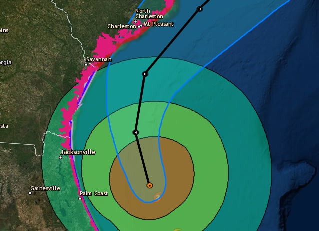
It’s been a few days now since the Governor of South Carolina declared a state of emergency and started the wheels rolling to get people off the South Carolina coast. Hurricane Dorian hadn’t even hit the Bahamas yet. The ripple effect is we have been in a state of waiting now for half a week now. The long holiday weekend has made everything a little surreal, a three day weekend slowly drifting longer and longer. I can’t leave as I’m in a recall status, so it’s a waiting game now. Schools are closed as shelters are open, our major interstate highway, I-26, been under lane reversals for the last two days, so travel is by back roads. Hurricane warning & watches are running up the coast from South Florida to Virginia like a racing stripe. And yet Dorian still churns off North Florida, slowly making it’s way up the coast. Make no mistake, Dorian has proven to be a deadly storm. It’s death toll is in the single digits today but sadly, I fully expect it to tragically rise as the Bahamas start their recovery. Locally, we should see the worst of Dorian tomorrow as she slowly grinds past us. Most of our hurricane prep’s are done. Fortunately for us, it looks like we’ll suffer not much more than a glancing blow as she makes her way in to the Atlantic over the next few more days. But for now, we just wait.
Mt. Mitchell (6684′) & Waterrock Knob (6292′) are in the bag. This was as much an impromptu therapy couple days as much as anything else. It felt good to get out and go (highly recommended).
I had read about the southern sixer’s and decided to go out and try to bag a couple. Unfortunately, I had some pesky obligations for Monday (work), so I had to box in my plans down to driving up Saturday to North Carolina from Dorchester, South Carolina, hike a couple peaks, and then drive home on Sunday.
Normally I like to do a whole lot more planning when I’m heading in to somewhere new. This time I pretty much just hit the road, I had not really scope out the trails, or much of anything else, so I didn’t know what to expect when I arrived at the trail heads. This worked against me a little where I had wanted maybe a little more trail time and hit another peak or two, but the unknown added to the sense of adventure too. It ended up with me really not too sure where to pick up some of the trails to another nearby peak until it was too late in the day. This was still a really good trip. What I did know is Mt. Mitchell is the highest peak east of the Mississippi, I figured I would go there first.
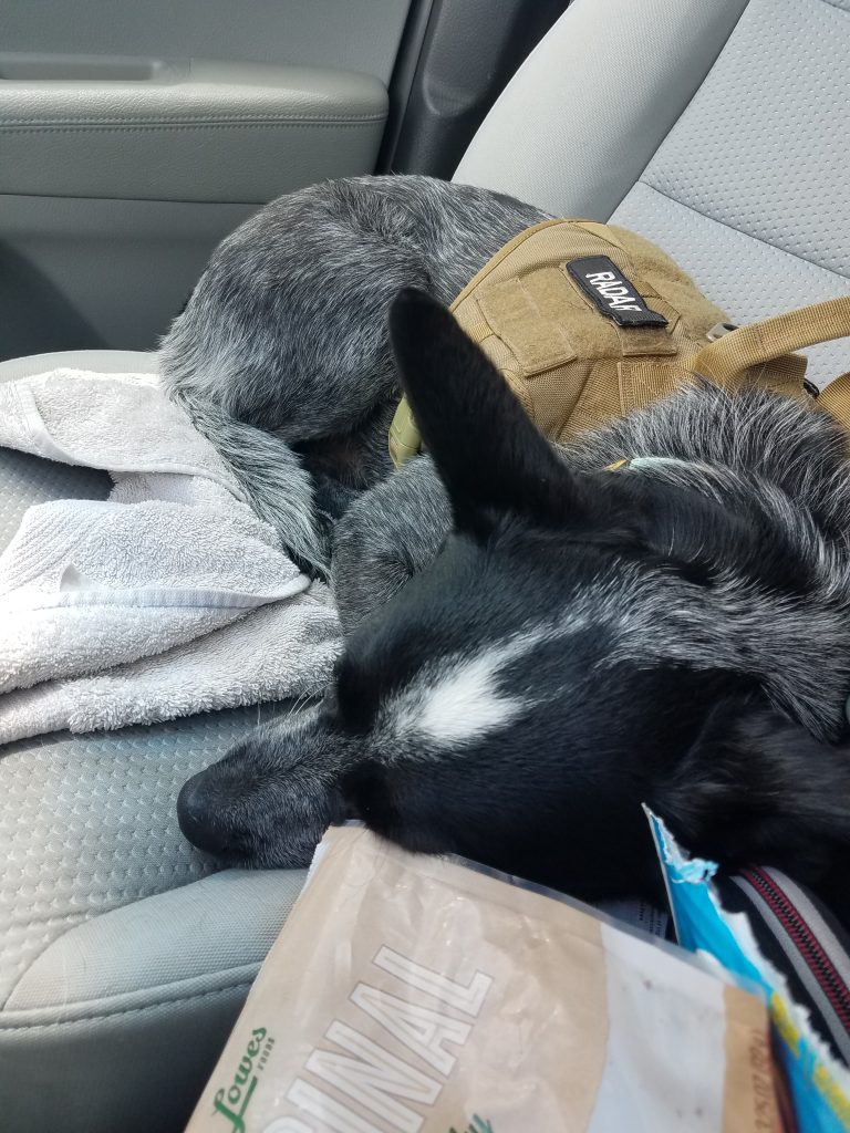
I basically just took my backpack (just in case), a change of clothes, some dog stuff an hit the road with Radar as my co-pilot. It felt like I had loaded more stuff for Radar than me, but I think I’m just a better packer than he is. Radar (with the help of Mr. Garmin) was able to expertly navigate us from the house all the way to the Mt. Mitchell visitor center parking lot without missing a turn.
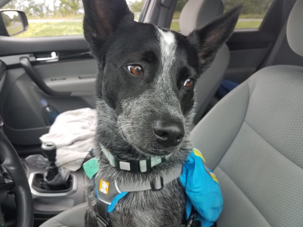
Radar is concerned about my level of planning
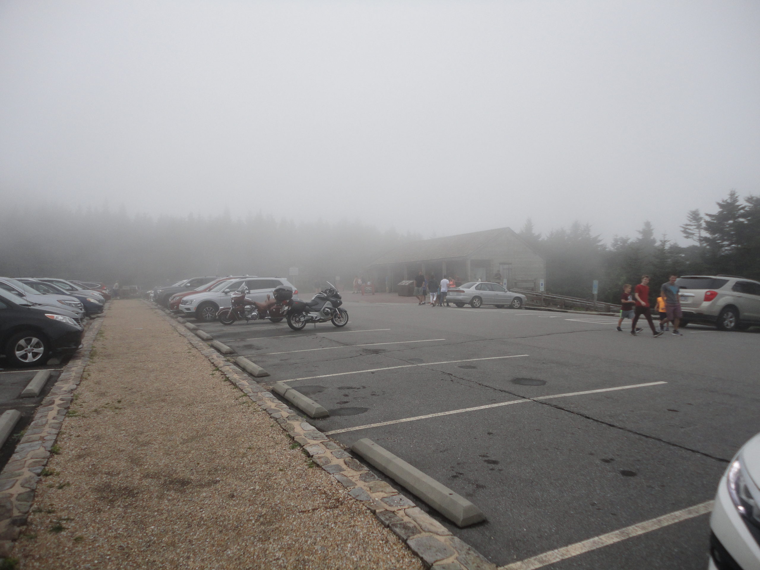
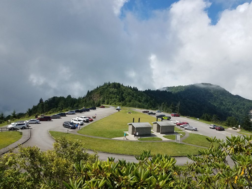
The trip up from south Carolina up to Mt. Mitchell was pretty uneventful, for a 5+ hour drive. Radar and I got to the Mt. Mitchell visitor center parking lot around mid afternoon. The visitor center was amazingly nice with ample parking. We geared up and headed out and up the mountain. Because of my lack of extensive trip planning, I really didn’t have a good idea how far it was to the summit, I found the hike from the visitor center parking lot summit trail head to the summit was incredibly difficult (just kidding, it was surprisingly easy!). The trail to the summit is actually paved and is an easy short walk for most people. The air was cool and a nice refreshing change from the heat in the low-country.
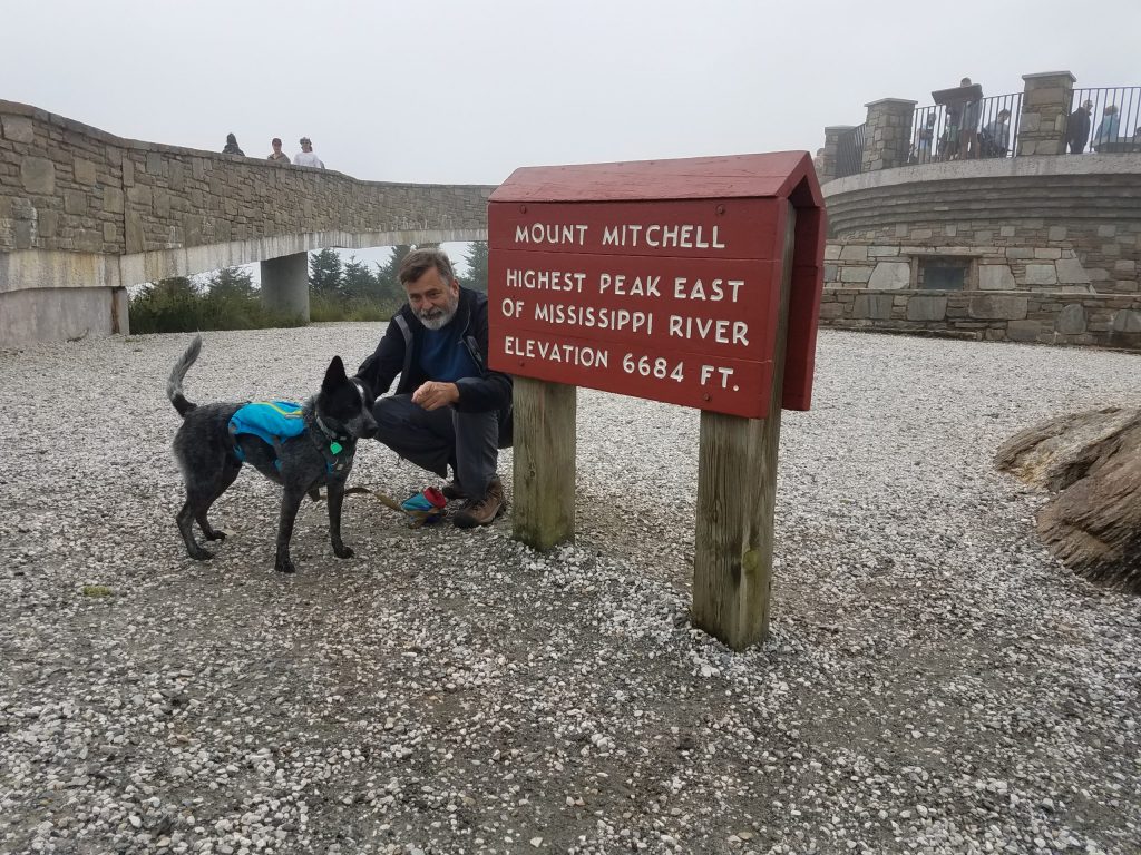
Radar and I submitted Mt. Mitchell about a quarter after 3 in the afternoon, on July 20th. The summit on this day was in the clouds, so visibility was pretty socked in – not really a whole lot to see. But then the view was not the prime reason I had come.
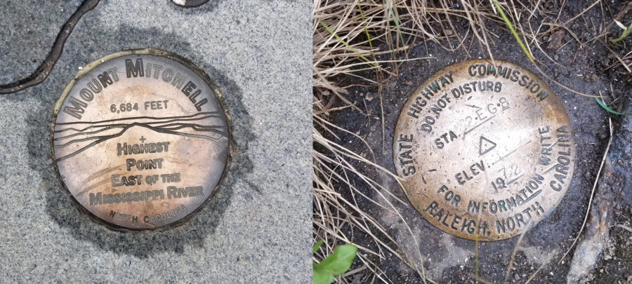
Summit of Mount Mitchell
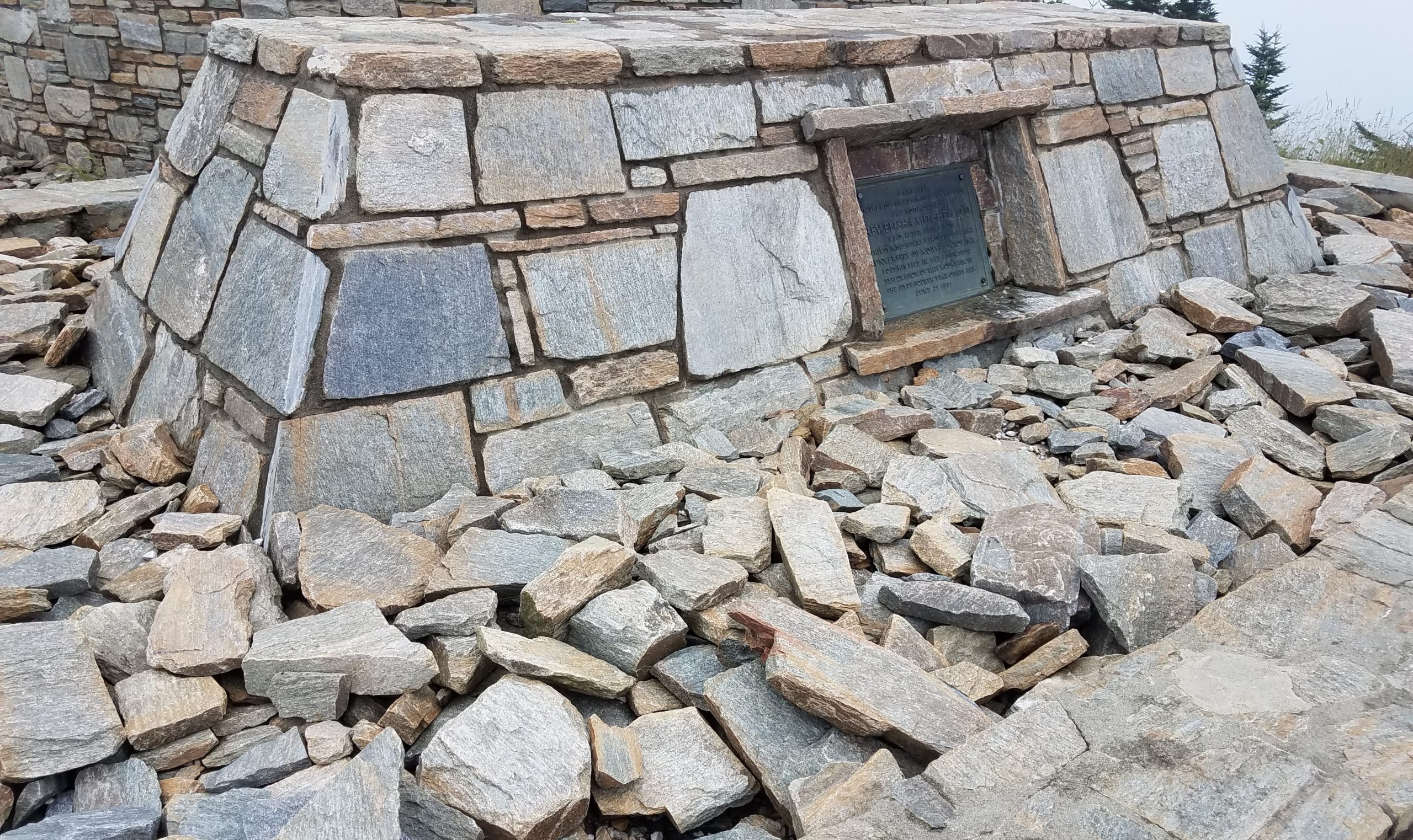
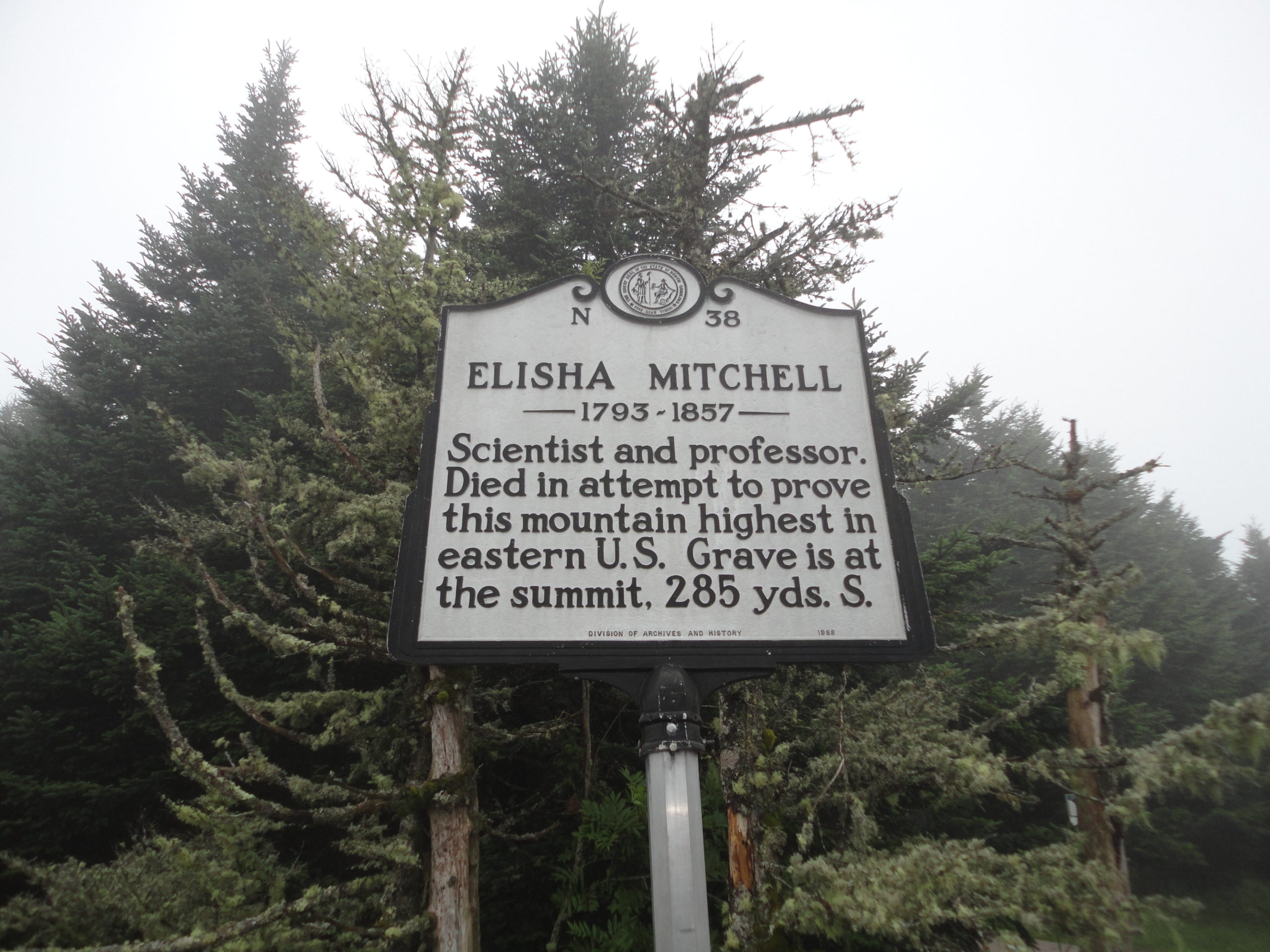
I did not know this until I got to the summit (must remember to planning more), but Mt. Mitchell is named after Elisha Mitchell. He died on the mountain in 1857, trying to prove the elevation of this mountain. His remains are buried on the summit still. Mountain graves and memorials are not uncommon, I’ve seen a number while hiking over the years. I often stop and think about the person behind the plaque. What events in their life brought to where they ended up. I leave a stone to let them know they are not forgotten. I again left a small stone. This time; the name of a cousin of mine was engraved on the stone.
Several years ago I sadly lost a cousin and I had made a small memorial stone for him. In the back of my mind, I wanted to leave it on a tall mountain somewhere. I had brought this stone with me on this trip. It seemed fitting, so I left my stone on this high mountain, 6684 feet above sea level, discreetly near the summit of the highest peak East of the Mississippi River. Radar and I returned to our car and headed down and west along the Blue Ridge Parkway, towards Ashville, for the night.
We stayed in a pet friendly independent motel (which shall remain nameless – unless you ask) on the edge of Ashville. I had selected it on the internet strictly based on price. Radar took one look at the motel room, then me, and pleaded with me not to leave him there alone when I went for dinner. I couldn’t blame him. So we both headed out for some Mexican at restaurant with an outdoor patio. When we returned to the motel we took turns sleeping. I gotta say, they tried, it really wasn’t too bad, and it was an experience, but I likely will not schedule a return there anytime in the near future.
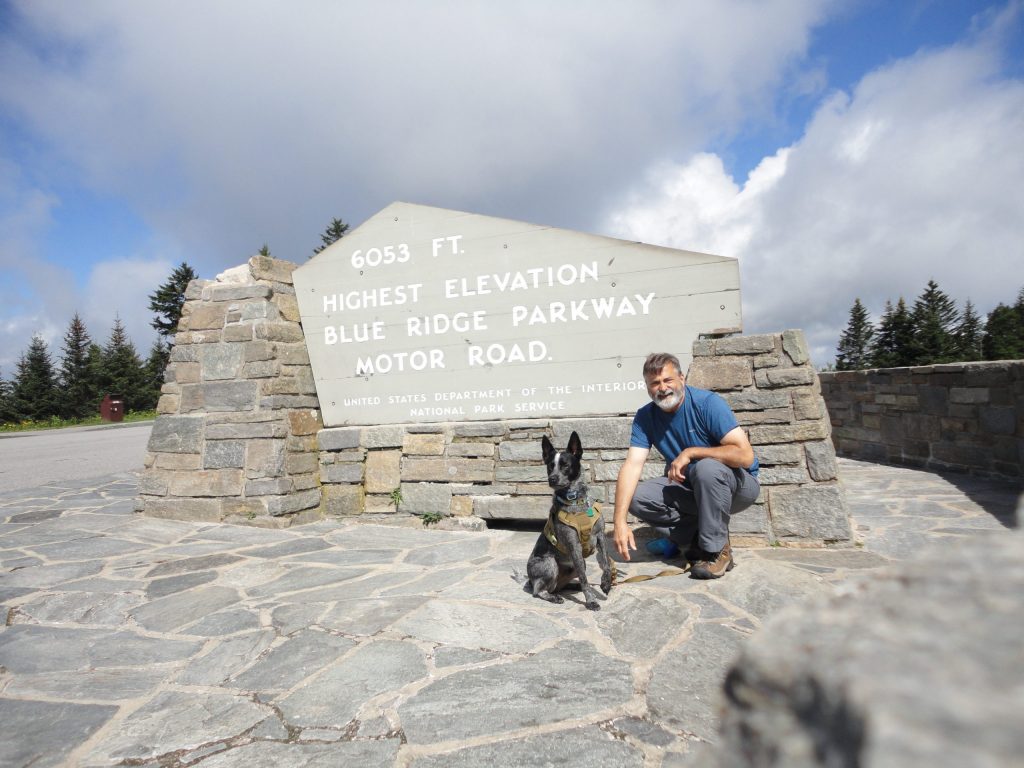
Anyway, Sunday we were up and out early. We had to head home but I wanted to try to bag a couple more peaks, if we could. Back on the Blue Ridge Parkway, we continued heading west from Ashville, towards Waterrock Knob. One of our high points on the way, was being able to claim standing on the highest park of the Blue Ridge Parkway.
The highest road elevation along the Blue Ridge Parkway
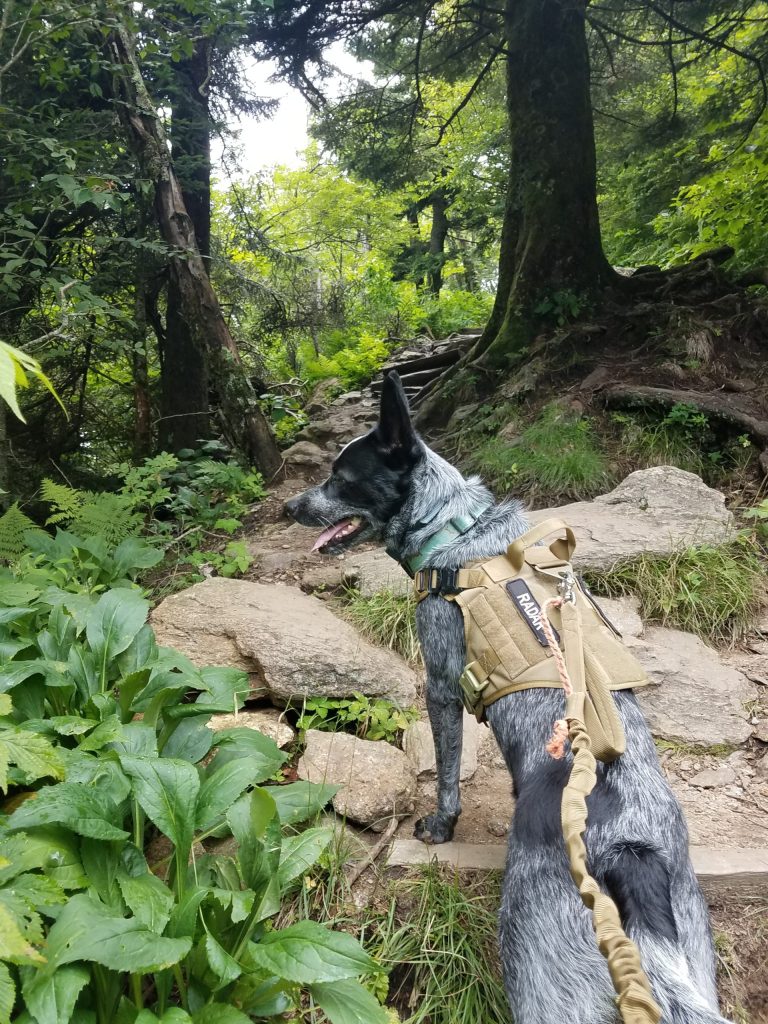
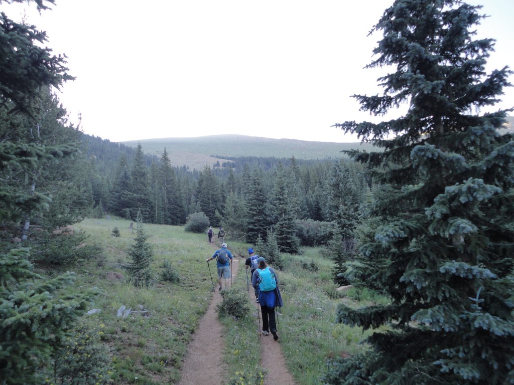
By the time we got to the Waterrock Knob visitor parking area, I knew we would be pressed for adventure time. There was supposed to be a trail at Waterrock Knob which ran across three or four peaks there. Unfortunately again, my (lack of) high level, detailed, planning would catch up with me. This peak also had an amazingly nice visitor center (they even let Radar inside) and nice parking. However, unlike Mt Mitchell, the trail to the summit of Waterrock Knob was not such an easy hike. The trail to the summit, while fairly short, just under a mile, it was a steep up hill climb. It felt good to work a little for the hike up.
Radar leading on the trail to Waterrock Knob
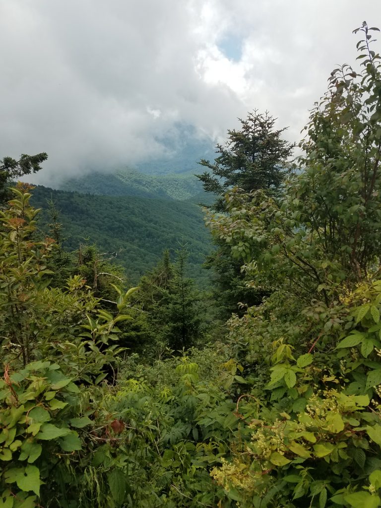
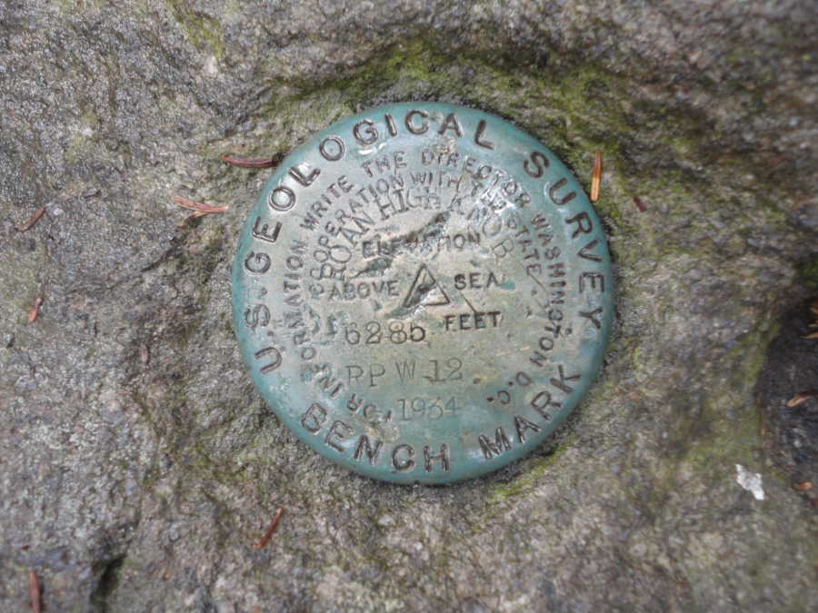
Like Mount Mitchell, the peak was also clouded in so the view was limited to the inside of the clouds. We hung out at the peak a little catching my breath. I tried to pick up the trail to the next peak, but really didn’t know where to go. With a limited time schedule and really not knowing the trails held me back from getting likely hopelessly lost that day. So we just explored the peak a little. Hidden in the grass and almost covered with dirt, we were able to locate the benchmark. With this as the days accomplishment, I felt good about heading back down. I told Radar next time he needs to research this trail stuff a bit more. During our decent we located a couple more trails which were likely candidates for some future hikes, but for now, we were done. It was time to head back home.
View from Waterrock Knob
Waterrock Knob Visitor Parking
Radar after hiking up Waterrock Knob
Radar surprisingly slept almost the entire way back home. It was nice to get out and back up to the mountains. Being on the trail even for just a little while, helps put things back in place. Over all, a very therapeutic and worthwhile trip.
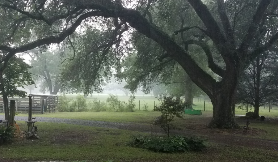
It was raining when I started writing this post and it fits the mood. It’s been a bit busy in a lot of ways this past month for me and I’ve fallen behind my goal of more frequent postings.
I’ve had a few setbacks recently, which really do nothing to help in the writing category. Most notably, was the cancellation of our annual backpacking trip. Again. This is the second year in a row it’s been cancelled. I was really hoping to get some time in hiking a section of the Appalachian Trail, however there was some “dangerous” weather conditions forecast for our planned hike period. It would have made for a big fubar to bring new hikers into a week of really crappy, and potentially dangerous, weather, so discretion won out. But I feel like I should have gone anyway, even solo. My hindsight is way better than my foresight.
I had an idea and had applied for a federal grant to research a “save the world,” but I never heard back. I don’t think it was taken seriously by the big government givers away of money because I’m not affiliated with any major institutions of “higher” learning. Oh well. On an unrelated side note, if anyone is interested in crowd-sourcing atmospheric carbon capture using existing commercial building infrastructure, just let me know.
I also started teaching night classes again for the summer, which I do enjoy. Coupled with trying to set some sort of weekly gym-fitness routine, I was keeping busy. This was going well for the most part, but somehow still felt more like a place holder than anything else. Nice, but not hitting on all cylinders. So I went poking a stick in the bushes looking for some kind of a new job to explore. Besides, I felt a bit of positive cash flow would be nice for a change. Anyway, long story-short, I have just started working a new job. I’m grateful for the opportunity, yet I have a sense of being somewhat constrained by draft now. Unfortunately this may mean I loose out on an epic Utah trip this fall with my brother. We’ll see how everything shakes out.
Just because I seem to like trying new things, I’ve been bouncing around the idea of starting up a podcast too, but have held off. I have started listening to some really great sets, and they piqued my interest from the story telling perspective. I need to spend some time focusing on the direction(s) I want to take this. For now I think I’ll move this idea into the “future projects” file, maybe for when the rain stops.
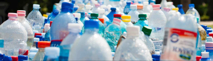
I recently posted some random thoughts about our environment, about the state of the world, and particularly related to the enormous amount of plastic waste ending up in the oceans (it’s really enough to account for some sea level rise). I was doing a bunch of farm work the other day, and during a break, drinking a much needed cool drink my GF provided, I noticed the plastic bottle had a five cent deposit (if you were in Maine), which got me thinking, “Why doesn’t my state do this?”
As a kids, we used to collect glass soda bottles and turn them in for the deposit. That’s how I remember making my first pocket money. My brother and I would pick bottles up from the side of the road, and cash them in at the convenience store. I think they were worth like a nickle a bottle even back then. Half a dozen bottles and we were on our way to the candy isle! The point is, as a state, as a country, as a global community, we have gotten away from that idea of reusing and recycling. We throw away plastic. It’s cheap. We’ll make more. No need for the whole deposit thing any more. Well the cheap and “we’ll make more” is catching up to us. Globally now.
Recent news around my state and the nation and the world, now includes gross amounts of plastic waste being discarded, ending up in the oceans, killing marine life. Causing problems, crazy problems everywhere. Go to any beach anywhere, walk along the shore 100 meters, and tell me there is no plastic trash washing up. Municipalities in my state struggle with maintaining recycling programs, communities are trying to ban plastic straws and shopping bags, and inexplicably, legislators are trying to outlaw those same plastic bans. We have a problem.
I will not argue plastics are a boon to both safety and convenience. Plastic saves tons of energy to transport due to their lower weight. Without a doubt, plastic containers have a lot of advantages. The problem is, we are making far more plastic than we are recycling. If you want to talk about something which really can end the world in 12 years, I will argue, drowning and choking to death on waste plastic is it.
Voluntary plastic recycling is great, but hit and miss and does not seem well supported by communities as a whole across the nation. Government curbside recycling often struggles to break even, often giving the impression these programs are only in place to check-off the “we recycle” box and to keep a lid on the environmentalists. I suspect the prime reason there is so much plastic waste is because it generally has no intrinsic value.
I really don’t think there is an easy fix. As a consumer we’re encouraged to “Pitch it in.” We’re doing the right thing by properly disposing of our waste, right? Maybe not any more. As a consumer, we have no skin in the game. But my thought is, a state “bottle bill” could help change this. By placing a value on these types of containers, people would be incentivized to return plastic bottles and containers. In my country, there are only ten state (out of fifty) which have some form of a container deposit legislation. These states with such laws, have less litter and more recycling. They are capturing the plastic before it enters the waste stream and becomes a problem. It’s an idea we can build on.
Fight Litter. Save the world. Ask your legislator for a bottle bill.
A couple years ago and for a lot of different reasons, I had set and completed the goal of climbing Pikes Peak in Colorado and was able to successfully “bag” my first Fourteener. It was only after I had set my Pikes Peak goal, I learned climbing mountains over 14,000 feet is a thing. Especially in Colorado since they have something like 53 of these beasts. I feel like I would like to try some more of them, maybe, but I would probably need to live in Colorado.
Just this week however, I learned of something called the “Southern Sixers.” These are the tallest mountains in the eastern United States which are all over 6,000 feet. All (besides New Hampshire’s Mount Washington) are in and around the Appalachian mountains of North Carolina and Tennessee. “Wow,” I thought, they sound close to home, maybe I could hike a couple of them. I did a little research, pulled up the list of mountains, and noticed a bunch of very familiar names. Low and behold, it looks like I’ve already hit about a quarter of them!
Now it’s time to start planning to bag the rest of them.
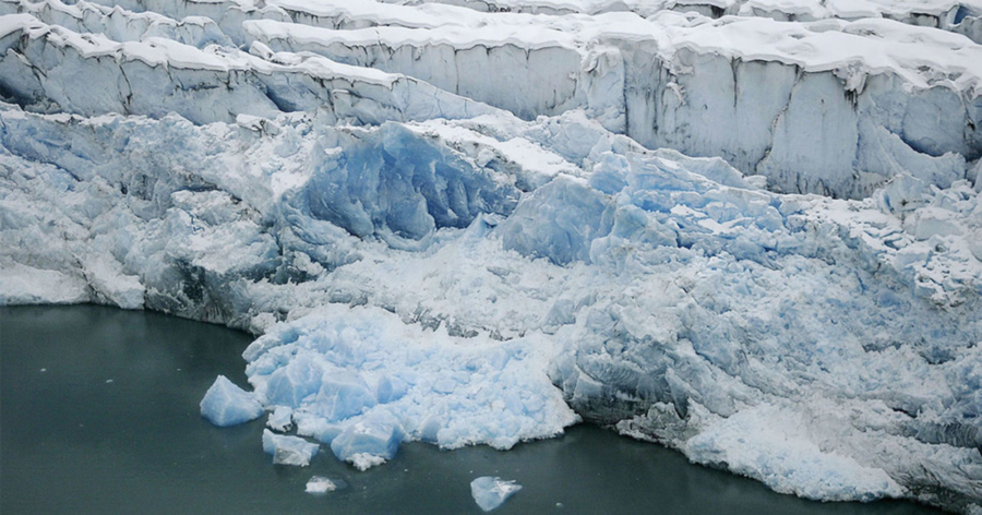
Here’s a frigging idea. Maybe it’s not the ice melting (which has recently been reported are re-freezing)? Follow along, please.
I recently read an online article from EcoWatch which popped up in my news feed. The article indicated “glaciers lose about 335 billion tons of ice a year, the equivalent of one millimeter per year of sea level rise.” Curious, I explored this statement a bit. According to some quick math, 1 ton of ice equals about 264.5 gallons of water (I know it’s not as simple as this, but this is the internet, so we’ll run with it).
So, 335 billion tons of melting ice would be something crazy like adding 88.6 Trillion gallons of water a year to the oceans just to push the level up 1 mm. However our planet also has other things which “displace” water, like boats. These things would also have the effect of adding volume to the oceans and would also contribute to “sea level rise.” According to the 2018 e-Handbook of statistics, globally, we have a growing fleet of commercial (those over 1000t capacity) vessels in the neighborhood of 1.9 Billion tons, this would be the equivalent of an additional 502.6 Billion gallons of water added to the oceans. And trash also displaces water. According to the earth day folks, we add an estimated 8 Billion tons of plastic alone to the oceans, each year. This would be like pouring in an additional 2.1 Trillion gallons of water every year. if we’ve dumped at the same rate for the last 10 years, we’re at an additional 21.2 Trillion gallons and rising. And of course, our rate of “contribution” for plastics in the ocean is set to increase tenfold by 2020. And this doesn’t include all the other garbage we generously include, like cruise ships pumping a billion gallons of sewage (that’s poop, feces, or sh*t for the layman) in to the ocean a year. We dump or pump untold quantities of junk into our oceans. Sadly.
I don’t dispute our climate can and does change. I don’t dispute we, as people, can have some level of influence on any possible change. I ‘m just not convinced melting ice is our problem. I do think our “problem” comes from an ironically deeper, darker place. A place where we keep disregarding the natural world around us. We keep reaching for those shinny brass rings on the bright loud carousel ride of life and not looking around. we’re distracted by the loud music and bright lights. I think we need to get the hell off the ride and leave the noise of the amusement park sometime. We need to walk in grass with bare feet. Look at the stars at night. Hike up a mountain sometime. Sit with the warmth of the sun on your body and smell clean air. Maybe then we’ll appreciate more, and take better care of, what our mother nature has given us.
This is one of the biggest outdoor conservation bills in a long time and it looks like it’s been done right. While the bill still needs to make it through the House and then be signed by the President, this bill has an impact in just about every state of the nation and when signed, will have a positive and lasting impact for a long time to come.
The Senate, working together, in a seemingly and sometimes rare bipartisan manner, passed S.47 – Natural Resources Act. The bill is to protect millions of acres of land, hundreds of miles of wild rivers, and establishing four new national monuments. Legally, by congress coming together to pass federal legislation. This is hugely important to the outdoor community and should be as important to everyone. The outdoor community at first was celebratory with former President Obama’s executive orders declaring new areas as protected lands, then anguishing as current President Trump looked at undoing some of these “protected” areas. Many may have felt rightly upset, as if the outdoor conservation rug had been pulled out from under them.
This bill makes a giant step forward in cementing the protection of what Americans love about our lands. From wilderness area, to historical areas, to outdoor sports and activities we enjoy, this bill has something for just about any one who steps outside of their house. This new legislation is a huge win for everyone really. If you read the Tribune’s article, you get an idea of the magnitude of this piece of legislation. And unlike executive orders, bills like this will have the proper funding to go with it for park and program maintenance.
Hiking back down from Pike’s Peak into the forest
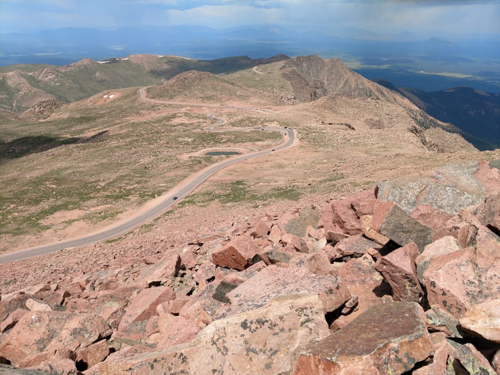
A view down from Pike’s Peak with the boulder field in the foreground
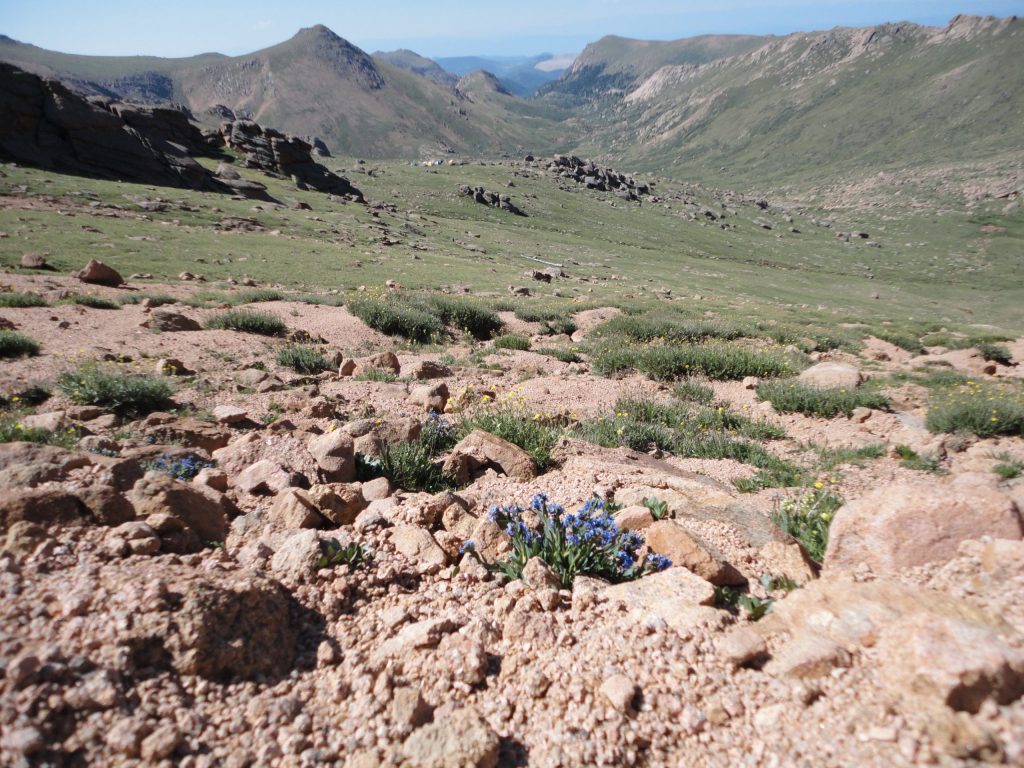
The tundra along the trail to Pikes Peak
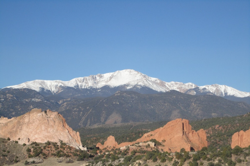
Pikes Peak
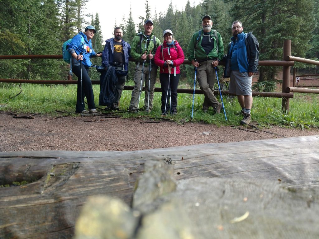
The new 14er hikers, all finished safe and mostly sound
The value of this bill really struck home with me as I was reading over the introduction in Section 1 of the bill. One of the very first things I read was about the Crags Land Exchange to enhance the Pike’s National Forest and provide permanent trail easement. This is the side of Pikes Peak I climbed with my family. For me anyway, this is an amazing section of trail and land. The experience was something I will hold dear to me. If any of the rest of the areas or items in the bill are worth even a fraction of the Crags portion and my experience hiking there, then this bill is priceless in providing current and future generations with the best outdoor experience possible.
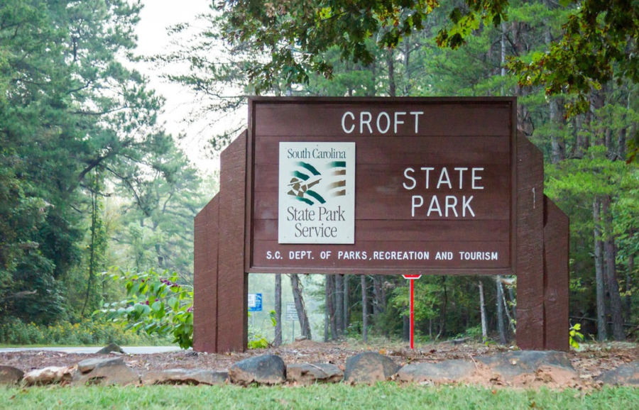
If you like the outdoors, then Croft State Park has something for you. From horses to bikes to hiking to boating to shooting sports, this park offers a heavy helping of fun for everyone and is another outstanding South Carolina destination to explore.
Located in the rolling, wooded terrain of the upstate, Croft has an amazing amount of trails within the park to explore. All the 50 miles of trails at Croft are open to hikers and include the 12.6 mile Croft Passage of the Palmetto Trail, almost 17 miles of trails for Mountain Bikes, and another 17 miles of horse trails. While my girlfriend rode the horse trails with her friends, Radar and I took a day and hiked just about 13 miles of various trails including 8.5 of the Palmetto Trail section. We barely scratched where we could go.
This park opened in 1949 and with 7054 acres, is the third largest in the South Carolina State Park system. Besides the hiking, biking, and horseback riding, this park is packed with other things to do too. There are about 190 acres between the two lakes which support fishing, boating, and bird watching. There are picnic shelters, a playground, and several geocaches are located on the park. This is also one of the few South Carolina Sate Parks with a shooting range (contact the park for more information).
Favorite Time of year: Anytime for camping.
Things to Know: Please speak to a park ranger before setting a geocache. Swimming is not permitted in the lake, but you may wade in the Fairforest Creek at your own risk of course.
Camping: Camping from RV to primitive is available at Croft. Call 1-866-345-PARK (or go here for reservations).
Pet friendly: Pets allowed in most outdoor areas but must be physical restraint or on a leash not longer than six feet.
Getting There: Croft is in the upstate of South Carolina, just 5 minutes South and East of Spartanburg, between I-26 and US-176. It’s about a 4 hour drive from the Charleston area.