The journey of a thousand miles begins with the first step, and this is mine.

Montana Mountains

Category: Hiking & Camping in South Carolina Page 3 of 6

Eutaw Springs Passage of the Palmetto Trail

South Carolina – Eutaw Springs & Santee Passages

Are you looking for a nice +20 or 30 mile section of trail to take you through shaded woods and rolling meadows to see nature while you hike or backpack? Possibly a secluded camp overnight? Then these two sections of the Palmetto Trail are not for you.

The Eutaw Springs Passage is a 21.3 mile section and the Santee Passage is a 12.7 mile section of the Palmetto Trail bridging the end of the Lake Moultrie Passage to the south and the Lake Marion Passage to the north. I selected both of these sections to explore and hike with Radar as part of our Palmetto Challenge mileage. Boy was I surprised.

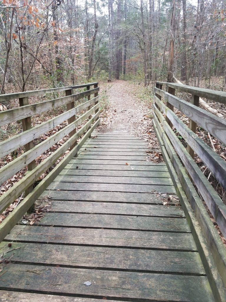
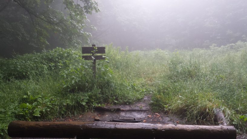
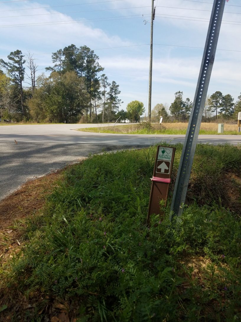
Often when trails overlap roads out of necessity, the trails will run parallel with roads. Sometime the trails will be just off the road in the woods, occasionally using a short section of asphalt as a bridge or to link the actual hiking trail. So when I looked at the maps for these areas, I didn’t think anything of the route following along the roads. However, in this case the roads are the trail. Make no mistake here, there is no hiking “trail.” You will be walking along the roadway. For miles. There are short sections of wooded hiking trails used to link the miles of roads these routes claims to be. Out of the 34 miles these two sections make up, there is only like about 5 miles of what most people would call actual hiking trails. There is a statement included on the back of the Eutaw Springs map which states:

“Much of this trail uses rural highways and dirt roads. You should prepare for possibility of unleashed dogs and wear bright clothing (and reflectors) to warn drivers. The spur trail is occasionally wet and muddy”

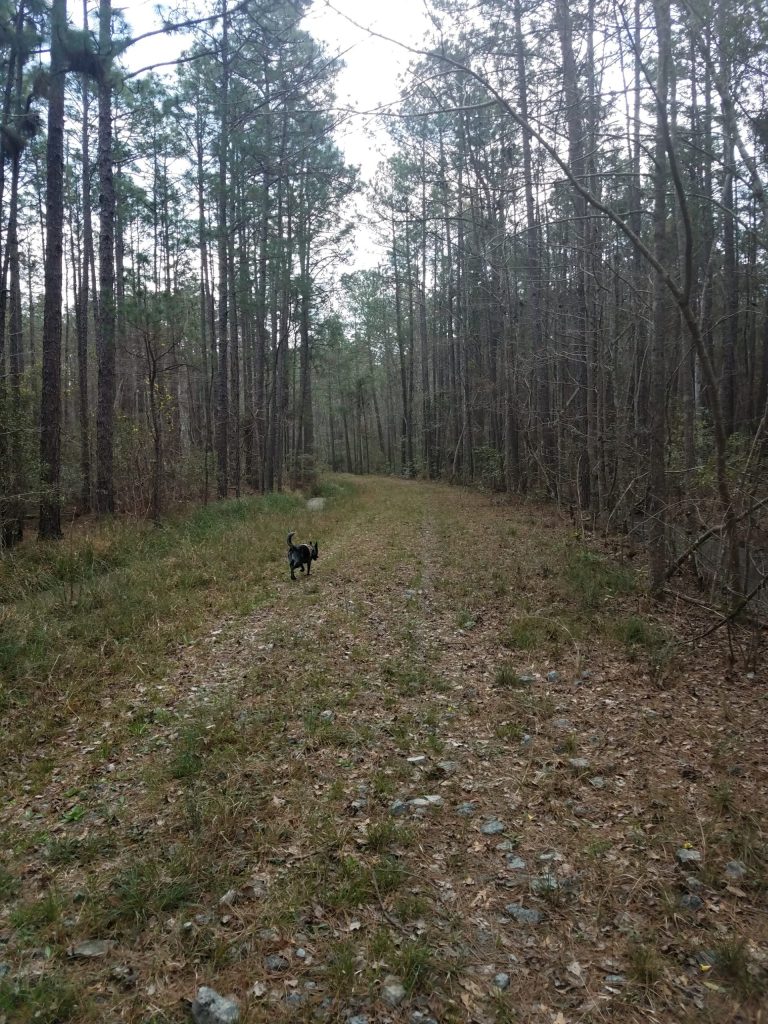
I can honestly say, it’s an understated but accurate statement. I drove from the start of the Eutaw Springs Passage to mile 7 before I could find where any of the “trail” left the road for a walk in the woods. The trail section from mile 7 to 9 is a wooded trail. Radar and I hiked this in and back, enjoying a light trail side lunch. At mile 9 the wooded trail yields again to more paved road. Once we got back to the car, we drove most of the remaining route trying to identify any remaining wooded trails. Absolutely much of the roadway travels through rural neighborhoods and communities on the southwest side of Lake Marion. To call some of the houses, trailers, and buildings along this section of trail “rustic” might be a bit too generous. It looks like from mile 10.5 to 12.2 is another wooded trail section joining roads. Fedcon Road (miles 12.5 to 17) is a deceiving dirt road which was impassable somewhere around mile 15 due to really heavy deep mud ruts. There was a pick-up truck with an older guy and his hound dog, traveling ahead of us, which ended high-centered and stuck. I tried to help push him out but we ended up turning around in my car and taking him and his pup back to his home so he could get a wrecker to extract his truck from the mud.

I would not recommend hiking any of this section in the summer as you will be out on the open road and under the sun 90% of the time. And I wouldn’t hike if it’s rained recently. While most of the roads will be fine, any actual hiking trail will likely be wet and or muddy. The Rocks Pond camp ground (about a mile down campground road from mile 13) is mostly RV sites but likely has some tent sites as well. The other camp site on the trail (about mile 18.5) we didn’t make due to helping out the stuck truck, but looks like it’s on the only other section of wooded trail. We explored the Santee Passage section and it’s virtually all roadway with no designated camping.

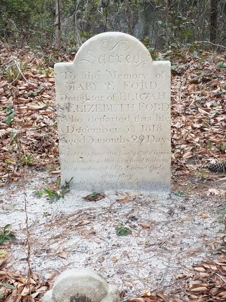
The one really cool place to visit is in Eutaw Springs. Located just past a turn in the trail/road is the American Revolutionary War era Eutaw Springs Battlefield. This was one of the last major engagement of the war in the Carolina’s, both sides claimed victory. We forget sometimes, how old our country is and the sacrifices our forefathers made to create a new nation. Definitely worth stopping, walking, and reading the self guided interpretive signs around the battleground.

Favorite Time of year: Maybe the Spring and fall (low bug time) for camping when its cool and dry.

Things to Know: You will be traveling on public roads most of these two trail sections. Pick a day with good cloud cover and use a good sunscreen.

Camping: RV and tent camping is available at Rocks Pond Campground, trail side primitive camping around mile 18.5 on the Eutaw Springs Section. There is no designated camping in the Santee Passage Section.

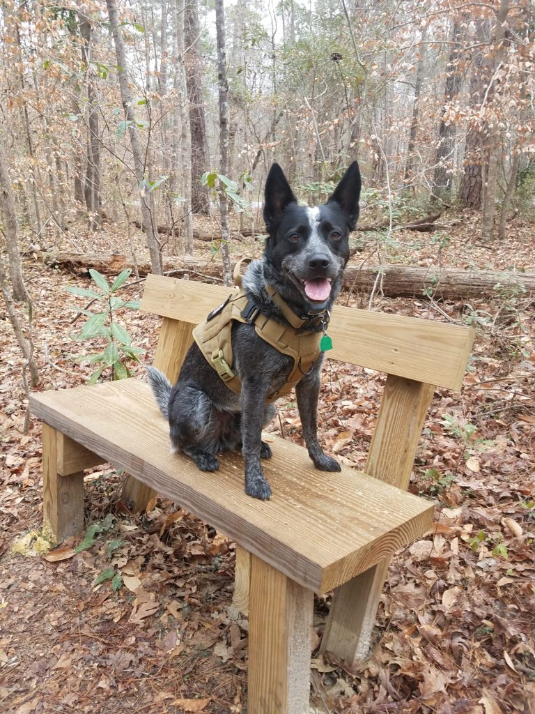
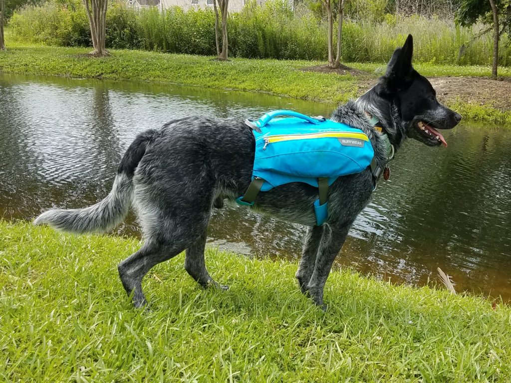
Pet friendly: There are no known restrictions on the trail but I would keep on leash while on the roadways. Watch for unleashed local dogs.

Getting There: The Eutaw Springs Section starts at the Diversion Canal, about an hours drive from the Charleston area. Good luck.

#

Givhans Ferry State Park Entrance

Hiking South Carolina – Givhans Ferry State Park

Located on the high limestone bluff on a gentle bend in the Edisto River, Givhans Ferry State Park offers a relaxing place to sit and watch the river flow by.


Relax on the porch of the Riverfront Hall a popular spot for family gatherings
(from the SCSP web site).

Just 35 miles from downtown Charleston, Givhans Ferry has cabins, RV, and standard tent sites, as well as a primitive camping area. This park has the unique distinction of being located at the end of the 23-mile Edisto River kayak and canoe trail which begins upriver at Colleton State Park. The Edisto River is the longest free-flowing, blackwater river in North America. There is a really nice sand beach for wading and swimming along with a new integrated ramp for launching and recovery of canoes and kayaks making this a must do for paddle craft sports.

The bridge in Givhans Ferry State Park on the River Bluff Trail

For hiking, Givhans has a fairly short 1.5 mile River Bluff trail in the main park, however if you cross the road at the park entrance you can pick up the 4.7 mile Old Loop Trail which winds around the perimeter of the largely undeveloped park boundary with woods on both sides. Radar and I took a day and hiked both the River bluff trail and then the Old Loop trail as one big loop, for just over 7.4 miles returning to where we started.

Hiking the Old Loop Trail with Radar

The park is located where there was a ferry crossing the river dating way back to the 1700’s. In the 1930’s, this was one of the original 16 South Carolina state parks built with the help of the Civilian Conservation Corps. The park consists of about 988 acres and offers swimming, fishing, boating, and bird watching. There are also picnic shelters, a playground, and several geocaches are located on the park.

On the bluff is a small grave for Mary E. Ford

Givhans Ferry State Park (123′) | County Rd S-18-30 |Ridgeville | Dorchester, SC | 11 March 2019 | 7.4 miles | 163′ gain | Moderate

Favorite Time of year: Spring and fall for camping.

Things to Know: Please speak to a park ranger before setting a geocache. Swimming is permitted in the Edisto River, but with no life guard, at your own risk of course.

Camping: Camping from RV to primitive is available at Givhans. go here for reservations or call (843) 873-0692.

Pet friendly: Pets allowed in most outdoor areas but must be physical restraint or on a leash not longer than six feet.

Getting There: Givhans is in the lowcountry of South Carolina, just East of Summerville, between I-95 and I-26, just off SC-61N. It’s about an hours drive from the Charleston area.

#

Outdoor Tips – New Gear

Looking to upgrade or replace gear? Watch for sales.

I know, I know. This sounds like “duh, no kidding.” It’s tempting, but new camping – hiking – backpacking gear can be crazy expensive. If you want to sale a little money, be patient and spend some time figuring out what you’re really looking for in a particular item. There’s so much information available now you can compare features and pricing easily. Considering last years model may save you considerably on “new” gear. Expect to pay full retail price on the new gear when it first comes out. When the “latest and greatest” new gear does come out however, stores will often discount the old or last years model to move it to make room for the new. I had been thinking about a new backpack for some time but the packs I had been considering were several hundred dollars and I just couldn’t make the plunge. And as luck would have it, one day there was an ad, I did some quick research, and was able to pick up a name brand backpack for half price because it was last years model. The best part is it’s also half the weight of my old pack!

The bridge in Givhans Ferry State Park on the River Bluff Trail

And We’re Off and Hiking

It’s day 1 of the hiking challenge and our first hike is in the bag.

I signed Radar and myself up for the 2019 Palmetto Challenge a couple weeks ago and today was the start of the challenge. Basically, the Palmetto Conservation Foundation (the folks who administer the Palmetto Trail) is sponsoring Palmetto Challenge to “inspire teams to hike or bike as many miles as possible between March 11 and April 28”. So “We” signed up. I wasn’t sure at first if Radar’s miles would count with mine, or really how the miles would be counted in the teams. Then I received a confirmation email last week with all the rules and etc. information. The best line in it was “Teams that have registered a dog as their team mate will be counting the mileage done by the dog during the week the same as a human partner.” Woot woot, Radar’s as good as a human! He’ll be so happy to hear.

Radar taking a short break hiking the Givhans Ferry State Park trails

We did our first hike for record today at Givhans Ferry State Park (more on this park later). In some parts of our area the leaves and flowers are starting to pop. The park however was really still in it’s winter colors with very little signs of spring. And despite a recent rain last night, every thing had a light yellow pollen tint, which is typical for us this time of year. I was hoping to see more green and spring colors today but I know their coming. Anyway, the weather was great as we headed out. We started with the River Bluff Trail, then rolled over on to the Old Loop Trail, and finally making our way back to where we left the car, just ahead of the rain, covering just over 7.4 miles.

Radar normally talks me in to going with him for a walk either around the farm or for a couple miles down the road at least several times a week. For this challenge, I knew we needed more miles, so I started a list of local hikes to draw from as well. Somewhere on my list is an overnight trip on the Palmetto Trail. Unfortunately, I think we’ll be able to burn up the available local trails pretty quickly and may need to do some new trails in the up-state. But this Givhans hike was first on the list. Beginning next week you will be able to follow team progress here. It was nice to get out in the woods walking and I’m looking forward to more hikes with my team mate.

Givhans Ferry State Park (123′) | County Rd S-18-30 |Ridgeville | Dorchester, SC | 11 March 2019 | 7.4 miles | 163′ gain | Moderate

#

Outdoor Tips – Seal It

There is little worse than being warmly huddled in a tent at 2 AM as the heavy rain starts, and there is a drip on your forehead. Except maybe waking up cold and wet to a flooded tent. Depending on how often you camp or use your gear, applying a fresh coat of waterproofing at the beginning of the season helps keep you happy when it rains.

The obvious item to hit is the tent rain fly, but also consider a healthy application of water proofing on other exposed tent fabric, backpacks, shoes, and even your rain gear. After several years of wear and tear and cleaning and washing, some of the original waterproofing may need a boost. Another useful tool in the weather proofing toolbox is seam sealer. Check the stitched seams for your rain fly’s and exposed tent seams for old or no sealer. It’s a huge help in stopping leaks where stitching pokes holes in the fabric. Apply as needed and of course follow the manufacture application instructions.

Checking your gear and applying fresh waterproofing and seam sealer (as needed) at the beginning of the camping season goes a long way toward extending the life of your tent and other gear, not to mention keeping have a dry place to go when the rains come.

#

2019 Palmetto Challenge

He doesn’t know yet …

I signed us up for the 2019 Palmetto Trail Challenge and Radar is going to be my plus one. He just doesn’t know it yet.

This 48 day event is hosted by the Palmetto Conservation Foundation (PCF) and is intended to inspire teams to hike or bike as many miles as possible between March 11 and April 28 “on the state’s trails, greenways, sidewalks, and hallways” (yes, they said hallways).

This is great motivation to get out and hike more. I needed some trail time to help me prepare for this summer’s Appalachian Trail section hike with our volunteer group this summer. I’ve been doing fair amount of daily walking (along with other fitness stuff) around the neighborhood, but I want to get out more and see some of the local trails too. The challenge sounds kind of open ended if it includes “hallways” but I intend to use the challenge to close some of the trail section gaps I have in the Palmetto Trail, as well as hit the local trails around me. For Radar, he loves taking walks and hikes with me. He regularly walks with me in the neighborhood and we have done a couple day hikes in state parks like Lee and Croft, he has been a really great trail partner. With this challenge I hope to include at least one overnighter with him. I fully expect to work him (and me) up to both our longer hikes and our first over night camping experience. This should be a great learning experience for both of us. I’m excited for him. He just doesn’t know it yet but he’ll be excited too.

Radar sporting his Ruffwear day pack
Radar Radar sporting his Ruffwear day pack

So, whats a challenge without a goal? I’m going to put 200 miles on the table as our goal. We’ll see. I thing it’s obtainable with enough stretch to be motivating. But I’m not including any hallways.

Each week the teams send in their prior week total mileage, it gets recorded and displayed on the PCF website to help motivate the other teams. It seems last years participants hiked 8,000 mikes. If you are interested in taking up the challenge, then March 4th (noon) is the last day to register!

#

Good News for South Carolina State Parks!

But why isn’t this it’s own news story?

In today’s local paper, it was reported state tourism is at record levels “marking six years of consecutive record-breaking growth for the state’s visitor industry” according to the Post and Courier. Buried about half way through the article was a couple paragraphs indicating the state park system has “become almost entirely self-sufficient.”

Traveling across the country, I’ve often camped at parks. They are a welcome change from the commercial overcrowded main-stream lodging options. I love state and federal parks, there is so much hidden beauty and history in them. When I first moved to South Carolina over twenty years ago, it was readily apparent the states parks were under funded and under maintained. Kind of like a well worn deck of playing cards, a bit worn around the edges. Heck, some were out right in horrible shape. Colleton State Park was little more than a gate with a dirt road to the river front. Today it’s a little gem in the South Carolina crown of park jewels. This rise from the dust didn’t happen overnight and improvements across the state seem to be ongoing. A lot of hard work by dedicated park rangers have elevated each park from dependency to independence.

Having a park system which is paying their own way is a huge plus-up for the state. With over $30 million in park revenue last year they are just about paying their own way now and still improving. The powers that be are to be commended for the long hard trail to self-sufficiency they have been hiking. Support your local parks system, Come Out & Play!

#

Hiking South Carolina – Croft State Park

If you like the outdoors, then Croft State Park has something for you. From horses to bikes to hiking to boating to shooting sports, this park offers a heavy helping of fun for everyone and is another outstanding South Carolina destination to explore.

Located in the rolling, wooded terrain of the upstate, Croft has an amazing amount of trails within the park to explore. All the 50 miles of trails at Croft are open to hikers and include the 12.6 mile Croft Passage of the Palmetto Trail, almost 17 miles of trails for Mountain Bikes, and another 17 miles of horse trails. While my girlfriend rode the horse trails with her friends, Radar and I took a day and hiked just about 13 miles of various trails including 8.5 of the Palmetto Trail section. We barely scratched where we could go.

This park opened in 1949 and with 7054 acres, is the third largest in the South Carolina State Park system. Besides the hiking, biking, and horseback riding, this park is packed with other things to do too. There are about 190 acres between the two lakes which support fishing, boating, and bird watching. There are picnic shelters, a playground, and several geocaches are located on the park. This is also one of the few South Carolina Sate Parks with a shooting range (contact the park for more information).

Favorite Time of year: Anytime for camping.

Things to Know: Please speak to a park ranger before setting a geocache. Swimming is not permitted in the lake, but you may wade in the Fairforest Creek at your own risk of course.

Camping: Camping from RV to primitive is available at Croft. Call 1-866-345-PARK (or go here for reservations).

Pet friendly: Pets allowed in most outdoor areas but must be physical restraint or on a leash not longer than six feet.

Getting There: Croft is in the upstate of South Carolina, just 5 minutes South and East of Spartanburg, between I-26 and US-176. It’s about a 4 hour drive from the Charleston area.

#

What to do when the magnetic North Moves on you?

In recent news, the earths magnetic north pole has moved. A lot. What does this mean for the hiker trying to find their way?

If you are planning to navigate with a magnetic compass, the first thing you need to know is the average amount of variation in your area. In parts of the country and world other than South Carolina, the variation may be more or less and can be to the East instead of West. In South Carolina the magnetic declination or variation is normally between 6 and 9 degrees (depending on where you are in the state) to the West. This means when you are holding a compass in your hand, the needle will actually be pointing about 6 to 9 degrees West of the earths true North pole, it’s pointing towards the earths magnetic North pole. To find the true North direction you have to add this westerly variation to your magnetic compass reading. Simple right? Maybe.

Some compasses include an adjustment setting for declination or
variation. This is great if all your navigation is typically in one area and you have a large amount of declination, greater than 10 degrees. you can make the adjustment for your area and the compass will indicate true North. Most maps will have some sort of compass rose which typically will point to true North and may also indicate magnetic North. You should always use the most recent maps available for your area.

While a lot depends on how far you are traveling, most hikers follow established trails. In these cases, the compass is an aid to make sure you are heading in the correct direction on the trail, or to simple help you get back on trail if you step off for a quick bathroom break of to explore a bit (of course you would need to take a bearing when you head off). If you are truly navigating open areas with long distances where a couple of extra degrees of error may matter, I would recommend augmenting the compass with GPS or other aids. With regards to the movement of the earths magnetic North, I wouldn’t worry about it too much, yet.

#

Hiking South Carolina – Lee State Park

Lee State Park is a great place to take a walk and unwind a bit. It’s a good mid-sized state park of 2839 acres along the Lynches River near Bishopville in the eastern midlands of the state. The park has several short (under a mile) easy hiking trails near the camp grounds at the visitor center, including a nice elevated boardwalk through the wetlands. There are also several miles of horse-only trails. The Loop Road trail however is a good five miles and takes you past several of the parks artesian wells as it circles the park. This park is one of South Carolina’s first sixteen State Parks originally created during the 1930’s great depression by the Civilian Conservation Corps. Many of the original buildings remain. During my visit the weather was cool (no bugs!) and the fall foliage was turning which made for a really nice walk with Radar.  We walked the Loop Road and Boardwalk trails. This making his second hiking trail, Radar seems to enjoy hikes and really does a good job staying close even when horses and other dogs show up on the trail. We enjoyed a light trail lunch and drank from the artesian wells as we casually walked the trails and enjoyed the peaceful day. We followed up the hike with a short hammock nap. With no tempting wi-fi, Lee is a great place to disconnect and unwind.

Favorite Time of year: I must go with the fall season. Watch the weather for Lynches River levels.

Things to Know: They keep it pretty simple at Lee, no wi-fi, nice facilities but limited extra resources makes Lee a quite place to relax.

Camping: Site and RV camping is available at Lee, you can use the toll-free for reservations, or information (Reservations Required). Group primitive camping is also available but you will need to call.

Pet friendly: Pets are allowed in most outdoor areas provided they are under physical restraint or kept on a leash not longer than six feet

Getting There: Lee is in the Eastern midlands of South Carolina, West of Florence and East of Camden, just off highway 20. It’s about a 2-3 hour drive from the Charleston area.

#

Page 3 of 6

Powered by WordPress & Theme by Anders Norén